Category:The North West Trail
Jump to navigation
Jump to search
The North West Trail is a 202 miles or 326km circular cycle route through counties Donegal, Tyrone, Fermanagh, Cavan, Leitrim, and Sligo in the North West of Ireland. Travelling through a wide variety of scenic landscapes, utilising quiet country roads with some traffic free sections, mostly in urban areas. The route enjoys dramatic views of the Atlantic Ocean, with scenic cycling in remote uplands and through rural towns and villages passing through the main towns of Enniskillen, Sligo, Donegal, Lifford, Strabane and Omagh.
Media in category "The North West Trail"
The following 18 files are in this category, out of 18 total.
-
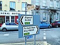
 Array of signs, The Diamond, Donegal - geograph.org.uk - 1719928.jpg 3,648 × 2,736; 2.11 MB
-
 Ballynagalliagh Townland - geograph.org.uk - 824300.jpg 640 × 479; 68 KB
-
 Cycle Path, Omagh - geograph.org.uk - 562126.jpg 640 × 480; 76 KB
-
 Drumcliff.JPG 2,048 × 1,536; 1,020 KB
-
 Enniskillen, castle and river - geograph.org.uk - 470700.jpg 640 × 429; 92 KB
-
 Lifford Road - geograph.org.uk - 1410973.jpg 640 × 479; 59 KB
-
 Looking towards the Border - geograph.org.uk - 1159097.jpg 640 × 480; 59 KB
-
 Main Street, Belcoo - geograph.org.uk - 1506191.jpg 640 × 479; 60 KB
-
 Road at Blacklion - geograph.org.uk - 1088893.jpg 640 × 479; 63 KB
-
 Road at Cliffony - geograph.org.uk - 825602.jpg 640 × 479; 56 KB
-
 Sign, McCauley Park, Omagh - geograph.org.uk - 759280.jpg 480 × 640; 102 KB
-
 Signs in The Diamond, Donegal - geograph.org.uk - 1719909.jpg 3,648 × 2,736; 2.35 MB
-
 Slish Wood Forest Trail - geograph.org.uk - 980403.jpg 640 × 480; 135 KB
-
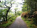
 Start of the Slish Wood Forest Trail - geograph.org.uk - 980398.jpg 640 × 480; 100 KB
-
 The Border - geograph.org.uk - 167708.jpg 640 × 480; 67 KB
-
 The Diamond, Donegal, June 2012 (04).JPG 4,272 × 2,848; 3.82 MB
-
 Three Coins sculpture, Lifford - geograph.org.uk - 1410975.jpg 640 × 479; 69 KB
-
 Tourists at Belcoo - geograph.org.uk - 492567.jpg 640 × 479; 81 KB


.JPG)

