Category:The Lizard
Jump to navigation
Jump to search
peninsula in Cornwall, England, UK  | |||||
| Upload media | |||||
| Instance of | |||||
|---|---|---|---|---|---|
| Location | Cornwall, South West England, England | ||||
 | |||||
English: The Lizard is a peninsula in southern Cornwall, England, United Kingdom. The most southerly point of the British mainland is near Lizard Point. Lizard village is the most southerly on the British mainland, and is in the civil parish of Landewednack, the most southerly parish. The valleys of the River Helford and Loe Pool form the northern boundary, with the rest of the peninsula surrounded by sea.
Subcategories
This category has the following 39 subcategories, out of 39 total.
A
B
- Black Head, The Lizard (18 F)
- Bumble Rock, The Lizard (4 F)
C
- Caerthilian Cove (9 F)
D
- Devil's Frying Pan, Cadgwith (3 F)
G
- Gew-graze, The Lizard (13 F)
H
K
- Kennack Sands, Cornwall (36 F)
L
- Lion Rock, Cornwall (12 F)
- Lizard Lighthouse (112 F)
M
- Man of War, Lizard Point (12 F)
- Mullion Cliff, Cornwall (10 F)
N
- Nare Point, The Lizard (15 F)
P
- Penare Point, The Lizard (6 F)
- Polurrian Cove, Mullion (9 F)
- Predannack Head (13 F)
S
- Shag Rock, Lizard Point (6 F)
T
- The Rill, Cornwall (7 F)
Media in category "The Lizard"
The following 68 files are in this category, out of 68 total.
-
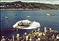 -1963-08-12 Duke of Cornwall Lizard Lifeboat Launch, Church Cove, The Lizard.jpg 3,284 × 2,278; 2.1 MB
-
 -1963-08-13 Pentreath Beach, The Lizard.jpg 2,647 × 1,935; 1.34 MB
-
 -1963-08-13 View of Pentreath Beach, The Lizard.jpg 1,083 × 740; 331 KB
-
 -1994-08-07 Steps down to Pentreath Beach, Lizard (1).jpg 1,509 × 2,218; 645 KB
-
 -1994-08-07 Steps down to Pentreath Beach, Lizard (2).jpg 1,542 × 2,277; 495 KB
-
 -1994-08-12 Lizard lifeboat RNLB David Robinson (ON 1145).JPG 4,744 × 3,123; 2.32 MB
-
 . . Sold Out. - panoramio.jpg 4,000 × 2,248; 5.22 MB
-
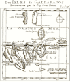
 Galapagos 1699.gif 600 × 700; 51 KB
-
 Galapagos 1699ef.gif 600 × 700; 60 KB
-
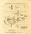 Gallapagos Islands 1684.jpg 1,845 × 2,020; 335 KB
-
 Admiralty Chart No 154 Approaches to Falmouth, Published 1943.jpg 8,284 × 12,086; 32.94 MB
-
 Admiralty Chart No 777 St Agnes Head to Gerrans Bay, Published 1892.jpg 11,860 × 8,230; 14.93 MB
-
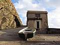
 Bass point cottage the Lizard R42 - panoramio.jpg 2,048 × 1,536; 858 KB
-
-
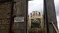 Building Shell, The Lizard.jpg 5,312 × 2,988; 2.31 MB
-
 Car Park, The Lizard - geograph.org.uk - 225424.jpg 640 × 480; 61 KB
-
 Cliffs at Ogo Dour Cove - geograph.org.uk - 1956630.jpg 640 × 426; 99 KB
-
 Cliffs north of Lizard Head - geograph.org.uk - 218974.jpg 450 × 600; 131 KB
-
 Coastal view west of Lizard - geograph.org.uk - 1780325.jpg 1,280 × 856; 209 KB
-
 Cornish hedge on The Lizard - geograph.org.uk - 706966.jpg 640 × 480; 108 KB
-
 Cornwall 2011 (6094221313).jpg 4,256 × 2,832; 1.65 MB
-
 Cornwall 2011 (6094222639).jpg 2,832 × 4,256; 2.34 MB
-
 CornwallMapOfParishesOnTheLizard.gif 1,000 × 925; 31 KB
-

-
 Gully on the Lizard. - geograph.org.uk - 917861.jpg 640 × 480; 128 KB
-
 Gunwalloe Church Cove Beach Cornwall-UK.jpg 6,000 × 3,376; 3.75 MB
-
 Gunwallow Church Cove.jpg 6,000 × 3,376; 3.89 MB
-
 High and dry - geograph.org.uk - 367334.jpg 640 × 480; 104 KB
-

-

-
 Kynance Cliffs - geograph.org.uk - 256436.jpg 640 × 480; 79 KB
-
 Lion's Den at the Lizard, Cornwall.jpg 8,384 × 1,696; 1.21 MB
-
 Lizard Ales Brewery - geograph.org.uk - 926711.jpg 640 × 480; 63 KB
-
 Lizard Peninsula Lighthouse , Coastline - panoramio (1).jpg 1,944 × 1,296; 432 KB
-
 Lizard Peninsula Lighthouse , Coastline - panoramio.jpg 1,804 × 1,203; 664 KB
-
 Lizard Peninsula Lighthouse - panoramio.jpg 1,944 × 1,296; 437 KB
-
 LizardGeologyMapCornwall.jpg 800 × 800; 74 KB
-
 Men Hyr, the Dales and Enoch Rock, south of Lizard - geograph.org.uk - 2366869.jpg 1,600 × 1,200; 744 KB
-

-
 Parn Voose Cove, The Lizard. Cornwall - geograph.org.uk - 730178.jpg 640 × 480; 123 KB
-
 Polpeor Cliff and path towards Lizard Point - geograph.org.uk - 1705814.jpg 1,024 × 768; 249 KB
-
 Private sign, Church Cove - geograph.org.uk - 498418.jpg 481 × 640; 209 KB
-
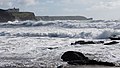
 Rough seas at Polpeor Cove - geograph.org.uk - 653464.jpg 640 × 427; 76 KB
-
 Sea Cliff near Lizard Point - geograph.org.uk - 1261799.jpg 640 × 425; 115 KB
-
 Serpentine workshop and shop - geograph.org.uk - 989377.jpg 640 × 427; 57 KB
-
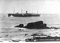 StateLibQld 1 107024 Suevic (ship).jpg 1,000 × 719; 99 KB
-
 StateLibQld 1 170503 Suevic (ship).jpg 1,000 × 603; 57 KB
-
 Suevic postcard-2.jpeg 652 × 405; 57 KB
-
 Suevic postcard-3 (cropped).jpeg 636 × 370; 57 KB
-
 Suevic postcard-3.jpeg 638 × 405; 66 KB
-
 Sunrise over The Lizard - geograph.org.uk - 1660030.jpg 640 × 427; 45 KB
-
 The Lizard - Cornwall (48316917341).jpg 2,048 × 1,367; 1.83 MB
-
 The Lizard 8 March 2005 Cornwall ad (278545123).jpg 1,200 × 1,600; 489 KB
-
 The Lizard 8 March 2005 Cornwall c (278545481).jpg 1,600 × 1,071; 695 KB
-

-

-
 The Naval Manoeuvres, the decisive battle off the Lizard - The Graphic 1901.jpg 1,024 × 838; 310 KB
-
 The path to Kynance - geograph.org.uk - 664692.jpg 640 × 480; 47 KB
-
 The Quadrant - geograph.org.uk - 926670.jpg 640 × 480; 90 KB
-
 The Top House, Lizard - geograph.org.uk - 1780243.jpg 1,280 × 856; 164 KB
-
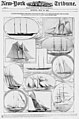 Yachts entered for the ocean race for a cup presented by the Kaiser LOC 3993144785.jpg 2,078 × 3,134; 702 KB
-
 Bridleway east - geograph.org.uk - 367318.jpg 640 × 480; 132 KB
-
 Lizard Downs - geograph.org.uk - 266291.jpg 640 × 480; 127 KB
-
 Lizard Downs - geograph.org.uk - 266297.jpg 640 × 480; 158 KB
-
 Lizard Downs Nature Reserve - geograph.org.uk - 367288.jpg 640 × 480; 122 KB
-
 Looking Inland - geograph.org.uk - 263599.jpg 640 × 480; 82 KB
-
 Near Lizard Village - geograph.org.uk - 665753.jpg 640 × 480; 54 KB
-
 The Balk Beacon, Parn Voose Cove - geograph.org.uk - 585695.jpg 640 × 479; 68 KB


.jpg)
.jpg)
.JPG)


.jpg)
.jpg)

_-_The_Graphic_1901_(cropped).jpg)


.jpg)


.jpg)


.jpg)
.jpg)

.jpeg)


.jpg)
.jpg)
.jpg)

_-_The_Graphic_1901_(cropped).jpg)


