Category:The Hare Warren
Jump to navigation
Jump to search
The Hare Warren is a 300 acre wood about two miles south of the town of Wilton in southern Wiltshire and grows along the north side of the chalk escarpment that separates the Nadder and Ebble rivers before they converge with the Avon around Salisbury. During the 16th century Hare Warren was fenced off from the rest of Wilton House parkland in order to preserve it for the hunting of the hare.
Media in category "The Hare Warren"
The following 18 files are in this category, out of 18 total.
-
 A sign of the times, Harwarren - geograph.org.uk - 706134.jpg 403 × 640; 99 KB
-
 Ancient tree in the Harewarren - geograph.org.uk - 668191.jpg 480 × 640; 156 KB
-

-
 Casualty of the storm, Harewarren - geograph.org.uk - 2751487.jpg 640 × 480; 128 KB
-
 Fallen beech tree, Harewarren - geograph.org.uk - 2751513.jpg 640 × 480; 116 KB
-
 Fallen Tree in the Harewarren - geograph.org.uk - 326273.jpg 640 × 480; 161 KB
-
 Field Boundary - geograph.org.uk - 681046.jpg 640 × 480; 132 KB
-
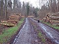
 Forest Track at the Harewarren - geograph.org.uk - 309429.jpg 640 × 480; 155 KB
-
 Forest Track in the Harewarren - geograph.org.uk - 326261.jpg 640 × 480; 154 KB
-
 Fungus, Harewarren - geograph.org.uk - 668272.jpg 480 × 640; 148 KB
-
 Hoar frost, Harewarren - geograph.org.uk - 1116235.jpg 480 × 640; 177 KB
-
 Litter at the Harewarren - geograph.org.uk - 310803.jpg 640 × 405; 152 KB
-
 Piles of Timber - geograph.org.uk - 309428.jpg 640 × 480; 152 KB
-
 Stacked Timber - geograph.org.uk - 309426.jpg 640 × 480; 154 KB
-
 Stacked Timber - geograph.org.uk - 326285.jpg 640 × 480; 141 KB
-
 Storm Damage in the Harewarren - geograph.org.uk - 318233.jpg 640 × 480; 165 KB
-
 Storm Damage in the Harewarren - geograph.org.uk - 326253.jpg 640 × 480; 179 KB
-
 Woodland footpath in the Harewarren - geograph.org.uk - 648670.jpg 640 × 480; 156 KB


