Category:The Copperfield, Birkenhead
Jump to navigation
Jump to search
| Object location | | View all coordinates using: OpenStreetMap |
|---|
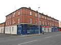
This is a category about listed building number 1218093. |
Grade II listed building in Birkenhead  | |||||
| Upload media | |||||
| Instance of | |||||
|---|---|---|---|---|---|
| Location | Birkenhead, Wirral, Merseyside, North West England, England | ||||
| Street address |
| ||||
| Heritage designation |
| ||||
 | |||||
Media in category "The Copperfield, Birkenhead"
The following 6 files are in this category, out of 6 total.
-
 38-50 Argyle Street, Birkenhead.jpg 4,608 × 3,456; 3.43 MB
-
 Hamilton Street - geograph.org.uk - 1002585.jpg 640 × 480; 112 KB
-
 No longer a public house.jpg 1,536 × 2,048; 1,005 KB
-
 The Copperfield Project plaque 36 Hamilton Street Birkenhead CH41 5AD.jpg 3,000 × 2,250; 1.8 MB
-
 The Copperfield, Birkenhead 2019.jpg 4,617 × 3,216; 9.97 MB
-
 The Copperfield, Birkenhead.jpg 4,608 × 3,456; 3.99 MB


