Category:The Cairnwell
Jump to navigation
Jump to search
Scottish mountain _(Cairngorm_Mountains,_Aberdeenshire,_Scotland).JPG) | |||||
| Upload media | |||||
| Instance of | |||||
|---|---|---|---|---|---|
| Location |
| ||||
| Mountain range | |||||
| Topographic prominence |
| ||||
| Elevation above sea level |
| ||||
 | |||||
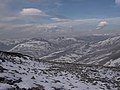
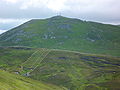
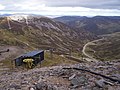
The Cairnwell (Gaelic: Càrn Bhalg) is a mountain in the Eastern Highlands of Scotland, south of Braemar. Glenshee Ski Centre covers the eastern slope of the mountain. It is 933 m in height, and listed as a Munro.
Media in category "The Cairnwell"
The following 44 files are in this category, out of 44 total.
-
 A view east from the Cairnwell Chairlift - geograph.org.uk - 3026824.jpg 3,648 × 2,736; 1.23 MB
-
 A view east from the Cairnwell Chairlift - geograph.org.uk - 3026910.jpg 3,648 × 2,736; 1.02 MB
-
 A view north from near the top of the Cairnwell Chairlift - geograph.org.uk - 3026695.jpg 3,648 × 2,736; 1.49 MB
-
 A view north towards Carn Aosta - geograph.org.uk - 3026944.jpg 3,648 × 2,736; 2.22 MB
-
 A view of The Cairnwell - geograph.org.uk - 197714.jpg 640 × 480; 139 KB
-
 A view over the Cairnwell Pass to Carn an Tuirc - geograph.org.uk - 3026655.jpg 3,648 × 2,736; 1.55 MB
-
 Across the corrie to the Cairnwell - geograph.org.uk - 2986709.jpg 640 × 480; 100 KB
-
 Approaching the summit of the Cairnwell - geograph.org.uk - 4273704.jpg 1,600 × 1,085; 355 KB
-
 Cairn - geograph.org.uk - 1583608.jpg 480 × 640; 74 KB
-
 Cairn on the Cairnwell - geograph.org.uk - 949752.jpg 640 × 433; 63 KB
-
 Carn Aosda from the Cairnwell.jpg 1,998 × 1,410; 262 KB
-
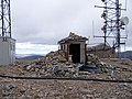
 Communications centre on The Cairnwell summit - geograph.org.uk - 3026714.jpg 3,648 × 2,736; 1.68 MB
-
 Eastern slopes of Carn a' Gheoidh - geograph.org.uk - 776948.jpg 1,024 × 668; 939 KB
-
 Foot of The Cairnwell - geograph.org.uk - 1502793.jpg 640 × 480; 94 KB
-
-
 Loch Vrotachan from The Cairnwell - geograph.org.uk - 1502874.jpg 640 × 480; 101 KB
-
 Looking North from The Cairnwell - geograph.org.uk - 38381.jpg 640 × 446; 53 KB
-
 Looking through the mast - geograph.org.uk - 1006381.jpg 640 × 448; 102 KB
-

-
 Near the summit of the Cairnwell - geograph.org.uk - 3268181.jpg 1,280 × 1,024; 231 KB
-
 North from the summit - geograph.org.uk - 1502920.jpg 640 × 480; 100 KB
-
 Portable Cabin - geograph.org.uk - 1006391.jpg 640 × 457; 86 KB
-
 Rocky road - geograph.org.uk - 1502893.jpg 640 × 480; 127 KB
-
 Sculptures on The Cairnwell - geograph.org.uk - 1502803.jpg 640 × 480; 117 KB
-
 Signpost on The Cairnwell - geograph.org.uk - 1502891.jpg 640 × 480; 105 KB
-
 Southern side of the Cairnwell - geograph.org.uk - 103355.jpg 640 × 480; 65 KB
-
 Stone shelter - geograph.org.uk - 1583610.jpg 640 × 480; 63 KB
-
 Summit cairn^ - geograph.org.uk - 1502900.jpg 640 × 480; 115 KB
-
 Summit of The Cairnwell - geograph.org.uk - 1502907.jpg 640 × 480; 108 KB
-
 Summit of The Cairnwell - geograph.org.uk - 1502915.jpg 640 × 480; 76 KB
-
 The Cairnwell (An Càrn Bhailg) (Cairngorm Mountains, Aberdeenshire, Scotland).JPG 4,000 × 3,000; 5.77 MB
-
 The Cairnwell - geograph.org.uk - 1502844.jpg 640 × 480; 105 KB
-
 The Cairnwell - geograph.org.uk - 1502886.jpg 640 × 480; 97 KB
-
 The Cairnwell - geograph.org.uk - 650677.jpg 640 × 426; 98 KB
-
 The Cairnwell chair lift - geograph.org.uk - 1503050.jpg 640 × 480; 111 KB
-
 The Cairnwell chair lift - geograph.org.uk - 80774.jpg 421 × 640; 91 KB
-

-
 The Carnwell from the west - geograph.org.uk - 1634208.jpg 640 × 482; 78 KB
-
 The price we pay for mobile phones - geograph.org.uk - 9274.jpg 427 × 640; 81 KB
-

-
 The top of Carn a Gheoidh - geograph.org.uk - 1634442.jpg 640 × 482; 78 KB
-
 Track up The Cairnwell - geograph.org.uk - 1502868.jpg 640 × 480; 88 KB
-
 View south from The Cairnwell - geograph.org.uk - 1634592.jpg 640 × 482; 63 KB
-


