Category:Thalmässing
Jump to navigation
Jump to search
market municipality in the district of Roth, in Bavaria, Germany | |||||
| Upload media | |||||
| Instance of |
| ||||
|---|---|---|---|---|---|
| Part of |
| ||||
| Location | Roth, Middle Franconia, Bavaria, Germany | ||||
| Population |
| ||||
| Area |
| ||||
| Elevation above sea level |
| ||||
| official website | |||||
 | |||||
Subcategories
This category has the following 12 subcategories, out of 12 total.
A
C
E
J
O
S
Media in category "Thalmässing"
The following 13 files are in this category, out of 13 total.
-
DEU Thalmässing COA.svg 860 × 963; 243 KB
-
Wappen von Thalmässing.png 194 × 210; 13 KB
-
Bahnsteig ehemaliger Bahnhof Thalmässing - panoramio.jpg 1,400 × 991; 487 KB
-
Digitales Orthofoto von Thalmässing (Bayerische Vermessungsverwaltung).tif 27,500 × 35,000; 1.98 GB
-
Göllersreuth, 91177 Thalmässing, Germany - panoramio.jpg 1,024 × 768; 504 KB
-
Leichenhaus, Thalmässing.jpg 3,024 × 3,024; 5.51 MB
-
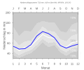
THALMAESSING nieder.png 480 × 360; 5 KB
-
THALMAESSING nieder.svg 512 × 427; 21 KB
-
Thalmässing - 006.jpg 6,000 × 4,000; 5.67 MB
-
Thalmässing - 010.jpg 4,000 × 6,000; 7.3 MB
-
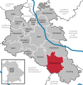
Thalmässing im Lk Roth.png 390 × 391; 18 KB
-
Thalmässing in RH.svg 592 × 607; 1.05 MB
-
Thalmässing Synagoge 1.jpg 600 × 373; 45 KB


