Category:Thüngfeld (Schlüsselfeld)
Jump to navigation
Jump to search
district of Schlüsselfeld in Germany   | |||||
| Upload media | |||||
| Instance of |
| ||||
|---|---|---|---|---|---|
| Location | Schlüsselfeld, Bamberg, Upper Franconia, Bavaria, Germany | ||||
| Elevation above sea level |
| ||||
 | |||||
Subcategories
This category has only the following subcategory.
!
Media in category "Thüngfeld (Schlüsselfeld)"
The following 12 files are in this category, out of 12 total.
-
 Wappen Thuengfeld.jpg 216 × 224; 14 KB
-
 Schlüsselfeld, Thüngfeld, Wegkreuz neben D-4-71-220-126, 001.jpg 3,264 × 4,928; 11.1 MB
-
 Thüngfeld Bahnlinie-20230604-RM-171128.jpg 3,918 × 3,303; 8.09 MB
-
 Thüngfeld Bahnlinie-20230604-RM-171137.jpg 2,956 × 3,646; 7.44 MB
-
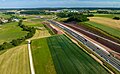 Thüngfeld Bundesautobahn 3 Luftbild-20230604-RM-170624.jpg 4,594 × 2,824; 8 MB
-
 Thüngfeld Bundesautobahn 3 Luftbild-20230604-RM-170630.jpg 4,666 × 2,365; 5.31 MB
-
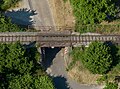 Thüngfeld Eisenbahnbrücke-20230604-RM-170947.jpg 3,013 × 2,230; 4.56 MB
-
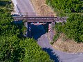 Thüngfeld Eisenbahnbrücke-20230604-RM-171020.jpg 3,634 × 2,721; 6.36 MB
-
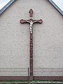 Thüngfeld Kruzifix 2110244.jpg 3,888 × 5,184; 7.21 MB
-
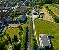
 Thüngfeld Luftbild Friedhof-20230604-RM-171232.jpg 4,798 × 3,593; 12.15 MB
-
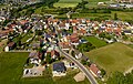 Thüngfeld Luftbild-20230604-RM-160823.jpg 4,449 × 2,820; 6.67 MB
-
 Thüngfeld Luftbild-20230604-RM-161032.jpg 4,496 × 3,593; 7.77 MB


