Category:Teversal
Jump to navigation
Jump to search
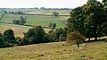
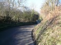
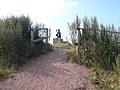
English: Teversal is a small village in the Ashfield district of Nottinghamshire, England, located 3 miles west of Mansfield, close to the Derbyshire border. It was formerly known as Teversall.
village in United Kingdom  | |||||
| Upload media | |||||
| Instance of | |||||
|---|---|---|---|---|---|
| Location | Ashfield, Nottinghamshire, East Midlands, England | ||||
 | |||||
Subcategories
This category has the following 5 subcategories, out of 5 total.
Media in category "Teversal"
The following 101 files are in this category, out of 101 total.
-
 Arable land near Newbound Lane - geograph.org.uk - 1591009.jpg 640 × 480; 152 KB
-
 Arable land south of Norwood Lodge - geograph.org.uk - 1584003.jpg 640 × 480; 112 KB
-

-
 Coal Garden, Teversal, Nottinghamshire.jpg 2,592 × 1,944; 2.81 MB
-
 Conservative graffiti - geograph.org.uk - 1589247.jpg 640 × 480; 195 KB
-
 Easy route to the monument - geograph.org.uk - 1565392.jpg 640 × 480; 107 KB
-
 Entrance road to Teversal Manor Gardens, Notts. - geograph.org.uk - 1491113.jpg 1,024 × 694; 238 KB
-
 Footpath - panoramio - PJMarriott.jpg 3,072 × 2,304; 1.45 MB
-
 Hardwick Park Farm - 1 - geograph.org.uk - 1583651.jpg 640 × 477; 136 KB
-
 Hardwick Park Farm - 2 - geograph.org.uk - 1583660.jpg 640 × 480; 96 KB
-
 House on Newbound Lane - geograph.org.uk - 1591256.jpg 640 × 480; 105 KB
-
 Lane to Dovedale Farm - geograph.org.uk - 1583630.jpg 640 × 480; 95 KB
-
 Mystery archway - geograph.org.uk - 1592576.jpg 640 × 480; 176 KB
-
 Newbound Lane - geograph.org.uk - 1591014.jpg 640 × 480; 112 KB
-
 Newbound Lane - panoramio.jpg 3,072 × 2,304; 1.26 MB
-
 Norwood Lodge - geograph.org.uk - 3864090.jpg 5,182 × 3,702; 4.86 MB
-
 Old railway bridge - geograph.org.uk - 1592582.jpg 640 × 480; 133 KB
-
 Old Railway Bridge - geograph.org.uk - 1600461.jpg 640 × 480; 138 KB
-
 Public footpath to Norwood Lodge - geograph.org.uk - 1583895.jpg 640 × 480; 112 KB
-
 Public footpath to Norwood Lodge - geograph.org.uk - 1583986.jpg 640 × 480; 116 KB
-
 Public footpath to Teversal - geograph.org.uk - 1591017.jpg 640 × 480; 128 KB
-
 School House Cottage And Adjoining Manor Room, Buttery Lane, Teversal, Mansfield (1).jpg 4,048 × 3,036; 2.87 MB
-
 Silverhill Lane - Footpath View - geograph.org.uk - 687739.jpg 640 × 480; 62 KB
-
 Silverhill Lane View - geograph.org.uk - 687729.jpg 640 × 480; 64 KB
-
 Silverhill Lane View - geograph.org.uk - 687743.jpg 640 × 480; 95 KB
-
 Silverhill Lane View - geograph.org.uk - 688297.jpg 640 × 480; 73 KB
-

-

-
-

-
 Stanton Hill - geograph.org.uk - 287180.jpg 640 × 480; 120 KB
-
 Stanton Hill roundabout - geograph.org.uk - 286987.jpg 640 × 429; 139 KB
-
 Steps in Lady Spencer's Wood - geograph.org.uk - 651973.jpg 480 × 640; 123 KB
-
 Stile with Dog Flap - geograph.org.uk - 1520996.jpg 640 × 480; 138 KB
-
 Teversal - Buttery Lane - geograph.org.uk - 762479.jpg 640 × 480; 105 KB
-
 Teversal - footpath to Skegby - geograph.org.uk - 1020800.jpg 409 × 640; 104 KB
-
 Teversal - Footpath View - geograph.org.uk - 762038.jpg 640 × 480; 86 KB
-
 Teversal to Pleasley railway - 1 - geograph.org.uk - 1590998.jpg 640 × 480; 165 KB
-
 Teversal to Pleasley railway - 2 - geograph.org.uk - 1591005.jpg 480 × 640; 160 KB
-
 Teversal Village.jpg 1,065 × 1,011; 508 KB
-
 The Carnarvon, Fackley Road, Teversal, Sutton-in-Ashfield (1).jpg 3,036 × 4,048; 3.9 MB
-
 The Carnarvon, Fackley Road, Teversal, Sutton-in-Ashfield (2).jpg 3,036 × 4,048; 4.69 MB
-
 The Carnarvon, Fackley Road, Teversal, Sutton-in-Ashfield (3).jpg 3,036 × 4,048; 4.3 MB
-
 The Carnarvon, Fackley Road, Teversal, Sutton-in-Ashfield (4).jpg 3,036 × 4,048; 2.81 MB
-
 The Carnarvon, Fackley Road, Teversal, Sutton-in-Ashfield (5).jpg 4,048 × 3,036; 3.79 MB
-
 The Carnarvon, Fackley Road, Teversal, Sutton-in-Ashfield (6).jpg 3,036 × 4,048; 3.7 MB
-
 The Carnarvon, Fackley Road, Teversal, Sutton-in-Ashfield (7).jpg 4,048 × 3,036; 3.51 MB
-
 The Carnarvon, Fackley Road, Teversal, Sutton-in-Ashfield (8).jpg 3,036 × 4,048; 4.29 MB
-
 The Old Rectory And Adjoining Garden Wall, Buttery Lane, Teversal, Mansfield (20).jpg 4,048 × 3,036; 2.37 MB
-
 The Privets, Teversal - geograph.org.uk - 4274594.jpg 1,280 × 960; 394 KB
-
 Tub on roundabout - geograph.org.uk - 287219.jpg 640 × 480; 102 KB
-
 Wheat crop at Park Spring - geograph.org.uk - 1591261.jpg 640 × 480; 129 KB
-
 An Autumnal Stroll - geograph.org.uk - 335660.jpg 640 × 360; 105 KB
-
 An Autumnal Stroll - geograph.org.uk - 335673.jpg 640 × 360; 90 KB
-
 An Autumnal Stroll - geograph.org.uk - 335687.jpg 640 × 360; 132 KB
-
 An Autumnal Stroll - geograph.org.uk - 335717.jpg 640 × 360; 117 KB
-
 An Autumnal Stroll - geograph.org.uk - 335792.jpg 640 × 359; 126 KB
-
 An Autumnal Stroll - geograph.org.uk - 335803.jpg 640 × 360; 131 KB
-
 An Autumnal Stroll - geograph.org.uk - 335818.jpg 640 × 360; 134 KB
-
 An Autumnal Stroll - geograph.org.uk - 336430.jpg 640 × 360; 80 KB
-
 Brook below Stanley Farm, Stanley - geograph.org.uk - 286017.jpg 480 × 640; 125 KB
-
 Dawgates Farm - geograph.org.uk - 287194.jpg 640 × 480; 116 KB
-
 Disused rail track near Fackley - geograph.org.uk - 287022.jpg 428 × 640; 195 KB
-
-
 Estate Workers houses - geograph.org.uk - 287148.jpg 640 × 480; 119 KB
-
 Field and tracks. - geograph.org.uk - 286602.jpg 640 × 480; 120 KB
-
 Footbridge near Fackley - geograph.org.uk - 286985.jpg 640 × 481; 164 KB
-
 Fungi in Lady Spencer's Wood - geograph.org.uk - 112004.jpg 640 × 360; 102 KB
-
 Green Man - geograph.org.uk - 190615.jpg 450 × 600; 398 KB
-
 Hardwick Park Farm - Entrance - geograph.org.uk - 575851.jpg 640 × 480; 89 KB
-

-
 Lady Spencer's Walk - geograph.org.uk - 335829.jpg 640 × 360; 135 KB
-
 Meden Valley - geograph.org.uk - 287037.jpg 640 × 428; 119 KB
-
 Mole Hill^ - geograph.org.uk - 287139.jpg 640 × 480; 121 KB
-
 Norwood Lodge - geograph.org.uk - 287008.jpg 640 × 480; 162 KB
-
 Old Rail Bridge - geograph.org.uk - 287198.jpg 640 × 480; 119 KB
-
 Pond, near Teversal Trails - geograph.org.uk - 190583.jpg 640 × 480; 158 KB
-
 Pony in Lady Spencer's Wood - geograph.org.uk - 659484.jpg 480 × 640; 140 KB
-
 Road Block - geograph.org.uk - 286611.jpg 640 × 480; 115 KB
-
 Road junction - geograph.org.uk - 286597.jpg 640 × 480; 115 KB
-
 Shepherd's Lane Farm near Stanley - geograph.org.uk - 286126.jpg 640 × 429; 146 KB
-
 Shepherds Lane Farm - geograph.org.uk - 286606.jpg 640 × 480; 117 KB
-
 Silverhill Wood Country Park - geograph.org.uk - 554359.jpg 640 × 480; 96 KB
-
 Silverhill Wood Country Park - geograph.org.uk - 554372.jpg 640 × 480; 99 KB
-
 Silverhill Wood Country Park - geograph.org.uk - 554376.jpg 640 × 480; 133 KB
-
 Silverhill Wood Country Park - geograph.org.uk - 554386.jpg 640 × 480; 103 KB
-
 Silverhill Wood Country Park - geograph.org.uk - 554389.jpg 640 × 480; 102 KB
-
 Silverhill Wood Country Park - geograph.org.uk - 554395.jpg 640 × 480; 133 KB
-
 Silverhill Wood Country Park - geograph.org.uk - 554431.jpg 640 × 480; 130 KB
-
 Silverhill Wood Country Park - geograph.org.uk - 554439.jpg 640 × 480; 128 KB
-
 Silverhill Wood Country Park - geograph.org.uk - 668889.jpg 640 × 480; 90 KB
-

-

-
 Silverhill Wood Country Park Pond - geograph.org.uk - 554365.jpg 640 × 480; 112 KB
-
 Silverhill Wood Country Park Pond - geograph.org.uk - 668871.jpg 640 × 480; 73 KB
-
 Silverhill Wood Country Park Pond - geograph.org.uk - 668881.jpg 640 × 480; 79 KB
-
 Teversal Trail - geograph.org.uk - 286587.jpg 480 × 640; 102 KB
-
 Teversal Trail - geograph.org.uk - 287213.jpg 640 × 480; 120 KB
-
 Teversal Trails - geograph.org.uk - 190623.jpg 600 × 450; 456 KB
-
 Trail Guide Posts - geograph.org.uk - 287185.jpg 640 × 480; 117 KB
-
 Trail information board - geograph.org.uk - 286592.jpg 640 × 480; 112 KB


.jpg)


.jpg)
.jpg)
.jpg)
.jpg)
.jpg)
.jpg)
.jpg)
.jpg)
.jpg)


