Category:Terregles
Jump to navigation
Jump to search
village in Dumfries and Galloway, Scotland, UK  | |||||
| Upload media | |||||
| Instance of | |||||
|---|---|---|---|---|---|
| Location |
| ||||
 | |||||
Terregles is a village and parish in en:Kirkcudbrightshire within the District Council Region of Dumfries and Galloway, Scotland.
Terregles is a Civil Parish area in en:Kirkcudbrightshire.
For placenames in Terregles, see : http://www.kirkcudbright.co/places.asp?ID=17
Subcategories
This category has the following 3 subcategories, out of 3 total.
T
- Terregles Church (6 F)
W
- White Hill of Terregles (3 F)
Media in category "Terregles"
The following 65 files are in this category, out of 65 total.
-
 A75 Bridge - geograph.org.uk - 455330.jpg 640 × 480; 71 KB
-
 Beltonhill Farm - geograph.org.uk - 1325343.jpg 640 × 480; 105 KB
-
 BPI Polythene - geograph.org.uk - 1768408.jpg 1,024 × 768; 603 KB
-
 BPI Polythene, Dumfries - geograph.org.uk - 1768414.jpg 1,024 × 768; 608 KB
-
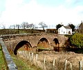 Bridge at Newbridge - geograph.org.uk - 708098.jpg 640 × 544; 91 KB
-
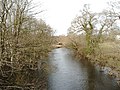
 Cargen Water - geograph.org.uk - 486733.jpg 640 × 480; 85 KB
-
 Cattle Grid - geograph.org.uk - 724682.jpg 640 × 480; 71 KB
-
 Cluden Water at Newbridge, Dumfries - geograph.org.uk - 713275.jpg 640 × 479; 103 KB
-
 Collochan Loch - geograph.org.uk - 914174.jpg 640 × 382; 59 KB
-

-
 Countryside near Terregles - geograph.org.uk - 1358493.jpg 480 × 640; 59 KB
-
 Countryside near Terregles - geograph.org.uk - 706806.jpg 640 × 480; 35 KB
-
 Cycle Path - geograph.org.uk - 1770216.jpg 480 × 640; 70 KB
-
 Cycleway Plaque - geograph.org.uk - 724673.jpg 640 × 438; 73 KB
-
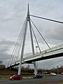 Dumfries Bypass, Glasgow Road footbridge - geograph.org.uk - 1761149.jpg 1,024 × 1,365; 788 KB
-
 Dumfries Bypass, Glasgow Road footbridge - geograph.org.uk - 1761157.jpg 1,024 × 1,365; 832 KB
-

-
 Edge of the forest - geograph.org.uk - 610423.jpg 640 × 480; 107 KB
-
 End of the rainbow... Lochside ^ - geograph.org.uk - 706790.jpg 640 × 480; 34 KB
-
 Field by Beltonhill - geograph.org.uk - 430855.jpg 640 × 428; 128 KB
-

-
 Footbridge over A75 - geograph.org.uk - 1768444.jpg 1,022 × 698; 539 KB
-
 Frost Covered Conifers in White Hill Wood - geograph.org.uk - 638743.jpg 480 × 640; 216 KB
-
 Glen Mill - geograph.org.uk - 786092.jpg 504 × 378; 96 KB
-
 Gorse strewn grazing - geograph.org.uk - 430866.jpg 640 × 438; 107 KB
-
 Hey^ It's Hay^ - geograph.org.uk - 490753.jpg 640 × 480; 61 KB
-
 Hippie Horse - geograph.org.uk - 486744.jpg 640 × 480; 87 KB
-
 Jacobite broadside - Gardens, Terragles.jpg 2,500 × 2,015; 2.72 MB
-
 Jacobite broadside - Terregles House.jpg 2,500 × 1,778; 2.12 MB
-
 Lincluden Parks Department depot - geograph.org.uk - 1769769.jpg 1,024 × 768; 603 KB
-
 Lincluden primary school - geograph.org.uk - 1769787.jpg 1,022 × 712; 486 KB
-
 Lincluden primary school - geograph.org.uk - 1769789.jpg 1,024 × 768; 582 KB
-
 Lincluden shops - geograph.org.uk - 1769790.jpg 640 × 480; 88 KB
-
 Lochside Church, Dumfries - geograph.org.uk - 706314.jpg 640 × 480; 48 KB
-
 Lochside Farm - geograph.org.uk - 875245.jpg 640 × 437; 68 KB
-
 Lochside housing blocks - geograph.org.uk - 456534.jpg 640 × 480; 68 KB
-
 Lochside play area - geograph.org.uk - 456527.jpg 640 × 480; 74 KB
-
 Long wait for buses^ - geograph.org.uk - 1769755.jpg 640 × 458; 81 KB
-
 Mapa dg tìr na h-eaglaise.jpg 2,004 × 1,363; 599 KB
-

-
 Nunwood Road, approaching Terregles - geograph.org.uk - 455569.jpg 640 × 480; 77 KB
-

-

-
 Playing field at Lincluden - geograph.org.uk - 457719.jpg 640 × 480; 92 KB
-
 Public open space at Lochfoot - geograph.org.uk - 1325339.jpg 640 × 480; 129 KB
-
 Railway bridge without a railway - geograph.org.uk - 1768430.jpg 1,024 × 768; 757 KB
-
 Rainbow view - geograph.org.uk - 1774346.jpg 600 × 800; 138 KB
-
 Rhino statue, Lincluden - geograph.org.uk - 186920.jpg 640 × 480; 73 KB
-
 Rhinos at Lincluden - geograph.org.uk - 186918.jpg 640 × 480; 88 KB
-
 Road towards Collochan - geograph.org.uk - 1774332.jpg 600 × 800; 120 KB
-
 Road up the hill - geograph.org.uk - 1774336.jpg 480 × 640; 71 KB
-
 Structure alongside dismantled railway - geograph.org.uk - 1768397.jpg 1,024 × 768; 597 KB
-
 Terregles Outbuilding - geograph.org.uk - 1208131.jpg 640 × 427; 81 KB
-
 Terregles Parish Church.jpg 3,872 × 2,592; 2.72 MB
-
 Terregles War Memorial - geograph.org.uk - 455303.jpg 640 × 480; 89 KB
-
 The Cluden Water - geograph.org.uk - 385565.jpg 640 × 480; 107 KB
-
 Tower home near Maryfield - geograph.org.uk - 455283.jpg 640 × 497; 102 KB
-
 Track near Terregles - geograph.org.uk - 610403.jpg 640 × 480; 87 KB
-
 Track to Beltonhill - geograph.org.uk - 913158.jpg 640 × 366; 66 KB
-
 Trees and cattle - geograph.org.uk - 610410.jpg 640 × 480; 103 KB
-
 Twister - geograph.org.uk - 430884.jpg 640 × 380; 83 KB
-
 Twister - geograph.org.uk - 689460.jpg 640 × 429; 73 KB
-
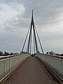
 Under the footbridge - geograph.org.uk - 1769747.jpg 768 × 1,024; 225 KB
-
 West from the footbridge - geograph.org.uk - 1769743.jpg 640 × 480; 98 KB
-


