Category:Tenma Bridge, Osaka
Jump to navigation
Jump to search
| Object location | | View all coordinates using: OpenStreetMap |
|---|
  | |||||
| Upload media | |||||
| Instance of | |||||
|---|---|---|---|---|---|
| Part of |
| ||||
| Named after | |||||
| Location | |||||
| Crosses | |||||
| Carries | |||||
| Inception |
| ||||
| Width |
| ||||
| Length |
| ||||
| Next crossing upstream | |||||
| Next crossing downstream | |||||
| official website | |||||
 | |||||
Media in category "Tenma Bridge, Osaka"
The following 25 files are in this category, out of 25 total.
-
 1 Chome Tenma, Kita-ku, Ōsaka-shi, Ōsaka-fu 530-0043, Japan - panoramio (1).jpg 2,272 × 1,704; 1.03 MB
-
-
 Chuo Ward, Osaka, Osaka Prefecture, Japan - panoramio (1).jpg 2,272 × 1,704; 1,019 KB
-
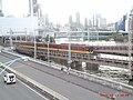 Keihan Limited Express 8000 Ohtemae (2).jpg 4,320 × 3,240; 6.47 MB
-
 Temma Bridge, Osaka (NYPL Hades-2360390-4044189).jpg 4,672 × 3,038; 3.83 MB
-
 Temma Bridge, Osaka (NYPL Hades-2360390-4044189).tiff 6,605 × 5,247, 2 pages; 99.43 MB
-
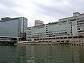
 Osaka Merchandise Mart Building in 201504 001.JPG 3,840 × 2,560; 3.28 MB
-
 Osaka Merchandise Mart Building in 201504 002.JPG 3,840 × 2,560; 3.15 MB
-
 Temma Bridge, Settsu Province LACMA M.40.1.163.jpg 2,100 × 1,426; 1.33 MB
-
 Temma-Bridge on Temmabashi-suji.jpg 2,560 × 1,600; 1.13 MB
-
 Temmabashi - panoramio (1).jpg 2,272 × 1,704; 941 KB
-
 Temmabashi St and Hachikenyahama 20080416 1.JPG 2,272 × 1,704; 797 KB
-
 Temmabashi St and Hachikenyahama 20080416 2.JPG 2,272 × 1,704; 742 KB
-
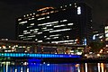
 Temmabashi-Bridge at Night.jpg 3,200 × 1,800; 1.92 MB
-
 Temmabashi-Bridge at Twilight.jpg 2,400 × 1,500; 657 KB
-
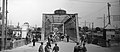
 Tenma Bridge in the Meiji era.JPG 530 × 346; 60 KB
-
 Tenmabashi - panoramio (15).jpg 1,600 × 1,200; 400 KB
-
 Tenmabashi - panoramio (6).jpg 1,600 × 1,200; 370 KB
-
 Tenmabashi - panoramio (9).jpg 1,600 × 1,200; 378 KB
-
 Tenmabashi-oldphoto-japan.jpg 3,492 × 1,519; 1.39 MB
-
 Tenmabashi01.jpg 3,264 × 2,040; 864 KB
-
 Tenmabashi02.JPG 4,032 × 3,024; 2.46 MB
-
 Tennmabashi 01.jpg 1,648 × 1,284; 1.52 MB
-
 天満橋.jpg 691 × 518; 59 KB
-
.jpg)

.jpg)
.jpg)
.jpg)


.jpg)


.jpg)
.jpg)
.jpg)


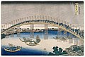
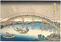
,_from_the_series_Remarkable_Views_of_Bridges_in_Various_Provinces_(Shokoku_meiky%C5%8D_kiran)_MET_DP141277.jpg)