Category:Tenbury
Jump to navigation
Jump to search
civil parish in Malvern Hills, Worcestershire, England | |||||
| Upload media | |||||
| Instance of | |||||
|---|---|---|---|---|---|
| Location | Malvern Hills, Worcestershire, West Midlands, England | ||||
| Population |
| ||||
| Said to be the same as | Tenbury Wells | ||||
 | |||||
Subcategories
This category has the following 4 subcategories, out of 4 total.
Media in category "Tenbury"
The following 200 files are in this category, out of 293 total.
(previous page) (next page)-
 1 and 3 Cross Street, Tenbury Wells (geograph 7273519).jpg 1,024 × 768; 115 KB
-
 4 Market Square, Tenbury Wells (geograph 7273517).jpg 1,024 × 768; 155 KB
-
 43 and 45 Teme Street, Tenbury Wells (geograph 7273510).jpg 1,024 × 757; 144 KB
-
 5 and 6 Market Square, Tenbury Wells (geograph 7273518).jpg 1,024 × 825; 172 KB
-
 51 and 53 Teme Street, Tenbury Wells (geograph 7273509).jpg 1,024 × 768; 165 KB
-
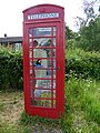 A beekeeper in a telephone box - geograph.org.uk - 5409692.jpg 768 × 1,024; 291 KB
-
 A loo with a difference - geograph.org.uk - 4581042.jpg 531 × 800; 118 KB
-
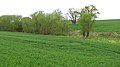
 A tidy field - geograph.org.uk - 3274730.jpg 640 × 480; 275 KB
-
 A wet field - geograph.org.uk - 3856258.jpg 640 × 480; 290 KB
-
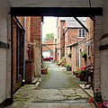 Alleyway off Teme Street - geograph.org.uk - 5012322.jpg 1,599 × 1,600; 1.55 MB
-
 Apple orchard - geograph.org.uk - 4577169.jpg 800 × 531; 159 KB
-
 Apple Tree by the Pump Rooms (Tenbury Wells) - geograph.org.uk - 6220062.jpg 3,648 × 2,056; 3.66 MB
-
 Arable field - geograph.org.uk - 5407194.jpg 1,024 × 768; 253 KB
-
 Arable land near St Michaels - geograph.org.uk - 5621699.jpg 1,024 × 768; 229 KB
-
 Arable land, Sutton Court - geograph.org.uk - 1850847.jpg 640 × 359; 74 KB
-
 B4204 at White House Lane junction - geograph.org.uk - 3574801.jpg 640 × 480; 48 KB
-
 B4204 near Burntlands - geograph.org.uk - 3574800.jpg 640 × 480; 54 KB
-
 B4204 towards Tenbury Wells - geograph.org.uk - 4167434.jpg 1,024 × 683; 183 KB
-
 B4214, Sutton - geograph.org.uk - 3856253.jpg 640 × 480; 286 KB
-
 Barley crop in a field entrance - geograph.org.uk - 4577166.jpg 1,024 × 680; 258 KB
-
 Barley field near Rochford - geograph.org.uk - 4577165.jpg 1,024 × 680; 247 KB
-
 Barn and farm building, The Meadows - geograph.org.uk - 5407237.jpg 1,024 × 768; 210 KB
-
 Barn at Lower Berrington - geograph.org.uk - 5408541.jpg 1,024 × 768; 268 KB
-
 Bednal Bridge - geograph.org.uk - 4460461.jpg 800 × 600; 559 KB
-
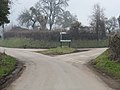 Berrington Road Junction - geograph.org.uk - 1701830.jpg 640 × 480; 189 KB
-
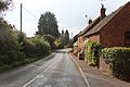
 Berrington Road, Tenbury Wells - geograph.org.uk - 5407366.jpg 1,024 × 768; 193 KB
-
 Blue Plaque on Old Fire Station (Tenbury Wells) - geograph.org.uk - 5744592.jpg 3,264 × 2,448; 1.92 MB
-
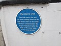 Blue Plaque on The Royal Oak (Tenbury Wells) - geograph.org.uk - 5744712.jpg 3,264 × 2,448; 1.52 MB
-
 Bridge near Sutton Mill - geograph.org.uk - 3856271.jpg 640 × 480; 335 KB
-
 Bridge over the river Teme - geograph.org.uk - 4441782.jpg 640 × 480; 54 KB
-
 Bromyard Road - geograph.org.uk - 4165106.jpg 1,024 × 683; 155 KB
-
 Bromyard Road without the windscreen - geograph.org.uk - 3856239.jpg 640 × 480; 313 KB
-
 Building attached to former workhouse - geograph.org.uk - 4167397.jpg 1,024 × 1,024; 208 KB
-
 Buildings on Market Street, Tenbury Wells (geograph 7278353).jpg 4,265 × 2,750; 1.55 MB
-
 Buildings on Teme Street, Tenbury Wells (geograph 7278805).jpg 4,023 × 2,285; 1.27 MB
-
 Cadmore Lake - geograph.org.uk - 3591551.jpg 640 × 483; 46 KB
-
 Cadmore Lake and Golf Course - geograph.org.uk - 3591552.jpg 640 × 473; 43 KB
-
 Cadmore Lake, near Tenbury Wells - geograph.org.uk - 5106108.jpg 3,264 × 2,448; 2.28 MB
-
 Cadmore Lodge Hotel and Country Club - geograph.org.uk - 3591553.jpg 640 × 471; 39 KB
-
 Car Park at Tenbury Swimming Pool - geograph.org.uk - 6220053.jpg 3,648 × 2,056; 2.82 MB
-
 Car park, Tenbury Wells, 1985 - geograph.org.uk - 4772926.jpg 800 × 527; 79 KB
-
 Car Park, Tenbury Wells, 1985 - geograph.org.uk - 4772945.jpg 800 × 534; 82 KB
-
 Car Park, Tenbury Wells, 1985 - geograph.org.uk - 4773138.jpg 800 × 537; 103 KB
-
 Cat by the Garden of Remembrance (Tenbury Wells) - geograph.org.uk - 6220645.jpg 3,648 × 2,736; 4.77 MB
-
 Cat inside the Pavilion at Tenbury Wells Bowling Green - geograph.org.uk - 6220622.jpg 3,648 × 2,736; 4.8 MB
-
 Cat inside the Pavilion at Tenbury Wells Bowling Green - geograph.org.uk - 6220626.jpg 3,648 × 2,736; 4.82 MB
-
-
 Checkpoint Garage - geograph.org.uk - 3855275.jpg 640 × 480; 301 KB
-
 Christmas Tree at Tenbury Wells - geograph.org.uk - 5990747.jpg 1,920 × 1,080; 546 KB
-
 Churchyard at St. Mary's Church (Tenbury Wells) - geograph.org.uk - 5744575.jpg 3,264 × 2,448; 2.59 MB
-
 Corner pond. - geograph.org.uk - 88814.jpg 640 × 480; 104 KB
-
 Cottage in St Michaels - geograph.org.uk - 5409686.jpg 800 × 600; 144 KB
-
 Cottages overlooking Oldwood Common - geograph.org.uk - 5409827.jpg 1,024 × 768; 242 KB
-
 County Border - geograph.org.uk - 4379917.jpg 800 × 600; 70 KB
-
 Cross Street - geograph.org.uk - 4165534.jpg 1,024 × 683; 200 KB
-
 Crow Hotel - geograph.org.uk - 2951045.jpg 480 × 640; 93 KB
-
 Datestone on the old workhouse - geograph.org.uk - 4927439.jpg 1,280 × 960; 267 KB
-
 Datestone on the old workhouse - geograph.org.uk - 4927442.jpg 1,280 × 960; 321 KB
-

-

-
 Entrance drive to Hill Farm - geograph.org.uk - 4576350.jpg 1,024 × 680; 256 KB
-

-

-
 Entrance to Cadmore Lodge - geograph.org.uk - 5409671.jpg 1,024 × 768; 291 KB
-
 Entrance To Cinders Wood - geograph.org.uk - 1480141.jpg 640 × 480; 284 KB
-
 Entrance to St. Michael ^ All Angels Church (St. Michael's) - geograph.org.uk - 5991500.jpg 2,736 × 3,648; 4.02 MB
-
-

-
 Farm buildings alongside the B4204 - geograph.org.uk - 3574805.jpg 640 × 480; 64 KB
-
 Farm Sculptures by the River Teme (Tenbury Wells) - geograph.org.uk - 6220588.jpg 3,648 × 2,056; 3.54 MB
-
 Farmland at Berrington - geograph.org.uk - 5408916.jpg 1,024 × 768; 205 KB
-
 Farmland near Lower Berrington - geograph.org.uk - 5621664.jpg 1,024 × 768; 193 KB
-

-
 Farmland to the west of Tenbury Wells - geograph.org.uk - 5407372.jpg 1,024 × 768; 250 KB
-
 Farmland, Hilltop Farm - geograph.org.uk - 4576447.jpg 1,024 × 680; 278 KB
-
 Field beside Hilltop Farm - geograph.org.uk - 4576451.jpg 800 × 531; 113 KB
-
 Field on Haws Hill - geograph.org.uk - 5065246.jpg 1,024 × 683; 386 KB
-
 Field with grazing sheep - geograph.org.uk - 4460503.jpg 800 × 600; 421 KB
-
 Field, Berrington - geograph.org.uk - 4460480.jpg 800 × 600; 361 KB
-
 Forested Hillside Off Berrington Road - geograph.org.uk - 1701835.jpg 640 × 480; 199 KB
-
 Former cattle market, Tenbury Wells - geograph.org.uk - 4927414.jpg 1,280 × 960; 250 KB
-
 Former Court House and Police Station - Berrington Road - geograph.org.uk - 4102202.jpg 1,600 × 1,064; 409 KB
-
 Former Post Office (Tenbury Wells) - geograph.org.uk - 5744740.jpg 3,264 × 2,448; 1.85 MB
-
 Former Post Office (Tenbury Wells) - geograph.org.uk - 6220189.jpg 3,648 × 2,736; 4.02 MB
-
 Former Post Office, Tenbury Wells - geograph.org.uk - 4927470.jpg 982 × 1,280; 266 KB
-
 Former workhouse building, Tenbury Wells - geograph.org.uk - 4927423.jpg 1,280 × 1,280; 310 KB
-
 Fountain Inn sign - geograph.org.uk - 5407255.jpg 768 × 1,024; 130 KB
-
 Frank P Matthews Nursery - geograph.org.uk - 5408507.jpg 1,024 × 768; 298 KB
-
 Garden at Tenbury Wells Bowling Green and Tennis Courts - geograph.org.uk - 6123895.jpg 3,648 × 2,736; 5.12 MB
-
 Garden gate, St Michael's - geograph.org.uk - 4679639.jpg 1,244 × 1,870; 3.61 MB
-
 Gated Road At Wilden - geograph.org.uk - 1480152.jpg 640 × 480; 281 KB
-
 Gates, Frith Farm - geograph.org.uk - 5065249.jpg 1,024 × 683; 330 KB
-
 Gateway To Cinders - geograph.org.uk - 1480148.jpg 640 × 480; 183 KB
-
 Grass Track Bridleway - geograph.org.uk - 855427.jpg 640 × 426; 122 KB
-
 Haresbrook Park - geograph.org.uk - 835369.jpg 640 × 420; 61 KB
-
 Haws Hill Vista - geograph.org.uk - 1480113.jpg 640 × 480; 253 KB
-
 Holland House (Tenbury Wells) - geograph.org.uk - 5744601.jpg 3,264 × 2,448; 1.82 MB
-
 Holland House - geograph.org.uk - 2951434.jpg 640 × 480; 88 KB
-
 Holland House - geograph.org.uk - 4581026.jpg 800 × 531; 89 KB
-
 Holland House, Tenbury Wells - geograph.org.uk - 5263830.jpg 640 × 480; 61 KB
-
 Houses on Church Street - geograph.org.uk - 4581019.jpg 1,024 × 680; 288 KB
-
 Kyre Brook - geograph.org.uk - 2375045.jpg 2,592 × 1,944; 2.77 MB
-
 Kyre Brook - geograph.org.uk - 3874459.jpg 640 × 480; 347 KB
-
 Kyre Brook - geograph.org.uk - 4379979.jpg 599 × 800; 90 KB
-
 Kyre Brook, Tenbury - geograph.org.uk - 5663086.jpg 427 × 640; 106 KB
-
 Kyre Brook, Tenbury Wells - geograph.org.uk - 5475799.jpg 851 × 1,280; 547 KB
-
 Lane Near Currall Hall - geograph.org.uk - 1480124.jpg 640 × 480; 206 KB
-
 Lane Near Hayes Farm - geograph.org.uk - 1701789.jpg 640 × 480; 79 KB
-
 Lane past Berrington Court - geograph.org.uk - 4165530.jpg 1,024 × 683; 214 KB
-
 Lane To Cinders - geograph.org.uk - 1480144.jpg 640 × 480; 81 KB
-
 Lane To Hayes Farm - geograph.org.uk - 1701787.jpg 640 × 480; 207 KB
-
 Lane To Sutton Mill - geograph.org.uk - 1701906.jpg 640 × 480; 164 KB
-
 Lane To The Meadows - geograph.org.uk - 1480128.jpg 640 × 480; 175 KB
-
 Lane To Wilden - geograph.org.uk - 1480149.jpg 640 × 480; 282 KB
-
 Large Field Near Hilltop Farm - geograph.org.uk - 1480244.jpg 640 × 480; 184 KB
-
 Listed buildings, Tenbury Wells (geograph 7283561).jpg 4,288 × 2,848; 2.07 MB
-
 Lower Town Farm - geograph.org.uk - 5408533.jpg 1,024 × 768; 250 KB
-
 Lychgate to St Michaels graveyard - geograph.org.uk - 5409683.jpg 1,024 × 768; 239 KB
-
 Mallards at the River Teme (Tenbury Wells) - geograph.org.uk - 6220398.jpg 3,648 × 2,056; 3.53 MB
-
 Market House (Tenbury Wells) - geograph.org.uk - 5744593.jpg 3,264 × 2,448; 1.84 MB
-
 Market House (Tenbury Wells) - geograph.org.uk - 5990749.jpg 1,920 × 1,080; 752 KB
-
 Market Square - geograph.org.uk - 4165125.jpg 1,024 × 683; 201 KB
-
 Market Square, Tenbury Wells, east side (geograph 7273520).jpg 1,024 × 768; 120 KB
-
 Market Street, Tenbury Wells - geograph.org.uk - 4927477.jpg 1,280 × 960; 273 KB
-
 Market Street, Tenbury Wells - geograph.org.uk - 5475718.jpg 1,280 × 851; 398 KB
-
 Market Tavern, Tenbury Wells, Worcestershire - geograph.org.uk - 4940119.jpg 1,600 × 1,200; 336 KB
-
 Millennium Tree - geograph.org.uk - 2950953.jpg 480 × 640; 88 KB
-
 Millennium Tree - geograph.org.uk - 2950961.jpg 640 × 480; 78 KB
-
 Millennium Tree - geograph.org.uk - 5111622.jpg 3,264 × 2,448; 2.53 MB
-
 Millennium Tree - geograph.org.uk - 844052.jpg 640 × 480; 108 KB
-
 Millennium Tree on Oldwood Common - geograph.org.uk - 5991593.jpg 3,648 × 2,736; 4.78 MB
-
 Millennium Tree on Oldwood Common - geograph.org.uk - 6057179.jpg 1,920 × 1,080; 1.08 MB
-
 Model of the Pump Rooms, Tenbury Wells Museum - geograph.org.uk - 2651339.jpg 3,488 × 2,616; 2.28 MB
-
 Nineteenth century benchmark on church - geograph.org.uk - 4991413.jpg 2,560 × 1,920; 3.14 MB
-
 Nineteenth century benchmark on Temeside House - geograph.org.uk - 4991408.jpg 2,560 × 1,920; 3.12 MB
-
 No through road at Kyrewood - geograph.org.uk - 4577167.jpg 1,024 × 680; 313 KB
-
 Nursery, Berrington - geograph.org.uk - 4460469.jpg 800 × 600; 437 KB
-
 Oaks near Tenbury - geograph.org.uk - 4459159.jpg 800 × 600; 401 KB
-
 Oast House Toilets (Tenbury Wells) - geograph.org.uk - 5744675.jpg 3,264 × 2,448; 1.79 MB
-
 Oast House Toilets (Tenbury Wells) - geograph.org.uk - 5744686.jpg 3,264 × 2,448; 2.4 MB
-
 Oilseed rape, Sutton Court - geograph.org.uk - 1850840.jpg 640 × 359; 82 KB
-
-
 Old Car on the A4112 Road (Tenbury Wells) - geograph.org.uk - 6220373.jpg 3,648 × 2,736; 3.4 MB
-
 Old stamp machines, former Post Office - geograph.org.uk - 4927474.jpg 1,280 × 935; 244 KB
-

-
 Oldwood Common (St. Michael's) - geograph.org.uk - 5991586.jpg 1,920 × 1,080; 1.02 MB
-
 Oldwood Common (St. Michael's) - geograph.org.uk - 6057173.jpg 1,920 × 1,080; 1,016 KB
-
 Oldwood Common (St. Michael's) - geograph.org.uk - 6057177.jpg 1,920 × 1,080; 1.07 MB
-
 Oldwood Common - geograph.org.uk - 1480138.jpg 640 × 480; 155 KB
-
 Oldwood Common near Tenbury Wells - geograph.org.uk - 6199524.jpg 3,625 × 1,288; 1.43 MB
-
 Orchard and poplars - geograph.org.uk - 4460490.jpg 800 × 600; 459 KB
-
 Orchard near Westview - geograph.org.uk - 5621681.jpg 1,024 × 768; 307 KB
-
 Orchard, Sutton - geograph.org.uk - 3856265.jpg 640 × 480; 330 KB
-
 Passageway from Teme Street (geograph 7283744).jpg 2,620 × 4,137; 687 KB
-
 Path, Haws Hill - geograph.org.uk - 5064542.jpg 1,024 × 683; 519 KB
-
 Pavilion at Tenbury Bowling Green - geograph.org.uk - 6123919.jpg 3,648 × 2,736; 4.98 MB
-
 Pavilion at Tenbury Wells Bowling Green - geograph.org.uk - 6123888.jpg 3,648 × 2,736; 4.39 MB
-
 Pavilion at Tenbury Wells Bowling Green - geograph.org.uk - 6220632.jpg 3,648 × 2,736; 5.05 MB
-
 Pebbles at the Garden of Remembrance (Tenbury Wells) - geograph.org.uk - 6123924.jpg 3,648 × 2,736; 4.95 MB
-
 Pebbles at the Garden of Remembrance (Tenbury Wells) - geograph.org.uk - 6123925.jpg 3,648 × 2,736; 4.76 MB
-
 Plaque on Tenbury House (Tenbury Wells) - geograph.org.uk - 6220302.jpg 3,648 × 2,736; 4.67 MB
-
 Playground by Tenbury Swimming Pool - geograph.org.uk - 6220057.jpg 3,648 × 2,056; 3.83 MB
-
 Poppies by the Pavilion at Tenbury Wells Bowling Green - geograph.org.uk - 6220628.jpg 3,648 × 2,736; 4.84 MB
-
 Posh Shelter - geograph.org.uk - 4379929.jpg 800 × 600; 82 KB
-
 Potato crop in the Teme valley - geograph.org.uk - 4577138.jpg 800 × 531; 155 KB
-
 Power Line On Haws Hill - geograph.org.uk - 1480117.jpg 640 × 480; 195 KB
-
 Public Toilets and Pavilion at Tenbury Wells Bowling Green - geograph.org.uk - 6220616.jpg 3,648 × 2,736; 4.79 MB
-
 Pump rooms, Tenbury Wells - geograph.org.uk - 4927480.jpg 1,280 × 928; 275 KB
-
 Pump Rooms, Tenbury Wells - geograph.org.uk - 5013103.jpg 1,600 × 903; 709 KB
-
 Rare and unusual local Herefordshire livestock. - geograph.org.uk - 1752530.jpg 768 × 1,024; 249 KB
-
 Rear of Police Station - Berrington Road - geograph.org.uk - 4102208.jpg 1,600 × 1,064; 513 KB
-
 Regal Cinema (Tenbury Wells) - geograph.org.uk - 6220610.jpg 3,648 × 2,736; 4.81 MB
-

-
 Retail store, Market Street - geograph.org.uk - 4927486.jpg 893 × 1,280; 267 KB
-
 River Path - geograph.org.uk - 4379945.jpg 800 × 600; 107 KB
-
 River Scene - geograph.org.uk - 4379923.jpg 800 × 600; 70 KB
-
 River Teme at Burford - geograph.org.uk - 5012258.jpg 1,600 × 1,200; 1 MB
-
 River Teme at Tenbury Wells - geograph.org.uk - 3596683.jpg 3,301 × 2,284; 2.36 MB
-
 River Teme Tenbury Wells - geograph.org.uk - 2375051.jpg 2,592 × 1,944; 2.1 MB
-
 River Teme, upstream of Teme Bridge - geograph.org.uk - 2557977.jpg 1,024 × 768; 212 KB
-
 Rocca Italian Food and Coffee (Tenbury Wells) - geograph.org.uk - 6220209.jpg 3,648 × 2,736; 3.77 MB
-
 Row of Cottages, Church Street - geograph.org.uk - 5013100.jpg 1,600 × 901; 810 KB
-
 Ruined Cottage Near Haws Hill - geograph.org.uk - 1480103.jpg 640 × 480; 216 KB
-
 Scotland Place (Tenbury Wells) - geograph.org.uk - 5742168.jpg 3,264 × 2,448; 2.39 MB
-
 Scout Hut - geograph.org.uk - 4379938.jpg 800 × 600; 121 KB
-
 Sign at The Market Tavern (Tenbury Wells) - geograph.org.uk - 5744613.jpg 3,264 × 2,448; 1.86 MB
-
 Sign by The River Teme (Burford) - geograph.org.uk - 5799041.jpg 1,920 × 1,080; 1.04 MB
-
 Sign by The River Teme (Burford) - geograph.org.uk - 5799061.jpg 2,048 × 1,360; 1.42 MB
-

-
 Somewhere to hop to in need - geograph.org.uk - 4927496.jpg 960 × 1,280; 248 KB
-
 Spring - geograph.org.uk - 3856246.jpg 640 × 480; 285 KB
-
 St Mary's Church (War Memorial ^ Tenbury Wells) - geograph.org.uk - 5742219.jpg 3,264 × 2,448; 2.49 MB
-
 St Michaels war memorial - geograph.org.uk - 5409664.jpg 768 × 1,024; 292 KB
-

-
 Stubble Fields Near Sutton Court - geograph.org.uk - 1480263.jpg 640 × 480; 220 KB
-
 Sunnycroft (St. Michael's) - geograph.org.uk - 5991459.jpg 3,648 × 2,736; 4.23 MB
-
 Sutton Mill - geograph.org.uk - 4576361.jpg 800 × 531; 138 KB
-
 Teme flood plain - geograph.org.uk - 3856285.jpg 640 × 480; 315 KB
-
 Teme Street (Tenbury Wells) - geograph.org.uk - 5744781.jpg 3,264 × 2,448; 1.66 MB
-
 Teme Street (Tenbury Wells) - geograph.org.uk - 5744797.jpg 1,500 × 1,093; 135 KB
.jpg)
.jpg)
.jpg)
.jpg)
.jpg)


_-_geograph.org.uk_-_6220062.jpg)


_-_geograph.org.uk_-_5744592.jpg)
_-_geograph.org.uk_-_5744712.jpg)


.jpg)
.jpg)


_-_geograph.org.uk_-_6220645.jpg)


_-_geograph.org.uk_-_5744575.jpg)


_-_geograph.org.uk_-_6057135.jpg)


_-_geograph.org.uk_-_5991500.jpg)
_-_geograph.org.uk_-_6057144.jpg)
_-_geograph.org.uk_-_6057161.jpg)

_-_geograph.org.uk_-_6220588.jpg)


_-_geograph.org.uk_-_5744740.jpg)
_-_geograph.org.uk_-_6220189.jpg)


_-_geograph.org.uk_-_5744601.jpg)


.jpg)


_-_geograph.org.uk_-_6220398.jpg)
_-_geograph.org.uk_-_5744593.jpg)
_-_geograph.org.uk_-_5990749.jpg)

.jpg)


_-_geograph.org.uk_-_5744675.jpg)
_-_geograph.org.uk_-_5744686.jpg)


_-_geograph.org.uk_-_6220373.jpg)


_-_geograph.org.uk_-_5991586.jpg)
_-_geograph.org.uk_-_6057173.jpg)
_-_geograph.org.uk_-_6057177.jpg)


.jpg)


_-_geograph.org.uk_-_6123924.jpg)
_-_geograph.org.uk_-_6123925.jpg)
_-_geograph.org.uk_-_6220302.jpg)


_-_geograph.org.uk_-_6220610.jpg)
_-_geograph.org.uk_-_6057132.jpg)


_-_geograph.org.uk_-_6220209.jpg)


_-_geograph.org.uk_-_5742168.jpg)

_-_geograph.org.uk_-_5744613.jpg)
_-_geograph.org.uk_-_5799041.jpg)
_-_geograph.org.uk_-_5799061.jpg)
_-_geograph.org.uk_-_6057147.jpg)


_-_geograph.org.uk_-_5742219.jpg)

_-_geograph.org.uk_-_5991460.jpg)

_-_geograph.org.uk_-_5991459.jpg)


_-_geograph.org.uk_-_5744781.jpg)
_-_geograph.org.uk_-_5744797.jpg)