Category:Temple (Ruelle du Temple 5.1, Villars-le-Grand)
Jump to navigation
Jump to search
| Object location | | View all coordinates using: OpenStreetMap |
|---|
church building in Villars-le-Grand in the canton of Vaud, Switzerland  | |||||
| Upload media | |||||
| Instance of | |||||
|---|---|---|---|---|---|
| Part of | |||||
| Location |
| ||||
| Street address |
| ||||
| Heritage designation | |||||
 | |||||
Media in category "Temple (Ruelle du Temple 5.1, Villars-le-Grand)"
The following 4 files are in this category, out of 4 total.
-
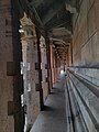 Thousand Pillers Temple.jpg 3,000 × 4,000; 1.5 MB
-
 Villars-le-Grand, temple octogonal, porte.jpg 3,672 × 4,896; 4.55 MB
-
 Villars-le-Grand, temple octogonal.jpg 4,896 × 3,672; 6.46 MB
-
 Villars-le-Grand, temple octogononal, intérieur.jpg 3,672 × 4,896; 4.17 MB


