Category:Temiar
Jump to navigation
Jump to search
| Object location | | View all coordinates using: OpenStreetMap |
|---|
Русский: ru:Темиар
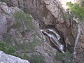
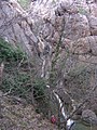
river in Crimea  | |||||
| Upload media | |||||
| Instance of | |||||
|---|---|---|---|---|---|
| Location |
| ||||
| Length |
| ||||
| Mouth of the watercourse |
| ||||
 | |||||
Media in category "Temiar"
The following 6 files are in this category, out of 6 total.
-
 Temiar 1.jpg 2,608 × 1,950; 1.02 MB
-
 Temiar 2.jpg 1,950 × 2,608; 1.09 MB
-
 Temiar 3.jpg 2,608 × 1,950; 961 KB
-
 Temiar 4.jpg 2,608 × 1,950; 794 KB
-
 Temiar 5.jpg 1,950 × 2,608; 1.38 MB
-
 Temiar 6.jpg 1,950 × 2,608; 1.12 MB


