Category:Teigngrace
Jump to navigation
Jump to search
civil parish in Devon, UK  | |||||
| Upload media | |||||
| Instance of | |||||
|---|---|---|---|---|---|
| Location | Teignbridge, Devon, South West England, England | ||||
 | |||||
Subcategories
This category has the following 7 subcategories, out of 7 total.
L
- Leygreen, Devon (6 F)
P
- Teigngrace church (6 F)
S
- Granite Lodge, Stover (6 F)
- Stover House (8 F)
T
Media in category "Teigngrace"
The following 200 files are in this category, out of 482 total.
(previous page) (next page)-
 A bend in the track to Blatchford - geograph.org.uk - 1736448.jpg 640 × 480; 439 KB
-
 A sharp bend in Teigngrace (2) - geograph.org.uk - 1730407.jpg 640 × 480; 388 KB
-
 A38 - geograph.org.uk - 3035752.jpg 640 × 430; 42 KB
-
 A38 and bridge for riders and walkers - geograph.org.uk - 4738355.jpg 1,600 × 1,200; 1.23 MB
-
 A38 and British Ceramic Tile - geograph.org.uk - 6091635.jpg 640 × 480; 62 KB
-
 A38, Heathfield Cross - geograph.org.uk - 4761672.jpg 640 × 382; 39 KB
-
 A382 bridge, A38 - geograph.org.uk - 4765423.jpg 640 × 399; 37 KB
-
 A383 passing East Gold Marshes - geograph.org.uk - 3402497.jpg 1,024 × 768; 181 KB
-
 Absent pontoon, Stover - geograph.org.uk - 5557996.jpg 3,072 × 2,048; 1,012 KB
-
 An area of fallen trees near Teigngrace - geograph.org.uk - 5165980.jpg 1,200 × 1,600; 936 KB
-
 Approaching Stover Quarry - geograph.org.uk - 1730381.jpg 640 × 480; 673 KB
-
 Aqueduct across the River Bovey - geograph.org.uk - 1660304.jpg 640 × 480; 661 KB
-
 Arm of lake, Stover - geograph.org.uk - 5559125.jpg 2,448 × 3,264; 1.48 MB
-
 At Ventiford Basin - geograph.org.uk - 4989997.jpg 1,920 × 1,280; 878 KB
-
 Autumn by the Teign - geograph.org.uk - 1050912.jpg 463 × 640; 113 KB
-
 Autumn trees by the Teign - geograph.org.uk - 1052049.jpg 640 × 480; 124 KB
-
 Back entrance to East Gold Works - geograph.org.uk - 995204.jpg 640 × 480; 76 KB
-
 Banks of the Teign - geograph.org.uk - 1052229.jpg 640 × 480; 99 KB
-
 Barn at Teigngrace - geograph.org.uk - 5165938.jpg 1,600 × 1,200; 756 KB
-
 Barn at Teigngrace - geograph.org.uk - 874268.jpg 640 × 452; 133 KB
-

-
 Bend in the disused railway - geograph.org.uk - 1660186.jpg 640 × 480; 591 KB
-
 Birch trees near Jetty Marsh - geograph.org.uk - 1052915.jpg 480 × 640; 97 KB
-
 Bird Hide - geograph.org.uk - 6230020.jpg 1,024 × 768; 250 KB
-
 Bird Hide, Stove Country Park Lake - geograph.org.uk - 4267252.jpg 800 × 532; 123 KB
-
 Blossom, Stover - geograph.org.uk - 2355036.jpg 640 × 460; 77 KB
-

-

-
 Bridge - geograph.org.uk - 4267280.jpg 800 × 532; 162 KB
-
 Bridge carrying Templer Trail cycleway - geograph.org.uk - 5165911.jpg 1,600 × 1,200; 847 KB
-
 Bridge for carriage drive in Stover Park - geograph.org.uk - 5166015.jpg 1,600 × 1,200; 708 KB
-
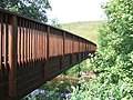
 Bridge for riders and walkers over A38 - geograph.org.uk - 4738350.jpg 1,600 × 1,200; 1.39 MB
-
 Bridge on Templar Way - geograph.org.uk - 1052562.jpg 480 × 640; 151 KB
-
 Bridge on Templer Way - geograph.org.uk - 1371776.jpg 640 × 480; 307 KB
-
 Bridge over disused railway - geograph.org.uk - 1660174.jpg 640 × 480; 645 KB
-
 Bridge over Stover Canal - geograph.org.uk - 2371939.jpg 800 × 600; 425 KB
-
 Bridge over the River Teign - geograph.org.uk - 3307598.jpg 1,024 × 768; 224 KB
-
 Bridge over Ventiford Brook in Stover Country Park - geograph.org.uk - 3145415.jpg 4,000 × 3,000; 4.81 MB
-
 Bridge under railway, Newton Abbot - geograph.org.uk - 3341286.jpg 640 × 480; 52 KB
-
 Bridge, Stover Country Park - geograph.org.uk - 3501210.jpg 640 × 480; 137 KB
-
 Brocks Farm - geograph.org.uk - 1660169.jpg 640 × 426; 423 KB
-
 Canal bridge on Old Exeter Road - geograph.org.uk - 995174.jpg 640 × 497; 113 KB
-
 Canal, footpath and cycleway - geograph.org.uk - 5165928.jpg 1,600 × 1,200; 860 KB
-
 Canal, Stover - geograph.org.uk - 2355019.jpg 640 × 480; 141 KB
-
 Canal, Stover - geograph.org.uk - 4242242.jpg 1,920 × 1,440; 1.08 MB
-
 Car park, Stover - geograph.org.uk - 5559035.jpg 2,048 × 3,072; 1.33 MB
-
 Car park, Stover - geograph.org.uk - 5559038.jpg 3,072 × 2,048; 1.15 MB
-

-
 Carriage Drive and Gatehouse, Stover Estate - geograph.org.uk - 3145267.jpg 4,000 × 3,000; 5.12 MB
-
 Carriage Drive, Stover Country Park - geograph.org.uk - 3145275.jpg 4,000 × 3,000; 4.57 MB
-
 Cars parked for Stover Park - geograph.org.uk - 4901548.jpg 640 × 480; 194 KB
-
 Cattle by Ventiford Brook - geograph.org.uk - 872895.jpg 640 × 464; 126 KB
-
 Causeway, Old Exeter Road - geograph.org.uk - 1736443.jpg 640 × 480; 381 KB
-

-

-
 Clay waste heap north of Brocks Farm - geograph.org.uk - 1660196.jpg 640 × 427; 342 KB
-
 Clay waste heap west of Brocks farm - geograph.org.uk - 1660222.jpg 640 × 426; 363 KB
-
 Clay waste, Stover Quarry - geograph.org.uk - 1730318.jpg 2,449 × 1,837; 2.86 MB
-
 Clay Works, Kingsteignton - geograph.org.uk - 4779901.jpg 640 × 480; 63 KB
-
 Compass Caravan Park - geograph.org.uk - 12055.jpg 573 × 338; 254 KB
-

-
 Conifers by the Templer Way - geograph.org.uk - 2815218.jpg 503 × 640; 120 KB
-
 Crossing Keepers Cottage, Teign Bridge - geograph.org.uk - 16324.jpg 634 × 422; 104 KB
-
 Cycle Path and footpath - geograph.org.uk - 3755098.jpg 640 × 428; 129 KB
-
 Cycle path at Stover - geograph.org.uk - 5559049.jpg 2,048 × 3,072; 1.22 MB
-
 Cycle path at Stover - geograph.org.uk - 5559115.jpg 2,385 × 3,090; 1.19 MB
-
 Cycle path at Stover - geograph.org.uk - 5559253.jpg 2,115 × 2,691; 1.08 MB
-
 Cycle route along Templar Way (3) - geograph.org.uk - 1052549.jpg 480 × 640; 138 KB
-
 Cycle route along Templar Way - geograph.org.uk - 1052497.jpg 480 × 640; 145 KB
-
 Cycle route along the Templer Way - geograph.org.uk - 1052385.jpg 640 × 480; 148 KB
-
 Cycleway over the A38 - geograph.org.uk - 5113107.jpg 2,000 × 1,333; 1.95 MB
-
 Dappled tree bough, River Teign - geograph.org.uk - 992057.jpg 477 × 640; 140 KB
-
 Derelict lock - Stover Canal - geograph.org.uk - 4324880.jpg 640 × 480; 138 KB
-
 Dew-covered low-lying cobwebs - geograph.org.uk - 3145186.jpg 4,000 × 3,000; 2.65 MB
-
 Disused Lock at Locksbridge - geograph.org.uk - 5028207.jpg 1,600 × 1,067; 997 KB
-
 Disused lock at Locksbridge - geograph.org.uk - 5028215.jpg 1,600 × 1,067; 971 KB
-
 Disused railway at Teigngrace - geograph.org.uk - 1371749.jpg 640 × 480; 296 KB
-

-

-
-
 Douglas Fir plantation - geograph.org.uk - 1730213.jpg 640 × 480; 571 KB
-
 Drain by Templar Way - geograph.org.uk - 1052568.jpg 480 × 640; 131 KB
-
 Drain near Teignbridge Crossing - geograph.org.uk - 994984.jpg 480 × 640; 127 KB
-

-
 Duckboards, Templar Way - geograph.org.uk - 994239.jpg 640 × 480; 138 KB
-
 Duckboards, Templar Way - geograph.org.uk - 994254.jpg 480 × 640; 140 KB
-
 Duckboards, Templer Way - geograph.org.uk - 994111.jpg 640 × 480; 141 KB
-
 East Gold Works from Mount Pleasant - geograph.org.uk - 3330775.jpg 460 × 640; 58 KB
-
 Edge of a plantation - geograph.org.uk - 1730209.jpg 640 × 480; 474 KB
-
 Entering Newton Abbot on the A382 - geograph.org.uk - 3485236.jpg 800 × 600; 128 KB
-

-
 Erosion and deposition by the Teign - geograph.org.uk - 1730431.jpg 640 × 480; 492 KB
-
-
 Exeter Road - geograph.org.uk - 1050696.jpg 640 × 480; 131 KB
-
 Exeter Road bridge over Stover Canal - geograph.org.uk - 5233873.jpg 1,600 × 1,200; 805 KB
-
 Fallen willow, east bank of the Teign - geograph.org.uk - 1730413.jpg 640 × 480; 640 KB
-
 Fence, Newton Abbot Racecourse - geograph.org.uk - 3369545.jpg 640 × 403; 61 KB
-
 Field and pylon near Heathfield - geograph.org.uk - 3145181.jpg 3,887 × 2,906; 2.99 MB
-
 Field by the Templar Way - geograph.org.uk - 994233.jpg 640 × 489; 145 KB
-
 Field drain and footpath near Teigngrace - geograph.org.uk - 3145352.jpg 4,000 × 3,000; 3.21 MB
-
 Field drain near Teigngrace - geograph.org.uk - 3145346.jpg 4,000 × 3,000; 3.8 MB
-
 Field north-east of Stover School - geograph.org.uk - 5166002.jpg 1,600 × 1,200; 832 KB
-

-
 Field, Stover - geograph.org.uk - 2815207.jpg 640 × 424; 54 KB
-
 Field, Teigngrace - geograph.org.uk - 2815225.jpg 640 × 481; 58 KB
-
 Field, Teigngrace - geograph.org.uk - 2815230.jpg 640 × 438; 58 KB
-
 Flats seen from Templer Way - geograph.org.uk - 5233881.jpg 1,600 × 1,200; 846 KB
-
 Flooded woodland by Templer Way - geograph.org.uk - 1052678.jpg 640 × 480; 138 KB
-
 Foot- and cycle-bridge at Drumbridges - geograph.org.uk - 5056843.jpg 3,072 × 2,048; 961 KB
-
 Footbridge crossing the Teign - geograph.org.uk - 4268382.jpg 800 × 532; 184 KB
-
 Footbridge in Stover Country Park - geograph.org.uk - 2371848.jpg 800 × 600; 570 KB
-
 Footbridge on the Templer Way - geograph.org.uk - 1371741.jpg 640 × 480; 244 KB
-
 Footbridge over River Teign - geograph.org.uk - 1371732.jpg 640 × 480; 284 KB
-
 Footbridge over the A38 - geograph.org.uk - 4761674.jpg 640 × 404; 51 KB
-
 Footbridge over the River Teign - geograph.org.uk - 5233861.jpg 1,200 × 1,600; 926 KB
-
 Footbridge over the River Teign - geograph.org.uk - 5740330.jpg 640 × 426; 37 KB
-
 Footpath approaching Stover Country Park wood - geograph.org.uk - 3145407.jpg 4,000 × 3,000; 4.14 MB
-
 Footpath beside the former Stover Canal - geograph.org.uk - 5165922.jpg 1,200 × 1,600; 825 KB
-
 Footpath by the Teign - geograph.org.uk - 1050717.jpg 640 × 480; 77 KB
-
 Footpath crossing railway at Teigngrace - geograph.org.uk - 2662971.jpg 768 × 1,024; 296 KB
-
 Footpath raised walkway - geograph.org.uk - 3755182.jpg 640 × 428; 138 KB
-
 Footpath to Kingsteignton - geograph.org.uk - 3903566.jpg 1,024 × 686; 249 KB
-
 Footpath to Preston - geograph.org.uk - 5028235.jpg 1,600 × 1,067; 600 KB
-
 Footpath upstream from Teign Bridge - geograph.org.uk - 1736464.jpg 640 × 480; 443 KB
-
 Former East Golds clay quarry - geograph.org.uk - 1736511.jpg 640 × 480; 358 KB
-
 Former pond by Templar Way - geograph.org.uk - 1052574.jpg 640 × 480; 164 KB
-
 Former warehouses - Teigngrace - geograph.org.uk - 4806806.jpg 640 × 480; 106 KB
-

-
 Fungus, Stover Park - geograph.org.uk - 3720196.jpg 1,920 × 1,471; 789 KB
-
 Gate and posts near Teigngrace - geograph.org.uk - 993220.jpg 640 × 443; 116 KB
-
 Gate into Newpark Plantation - geograph.org.uk - 4242241.jpg 1,920 × 2,324; 1.26 MB
-
 Gate, Stover Country Park - geograph.org.uk - 6219863.jpg 640 × 474; 149 KB
-
 Gated field entrance - geograph.org.uk - 4901546.jpg 640 × 480; 155 KB
-
 Gates on the Templer Way - geograph.org.uk - 3501060.jpg 540 × 640; 118 KB
-
 Goldfinch bathing by The Teign - geograph.org.uk - 887863.jpg 608 × 640; 113 KB
-
 Granite Lodge - geograph.org.uk - 5356089.jpg 640 × 425; 65 KB
-
 Granite Lodge, Stover - geograph.org.uk - 5074585.jpg 2,662 × 1,715; 1.13 MB
-
 Granite Lodge, Stover - geograph.org.uk - 5075855.jpg 1,665 × 1,149; 513 KB
-
 Grassland by the Templar Way - geograph.org.uk - 1052545.jpg 640 × 480; 135 KB
-
 Graving Dock Lock on Stover Canal - geograph.org.uk - 5233866.jpg 1,600 × 1,200; 777 KB
-
 Graving Dock Lock on Stover Canal - geograph.org.uk - 5233871.jpg 1,600 × 1,200; 831 KB
-
 Graving Dock lock, Stover Canal (1) - geograph.org.uk - 993879.jpg 480 × 640; 142 KB
-
 Graving Dock lock, Stover Canal (2) - geograph.org.uk - 993885.jpg 640 × 480; 145 KB
-
 Graving Dock lock, Stover Canal (3) - geograph.org.uk - 993899.jpg 480 × 640; 108 KB
-
 Graving Dock on Stover Canal - geograph.org.uk - 5233868.jpg 1,600 × 1,200; 827 KB
-

-

-
 Greycoat Lane - geograph.org.uk - 5693541.jpg 3,558 × 2,166; 1.05 MB
-
 Greycoat Lane at Forches Cross - geograph.org.uk - 2371877.jpg 800 × 600; 474 KB
-
 Gullying in clay waste, Stover Quarry - geograph.org.uk - 1730402.jpg 640 × 480; 419 KB
-
 Haytor Granite Tramway - geograph.org.uk - 4989690.jpg 1,920 × 2,638; 1.85 MB
-
 Haytor Granite Tramway - geograph.org.uk - 4989784.jpg 1,920 × 2,880; 1.97 MB
-
 Haytor Granite Tramway - geograph.org.uk - 4989980.jpg 1,920 × 2,880; 1.96 MB
-
 Hearders, Teigngrace - geograph.org.uk - 4268283.jpg 800 × 532; 132 KB
-
 Heatherfield Cross - geograph.org.uk - 5356090.jpg 640 × 496; 69 KB
-
 Heathfield , British Ceramic Tiles - geograph.org.uk - 6331605.jpg 6,000 × 4,000; 7.76 MB
-
 Heathfield branch line - geograph.org.uk - 3145195.jpg 4,000 × 3,000; 4.45 MB
-
 Heathfield branch line near Brocks Farm - geograph.org.uk - 3145202.jpg 4,000 × 3,000; 3.88 MB
-
 Heathfield branch line near the disused Teigngrace Halt - geograph.org.uk - 3145374.jpg 4,000 × 3,000; 3.71 MB
-
 Heathfield branch line near Ventiford, looking north - geograph.org.uk - 3145294.jpg 4,000 × 3,000; 5.19 MB
-
 Heathfield branch line near Ventiford, looking south - geograph.org.uk - 3145285.jpg 4,000 × 3,000; 5.21 MB
-

-
 Hide by Templar Way - geograph.org.uk - 1052557.jpg 640 × 480; 125 KB
-
 House at Leygreen - geograph.org.uk - 3500553.jpg 640 × 470; 75 KB
-
 Houses at Ventiford - geograph.org.uk - 3500607.jpg 640 × 470; 82 KB
-
 Houses near Mount Pleasant - geograph.org.uk - 1736446.jpg 640 × 480; 407 KB
-
 Ilford Park - geograph.org.uk - 13101.jpg 636 × 424; 255 KB
-
 Imerys Minerals Ltd - geograph.org.uk - 6219857.jpg 640 × 480; 84 KB
-
 Important habitat for Sandmartins - geograph.org.uk - 1097484.jpg 640 × 480; 115 KB
-
 Important habitat for Sandmartins - geograph.org.uk - 887886.jpg 640 × 480; 116 KB
-
 Industrial branch line near Teigngrace - geograph.org.uk - 6091636.jpg 480 × 640; 181 KB
-

-

-
 Island in the Teign - geograph.org.uk - 992002.jpg 640 × 480; 116 KB
-
 Islands, River Teign - geograph.org.uk - 992096.jpg 640 × 484; 134 KB
-
 Jetty Marsh Basin - geograph.org.uk - 5871955.jpg 640 × 480; 138 KB
-

-
 Jetty Marsh canal basin - geograph.org.uk - 1186765.jpg 480 × 640; 107 KB
-
 Jetty Marsh Canal Basin on the Stover Canal - geograph.org.uk - 5233882.jpg 1,600 × 1,200; 806 KB
-
 Jetty Marsh Footpath - geograph.org.uk - 3753968.jpg 640 × 428; 147 KB
-
 Jetty Marsh Local Nature Reserve - geograph.org.uk - 900593.jpg 640 × 480; 125 KB
-
 Kestrel hunting rodents - geograph.org.uk - 1097508.jpg 556 × 640; 56 KB
-
 Kissing gate on Templer Way - geograph.org.uk - 1371755.jpg 640 × 480; 315 KB
-
 Lake backwater, Stover - geograph.org.uk - 5458178.jpg 3,072 × 2,048; 1.27 MB
-
 Lane (part of Templer Way) - geograph.org.uk - 1371761.jpg 640 × 480; 271 KB
-
 Lane to Brocks Farm (2) - geograph.org.uk - 1660122.jpg 640 × 426; 441 KB
-

-
 Level crossing - Teigngrace - geograph.org.uk - 4324881.jpg 640 × 480; 112 KB
-
 Level Crossing, Teigngrace - geograph.org.uk - 4268287.jpg 800 × 532; 182 KB
-
 Ley Key Green bridge - geograph.org.uk - 1371713.jpg 640 × 480; 312 KB
-
 Locks Bridge, Stover Canal - geograph.org.uk - 3145364.jpg 4,000 × 3,000; 3.86 MB
-
 Looking upstream, River Teign - geograph.org.uk - 4268368.jpg 800 × 516; 166 KB
-

-
 Marsh marigolds, Stover Canal - geograph.org.uk - 1252250.jpg 640 × 488; 80 KB
-
 Meadow beside the Templar Way (2) - geograph.org.uk - 1052438.jpg 640 × 464; 136 KB
-
 Meadow beside the Templar Way - geograph.org.uk - 994815.jpg 640 × 480; 96 KB
-
 Meadow beside the Templer Way (3) - geograph.org.uk - 1052479.jpg 640 × 480; 113 KB
-
 Meadow beside the Templer Way (4) - geograph.org.uk - 1052504.jpg 480 × 640; 123 KB
-
 Meadow beside the Templer Way - geograph.org.uk - 1052419.jpg 640 × 480; 109 KB
-
 Meadow by the Templer Way - geograph.org.uk - 993993.jpg 640 × 480; 95 KB

_-_geograph.org.uk_-_1730407.jpg)


_-_geograph.org.uk_-_1660312.jpg)


_-_geograph.org.uk_-_1052549.jpg)


_-_geograph.org.uk_-_3755050.jpg)


_by_Templer_Way_-_geograph.org.uk_-_1371766.jpg)


_-_geograph.org.uk_-_993879.jpg)
_-_geograph.org.uk_-_993885.jpg)
_-_geograph.org.uk_-_993899.jpg)


_-_geograph.org.uk_-_3755065.jpg)


_-_geograph.org.uk_-_1371761.jpg)
_-_geograph.org.uk_-_1660122.jpg)


_-_geograph.org.uk_-_1052438.jpg)

_-_geograph.org.uk_-_1052479.jpg)
_-_geograph.org.uk_-_1052504.jpg)

