Category:Teddesley Hay
Jump to navigation
Jump to search
English: Teddesley Hay is a civil parish in the South Staffordshire district, in the county of Staffordshire, England.
civil parish in South Staffordshire, Staffordshire, England | |||||
| Upload media | |||||
| Instance of | |||||
|---|---|---|---|---|---|
| Location | South Staffordshire, Staffordshire, West Midlands, England | ||||
 | |||||
Media in category "Teddesley Hay"
The following 153 files are in this category, out of 153 total.
-
 A seat in the sky - geograph.org.uk - 5399859.jpg 1,469 × 1,102; 646 KB
-

-
 A34 Cannock to Stafford road - geograph.org.uk - 2451869.jpg 640 × 428; 81 KB
-
 A34 north of Bog Moor - geograph.org.uk - 5400723.jpg 1,469 × 1,102; 801 KB
-
 Along the northern edge of Bright's Plantation - geograph.org.uk - 5399872.jpg 1,469 × 1,102; 658 KB
-
 Anglers north of Penkridge, Staffordshire - geograph.org.uk - 4178817.jpg 1,024 × 688; 434 KB
-

-
 Badger Slade - Cannock Chase - geograph.org.uk - 4030547.jpg 3,954 × 3,171; 4.23 MB
-
 Badger's Hills - geograph.org.uk - 3858035.jpg 640 × 480; 367 KB
-
 Barns at Coppice Farm - geograph.org.uk - 4983676.jpg 1,600 × 1,200; 493 KB
-
 Bend on the A34 by Bright's Plantation - geograph.org.uk - 5399868.jpg 1,306 × 979; 673 KB
-
 Boat lift-crane at the Teddesley Boat Company marina - geograph.org.uk - 5399035.jpg 1,469 × 1,102; 529 KB
-
 Boat yard at Teddesley near Penkridge, Staffordshire - geograph.org.uk - 5609825.jpg 960 × 1,280; 1.11 MB
-
 Boatyard Behind Bridge 90. - geograph.org.uk - 2432350.jpg 640 × 428; 79 KB
-
 Bridge over the M6 - geograph.org.uk - 3195398.jpg 3,440 × 1,862; 1.16 MB
-
 Bridleway into Dark Slade wood - geograph.org.uk - 5400706.jpg 1,469 × 1,102; 865 KB
-
 Bridleway to Dark Slade - geograph.org.uk - 5400709.jpg 1,469 × 1,102; 581 KB
-
 Broadhurst Green - geograph.org.uk - 2655777.jpg 2,560 × 1,920; 2.35 MB
-
 Burrows (GM) Limited, Bednall. - geograph.org.uk - 2432561.jpg 640 × 428; 65 KB
-
 Camp Road - geograph.org.uk - 2077539.jpg 640 × 427; 271 KB
-
 Camp Road - geograph.org.uk - 4030554.jpg 3,119 × 2,563; 2.86 MB
-
 Canal and road north of Penkridge in Staffordshire - geograph.org.uk - 6018020.jpg 1,440 × 960; 1.61 MB
-

-

-

-

-

-

-
 Canal south of Acton Trussell in Staffordshire - geograph.org.uk - 5365657.jpg 1,280 × 960; 1.25 MB
-
 Cannock Chase Treking Centre - geograph.org.uk - 6264968.jpg 2,000 × 1,500; 2.96 MB
-
 Cannock Chase War Cemeteries - geograph.org.uk - 2655772.jpg 2,560 × 1,920; 2.21 MB
-
 Cattle grazing north of Penkridge, Staffordshire - geograph.org.uk - 5365669.jpg 1,280 × 874; 742 KB
-
 Cattle grazing north of Penkridge, Staffordshire - geograph.org.uk - 5365673.jpg 1,280 × 810; 1.17 MB
-
 Clogged meander of stream feeding river Penk - geograph.org.uk - 3446346.jpg 1,600 × 1,200; 629 KB
-
 Commonwealth War Cemetery - Cannock Chase - geograph.org.uk - 3669838.jpg 1,600 × 1,064; 394 KB
-
 Coppice Farm and Buxtons A34 - geograph.org.uk - 271285.jpg 640 × 303; 80 KB
-
 Crop field off Pottal Pool Road - geograph.org.uk - 6158402.jpg 800 × 600; 125 KB
-
 Disused pheasant kit in Pottal Covert - geograph.org.uk - 5399866.jpg 1,306 × 979; 913 KB
-

-

-

-
 Entrance to Pottal Covert - geograph.org.uk - 2899284.jpg 640 × 480; 79 KB
-
-
 Entrance to Teddesley Park - geograph.org.uk - 2444942.jpg 640 × 428; 101 KB
-
 Entrance To The Chase Golf Club. - geograph.org.uk - 2435783.jpg 640 × 428; 52 KB
-
 Estate track in Teddesley Park - geograph.org.uk - 5401680.jpg 1,469 × 1,102; 610 KB
-
 Estate track south of Teddesley Home Farm - geograph.org.uk - 5402457.jpg 1,632 × 1,224; 754 KB
-
 Extension to Pottal Pool Quarry - geograph.org.uk - 3669432.jpg 1,600 × 1,064; 267 KB
-
 Footpath into Dark Slade - geograph.org.uk - 3669396.jpg 1,600 × 1,064; 363 KB
-
 Footpath Near Teddesley - geograph.org.uk - 270526.jpg 640 × 480; 130 KB
-
 Footpath Near Wood Bank Farm - geograph.org.uk - 2567030.jpg 1,496 × 1,122; 840 KB
-
 Former Burrows GM Ltd showroom and workshops - geograph.org.uk - 4983791.jpg 1,600 × 1,200; 465 KB
-
 Former Service Block, Teddesley Hall.jpg 1,469 × 1,102; 781 KB
-
 Former Stable Block, Teddesley Hall.jpg 1,469 × 1,102; 702 KB
-
 Grenville's Wood - geograph.org.uk - 271287.jpg 640 × 480; 53 KB
-
 Hire boats north of Penkridge, Staffordshire - geograph.org.uk - 4178841.jpg 1,024 × 777; 436 KB
-
 Keepers Lodge - geograph.org.uk - 187105.jpg 640 × 427; 113 KB
-
 Lake, Teddesley Park - geograph.org.uk - 385521.jpg 640 × 480; 119 KB
-
 Lock Steps Under Bridge 90. - geograph.org.uk - 2432344.jpg 640 × 428; 88 KB
-
 Looking down the Staffordshire Way - geograph.org.uk - 2478275.jpg 640 × 428; 91 KB
-
 Looking into the Pottal Valley - geograph.org.uk - 2899300.jpg 640 × 480; 94 KB
-
 M6 - looking north on a gloomy afternoon - geograph.org.uk - 2782647.jpg 1,404 × 1,053; 309 KB
-

-
 M6 south of Acton Trussell - geograph.org.uk - 2654734.jpg 640 × 430; 39 KB
-
 M6 southbound near Lower Drayton - geograph.org.uk - 2824896.jpg 640 × 480; 28 KB
-
 M6 southbound, north of Penkridge - geograph.org.uk - 2824902.jpg 640 × 481; 27 KB
-
 Minor road, towpath and canal - geograph.org.uk - 4601164.jpg 640 × 427; 102 KB
-
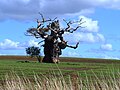 Monstrous Tree - geograph.org.uk - 4933171.jpg 1,600 × 1,200; 380 KB
-
 Moored narrowboat near Penkridge - geograph.org.uk - 3268459.jpg 640 × 424; 77 KB
-

-

-

-
 Narrowboat delivery (4) near Penkridge, Staffordshire - geograph.org.uk - 5610010.jpg 1,280 × 900; 1,020 KB
-

-

-

-

-

-
 Oaklands - geograph.org.uk - 5399126.jpg 1,469 × 1,102; 817 KB
-
 Oaklands - geograph.org.uk - 6158399.jpg 800 × 553; 149 KB
-
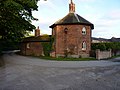 Octagonal cottage, Teddesley Home Farm.jpg 1,795 × 1,346; 844 KB
-
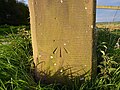
 OS benchmark - Bednall Head, gatepost into parkland - geograph.org.uk - 5400713.jpg 1,469 × 1,102; 732 KB
-
 OS benchmark - Teddesley Hay, bridge 89 - geograph.org.uk - 5399043.jpg 979 × 1,306; 697 KB
-
 OS benchmark - Teddesley Park, gatepost at The Beeches - geograph.org.uk - 5401712.jpg 1,102 × 1,469; 760 KB
-
-
 OS benchmark - Teddesley Park, Oaklands cottage - geograph.org.uk - 5399120.jpg 1,306 × 979; 683 KB
-

-
 Park Gate Bridge No 90 - geograph.org.uk - 5200018.jpg 800 × 575; 161 KB
-

-
 Park Gate Lock near Penkridge, Staffordshire - geograph.org.uk - 5365693.jpg 1,280 × 960; 990 KB
-
 Park Gate Lock near Penkridge, Staffordshire - geograph.org.uk - 5365695.jpg 1,280 × 799; 875 KB
-
 Park Gate Lock No 40 - geograph.org.uk - 5200031.jpg 800 × 758; 136 KB
-
 Park Gate Lock north of Penkridge, Staffordshire - geograph.org.uk - 3641633.jpg 1,024 × 734; 343 KB
-
 Penkridge Sewage Treatment Works - geograph.org.uk - 4548055.jpg 6,000 × 4,000; 4.25 MB
-
 Penkridge sewage works - geograph.org.uk - 2782653.jpg 1,142 × 857; 318 KB
-
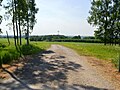
 Pottal Pool Road - geograph.org.uk - 6158403.jpg 800 × 600; 137 KB
-
 Pottal Valley - geograph.org.uk - 2484254.jpg 640 × 428; 120 KB
-
 Private road in Teddesley Park - geograph.org.uk - 4983699.jpg 1,600 × 1,200; 535 KB
-
 Quarry Fence, Dark Slade Wood - geograph.org.uk - 2074638.jpg 640 × 427; 282 KB
-
-
 Quarry, Warren Hill - geograph.org.uk - 2073650.jpg 640 × 427; 280 KB
-
 Reflections on the underside of Shutthill Bridge - geograph.org.uk - 2803100.jpg 3,872 × 2,592; 3.19 MB
-
 Road into Teddesley Park - geograph.org.uk - 5399118.jpg 1,469 × 1,102; 890 KB
-
 Shutt Hill Bridge No.91 And Locks. - geograph.org.uk - 2432383.jpg 640 × 428; 92 KB
-
 Shutt Hill Lock - geograph.org.uk - 3019529.jpg 1,280 × 856; 290 KB
-
 Shutt Hill Lock No 41 and Bridge No 91 - geograph.org.uk - 5200007.jpg 800 × 553; 143 KB
-
 Shutt Hill Lock south of Acton Trussell, Staffordshire - geograph.org.uk - 5365258.jpg 1,024 × 1,024; 884 KB
-

-

-
 Shutthill Lock - geograph.org.uk - 2803117.jpg 3,872 × 2,592; 5.86 MB
-
 Sled Dog Training Area - geograph.org.uk - 2428255.jpg 640 × 428; 118 KB
-
 Southeast of Teddesley Hall - geograph.org.uk - 5402723.jpg 1,632 × 1,224; 900 KB
-
 Spingslade lodge - geograph.org.uk - 3536446.jpg 1,600 × 1,200; 572 KB
-

-

-
 Staffordshire Way and an oak in a field - geograph.org.uk - 5401674.jpg 1,469 × 1,102; 701 KB
-
 Staffordshire Way crosses an estate road - geograph.org.uk - 5401672.jpg 1,469 × 1,102; 621 KB
-
 Strip of disorderly wood near Penkridge - geograph.org.uk - 3446353.jpg 1,600 × 1,200; 847 KB
-

-
 Teddesley Boat Company Ltd - geograph.org.uk - 5200046.jpg 800 × 568; 99 KB
-
 Teddesley Park - geograph.org.uk - 2478282.jpg 640 × 428; 92 KB
-
 Teddesley Park - geograph.org.uk - 385512.jpg 640 × 480; 78 KB
-
 Teddesley Park - geograph.org.uk - 4933210.jpg 1,600 × 1,064; 347 KB
-
 Teddesley Park Bridge - geograph.org.uk - 4601145.jpg 640 × 427; 108 KB
-
 Teddesley Park Bridge No 89 - geograph.org.uk - 5200049.jpg 800 × 525; 131 KB
-

-

-

-

-
 Teddesley Park Home Farm - geograph.org.uk - 4933202.jpg 1,600 × 1,200; 637 KB
-
 Teddesley Park, Staffordshire - geograph.org.uk - 2509734.jpg 640 × 428; 61 KB
-
 Teddesley Park, Staffordshire - geograph.org.uk - 2509747.jpg 640 × 428; 71 KB
-
 Teddesley Park, Staffordshire - geograph.org.uk - 2509759.jpg 640 × 428; 78 KB
-

-
 The Beeches in Spring - geograph.org.uk - 4933146.jpg 1,600 × 1,064; 523 KB
-
 The River Penk north of Penkridge, Staffordshire - geograph.org.uk - 5365686.jpg 1,280 × 847; 827 KB
-
 Towards Teddesley Park - geograph.org.uk - 5399863.jpg 1,469 × 1,102; 583 KB
-

-
 Track Diverted By Quarry Extension - geograph.org.uk - 2428270.jpg 640 × 428; 88 KB
-
 Track junction - geograph.org.uk - 5399884.jpg 1,469 × 1,102; 941 KB
-
 Track through Benty Hill Plantation - geograph.org.uk - 5399880.jpg 1,469 × 1,102; 876 KB
-
 Track through Pottal Covert - geograph.org.uk - 5399804.jpg 1,469 × 1,102; 779 KB
-
 Track To Keepers Lodge - geograph.org.uk - 2428310.jpg 640 × 428; 111 KB
-
 Track to Spring Slade - geograph.org.uk - 4983726.jpg 1,600 × 1,200; 752 KB
-
 Track to the east of Teddesley Home Farm - geograph.org.uk - 5402445.jpg 1,632 × 1,224; 697 KB
-
 Track Up To Springslade Lodge - geograph.org.uk - 2432539.jpg 428 × 640; 112 KB
-
 Trees and track in Bright's Plantation - geograph.org.uk - 5399878.jpg 1,469 × 1,102; 991 KB
-
 View From Under Bridge 91 - geograph.org.uk - 2432397.jpg 640 × 428; 83 KB
-
 Walking north up the towpath - geograph.org.uk - 5397205.jpg 1,306 × 979; 793 KB
-

-
 Woodland track, Cannock Chase - geograph.org.uk - 6158623.jpg 800 × 600; 172 KB
-
 Woodland, Badger Slade - geograph.org.uk - 3858026.jpg 640 × 480; 368 KB
-
 Woodland, Pottal Slade - geograph.org.uk - 3858053.jpg 640 × 480; 312 KB


_Limited,_Bednall._-_geograph.org.uk_-_2432561.jpg)


_near_Penkridge,_Staffordshire_-_geograph.org.uk_-_5609823.jpg)
_near_Penkridge,_Staffordshire_-_geograph.org.uk_-_5609987.jpg)
_near_Penkridge,_Staffordshire_-_geograph.org.uk_-_5609994.jpg)
_near_Penkridge,_Staffordshire_-_geograph.org.uk_-_5610010.jpg)
_near_Penkridge,_Staffordshire_-_geograph.org.uk_-_5610014.jpg)
_near_Penkridge,_Staffordshire_-_geograph.org.uk_-_5610018.jpg)
_near_Penkridge,_Staffordshire_-_geograph.org.uk_-_5610019.jpg)


_-_House_at_Broadhurst_Green_-_geograph.org.uk_-_3898389.jpg)


