Category:Tea maps
Jump to navigation
Jump to search
English: Maps related to tea
Media in category "Tea maps"
The following 14 files are in this category, out of 14 total.
-

-
 Where our tea comes from, 1937.jpg 5,614 × 9,000; 8.71 MB
-
 Ceylon, her tea and other industries.jpg 5,000 × 7,835; 28.82 MB
-
 China - Amoy tea districts LOC 2007627805.jpg 6,169 × 5,092; 3.52 MB
-
 Map of the Tea countries of Assam and Cachar - compiled by Major Briggs - btv1b53172875h.jpg 12,110 × 8,274; 10.91 MB
-
 Map of the tea localities in Kangra District (F11-27).jpg 8,274 × 5,737; 1.4 MB
-
 Map to illustrate fortune's visits to the Tea districts of China and India - 1853.jpg 2,636 × 3,372; 4.92 MB
-
 Names for tea.png 1,042 × 500; 156 KB
-
 Tea plantations distribution in Fujian 2010.png 1,242 × 1,059; 648 KB
-
 Tea plantations distribution in Fujian 2020.png 1,037 × 847; 623 KB
-
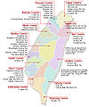 Teaareas taiwansmap.jpg 516 × 620; 111 KB
-
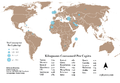 Top 20 Tea Consuming Countries.png 833 × 575; 139 KB
-

-
 Word for Tea in European Languages.svg 1,486 × 1,215; 1.89 MB
.jpg)


.jpg)


.jpg)
