Category:Tayport
Jump to navigation
Jump to search
town in Fife, Scotland, UK  | |||||
| Upload media | |||||
| Instance of | |||||
|---|---|---|---|---|---|
| Location |
| ||||
| Population |
| ||||
| official website | |||||
 | |||||
Subcategories
This category has the following 7 subcategories, out of 7 total.
E
- Tayport East Lighthouse (11 F)
H
- Tayport harbour (39 F)
P
- Tayport Pile Lighthouse (3 F)
R
- Railway Bridge (Morton) (7 F)
S
- Scotscraig golf course (23 F)
W
- Tayport West Lighthouse (12 F)
Media in category "Tayport"
The following 200 files are in this category, out of 276 total.
(previous page) (next page)-
 'The Auld Hoose' - geograph.org.uk - 4555655.jpg 4,608 × 3,456; 3.08 MB
-
 A cairn at Tayport - geograph.org.uk - 3569465.jpg 640 × 463; 178 KB
-
 A Dalgleish Street tenement,Tayport - geograph.org.uk - 5573116.jpg 4,895 × 3,142; 2.48 MB
-
 A narrow wynd in Tayport - geograph.org.uk - 4553518.jpg 3,456 × 4,608; 3.43 MB
-
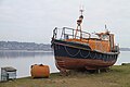
 A retired lifeboat in Tayport - geograph.org.uk - 4555124.jpg 4,608 × 3,456; 3.08 MB
-
 Access path to West Lighthouse - geograph.org.uk - 4549241.jpg 3,456 × 4,608; 4.44 MB
-
 Access to Scotscraig Golf Club, Tayport - geograph.org.uk - 4744789.jpg 4,217 × 2,987; 2.33 MB
-
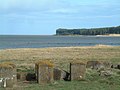
 Across the water to Broughty Castle - geograph.org.uk - 6311430.jpg 5,184 × 3,888; 4.55 MB
-

-

-

-
 Auld Kirk, Tayport - geograph.org.uk - 4086792.jpg 640 × 480; 107 KB
-
 Bales on stubble - geograph.org.uk - 4143123.jpg 2,048 × 1,536; 463 KB
-
 Beat of Tayport (Joiners) - geograph.org.uk - 4556162.jpg 4,608 × 3,456; 2.98 MB
-
 Bell Rock Tavern - geograph.org.uk - 4555256.jpg 640 × 480; 69 KB
-
 Bell Rock Tavern Tayport - geograph.org.uk - 337587.jpg 640 × 431; 65 KB
-
 Bell Rock Tavern, Tayport - geograph.org.uk - 2181284.jpg 640 × 480; 67 KB
-
 Bell Rock Tavern, Tayport - geograph.org.uk - 5573130.jpg 4,691 × 3,174; 1.84 MB
-
 Bench above the beach - geograph.org.uk - 1118875.jpg 640 × 483; 100 KB
-
 Benchmark on sea wall, Tayport - geograph.org.uk - 4900360.jpg 640 × 480; 82 KB
-
 Black headed gull Tayport.jpg 3,456 × 2,304; 4.6 MB
-
 BMX track, Lundin - geograph.org.uk - 2542836.jpg 640 × 480; 306 KB
-
 Boat entering the harbour at Tayport - geograph.org.uk - 5993315.jpg 640 × 419; 55 KB
-
 Boats moored in Tayport harbour - geograph.org.uk - 5993326.jpg 640 × 447; 59 KB
-
 Boatyard at Tayport - geograph.org.uk - 3358904.jpg 640 × 550; 258 KB
-
 Breakwater - geograph.org.uk - 153027.jpg 640 × 480; 69 KB
-
 Breakwater footpath - geograph.org.uk - 4140065.jpg 2,048 × 1,536; 1.53 MB
-
 Broughty Castle - geograph.org.uk - 6420994.jpg 640 × 480; 87 KB
-
 Broughty Ferry across the Firth of Tay - geograph.org.uk - 5446461.jpg 800 × 638; 138 KB
-
 Burn entering Firth of Tay at Tayport - geograph.org.uk - 3634570.jpg 640 × 472; 266 KB
-
 Caravan park, East Common - geograph.org.uk - 2543601.jpg 640 × 480; 300 KB
-
 Cattle near Tayport - geograph.org.uk - 5992622.jpg 640 × 527; 108 KB
-
 Cemetery pathway, Ferry Port of Craig - geograph.org.uk - 4549041.jpg 4,608 × 3,456; 3.01 MB
-

-
 Coastal defence - geograph.org.uk - 6397917.jpg 1,600 × 1,200; 387 KB
-
 Coastal Information Board (Vandalised) - geograph.org.uk - 4744334.jpg 4,608 × 3,456; 3.2 MB
-

-
 Cobbies Inn - geograph.org.uk - 6298134.jpg 640 × 480; 187 KB
-
 Cobbies Inn, Tay Street - geograph.org.uk - 4555280.jpg 4,608 × 3,456; 3.09 MB
-
 Cobbies Inn, Tayport - geograph.org.uk - 1454980.jpg 640 × 480; 61 KB
-

-
 Country road near Tayport - geograph.org.uk - 72333.jpg 640 × 480; 141 KB
-
 Cycle route on the salt marshes - geograph.org.uk - 6299432.jpg 640 × 480; 245 KB
-
 Cygnet Tayport.jpg 3,456 × 2,304; 4.66 MB
-
 Cygnets Birnie Loch Fife.jpg 3,456 × 2,304; 5.84 MB
-
 Cygnets Tayport.jpg 3,456 × 2,304; 5.02 MB
-
 DMU at Tayport.jpg 1,599 × 933; 102 KB
-
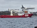 DOF Support Vessel, Skandia Carla - geograph.org.uk - 5573369.jpg 4,896 × 3,672; 6.64 MB
-
 Duckling 1 Tayport.jpg 3,456 × 2,304; 6.08 MB
-
 Duckling Tayport.jpg 3,456 × 2,304; 4.94 MB
-
 Ducklings Tayport.jpg 3,456 × 2,304; 4.91 MB
-
 Dundee and the Tay estuary from Fife - geograph.org.uk - 77631.jpg 640 × 480; 129 KB
-
 Early 20th Century post box - geograph.org.uk - 1454968.jpg 480 × 640; 132 KB
-
 East Common - geograph.org.uk - 2721702.jpg 640 × 480; 97 KB
-
 Entrance to Tayport Caravan Site - geograph.org.uk - 4744347.jpg 4,608 × 3,456; 3.21 MB
-
 Entry to Ferry Port on Craig Cemetery - geograph.org.uk - 4549031.jpg 4,608 × 3,456; 3.13 MB
-
 Fairway on Scotscraig Golf Course - geograph.org.uk - 6298559.jpg 640 × 480; 258 KB
-
 Fairway on Scotscraig Golf Course - geograph.org.uk - 6298565.jpg 640 × 480; 290 KB
-
 Farmland at Shanwell Farm - geograph.org.uk - 5244601.jpg 640 × 480; 48 KB
-
 Farmland, Tayport - geograph.org.uk - 2834309.jpg 640 × 360; 226 KB
-
 Ferry Port on Craig Cemetery - geograph.org.uk - 4549053.jpg 4,608 × 3,456; 3.08 MB
-
 Field at Shanwell near Tayport - geograph.org.uk - 4562396.jpg 640 × 473; 54 KB
-
 Fife coast of the Tay - geograph.org.uk - 2841278.jpg 2,048 × 1,536; 1.59 MB
-
 Fife Coastal Path at Tayport - geograph.org.uk - 5993054.jpg 640 × 403; 66 KB
-
 Filled in railway cutting - geograph.org.uk - 2833810.jpg 640 × 360; 231 KB
-
 Finish, Scottish Six Days Day 4 2009 - geograph.org.uk - 1434588.jpg 640 × 480; 109 KB
-
-
 Fisherman at Tayport harbour - geograph.org.uk - 5993311.jpg 640 × 443; 70 KB
-
 Footpath to Morton Lochs - geograph.org.uk - 3299328.jpg 2,048 × 1,536; 957 KB
-
 Former Drill Hall, Tayport - geograph.org.uk - 4074761.jpg 640 × 466; 64 KB
-
 Former railway bridges - geograph.org.uk - 3088305.jpg 2,816 × 2,112; 1.07 MB
-
 Gap in defences^ - geograph.org.uk - 764069.jpg 640 × 480; 66 KB
-
 Gospel Hall, Butter Wynd, Tayport - geograph.org.uk - 4555504.jpg 4,608 × 3,456; 2.99 MB
-

-
 Harbour at Tayport - geograph.org.uk - 4562412.jpg 640 × 479; 70 KB
-
 Harbour Cafe, Tay Street - geograph.org.uk - 4555232.jpg 3,456 × 4,608; 3.42 MB
-
 Harbour Cafe, Tayport - geograph.org.uk - 5573135.jpg 3,284 × 3,901; 1.99 MB
-
 Harbour entrance at Tayport - geograph.org.uk - 6311424.jpg 5,184 × 3,888; 2.68 MB
-
 Harbour swans - geograph.org.uk - 3925707.jpg 721 × 1,192; 197 KB
-
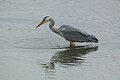
 Heron 1 Tayport.jpg 3,456 × 2,304; 3.85 MB
-
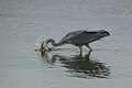
 Heron 2 Tayport.jpg 3,456 × 2,304; 3.96 MB
-
 Heron 3 Tayport.jpg 3,456 × 2,304; 3.9 MB
-
 Heron 4 Tayport.jpg 3,456 × 2,304; 4.1 MB
-
 Heron in flight 1.jpg 3,456 × 2,304; 3.99 MB
-
 Heron in flight 2.jpg 3,456 × 2,304; 3.68 MB
-
 Heron in flight 3.jpg 3,456 × 2,304; 3.14 MB
-
 High tide at Snook Head - geograph.org.uk - 6311426.jpg 5,146 × 2,971; 2.31 MB
-

-
 Houses on Commonty Road, Tayport - geograph.org.uk - 4553290.jpg 4,608 × 3,456; 3.25 MB
-
 Ice house - geograph.org.uk - 3925719.jpg 1,600 × 1,200; 374 KB
-
 Ice on the Tay Shoreline - geograph.org.uk - 2201099.jpg 1,600 × 1,200; 295 KB
-
 Inverdovat to Tayport road - geograph.org.uk - 439279.jpg 426 × 640; 128 KB
-
 Jellyfish Tayport 2.jpg 3,456 × 2,304; 4.52 MB
-
 Jellyfish Tayport 3.jpg 3,456 × 2,304; 4.23 MB
-
 Juvenile mallard Tayport Fife 1.jpg 3,456 × 2,304; 5.22 MB
-
 Juvenile mallard Tayport Fife.jpg 3,456 × 2,304; 4.72 MB
-
 Juvenile moorhen Tayport 1.jpg 3,456 × 2,304; 5.77 MB
-
 Juvenile moorhen Tayport.jpg 3,456 × 2,304; 4.82 MB
-
 Larick Beacon - geograph.org.uk - 2543606.jpg 640 × 480; 213 KB
-
 Larick Beacon - geograph.org.uk - 3357982.jpg 640 × 480; 202 KB
-
 Larick Scalp - geograph.org.uk - 3357996.jpg 640 × 455; 236 KB
-

-
 Lead Burn - geograph.org.uk - 2542834.jpg 640 × 359; 210 KB
-
 Lifeboat at Tayport Marina (26262842931).jpg 5,184 × 3,456; 3.41 MB
-
 Line of former railway at Tayport - geograph.org.uk - 4562422.jpg 640 × 480; 61 KB
-
 Links Road - geograph.org.uk - 1454394.jpg 640 × 359; 76 KB
-
 Links Road - geograph.org.uk - 2543603.jpg 640 × 480; 248 KB
-
 Links Road North - geograph.org.uk - 3088987.jpg 2,816 × 2,112; 1.33 MB
-
 Looking out to Lucky Scalp - geograph.org.uk - 764540.jpg 640 × 480; 57 KB
-
 Looking out towards Pile Lighthouse - geograph.org.uk - 4744324.jpg 4,608 × 3,456; 2.96 MB
-
 Looking out towards Tentsmuir National Nature Reserve - geograph.org.uk - 4744309.jpg 4,608 × 3,456; 3.19 MB
-
 Looking to Tayport - geograph.org.uk - 1540074.jpg 640 × 480; 42 KB
-
 Looking to Tentsmuir - geograph.org.uk - 2201119.jpg 1,600 × 1,200; 454 KB
-
 Low tide at Tayport - geograph.org.uk - 6298849.jpg 640 × 480; 265 KB
-
 Low water at Larick Scalp - geograph.org.uk - 4143116.jpg 2,048 × 1,536; 1.52 MB
-
 Lundin Burn - geograph.org.uk - 152829.jpg 640 × 480; 79 KB
-
 Lundin Burn - geograph.org.uk - 3634574.jpg 640 × 480; 67 KB
-
 Marina at Tayport - geograph.org.uk - 3141089.jpg 640 × 480; 52 KB
-
 Marina at Tayport Harbour - geograph.org.uk - 3445136.jpg 600 × 450; 73 KB
-
 Marina berths, Tayport New Harbour - geograph.org.uk - 5573245.jpg 4,896 × 3,672; 6.79 MB
-
 Masonic Lodge, Tayport, Fife - geograph.org.uk - 3003959.jpg 3,008 × 2,000; 2.64 MB
-
 Meteorological Station,Tayport - geograph.org.uk - 96037.jpg 640 × 480; 140 KB
-
 Moorhen Tayport.jpg 3,456 × 2,304; 4.74 MB
-
 Mudflats near Tayport - geograph.org.uk - 3358525.jpg 640 × 480; 314 KB
-
 Naval Mine Recovery and Disposal Squad at Work, Tayport A6425.jpg 800 × 629; 48 KB
-
 NCR1 and Old Railway track at Tayport - geograph.org.uk - 4553307.jpg 4,608 × 3,456; 3.2 MB
-
 Near Tayport - geograph.org.uk - 438900.jpg 640 × 411; 99 KB
-
 New harbour, Tayport - geograph.org.uk - 4555194.jpg 4,608 × 3,456; 3.1 MB
-
 Newport Railway - geograph.org.uk - 1454997.jpg 640 × 480; 143 KB
-
 Newport Railway - geograph.org.uk - 1455029.jpg 640 × 480; 81 KB
-
 Newport Railway - geograph.org.uk - 2819612.jpg 640 × 360; 290 KB
-
 Newport Railway - geograph.org.uk - 2819633.jpg 640 × 360; 236 KB
-
 Newport Railway - geograph.org.uk - 2834301.jpg 640 × 360; 278 KB
-
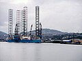
 Oil Rig departing River Tay - geograph.org.uk - 52051.jpg 640 × 480; 57 KB
-
 Old Burial ground - geograph.org.uk - 152796.jpg 640 × 480; 124 KB
-
 Old Harbour, Tayport - geograph.org.uk - 4555171.jpg 4,608 × 3,456; 3.2 MB
-
 Old Lifeboat at Tayport Harbour - geograph.org.uk - 3445144.jpg 600 × 450; 72 KB
-
 Old railway bridge near Tayport - geograph.org.uk - 3970793.jpg 640 × 480; 406 KB
-
 Ordnance Survey One-Inch Sheet 56 St Andrews and Kirkcaldy, Published 1957.jpg 8,278 × 9,952; 7.95 MB
-
 Ordnance Survey One-Inch Sheet 56 St Andrews and Kirkcaldy, Published 1969.jpg 8,287 × 9,866; 28.51 MB
-
 Ordnance Survey One-Inch Sheet 64 Dundee & St Andrews, Published 1945.jpg 14,463 × 10,617; 15.63 MB
-

-
 Pathway bridge over Quarry Road - geograph.org.uk - 4549273.jpg 4,608 × 3,456; 2.92 MB
-
 Perfect reflections - geograph.org.uk - 6298135.jpg 640 × 480; 258 KB
-
 Perfect reflections - geograph.org.uk - 6298137.jpg 640 × 480; 223 KB
-
 Perfect reflections - geograph.org.uk - 6298139.jpg 640 × 480; 239 KB
-
 Picnic area at Roofert Rock, Tayport - geograph.org.uk - 5992632.jpg 640 × 377; 46 KB
-
 Picnic table by the Firth of Tay - geograph.org.uk - 6299439.jpg 640 × 480; 236 KB
-
 Picturesque drain - geograph.org.uk - 2102399.jpg 2,560 × 1,920; 3.24 MB
-
 Pier at Tayport - geograph.org.uk - 3141097.jpg 640 × 480; 32 KB
-
 Pile Lighthouse at Tayport - geograph.org.uk - 5993335.jpg 640 × 444; 59 KB
-
 Pile Lighthouse, Tayport - geograph.org.uk - 4602483.jpg 640 × 481; 72 KB
-
 Pile Lighthouse, Tayport - geograph.org.uk - 5028263.jpg 640 × 401; 64 KB
-
 Pile Lighthouse, Tayport - geograph.org.uk - 5573109.jpg 4,896 × 3,672; 6.3 MB
-
 Pile Lighthouse, Tayport - geograph.org.uk - 6420989.jpg 480 × 640; 56 KB
-
 Plaque commemorating visit of President Ulysses S. Grant to Tayport, Fife, Scotland.jpg 3,912 × 1,638; 1.48 MB
-
 Ploughed field near Tayport - geograph.org.uk - 2825744.jpg 640 × 360; 238 KB
-
 Ploughed field near Tayport - geograph.org.uk - 2835445.jpg 640 × 360; 250 KB
-
 Pointing the wrong way, twice - geograph.org.uk - 337752.jpg 640 × 424; 63 KB
-
 Pseudo tombstones - geograph.org.uk - 4273380.jpg 786 × 577; 118 KB
-
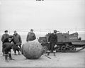 Recovered german mine.jpg 800 × 641; 48 KB
-
 Reed-ringed pond - geograph.org.uk - 2841305.jpg 2,048 × 1,536; 1.08 MB
-
 Remains of the woodland - geograph.org.uk - 5533779.jpg 1,024 × 1,024; 385 KB
-
 Ruins of a house at Garpit - geograph.org.uk - 1560368.jpg 640 × 480; 92 KB
-
 Salt marshes by the Firth of Tay - geograph.org.uk - 6299437.jpg 640 × 480; 285 KB
-
 SandyhillRoad, Tayport - geograph.org.uk - 3707086.jpg 640 × 481; 58 KB
-
 School Yard, Tayport - geograph.org.uk - 4555699.jpg 4,608 × 3,456; 2.73 MB
-
 Scotscraig Burn - geograph.org.uk - 3925734.jpg 745 × 1,186; 368 KB
-
 Scotscraig Estate - geograph.org.uk - 6066706.jpg 640 × 427; 39 KB
-
 Scotscraig Golf Course, Tayport - geograph.org.uk - 5157947.jpg 5,184 × 3,888; 5.52 MB
-
 Scott and Fyfe Ltd. - geograph.org.uk - 1456959.jpg 640 × 359; 64 KB
-
 Semi-detached bungalows - geograph.org.uk - 4556133.jpg 4,608 × 3,456; 3.04 MB
-
 Sewage Works near Tayport - geograph.org.uk - 4548974.jpg 4,608 × 3,456; 3.33 MB
-

-
 Shanwell Farm - geograph.org.uk - 579936.jpg 640 × 480; 68 KB
-
 Shanwell Road - geograph.org.uk - 1434311.jpg 640 × 480; 74 KB
-
 Sign for the Bell Rock Tavern - geograph.org.uk - 2181333.jpg 480 × 640; 93 KB
-
 Sign for the Bell Rock Tavern - geograph.org.uk - 2181344.jpg 507 × 640; 90 KB
-
 Small Blue butterfly.jpg 3,456 × 2,304; 4.74 MB
-
 Small blue on pink.jpg 3,456 × 2,304; 4.4 MB
-
 Small Blue Tayport.jpg 3,456 × 2,304; 4.89 MB
-

-

-
 Starling Tayport 2.jpg 3,456 × 2,304; 4.18 MB
-
 Starling Tayport.jpg 3,456 × 2,304; 4.32 MB
-
 Stone bridge over former railway cutting - geograph.org.uk - 4553332.jpg 4,608 × 3,456; 3.2 MB
-
 Sunrise over Tayport - geograph.org.uk - 3265109.jpg 640 × 480; 60 KB
-
 Sunset - geograph.org.uk - 428720.jpg 640 × 479; 49 KB
-
 Swan Tayport.jpg 3,456 × 2,304; 3.65 MB
-
 Tay estuary - geograph.org.uk - 3358436.jpg 640 × 480; 399 KB
-
 Tay estuary near Lundin Bridge - geograph.org.uk - 3358013.jpg 640 × 427; 207 KB
-
 Tay estuary near Lundin Bridge - geograph.org.uk - 3358406.jpg 640 × 480; 368 KB
-
 Tay Estuary near Snook Head, Tayport - geograph.org.uk - 4562406.jpg 640 × 473; 42 KB
-
 Tay Estuary west of Lucky Scalp - geograph.org.uk - 3527049.jpg 640 × 480; 360 KB
-
 Tay Estuary, Larick Scalp Marker Buoy - geograph.org.uk - 5061038.jpg 640 × 480; 335 KB
-
 Tay Street, Tayport - geograph.org.uk - 1454975.jpg 640 × 480; 76 KB
-
 Tayport from the South - geograph.org.uk - 72338.jpg 640 × 480; 133 KB
-
 Tayport Harbour - geograph.org.uk - 2181258.jpg 640 × 480; 75 KB
-
 Tayport Harbour - geograph.org.uk - 2543615.jpg 640 × 480; 249 KB
-
 Tayport Harbour - geograph.org.uk - 2566961.jpg 4,000 × 3,000; 3.79 MB


_-_geograph.org.uk_-_4553354.jpg)


_-_geograph.org.uk_-_4556162.jpg)


_-_geograph.org.uk_-_4744334.jpg)


.jpg)


