Category:Taygetos
Jump to navigation
Jump to search
mountain range in Peloponnese, Greece  | |||||
| Upload media | |||||
| Instance of | |||||
|---|---|---|---|---|---|
| Location |
| ||||
| Width |
| ||||
| Length |
| ||||
| Elevation above sea level |
| ||||
| Different from | |||||
 | |||||
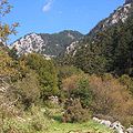
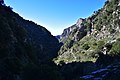
English: Taygetos, the mountain looming over Sparta, where classical Spartan boys were brought to train in the outdoors, is its own Natura 2000 protected area, Oros Taygetos.
Subcategories
This category has the following 5 subcategories, out of 5 total.
Media in category "Taygetos"
The following 74 files are in this category, out of 74 total.
-
 20171204 Δύση στην Καλαμάτα.jpg 4,128 × 3,096; 2.74 MB
-
 20180310 Ξυλόφουρνος στην Αρτεμισία.jpg 3,096 × 4,128; 4.29 MB
-
 20180421 Artemisia Meles Krini.jpg 3,096 × 4,128; 5.6 MB
-
 20180517 Almond tree in Kallithea of Kalamata.jpg 3,096 × 4,128; 4.9 MB
-
 20190429 142707 Αλαγονία από Αρτεμισία.jpg 4,128 × 3,096; 5.88 MB
-
 20190429 150113 Άγιος Γεώργιος Αρτεμισίας.jpg 3,096 × 4,128; 6.46 MB
-
 20190429 ΚαλαμταΑπόΆγιοΓεώργιοΑρτεμισίας.jpg 4,128 × 3,096; 4.39 MB
-
 Abyssal Thoughts.jpg 713 × 480; 62 KB
-
 Agios Nikon, Western Mani, Greece.JPG 1,280 × 960; 95 KB
-
 Apostolos Kaloudis - Taygetos.jpg 6,000 × 4,000; 4.28 MB
-
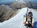 AscentonmountTaygetos.JPG 4,000 × 3,000; 3.1 MB
-
 FaraggiBir.JPG 601 × 599; 107 KB
-
 Faragki ridomou pigadia.jpg 4,496 × 3,000; 3.13 MB
-
 Koumousta, Taygetos, Lakonia (1988).jpg 3,860 × 2,549; 3.1 MB
-
 Malcolmia Alagonia.jpg 1,350 × 1,800; 1,012 KB
-
 Mani Clouds.jpg 3,472 × 2,365; 3.05 MB
-
 Mistra battlements and Taygetus.JPG 1,728 × 2,304; 818 KB
-
 Mount Marathos.JPG 2,592 × 1,944; 6.22 MB
-
 Overtheclouds.jpg 4,096 × 2,304; 1.18 MB
-
 Pigadia-taigetos.jpg 4,496 × 3,000; 4.44 MB
-
 Profitis Ilias - Taygetus peak.jpg 3,072 × 4,080; 4.41 MB
-
 Rasina gorge at Xerocambi (1988).jpg 3,880 × 2,539; 2.58 MB
-
 Ridomo braxos.jpg 3,000 × 4,496; 3.23 MB
-
 Ridomo gefira.jpg 3,000 × 4,496; 1.9 MB
-
 Ridomo taigetos.jpg 4,496 × 3,000; 3.28 MB
-
 Rintomo.jpg 4,160 × 3,120; 1.39 MB
-
 Sense of Absence.jpg 720 × 479; 71 KB
-
 Show Me The Way.jpg 720 × 478; 86 KB
-
 Sparta fault and Taygetos Mountains (50841106018).jpg 5,472 × 3,648; 4.93 MB
-
 Sparti in-river-Eurotas-valley flanked-by-Taygetos-mountains.jpg 1,800 × 1,247; 3.03 MB
-
 Taygetos gorge E of Kardamyle (1988).jpg 3,870 × 2,410; 2.07 MB
-
 Taygetos Ilias 1.jpg 2,400 × 1,600; 1.85 MB
-
 Taygetos Ilias 2.jpg 2,400 × 1,600; 1.67 MB
-
 Taygetos Ilias 3.jpg 2,400 × 1,600; 1.83 MB
-
 Taygetos Ilias 4.jpg 1,600 × 2,400; 1.64 MB
-
 Taygetos Profitis Ilias.jpg 1,824 × 1,368; 902 KB
-
 Taygetos-Mountain Tree line.jpg 4,608 × 3,456; 2.86 MB
-
 Taygetos-Mountain.jpg 3,637 × 3,088; 3.39 MB
-
 Taygetos.jpg 1,075 × 411; 78 KB
-
 Taygetoss.JPG 1,024 × 734; 50 KB
-
 To the top 2404.jpg 4,160 × 2,340; 1.17 MB
-
 Top of Taygetos.jpg 4,160 × 2,340; 851 KB
-
 Turkish bridge in Rasina gorge above Koumousta (1988) 01.jpg 3,860 × 2,540; 3.11 MB
-
 Turkish bridge in Rasina gorge above Koumousta (1988) 02.jpg 2,409 × 3,790; 2.74 MB
-
 Turkish bridge in Rasina gorge between Xerokambi and Koumousta (1988) 01.jpg 3,860 × 2,410; 2.97 MB
-
 Turkish bridge in Rasina gorge between Xerokambi and Koumousta (1988) 02.jpg 3,900 × 2,589; 3.15 MB
-
 Wiki Ga 16.jpg 4,928 × 3,264; 3.93 MB
-
 Άνοιξη στον Ταυγετο.jpg 1,024 × 768; 146 KB
-
 Άργιο τοπίο Λαγκάδας.jpg 3,000 × 4,000; 9.78 MB
-
 Αρτεμισία Μεσσηνίας- Αγιώργης - κεραίες.jpg 4,128 × 3,096; 4.2 MB
-
 Διάσελο Λαγκάδας 1.jpg 3,000 × 4,000; 5.67 MB
-
 Διάσελο Λαγκάδας 2.jpg 3,000 × 4,000; 5.31 MB
-
 Θέα από την κορυφή.jpg 3,033 × 2,207; 3 MB
-
 Λίγο κόκκινο στο απέραντο πράσινο του Ταΰγετου.jpg 1,024 × 768; 212 KB
-
 Λαγκάδα πνιγμένη στο πράσινο 1.jpg 3,000 × 4,000; 9.22 MB
-
 Λαγκάδα πνιμένη στο πράσινο 2.jpg 3,000 × 4,000; 8.27 MB
-
 Μέρος της πυραμίδας.jpg 3,072 × 2,304; 5.06 MB
-
 Μετά την φωτιά.JPG 1,152 × 864; 480 KB
-
 Μικρός καταράκτης.jpg 2,686 × 971; 678 KB
-
 Πόρτες.jpg 3,072 × 2,304; 4.53 MB
-
 Παγος στον ταυγετο.jpg 1,469 × 2,200; 1.9 MB
-
 Πεντε δρομοι.png 720 × 718; 645 KB
-
 Περασμα ταυγετου.jpg 2,200 × 1,469; 1.7 MB
-
 Πλαγιά Λαγκάδας 1.jpg 3,000 × 4,000; 6.13 MB
-
 Προφήτης Ηλίας, 2.407 μ.jpg 3,072 × 2,304; 4.26 MB
-
 Πυραμίδα.jpg 2,880 × 3,840; 6.42 MB
-
 Σύγνεφα στον Ταΰγετο.jpg 3,096 × 4,128; 1.84 MB
-
 Ταυγετος milkyway a.jpg 2,200 × 1,464; 1.61 MB
-
 Ταυγετος milkyway b.jpg 1,464 × 2,200; 1.64 MB
-
 ΤΑΥΓΕΤΟΣ.jpg 1,677 × 1,118; 629 KB
-
 Ταϋγετος.png 1,080 × 1,340; 2.22 MB
-
 Ταΰγετος.jpg 2,592 × 1,701; 2.84 MB
-
 Χαλασμένο, 2.204 μ.jpg 3,072 × 2,304; 2.9 MB
-
 Χιονια στο μαγαζακι του ταυγετου.jpg 2,200 × 1,469; 1.51 MB


.jpg)


.jpg)


.jpg)

.jpg)


_01.jpg)
_02.jpg)
_01.jpg)
_02.jpg)


