Category:Tawe-Uchaf
Jump to navigation
Jump to search
community in Powys, Wales  | |||||
| Upload media | |||||
| Instance of | |||||
|---|---|---|---|---|---|
| Location | Powys, Wales | ||||
| Population |
| ||||
| Area |
| ||||
 | |||||
Subcategories
This category has the following 7 subcategories, out of 7 total.
C
D
O
P
W
Media in category "Tawe-Uchaf"
The following 200 files are in this category, out of 417 total.
(previous page) (next page)-

-

-

-
 A line of standing stones, Glyntawe - geograph.org.uk - 3311844.jpg 640 × 532; 104 KB
-

-
 A pair of shake holes - geograph.org.uk - 2020002.jpg 2,272 × 1,704; 2.18 MB
-

-
-

-
 A welcome rest - geograph.org.uk - 1329863.jpg 640 × 480; 101 KB
-
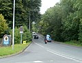
 A4067 at Penycae village - geograph.org.uk - 4670072.jpg 640 × 481; 56 KB
-
 A4067 at The Ancient Briton Hotel - geograph.org.uk - 4670068.jpg 640 × 480; 82 KB
-
 A4067 at Tyrysgol Penwyllt turn - geograph.org.uk - 4670075.jpg 640 × 480; 57 KB
-

-
 A4067 enters Ynyswen, Powys - geograph.org.uk - 2566249.jpg 640 × 520; 106 KB
-
 A4067 from Ynyswen to Penycae - geograph.org.uk - 2568969.jpg 640 × 515; 71 KB
-

-
 A4067 nearing Craig-y-nos - geograph.org.uk - 4670080.jpg 640 × 481; 94 KB
-
 A4067 nearing Glyntawe - geograph.org.uk - 4670087.jpg 640 × 481; 63 KB
-
 A4067 reaches Penycae - geograph.org.uk - 2568973.jpg 640 × 480; 88 KB
-
 A4221 at Caehopkin turn - geograph.org.uk - 4670049.jpg 640 × 480; 55 KB
-
 A4221 at Coelbren - geograph.org.uk - 4669360.jpg 640 × 481; 43 KB
-

-
 A4221 near Coelbren - geograph.org.uk - 4669363.jpg 640 × 480; 49 KB
-
 A4221 westbound nears Caehopkin - geograph.org.uk - 4669364.jpg 640 × 481; 62 KB
-
 Abercrave Farmhouse - geograph.org.uk - 2375986.jpg 640 × 480; 74 KB
-
 Abercrave Wood - geograph.org.uk - 2019993.jpg 2,272 × 1,704; 2.06 MB
-

-
 Access road to Blaenywaun Cottages - geograph.org.uk - 2586924.jpg 640 × 458; 68 KB
-

-
 Across the Tawe Valley - geograph.org.uk - 2704888.jpg 4,032 × 3,024; 2.76 MB
-
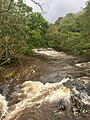
 Afon Llech - geograph.org.uk - 6244152.jpg 1,536 × 2,048; 1.55 MB
-
 Afon Llech - geograph.org.uk - 6246146.jpg 1,536 × 2,048; 1.44 MB
-
 Afon Pyrddin - geograph.org.uk - 5182324.jpg 640 × 480; 156 KB
-
 Afon Tawe - geograph.org.uk - 6286452.jpg 1,536 × 2,048; 1.48 MB
-

-
 Approaching Dan-yr-Ogof entrance - geograph.org.uk - 3727932.jpg 640 × 480; 78 KB
-
 Ashgrove Inn, Coelbren - geograph.org.uk - 2586900.jpg 640 × 424; 59 KB
-
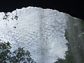 Behind the waterfall - geograph.org.uk - 6244131.jpg 2,048 × 1,536; 924 KB
-
 Behind the waterfall - geograph.org.uk - 6244135.jpg 1,536 × 2,048; 1.33 MB
-
 Bend ahead on the A4067 north of Penycae - geograph.org.uk - 2706680.jpg 640 × 480; 103 KB
-
 Between the fences near Onllwyn - geograph.org.uk - 5954871.jpg 5,184 × 3,888; 7.08 MB
-
 Blaen-Llech - geograph.org.uk - 932033.jpg 640 × 640; 359 KB
-

-
 Boardwalk and footbridge near Coelbren - geograph.org.uk - 4460457.jpg 4,000 × 3,000; 4.23 MB
-
 Boardwalk and footbridge near Coelbren - geograph.org.uk - 4460464.jpg 4,000 × 3,000; 4.65 MB
-
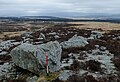
 Bog below Cribarth - geograph.org.uk - 2882213.jpg 640 × 480; 154 KB
-
 Boulder beside the footpath - geograph.org.uk - 2375950.jpg 640 × 480; 87 KB
-
-
 Brecon Beacons National Park IMG 5036 - panoramio.jpg 1,400 × 864; 448 KB
-
 Brecon Cottages, Dan-yr-Ogof, Glyntawe - geograph.org.uk - 3311855.jpg 640 × 480; 106 KB
-
 Brecon Forest Tramroad Incline - geograph.org.uk - 4564453.jpg 1,200 × 1,600; 286 KB
-
 Brecon Forest Tramroad Incline - geograph.org.uk - 4566306.jpg 1,200 × 1,600; 263 KB
-
 Brecon Road houses, Ynyswen - geograph.org.uk - 2566343.jpg 640 × 480; 69 KB
-
 Bridge across the Tawe, Penycae - geograph.org.uk - 2569360.jpg 640 × 480; 101 KB
-

-
 Brooklands Terrace, Caehopkin - geograph.org.uk - 3152006.jpg 640 × 480; 70 KB
-
 Caemaen semis near Ynyswen, Powys - geograph.org.uk - 2566198.jpg 640 × 467; 69 KB
-
 Cairn and wild pony near Cribarth - geograph.org.uk - 2375898.jpg 640 × 480; 73 KB
-
 Camp and caravan site at Dan-yr-Ogof - geograph.org.uk - 3727942.jpg 640 × 480; 64 KB
-
 Capel Ty'nycoed, Ynyswen - geograph.org.uk - 2568334.jpg 640 × 480; 75 KB
-
 Car boot sale, Abercrave - geograph.org.uk - 3149125.jpg 640 × 473; 84 KB
-

-
 Carreg Cadno - geograph.org.uk - 6456679.jpg 2,048 × 1,536; 1.66 MB
-
 Carreg Cadno boulder alignment - geograph.org.uk - 5683304.jpg 1,600 × 1,094; 1.1 MB
-
 Carreg Lwyd 2 prehistoric stone row - geograph.org.uk - 6412944.jpg 1,024 × 768; 313 KB
-
 Carreg Lwyd prehistoric stone row - geograph.org.uk - 6412914.jpg 1,024 × 733; 288 KB
-
 Castell y Geifr - geograph.org.uk - 5907157.jpg 3,264 × 2,448; 1.86 MB
-
 Caving club - geograph.org.uk - 6456166.jpg 2,048 × 1,536; 1.05 MB
-
 Cefn Coed Uchaf - geograph.org.uk - 6245698.jpg 3,264 × 2,448; 3.14 MB
-
 Cefnbyrle Road houses, Coelbren - geograph.org.uk - 3152160.jpg 640 × 397; 48 KB
-
 Cefngwaunhynog Farm - geograph.org.uk - 4896373.jpg 3,264 × 2,448; 2.72 MB
-
 Chambered tomb recreated at Dan-yr-Ogof - geograph.org.uk - 3727940.jpg 640 × 480; 119 KB
-
 Church outside Abercraf - geograph.org.uk - 70392.jpg 640 × 477; 69 KB
-
 Church tower, St David's, Abercrave - geograph.org.uk - 3149080.jpg 480 × 640; 62 KB
-
 Churchyard, Capel Ty'nycoed, Ynyswen - geograph.org.uk - 2568968.jpg 640 × 424; 75 KB
-
 Class 60 locomotive at Onllwyn Washery - geograph.org.uk - 5954844.jpg 3,888 × 5,184; 6.03 MB
-
 Coal train at Onllwyn - geograph.org.uk - 5717299.jpg 3,888 × 5,184; 6.21 MB
-
 Coal train at Onllwyn - geograph.org.uk - 5954841.jpg 5,182 × 2,915; 5.21 MB
-
 Coed Abercraf - geograph.org.uk - 4595570.jpg 640 × 480; 142 KB
-
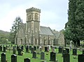
 Coelbren Church - geograph.org.uk - 4173427.jpg 640 × 480; 57 KB
-

-
 Commemorating Patti's oak in stone - geograph.org.uk - 5481326.jpg 512 × 768; 219 KB
-
 Commemoration stone - geograph.org.uk - 409879.jpg 640 × 480; 86 KB
-
 Confluence of Nant Llech with the Tawe - geograph.org.uk - 1404474.jpg 480 × 640; 151 KB
-
 Cottage at Nant-y-ffin near Pen-y-cae - geograph.org.uk - 2376085.jpg 640 × 480; 153 KB
-
 Country road SE of Penycae - geograph.org.uk - 2706539.jpg 640 × 480; 98 KB
-
 Craig y Nos Brecon - geograph.org.uk - 6408703.jpg 640 × 360; 104 KB
-
 Craig y Nos Brecon - geograph.org.uk - 6408707.jpg 640 × 360; 73 KB
-
 Craig y Nos country park - geograph.org.uk - 4593577.jpg 5,715 × 3,800; 4.35 MB
-
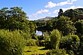 Craig y Nos country park - geograph.org.uk - 4593585.jpg 5,715 × 3,800; 4.53 MB
-
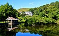 Craig y Nos reflections - geograph.org.uk - 4593597.jpg 4,655 × 2,910; 2.83 MB
-
 Craig y Rhiwarth near Glyntawe - geograph.org.uk - 2565094.jpg 640 × 480; 86 KB
-
 Craig-y-nos Castle - geograph.org.uk - 2375258.jpg 640 × 480; 69 KB
-
 Craig-y-Nos Castle - geograph.org.uk - 2882197.jpg 640 × 480; 73 KB
-
 Craig-y-nos Castle Hotel - geograph.org.uk - 4520813.jpg 800 × 600; 131 KB
-

-
 Craig-Y-Nos Castle.jpg 640 × 430; 91 KB
-
 Craig-y-Nos, Brecon - geograph.org.uk - 6408712.jpg 640 × 360; 86 KB
-
 Cribarth - geograph.org.uk - 4297758.jpg 640 × 480; 94 KB
-
 Cribarth - geograph.org.uk - 4299186.jpg 640 × 480; 61 KB
-
 Cribarth - geograph.org.uk - 4595548.jpg 640 × 480; 85 KB
-
 Cwm Tawe Uchaf - Upper Swansea Valley - geograph.org.uk - 1982769.jpg 640 × 480; 131 KB
-
 Cycles crossing, A4221 near Coelbren - geograph.org.uk - 3152141.jpg 640 × 597; 90 KB
-
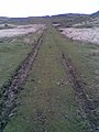
 Cyn rheilffordd - Former railway - geograph.org.uk - 4595649.jpg 640 × 480; 86 KB
-
 Cyn Rheilffordd - Former Railway - geograph.org.uk - 4595655.jpg 640 × 480; 85 KB
-
 Dan-yr-Ogof Caves - geograph.org.uk - 2508442.jpg 2,816 × 1,880; 2.28 MB
-
 Dan-yr-Ogof Farm - geograph.org.uk - 6515732.jpg 1,024 × 768; 147 KB
-

-
-
 Dinosaur showground - geograph.org.uk - 5593882.jpg 640 × 480; 127 KB
-
 Dinosaurs in the woods - geograph.org.uk - 4213824.jpg 640 × 480; 191 KB
-
 Dismantled tramway - geograph.org.uk - 6456168.jpg 1,536 × 2,048; 1.31 MB
-
 Disused building in Ynyswen - geograph.org.uk - 4460156.jpg 4,000 × 3,000; 3.89 MB
-
 Drainage channel, Ynyswen - geograph.org.uk - 3149094.jpg 640 × 480; 109 KB
-
 Drams, Craig-y-nos - geograph.org.uk - 3304062.jpg 640 × 495; 168 KB
-

-
 Eastern boundary of Abercrave - geograph.org.uk - 3149200.jpg 640 × 547; 107 KB
-
 Eastern end of Station Road, Abercrave - geograph.org.uk - 3149209.jpg 640 × 480; 103 KB
-
 Edge of woodland near Cefngwaunhynog - geograph.org.uk - 918675.jpg 640 × 480; 97 KB
-

-

-

-

-

-

-

-
-

-
 Farm building at Glyn-mawr - geograph.org.uk - 4460147.jpg 4,000 × 3,000; 4.15 MB
-

-

-
 Farm tractor above Abercrave Woods - geograph.org.uk - 4459969.jpg 4,000 × 3,000; 4.64 MB
-
 Field near Glynllech Uchaf - geograph.org.uk - 903622.jpg 640 × 480; 111 KB
-
 Flower-rich road margin - geograph.org.uk - 918680.jpg 640 × 480; 134 KB
-
 Flowing along below - geograph.org.uk - 1329893.jpg 640 × 480; 160 KB
-

-
 Footbridge across the Nant Llech - geograph.org.uk - 4460265.jpg 4,000 × 3,000; 5.57 MB
-

-
 Footbridge across the Tawe in Ynyswen - geograph.org.uk - 4460229.jpg 4,000 × 3,000; 5.42 MB
-
 Footbridge at Melin Llech - geograph.org.uk - 6245735.jpg 3,032 × 2,272; 3.45 MB
-
 Footbridge in Graig-y-nos Country Park - geograph.org.uk - 4460507.jpg 4,000 × 3,000; 5.14 MB
-
-

-

-
 Footpath past stables near Abercrave - geograph.org.uk - 2376002.jpg 640 × 480; 125 KB
-
 Footpath through a field in Ynyswen - geograph.org.uk - 4460211.jpg 4,000 × 3,000; 3.71 MB
-
 Footpath to Abercrave - geograph.org.uk - 2019983.jpg 2,272 × 1,704; 1.87 MB
-
 Forest beyond the Nant y Bryn - geograph.org.uk - 918684.jpg 640 × 480; 90 KB
-
 Former railway goods van beside a path in Ynyswen - geograph.org.uk - 4460188.jpg 4,000 × 3,000; 4.29 MB
-
 Former railway goods van in Ynyswen - geograph.org.uk - 4460169.jpg 4,000 × 3,000; 4.4 MB
-
 Fractured limestone - geograph.org.uk - 6456185.jpg 2,048 × 1,536; 1.22 MB
-
 Fungus near Henrhyd Falls - geograph.org.uk - 6515719.jpg 1,024 × 768; 225 KB
-
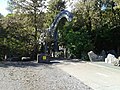
 Gateway to St David's Church, Abercraf - geograph.org.uk - 3648509.jpg 1,024 × 683; 690 KB
-

-

-
 Getting all of one's ducks in a row .... - geograph.org.uk - 4593641.jpg 4,655 × 2,910; 3.3 MB
-
 Glyntawe boundary sign - geograph.org.uk - 3311574.jpg 640 × 480; 109 KB
-

-
 Hairpin bend, Abercrave - geograph.org.uk - 3151971.jpg 640 × 480; 72 KB
-
 Hen Dramfordd - Old Tramway - geograph.org.uk - 4600383.jpg 640 × 480; 79 KB
-
 Hen Reilffordd- Old Railway - geograph.org.uk - 4595625.jpg 640 × 480; 88 KB
-
 Henrhyd Falls - geograph.org.uk - 4460437.jpg 2,979 × 3,972; 4.2 MB
-
 Henrhyd Falls - geograph.org.uk - 5150030.jpg 3,000 × 4,000; 2.42 MB
-
 Henrhyd Falls - geograph.org.uk - 6244088.jpg 1,536 × 2,046; 1.19 MB
-
 Henrhyd Falls - geograph.org.uk - 6244108.jpg 1,536 × 2,048; 1.56 MB
-
 Henrhyd Falls - geograph.org.uk - 6244116.jpg 3,100 × 4,554; 5.9 MB
-
 Henrhyd Falls - geograph.org.uk - 6245057.jpg 1,536 × 2,048; 1.35 MB
-
 Henrhyd Falls - geograph.org.uk - 6515717.jpg 768 × 1,024; 230 KB
-
 Henrhyd Falls from below - geograph.org.uk - 3490733.jpg 640 × 480; 148 KB
-
 Henrhyd Falls in a very dry spring - geograph.org.uk - 2882232.jpg 640 × 480; 116 KB
-
 Henrhyd Falls in May - geograph.org.uk - 3490727.jpg 640 × 480; 131 KB
-
 Heol Tawe, Abercrave - geograph.org.uk - 3149152.jpg 640 × 480; 82 KB
-
 Hillside trees near Onllwyn - geograph.org.uk - 5954888.jpg 4,904 × 3,677; 7.75 MB
-
 Hillside view from Pantyffordd - geograph.org.uk - 6380707.jpg 1,600 × 1,301; 613 KB
-
 Horse-riding near Penycae - geograph.org.uk - 4460494.jpg 2,874 × 2,400; 2.3 MB
-

-
 Housing in Cribarth, Ynyswen - geograph.org.uk - 4520809.jpg 800 × 600; 92 KB
-

-
 Information Board at Henrhyd Falls - geograph.org.uk - 6515721.jpg 1,024 × 768; 160 KB
-
 Information Board, St David's Church, Abercraf - geograph.org.uk - 3648514.jpg 1,024 × 683; 611 KB
-

-
 Isolated footbridge - geograph.org.uk - 2882247.jpg 640 × 480; 77 KB
-
 Junction ahead, A4221 near Coelbren - geograph.org.uk - 2576055.jpg 640 × 419; 54 KB
-

-
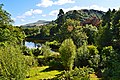
 Lake at Craig y Nos country park - geograph.org.uk - 2479503.jpg 1,600 × 1,279; 874 KB
-
 Lane to Cae-glas - geograph.org.uk - 3295305.jpg 640 × 500; 93 KB
-
 Leading to footpath at Blaen-Llech - geograph.org.uk - 932037.jpg 640 × 480; 272 KB
-

-
 Limestone debris - geograph.org.uk - 6456189.jpg 2,048 × 1,536; 1.04 MB
-
 Limestone mound - geograph.org.uk - 6456190.jpg 2,048 × 1,536; 865 KB
-
 Limestone mounds - geograph.org.uk - 6456192.jpg 4,032 × 3,024; 6.67 MB
-
 Llech Bridge - geograph.org.uk - 6243925.jpg 3,264 × 2,448; 4.2 MB
-
 Llwybr Craig Llech - Craig Llech path - geograph.org.uk - 4595608.jpg 640 × 480; 144 KB
-
 Llwybr Tonyfildre - Tonyfildre Path - geograph.org.uk - 5181285.jpg 480 × 640; 160 KB
-
 Llwybr Ynyswen Path - geograph.org.uk - 4595585.jpg 640 × 480; 92 KB
-
 Looking towards the ruined Melin Llech mill - geograph.org.uk - 4460293.jpg 4,000 × 3,000; 5.72 MB
-
 Main entrance, Craig y Nos Castle - geograph.org.uk - 5607145.jpg 1,024 × 768; 184 KB
-
 Mariah Chapel - geograph.org.uk - 6245732.jpg 2,048 × 1,536; 828 KB
-
 Mast near Henrhyd Falls - geograph.org.uk - 2376081.jpg 640 × 480; 96 KB


