Category:Tasman map
Jump to navigation
Jump to search
Media in category "Tasman map"
The following 14 files are in this category, out of 14 total.
-
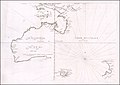 (Australia & New Zealand) 663 (ca. 1672).jpg 1,600 × 1,136; 1.5 MB
-

-
 AMH-5546-NA Map showing the journeys of Abel Tasman.jpg 2,400 × 1,871; 693 KB
-
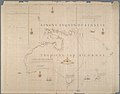
 Bowen- A Complete map of the Southern Continent.jpg 3,000 × 2,323; 1.94 MB
-
-
 Kaart der Reyse van Abel Tasman volgens syn eygen opstel.png 5,596 × 3,634; 33.11 MB
-
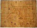
 Tasman Map at the SLNSW - November 2021.jpg 3,432 × 2,972; 601 KB
-
 Tasman's track.jpg 800 × 535; 40 KB
-
 Tasmania 1644.png 550 × 307; 151 KB
-
 TasmanMap.jpg 1,400 × 1,081; 1.33 MB
-
 Tasmanmap1644.jpg 3,236 × 2,516; 2.83 MB
-
 Tasmanroutes.PNG 600 × 455; 57 KB
-
 Thevenot - Hollandia Nova detecta 1644.png 2,916 × 2,310; 3.66 MB
-
 Thevmap.jpg 760 × 577; 81 KB
_663_(ca._1672).jpg)
_vol._1%27_(11245652285).jpg)


Categories:
- 1640s maps of Australia
- 1640s maps of New Zealand
- 1640s maps of Indonesia
- State Library of New South Wales
- New Holland (Australia)
- European exploration of New Zealand
- Old maps of New Guinea
- Old maps of Papua New Guinea
- Terra incognita
- Terra Australis
- Old maps of Tasmania
- Cape Leeuwin, Western Australia
- Nuytsland
- Eendrachtsland
- Maps connecting Australia and New Guinea