Category:Tarneit, Victoria
Jump to navigation
Jump to search
suburb of Melbourne, Victoria, Australia | |||||
| Upload media | |||||
| Instance of | |||||
|---|---|---|---|---|---|
| Location |
| ||||
| Population |
| ||||
| Elevation above sea level |
| ||||
 | |||||
Media in category "Tarneit, Victoria"
The following 24 files are in this category, out of 24 total.
-
 Aerial perspective of Penrose Promenade Community Centre. Shot 4th quarter 2018.jpg 4,000 × 3,000; 5.04 MB
-
 Aerial perspective of St John The Apostle School.jpg 4,000 × 2,250; 4.47 MB
-
 Aerial perspective of Tarneit Central Cricket Club. Shot in 4th quarter 2018.jpg 4,000 × 3,000; 5.77 MB
-

-
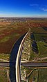 Davis Road flyover - panoramio.jpg 3,444 × 6,075; 13.09 MB
-
 Good evening Tarneit - panoramio.jpg 6,000 × 1,624; 7.05 MB
-
 Inverell Parkway, Tarneit - panoramio.jpg 2,592 × 1,936; 1.21 MB
-
 Meat - panoramio.jpg 3,680 × 2,070; 2.16 MB
-
 Tarneit Aerial over Inverell Park - panoramio.jpg 6,000 × 1,406; 7.24 MB
-
 Tarneit Central facing west.jpg 6,822 × 3,095; 14.56 MB
-
 Tarneit CFA Truganina (Leakes).jpg 3,264 × 2,448; 1.99 MB
-
 Tarneit facing NorthEast - panoramio.jpg 5,500 × 895; 4.31 MB
-
 Tarneit from the Sky - panoramio.jpg 5,000 × 749; 3.34 MB
-
 Tarneit Leakes Rd sign and Westbrook Estate Jan 2018.jpg 2,523 × 1,687; 1.03 MB
-
 Tarneit Residences - panoramio.jpg 2,000 × 670; 1.22 MB
-
 Tarneit Rise Primary School from the air.jpg 3,040 × 1,928; 2.49 MB
-
 Tarneit Sunset - panoramio.jpg 7,420 × 2,701; 11.36 MB
-
 Thomas Carr College aerial panorama.jpg 4,863 × 2,745; 10.98 MB
-
 Train approaching the Davis Road flyover - panoramio.jpg 3,500 × 2,048; 5.22 MB
-
 Vertical aerial panorama of Wyndham Village Shopping Centre.jpg 3,902 × 5,200; 14.89 MB
-
 View from Tarneit Station to Westbrook Estate Jan 2018.jpg 3,264 × 2,448; 2.52 MB
-
 View from train near Tarneit Station city.jpg 3,264 × 2,448; 1.82 MB
-
 View from train near Tarneit Station rural.jpg 3,264 × 2,448; 1.61 MB
-
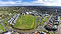
 Wootten Road Oval - panoramio.jpg 1,563 × 3,000; 3.98 MB


.jpg)


