Category:Tamworth Road, Long Eaton
Jump to navigation
Jump to search

The stretch of Tamworth Road (route B6540) in the town of Long Eaton, Derbyshire, England.
| Object location | | View all coordinates using: OpenStreetMap |
|---|
Subcategories
This category has the following 3 subcategories, out of 3 total.
B
- Bridge 4, Erewash Canal (15 F)
Media in category "Tamworth Road, Long Eaton"
The following 23 files are in this category, out of 23 total.
-
 Church of St Francis of Assisi, Tamworth Road - geograph.org.uk - 5643513.jpg 1,280 × 960; 316 KB
-
 Corner Shop - geograph.org.uk - 689792.jpg 427 × 640; 218 KB
-
 Demolition starts on the Royal Oak - geograph.org.uk - 4106371.jpg 1,280 × 853; 1.05 MB
-

-
 Flats on Tamworth Road - geograph.org.uk - 788004.jpg 640 × 414; 254 KB
-

-
 Long Eaton fire station - geograph.org.uk - 318305.jpg 640 × 427; 211 KB
-
 New Indian restaurant - geograph.org.uk - 1741845.jpg 1,024 × 683; 249 KB
-
 New Inn entrance - geograph.org.uk - 1741859.jpg 1,024 × 683; 169 KB
-
 New Retirement Apartments - geograph.org.uk - 1094672.jpg 640 × 426; 102 KB
-
 North end of Tamworth Road, Long Eaton - geograph.org.uk - 3740773.jpg 1,024 × 768; 114 KB
-
 Postbox and bench mark, Tamworth Road - geograph.org.uk - 5658644.jpg 956 × 1,280; 366 KB
-
 Retirement Apartments - geograph.org.uk - 942362.jpg 640 × 427; 194 KB
-

-
 Tamworth Road - geograph.org.uk - 1741790.jpg 1,024 × 683; 228 KB
-
 Tamworth Road Dental Practice - geograph.org.uk - 942647.jpg 640 × 427; 220 KB
-
 Tamworth Road, Long Eaton - geograph.org.uk - 1095729.jpg 640 × 426; 120 KB
-
 Tamworth Road, Long Eaton - geograph.org.uk - 1824920.jpg 640 × 480; 90 KB
-
 Tamworth Road, Long Eaton - geograph.org.uk - 1824926.jpg 640 × 480; 82 KB
-
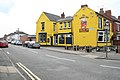 The Barge Inn, Tamworth Road, Long Eaton - geograph.org.uk - 786056.jpg 640 × 427; 187 KB
-
 The New Inn - geograph.org.uk - 990653.jpg 640 × 427; 152 KB
-
 The Royal Oak, Tamworth Road, Long Eaton - geograph.org.uk - 689796.jpg 640 × 427; 243 KB
-
 Under the Tamworth Road canal bridge - geograph.org.uk - 2377707.jpg 466 × 640; 78 KB


