Category:Talsperre Lütsche
Jump to navigation
Jump to search
| Object location | | View all coordinates using: OpenStreetMap |
|---|
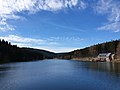
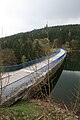
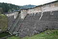
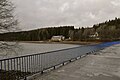
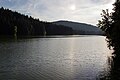
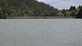
Deutsch: Die Talsperre Lütsche ist ein Staudamm nahe Frankenhain, Thüringen
English: The Talsperre Lütsche is a dam near Frankenhain, Thuringia, Germany
reservoir in Germany   | |||||
| Upload media | |||||
| Instance of | |||||
|---|---|---|---|---|---|
| Location |
| ||||
| Elevation above sea level |
| ||||
 | |||||
Media in category "Talsperre Lütsche"
The following 36 files are in this category, out of 36 total.
-
 Blick auf den Stausee Talsperre Lütsche 2022-04-17.jpg 4,032 × 3,024; 2.93 MB
-
 Flashlight at lütsche.jpg 1,920 × 1,080; 322 KB
-
 Luetsche dam emptied Dec 2020, wall view.jpg 4,000 × 2,250; 4.05 MB
-
 Luetsche dam emptied dec 2020.jpg 4,000 × 2,250; 4.2 MB
-
 Luetschetalsperre back.jpg 2,592 × 3,888; 4.31 MB
-
 Luetschetalsperre front.jpg 3,888 × 2,592; 4.07 MB
-
 Luetschetalsperre Lake.jpg 3,888 × 2,592; 2.08 MB
-
 Lütsche Stausee, Lütsche dam, Thuringia, Germany, aerial Sept 2020.jpg 4,000 × 2,250; 3.98 MB
-
 Lütsche und Umgebung.png 531 × 918; 383 KB
-
 Lütsche-Talsperre-1.JPG 2,848 × 4,288; 7.72 MB
-
 Lütsche-Talsperre-2.JPG 4,177 × 2,774; 6.01 MB
-
 Lütsche-Talsperre-3.JPG 4,288 × 2,848; 6.51 MB
-
 Lütsche-Talsperre-4.JPG 4,288 × 2,848; 9.58 MB
-
 Lütschetalsperre (dam).jpg 2,736 × 1,824; 4.08 MB
-
 Lütschetalsperre 01.jpg 5,291 × 1,840; 2.19 MB
-
 Talsperre Lütsche 01.jpg 5,184 × 3,456; 3.08 MB
-
 Talsperre Lütsche 02.jpg 4,966 × 3,310; 2.46 MB
-
 Talsperre Lütsche 03.jpg 5,184 × 3,456; 3.46 MB
-
 Talsperre Lütsche 04.jpg 5,051 × 3,368; 2.88 MB
-
 Talsperre Lütsche 05.jpg 4,966 × 3,310; 2.24 MB
-
 Talsperre Lütsche 06.jpg 5,184 × 3,456; 2.44 MB
-
 Talsperre Lütsche 07.jpg 5,184 × 3,456; 3.45 MB
-
 Talsperre Lütsche 1.jpg 4,896 × 3,672; 5.72 MB
-
 Talsperre Lütsche 10.jpg 4,896 × 3,672; 7.74 MB
-
 Talsperre Lütsche 11.jpg 4,896 × 3,672; 6.67 MB
-
 Talsperre Lütsche 12.jpg 2,560 × 1,920; 1.17 MB
-
 Talsperre Lütsche 2.jpg 2,560 × 1,920; 1 MB
-
 Talsperre Lütsche 3.jpg 4,896 × 3,672; 6.21 MB
-
 Talsperre Lütsche 4.jpg 4,896 × 3,672; 7.42 MB
-
 Talsperre Lütsche 5.jpg 4,896 × 2,752; 4.11 MB
-
 Talsperre Lütsche 6.jpg 4,896 × 2,752; 3.98 MB
-
 Talsperre Lütsche 7.jpg 4,896 × 3,672; 6.53 MB
-
 Talsperre Lütsche 8.jpg 4,896 × 3,672; 5.72 MB
-
 Talsperre Lütsche 9.jpg 4,896 × 3,672; 4.47 MB
-
 Unter Staumauer Lütsche.png 640 × 480; 731 KB
-
 Wegweiser an der Lütschetalsperre - panoramio.jpg 3,648 × 2,056; 3.95 MB


.jpg)


