Category:Talmühle Oberstammheim, Mühlengebäude mit Scheune
Jump to navigation
Jump to search
| Object location | | View all coordinates using: OpenStreetMap |
|---|
|
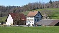
This is a category about a cultural property of regional significance in Switzerland with KGS number 7587
|
 | |||||
| Upload media | |||||
| Instance of |
| ||||
|---|---|---|---|---|---|
| Part of | |||||
| Location |
| ||||
| Street address |
| ||||
| Heritage designation | |||||
 | |||||
Media in category "Talmühle Oberstammheim, Mühlengebäude mit Scheune"
The following 4 files are in this category, out of 4 total.
-
 Oberstammheim Talmühle.jpg 4,000 × 2,248; 3.81 MB
-
 Talmühle - Scheune und Mühlengebäude.jpg 4,400 × 2,750; 9.48 MB
-
 Talmühle in Oberstammheim ZH.jpg 3,360 × 4,200; 8.33 MB
-
 Talmühle, Oberstammheim - Scheune und Mühlengebäude.jpg 4,400 × 2,750; 12.17 MB


