Category:Tal-y-llyn Pass
Jump to navigation
Jump to search
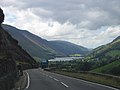
The Tal-y-llyn Pass (Welsh: Bwlch Llyn Bach) is a valley on the A487 road in mid Wales, overlooking Tal-y-llyn Lake.
Media in category "Tal-y-llyn Pass"
The following 26 files are in this category, out of 26 total.
-
 A470 approaching Minffordd - geograph.org.uk - 3394404.jpg 3,018 × 2,694; 1.64 MB
-
 A487 approaching Minffordd - geograph.org.uk - 63962.jpg 640 × 480; 31 KB
-
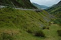
 A487 below Bwlch-llyn Bach - geograph.org.uk - 3394389.jpg 3,954 × 2,948; 2.32 MB
-
 A487 down Bwlch -llyn Bach - geograph.org.uk - 3089036.jpg 640 × 397; 46 KB
-
 A487 in Bwlch Llyn Bach - geograph.org.uk - 3089040.jpg 640 × 480; 58 KB
-

-
 A487 northbound - geograph.org.uk - 3266206.jpg 640 × 480; 52 KB
-
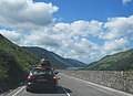
 A487 southbound - geograph.org.uk - 3266211.jpg 640 × 480; 62 KB
-
 A487 southbound - geograph.org.uk - 3266212.jpg 640 × 480; 66 KB
-
 A487 southwest from under Craig y Llam - geograph.org.uk - 3664457.jpg 5,184 × 3,456; 3.87 MB
-
 Bwlch Llyn Bach - geograph.org.uk - 232036.jpg 640 × 480; 48 KB
-
 Bwlch Llyn Bach - geograph.org.uk - 2418511.jpg 1,000 × 670; 272 KB
-
 Bwlch Llyn Bach - geograph.org.uk - 3183313.jpg 2,592 × 1,944; 1.34 MB
-
 Bwlch Talyllyn - Talyllyn Pass - geograph.org.uk - 3968816.jpg 3,264 × 2,448; 3.84 MB
-
 Cwm Rhwyddfor - geograph.org.uk - 1764255.jpg 1,600 × 1,200; 809 KB
-
 Cwm Rhwyddfor track - geograph.org.uk - 1972273.jpg 640 × 426; 86 KB
-

-

-
 Mach Loop.jpg 4,000 × 2,672; 5.66 MB
-
 Road down to Tal-y-Llyn - geograph.org.uk - 528344.jpg 640 × 480; 48 KB
-
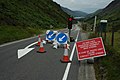
 Roadworks in Bwlch Llyn Bach - geograph.org.uk - 2557611.jpg 640 × 464; 60 KB
-
 Roadworks on the A487 - geograph.org.uk - 1972587.jpg 3,008 × 2,000; 1.59 MB
-
 Tal-y-llyn Lake and Bwlch Llyn Bach - geograph.org.uk - 2210411.jpg 2,592 × 1,944; 1.18 MB
-
 Tal-y-llyn Lake in the distance - geograph.org.uk - 136206.jpg 597 × 400; 71 KB
-
 The A487 below Mynydd Gwerngraig - geograph.org.uk - 1972246.jpg 3,008 × 2,000; 1.6 MB
-


_-_geograph.org.uk_-_172139.jpg)


_Skirting_along_Mynydd_Fron-fraith_-_geograph.org.uk_-_115206.jpg)