Category:Taken with Wiko Jerry 3
Jump to navigation
Jump to search
English: Taken with Wiko Jerry 3 mobile phones, W_K300.
Media in category "Taken with Wiko Jerry 3"
The following 66 files are in this category, out of 66 total.
-
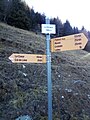
 Chemin pédestre - Poteau indicateur - Bovernier.jpg 1,920 × 2,560; 1.61 MB
-
 Chemin pédestre - Poteau indicateur - Chamoille (bis).jpg 1,920 × 2,560; 1.71 MB
-
 Chemin pédestre - Poteau indicateur - Chamoille d'en Haut.jpg 1,920 × 1,616; 946 KB
-
 Chemin pédestre - Poteau indicateur - Chamoille.jpg 1,920 × 2,560; 1.07 MB
-
 Chemin pédestre - Poteau indicateur - Chemin-Dessous.jpg 1,920 × 2,560; 1.34 MB
-
 Chemin pédestre - Poteau indicateur - Chez les Addy.jpg 1,920 × 2,020; 1.15 MB
-
 Chemin pédestre - Poteau indicateur - Chez les Proz.jpg 1,920 × 2,560; 1.95 MB
-
 Chemin pédestre - Poteau indicateur - Chez les Reuses.jpg 1,920 × 2,560; 2.17 MB
-
 Chemin pédestre - Poteau indicateur - Châtaigner ?.jpg 1,920 × 2,560; 1.08 MB
-
 Chemin pédestre - Poteau indicateur - Closuit - Laboureau.jpg 1,920 × 2,560; 2.15 MB
-
 Chemin pédestre - Poteau indicateur - Dranse.jpg 1,920 × 2,560; 1.71 MB
-
 Chemin pédestre - Poteau indicateur - Grands Communaux.jpg 1,920 × 2,560; 1.73 MB
-
 Chemin pédestre - Poteau indicateur - L'Arpille - Alpage.jpg 1,920 × 2,560; 1.48 MB
-
 Chemin pédestre - Poteau indicateur - La Crevasse.jpg 1,920 × 2,560; 1.02 MB
-
 Chemin pédestre - Poteau indicateur - La Douay.jpg 1,920 × 2,560; 1.56 MB
-
 Chemin pédestre - Poteau indicateur - La Fontaine.jpg 1,920 × 2,560; 1.92 MB
-
 Chemin pédestre - Poteau indicateur - La Garde.jpg 1,920 × 2,236; 1.61 MB
-
 Chemin pédestre - Poteau indicateur - La Rosière.jpg 1,920 × 2,560; 1.49 MB
-
 Chemin pédestre - Poteau indicateur - Le Borgeaud.jpg 1,920 × 2,092; 1.02 MB
-
 Chemin pédestre - Poteau indicateur - Le Feylet - Ravoire.jpg 1,820 × 2,148; 1.5 MB
-
 Chemin pédestre - Poteau indicateur - Le Rosé.jpg 1,920 × 2,560; 1.72 MB
-
 Chemin pédestre - Poteau indicateur - Le Signal.jpg 1,920 × 2,560; 1.6 MB
-
 Chemin pédestre - Poteau indicateur - Les Chesaux - Ravoire - 1109.jpg 1,920 × 2,560; 1.78 MB
-
 Chemin pédestre - Poteau indicateur - Les Chesaux - Ravoire - 1120.jpg 1,920 × 2,560; 2.38 MB
-
 Chemin pédestre - Poteau indicateur - Les Moulins.jpg 1,920 × 2,560; 2.57 MB
-
 Chemin pédestre - Poteau indicateur - Les Valettes.jpg 1,920 × 2,560; 1.16 MB
-
 Chemin pédestre - Poteau indicateur - Mayen Moret.jpg 1,920 × 2,560; 2.37 MB
-
 Chemin pédestre - Poteau indicateur - Mont de l'Arpille.jpg 1,920 × 2,560; 1.51 MB
-
 Chemin pédestre - Poteau indicateur - Orsières - Gare.jpg 3,840 × 2,560; 2.85 MB
-
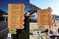
 Chemin pédestre - Poteau indicateur - Orsières - La Place.jpg 1,920 × 2,560; 1.81 MB
-
 Chemin pédestre - Poteau indicateur - Plan Bocon.jpg 1,920 × 1,584; 757 KB
-
 Chemin pédestre - Poteau indicateur - Plan Cerisier.jpg 1,920 × 2,560; 1.72 MB
-
 Chemin pédestre - Poteau indicateur - Plan Monnay.jpg 1,920 × 2,560; 1.56 MB
-
 Chemin pédestre - Poteau indicateur - Planojan.jpg 1,920 × 2,560; 1.3 MB
-
 Chemin pédestre - Poteau indicateur - Pont de Fully.jpg 1,150 × 1,024; 506 KB
-
 Chemin pédestre - Poteau indicateur - Revers d'Arpette.jpg 958 × 972; 294 KB
-
 Chemin pédestre - Poteau indicateur - Roc de Cornet.jpg 1,920 × 2,560; 1.91 MB
-
 Chemin pédestre - Poteau indicateur - Saxé.jpg 1,920 × 2,560; 1.12 MB
-
 Chemin pédestre - Poteau indicateur - Sembrancher - Gare.jpg 1,920 × 2,560; 899 KB
-
 Chemin pédestre - Poteau indicateur - Sembrancher.jpg 1,920 × 2,560; 1.65 MB
-
 Chemin pédestre - Poteau indicateur - Som la Proz.jpg 1,920 × 2,560; 1.57 MB
-
 Chemin pédestre - Poteau indicateur - Soulalex.jpg 1,920 × 2,560; 2.13 MB
-
 Chemin pédestre - Poteau indicateur - Sur le Mont.jpg 1,560 × 1,760; 997 KB
-
 Chemin pédestre - Poteau indicateur - Tassonnières.jpg 1,920 × 2,560; 2.19 MB
-
 Chemin pédestre - Poteau indicateur - Vers l'Église - Fully.jpg 1,920 × 1,280; 969 KB
-
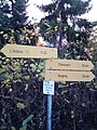
 Chemin pédestre - Poteau indicateur - Vichères.jpg 1,920 × 2,560; 1.83 MB
-
 Chemin pédestre - Poteau indicateur - Vieux Chêne.jpg 1,920 × 2,560; 1.41 MB
-
 Hiking - Ardévaz.jpg 1,920 × 2,560; 1.23 MB
-
 Hiking - Branson - Pont du Rhône - 1.jpg 3,024 × 4,032; 2.82 MB
-
 Hiking - Branson - Pont du Rhône - 2.jpg 2,560 × 1,920; 1.37 MB
-
 Hiking - Branson - Pont du Rhône - 3.jpg 2,560 × 1,920; 1.31 MB
-
 Hiking - Branson - Pont du Rhône - 4.jpg 2,560 × 1,920; 1.81 MB
-
 Hiking - La Croix - A.jpg 1,920 × 1,280; 1.01 MB
-
 Hiking - La Croix - B.jpg 1,920 × 2,560; 1.52 MB
-
 Hiking - La Dreudze.jpg 1,920 × 2,560; 1.85 MB
-
 Hiking - Le Cœur.jpg 1,920 × 2,560; 1.25 MB
-
 Hiking - Liddes.jpg 1,920 × 1,280; 1.04 MB
-
 Hiking - Mayens de l'Ardève.jpg 1,920 × 2,560; 1.98 MB
-
 Hiking - Sommet des Vignes.jpg 1,920 × 2,560; 2.03 MB
-
 Hiking 6.jpg 1,920 × 2,560; 1.82 MB
-
 Hiking 7.jpg 1,920 × 2,560; 1.8 MB
-
 Hiking guidepost - Pont de Branson.jpg 2,560 × 1,920; 2.32 MB
-
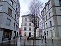 Passage Marie-Rogissart décembre 2020.jpg 2,560 × 1,920; 2.01 MB
-
 Plaque jardin Martha-Desrumaux décembre 2020.jpg 1,920 × 2,560; 1.58 MB
-
 Plaque passage Emma-Calvé décembre 2020.jpg 1,920 × 2,560; 770 KB
-
 Plaque passage Marie-Rogissart décembre 2020.jpg 1,920 × 2,560; 745 KB

.jpg)


