Category:Taken with Traveler DC-6900
Jump to navigation
Jump to search
Wikimedia category | |||||
| Upload media | |||||
| Instance of | |||||
|---|---|---|---|---|---|
| Category combines topics | |||||
| photographs by photographic equipment used | |||||
photographs which have been taken by a specific camera | |||||
| Instance of | |||||
| |||||
Media in category "Taken with Traveler DC-6900"
The following 159 files are in this category, out of 159 total.
-
 A little song............. - geograph.org.uk - 378750.jpg 640 × 472; 133 KB
-
 A46 at Nettleton - geograph.org.uk - 429959.jpg 640 × 480; 128 KB
-
 AmBock024.JPG 2,304 × 1,728; 1.54 MB
-
 Beck and Wolds - geograph.org.uk - 430100.jpg 640 × 480; 133 KB
-
 BergischeBautage025.JPG 2,304 × 1,728; 1.31 MB
-
 Besenbinder9.JPG 1,728 × 2,304; 2.23 MB
-
 BGlDenkmal282.JPG 2,304 × 1,728; 2.17 MB
-
 Burscheid Buergerbus 064.JPG 2,816 × 2,112; 2.54 MB
-
 Burscheid Friedhofskapelle 040.JPG 2,816 × 2,112; 2.14 MB
-
 Burscheid Haeuser 015.JPG 2,816 × 2,112; 1.97 MB
-
 Burscheid Rathaus 046.JPG 2,816 × 2,112; 1.98 MB
-
 Burscheid St. Laurentius 042.JPG 2,816 × 2,112; 1.57 MB
-
 Burscheid Wallace Brunnen 058.JPG 2,816 × 2,112; 3.42 MB
-
 Bücherschrank Hoffnungsthal.JPG 2,038 × 2,762; 3.03 MB
-
 Bücherschrank Overath (4).JPG 2,112 × 2,816; 1.79 MB
-
 Bürgerhaus Leichlingen 02b.JPG 2,816 × 2,112; 2.73 MB
-
 Bürgerhaus Leichlingen Eingang.JPG 2,816 × 2,112; 1.83 MB
-
 Bürgerhaus Leichlingen Rückseite b.JPG 2,816 × 2,112; 1.99 MB
-
 Cattle and Chalk - geograph.org.uk - 430524.jpg 640 × 480; 91 KB
-
 Chapel Farm and Lake - geograph.org.uk - 430040.jpg 640 × 480; 113 KB
-
 Church Street, Nettleton - geograph.org.uk - 429969.jpg 640 × 480; 123 KB
-
 Cottages, North Ormsby - geograph.org.uk - 461576.jpg 640 × 480; 133 KB
-
 Dramatic hills - geograph.org.uk - 430225.jpg 640 × 480; 110 KB
-
 Dreikoenigenpforte0032.JPG 2,304 × 1,728; 1.58 MB
-
 Dreikoenigenpforte013.JPG 2,304 × 1,728; 1.23 MB
-
 Erdbebenstation Bensberg 01.JPG 2,816 × 2,112; 2.98 MB
-
 Erdbebenstation Bensberg 03.JPG 2,816 × 2,112; 1.74 MB
-
 Erdbebenstation Bensberg Aushang.JPG 2,816 × 2,112; 1.57 MB
-
 Evang. Kirche Witzhelden 01.JPG 2,112 × 2,816; 2.57 MB
-
 Evang. Kirche Witzhelden 04.JPG 2,816 × 2,112; 3.31 MB
-
 Evang. Kirche Witzhelden Seitenportal.JPG 2,112 × 2,816; 1.52 MB
-
 Evang. Kirche Witzhelden Tafel.JPG 2,816 × 2,112; 2.24 MB
-
 Evang. Kirche Witzhelden Turmportal Figuren.JPG 2,816 × 2,112; 1.68 MB
-
 Evang. Kirche Witzhelden Turmportal.JPG 2,112 × 2,816; 2.09 MB
-
 Ferdinand Schmitz by Rolf Steudel.jpg 2,304 × 1,728; 2.1 MB
-
 Field gates and farm track - geograph.org.uk - 430529.jpg 640 × 480; 124 KB
-
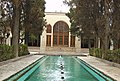 Finn Garden, Kashan, Iran.jpg 2,816 × 1,907; 1.85 MB
-
 Friedhof Immekeppel 20100310 (13).JPG 2,304 × 1,728; 1.61 MB
-
 Friedhof Immekeppel 20100310 (8).JPG 2,304 × 1,728; 1.28 MB
-
 Further down the Way - geograph.org.uk - 430497.jpg 640 × 480; 143 KB
-
 Gasthaus Paas 0137.JPG 2,304 × 1,728; 1.58 MB
-
 Geschichtelokal BGV (2).JPG 2,816 × 2,112; 2.01 MB
-
 Grab Leyhausen.JPG 2,112 × 2,816; 2.21 MB
-
 Hermanns Hauss 02.JPG 2,816 × 2,112; 2.94 MB
-
 Hermanns Hauss 03.JPG 2,816 × 2,112; 2.47 MB
-
 Hermanns Hauss 04b.JPG 2,816 × 2,112; 2.04 MB
-
 Hermanns Hauss 05b.JPG 2,816 × 2,112; 2.75 MB
-
 Hermanns Hauss 07b.JPG 2,816 × 2,112; 2.45 MB
-
 Hermanns Hauss Eingang.JPG 2,816 × 2,112; 2.93 MB
-
 Hexe Köbes 113.JPG 2,304 × 1,728; 1.5 MB
-
 Hills from the footpath - geograph.org.uk - 382834.jpg 640 × 480; 71 KB
-
 Immekeppel 20100310 (10).JPG 1,728 × 2,304; 1.83 MB
-
 Immekeppel 20100310 (13).JPG 2,304 × 1,728; 1.59 MB
-
 Immekeppel 20100310 (5).JPG 2,304 × 1,728; 1.77 MB
-
 Immekeppel 20100310 (6).JPG 2,304 × 1,728; 1.58 MB
-
 Immekeppel 20100310 (7).JPG 1,728 × 2,304; 1.78 MB
-
 Immekeppel 20100310 (9).JPG 2,304 × 1,728; 2.64 MB
-
 Immekeppel 20100310.JPG 2,304 × 1,728; 1.33 MB
-
 Johann Wilhelm Lindlar by Rolf Steudel.jpg 2,304 × 1,728; 2.28 MB
-
 Junction of the Vikings - geograph.org.uk - 430013.jpg 640 × 480; 111 KB
-
 Kirche Immekeppel 20100310 (3).JPG 2,304 × 1,728; 1.33 MB
-
 Kirche Immekeppel 20100310 (5).JPG 2,304 × 1,728; 1.49 MB
-
 Kirche Immekeppel 20100310 (6).JPG 2,304 × 1,728; 1.7 MB
-
 Kuerten-Delling Altes Pastorat (1).JPG 2,304 × 1,728; 1.77 MB
-
 Kuerten-Delling Altes Pastorat (5).JPG 2,304 × 1,728; 1.64 MB
-
 Kuerten-Delling Altes Pastorat (8).JPG 2,304 × 1,728; 1.85 MB
-
 Kuerten-Delling evang. Kirche (1).JPG 2,304 × 1,728; 1.32 MB
-
 Kuerten-Delling evang. Kirche (2).JPG 1,728 × 2,304; 1.54 MB
-
 Kuerten-Delling evang. Kirche.JPG 2,304 × 1,728; 2.35 MB
-
 Kuerten-Olpe kath Kirche (1).JPG 1,728 × 2,304; 1.51 MB
-
 Kuerten-Olpe kath Kirche (10).JPG 1,612 × 2,220; 1.97 MB
-
 Kuerten-Olpe kath Kirche (12).JPG 2,304 × 1,728; 1.53 MB
-
 Kuerten-Olpe kath Kirche (14).JPG 1,728 × 2,304; 1.79 MB
-
 Kuerten-Olpe kath Kirche (4).JPG 2,304 × 1,728; 1.61 MB
-
 Kuerten-Olpe kath Kirche (9).JPG 1,728 × 2,304; 1,000 KB
-
 LaleAkgün005.JPG 2,304 × 1,728; 1.16 MB
-
 Lane through woods - geograph.org.uk - 430132.jpg 640 × 480; 178 KB
-
 Lane to Ludborough Vale - geograph.org.uk - 460911.jpg 640 × 480; 84 KB
-
 Leichlingen Am Hammer 10 und 9 bearb.JPG 2,816 × 2,112; 3.07 MB
-
 Leichlingen Am Hammer 9 Eingang.JPG 2,816 × 2,112; 3.11 MB
-
 Lesende0130.JPG 2,304 × 1,728; 2.91 MB
-
 Linde (4) Kirche.JPG 1,728 × 2,304; 1.22 MB
-
 Linde (49) Kindergarten.JPG 2,304 × 1,728; 1.24 MB
-
 LindlarMitte (17).JPG 1,728 × 2,304; 877 KB
-
 LindlarMitte (3).JPG 2,304 × 1,728; 1.77 MB
-
 LindlarMitte (5).JPG 2,304 × 1,728; 1.8 MB
-
 Manor Farm, North Ormsby - geograph.org.uk - 461568.jpg 640 × 480; 102 KB
-
 Max Bruch and Maria Zanders by Rolf Steudel.jpg 2,304 × 1,728; 2.18 MB
-
 Narrow valley - geograph.org.uk - 430504.jpg 640 × 480; 107 KB
-
 Natural beauty - geograph.org.uk - 430096.jpg 640 × 480; 111 KB
-
 Naziopfer 156.JPG 2,304 × 1,728; 2.23 MB
-
 North Ormsby from the lane - geograph.org.uk - 461010.jpg 640 × 480; 110 KB
-
 North Ormsby from the valley - geograph.org.uk - 461613.jpg 640 × 480; 98 KB
-
 Obersteeg (11).JPG 2,816 × 2,112; 3.23 MB
-
 Papierschöpfer 139.JPG 2,304 × 1,728; 1.99 MB
-
 Pfarrhaus Immekeppel 20100310 (5).JPG 2,304 × 1,728; 1.49 MB
-
 Pretty village - geograph.org.uk - 373468.jpg 640 × 480; 92 KB
-
 RainerDeppe5.jpg 585 × 708; 295 KB
-
 SanktSeverin (14).JPG 1,728 × 2,304; 1.61 MB
-
 SanktSeverin (3).JPG 1,728 × 2,304; 1.89 MB
-
 SanktSeverin (5).JPG 1,728 × 2,304; 1.57 MB
-
 Schloss Eicherhof 01.JPG 2,816 × 2,112; 2.99 MB
-
 Schloss Eicherhof Park 01.JPG 2,816 × 2,112; 3.89 MB
-
 Schloss Eicherhof Park 02.JPG 2,112 × 2,816; 3.32 MB
-
 Schloss Eicherhof Park 03.JPG 2,816 × 2,112; 3.43 MB
-
 Schloss Eicherhof vom Wupperufer 01.JPG 2,816 × 2,112; 3 MB
-
 Schule Immekeppel 0084.JPG 2,304 × 1,728; 1.42 MB
-
 Sleepy way south - geograph.org.uk - 429989.jpg 640 × 480; 163 KB
-
 Slippery way for the Vikings^ - geograph.org.uk - 430180.jpg 640 × 480; 161 KB
-
 Sparse traffic - geograph.org.uk - 454650.jpg 640 × 480; 146 KB
-
 St. Barbara (2).JPG 2,112 × 2,816; 1.95 MB
-
 St. Barbara (5).JPG 2,816 × 2,112; 2.2 MB
-
 St. Barbara (6).JPG 2,816 × 2,112; 1.72 MB
-
 St. Barbara (7).JPG 2,816 × 2,112; 2.27 MB
-
 St. Barbara (9).JPG 2,816 × 2,112; 2.14 MB
-
 St. Mariä Himmelfahrt (4).JPG 2,816 × 2,112; 2.14 MB
-
 St. Mariä Himmelfahrt (7).JPG 2,112 × 2,816; 1.32 MB
-
 Stadtarchiv Bergisch Gladbach (6).jpg 1,832 × 1,374; 344 KB
-
 Steenkueler-Brunnen19.JPG 2,304 × 1,728; 2.31 MB
-
 Steenkueler-Brunnen20.JPG 2,304 × 1,728; 2.47 MB
-
 Steenkueler-Brunnen21.JPG 2,304 × 1,728; 2.5 MB
-
 Steenkueler-Brunnen22.JPG 2,304 × 1,728; 2.39 MB
-
 Steenkueler-Brunnen23.JPG 2,304 × 1,728; 2.49 MB
-
 Steenkueler-Brunnen24.JPG 2,304 × 1,728; 2.69 MB
-
 Steep descent - geograph.org.uk - 461025.jpg 640 × 480; 107 KB
-
 Sülztalberge (3).JPG 2,816 × 2,112; 1.72 MB
-
 Sülztalplatz261.JPG 2,304 × 1,728; 1.87 MB
-
 Sülztalplatz264.JPG 2,304 × 1,728; 2 MB
-
 Tebroke 01.jpg 897 × 1,285; 1,009 KB
-
 Tebroke 2013-05-23.JPG 862 × 816; 414 KB
-
 Tebroke 2013-05.JPG 488 × 591; 189 KB
-
 Thatched cottage - geograph.org.uk - 378606.jpg 640 × 480; 134 KB
-
 The Old Vicarage - geograph.org.uk - 460994.jpg 640 × 480; 129 KB
-
-
 Towards Nettleton top - geograph.org.uk - 430059.jpg 640 × 480; 113 KB
-
 Track, Hedges and Bridleway - geograph.org.uk - 454141.jpg 640 × 480; 139 KB
-
 Troisdorf Sikahirsche 102.JPG 2,816 × 2,112; 2.3 MB
-
 Turmhof Rösrath (1).JPG 2,816 × 2,112; 2.14 MB
-
 Turmhof Rösrath (5).JPG 2,816 × 2,112; 2.56 MB
-
 Turmhof Rösrath.JPG 2,112 × 2,816; 2.19 MB
-
 Untereschbach 2011 (3).JPG 2,816 × 2,112; 1.51 MB
-
 Untereschbach 2011 (4).JPG 2,816 × 2,112; 1.76 MB
-
 Venauen (21).JPG 2,304 × 1,728; 1.51 MB
-
 Venauen (26).JPG 2,304 × 1,728; 1.21 MB
-
 Venauen (6).JPG 2,304 × 1,728; 1.4 MB
-
 Viking Way southwards - geograph.org.uk - 430083.jpg 640 × 480; 116 KB
-
 Village lane, North Ormsby - geograph.org.uk - 461594.jpg 640 × 480; 178 KB
-
 VillaZanders132.JPG 2,304 × 1,728; 2.13 MB
-
 VillaZanders159.JPG 2,304 × 1,728; 1.43 MB
-
 VillaZanders160.JPG 1,728 × 2,304; 1.78 MB
-
 VillaZanders162.JPG 2,304 × 1,728; 1.79 MB
-
 Vinzenz Jakob von Zuccalmaglio by Rolf Steudel.jpg 1,590 × 1,644; 1.26 MB
-
 Vinzenz-Pallotti-Hospital 02.JPG 2,816 × 2,112; 2.17 MB
-
 Volberger Kirche 2012 (5).JPG 2,816 × 2,112; 2.78 MB
-
 Weg Schwiegelshohn.JPG 2,816 × 2,112; 3.41 MB
-
 Westward valley view - geograph.org.uk - 461564.jpg 640 × 480; 98 KB
-
 Winding lane - geograph.org.uk - 373466.jpg 640 × 480; 114 KB
-
 Wolds feature - geograph.org.uk - 430066.jpg 640 × 480; 126 KB
-
 Woodland from Viking Way - geograph.org.uk - 430213.jpg 640 × 480; 105 KB


.JPG)


.JPG)
.JPG)


.JPG)


.JPG)
.JPG)
.JPG)
.JPG)
.JPG)
.JPG)


.JPG)
.JPG)
.JPG)
.JPG)
.JPG)
.JPG)
.JPG)
.JPG)

.JPG)
.JPG)
.JPG)
.JPG)
.JPG)
.JPG)


_Kirche.JPG)
_Kindergarten.JPG)
.JPG)
.JPG)
.JPG)


.JPG)

.JPG)


.JPG)
.JPG)
.JPG)


.JPG)
.JPG)
.JPG)
.JPG)
.JPG)
.JPG)
.JPG)
.jpg)


.JPG)


.JPG)
.JPG)

.JPG)
.JPG)
.JPG)
.JPG)
.JPG)


.JPG)


