Category:Taken with Alps M12 Ultra
Jump to navigation
Jump to search
Media in category "Taken with Alps M12 Ultra"
The following 65 files are in this category, out of 65 total.
-
 A Banana Plantation in Masaka.jpg 3,235 × 2,266; 1.3 MB
-
 A Crop Garden with gentle slopes and Scattered trees in Masaka District.jpg 3,264 × 2,216; 1.55 MB
-
 A Fenced Ranch along Kampala-Masaka Highway.jpg 3,014 × 2,158; 1.12 MB
-
 A Fenced Ranch with gentle hills in Lyantonde District.jpg 3,264 × 2,268; 1.61 MB
-
 A Ground Nut Garden along Soroti Mbale Highway.jpg 3,264 × 2,448; 3.22 MB
-
 A house overlooking Hill Slops along Kabale-Mbarara Highway.jpg 3,264 × 2,233; 1.49 MB
-
 A Maize Garden along Soroti Mbale Highway.jpg 3,264 × 2,448; 4.24 MB
-
 A Maize Garden with Hills in the background along Kabale-Mbarara.jpg 3,264 × 2,448; 3.24 MB
-
 A Marrum Road joining Mbarara-Masaka Highway in Lyantonde District.jpg 3,264 × 2,296; 1.71 MB
-
 A Marrum Road through a Ranch in Lyantonde District.jpg 3,264 × 2,239; 1.61 MB
-
 A Papyrus Swamp along Kabale-Mbarara Highway.jpg 3,255 × 2,233; 1.43 MB
-
 A Papyrus Swamp along Pallisa Kumi Highway.jpg 3,264 × 2,448; 2.46 MB
-
 A Ranch along Lyantonde-Masaka Highway.jpg 3,264 × 2,179; 1.73 MB
-
 A Ranch overlooking Hill Slops in Lyantonde District.jpg 2,877 × 2,225; 1.66 MB
-
 A Rice Garden along Soroti Mbale Highway.jpg 3,264 × 2,448; 3.06 MB
-
 A Sugarcane Garden along Kampala Jinja Highway.jpg 3,264 × 2,448; 3.44 MB
-
 A Swamp along Kabale -Masaka Highway with Green Vegetation.jpg 3,264 × 2,182; 1.68 MB
-
 A Swamp along Kabale -Mbarara Highway.jpg 3,241 × 2,254; 1.62 MB
-
 A Swamp along Kabale-Mbarara Highway with Eucalyptus trees.jpg 3,264 × 2,216; 1.98 MB
-
 A Swamp along Kabale-Mbarara Highway with Hills in the background.jpg 3,264 × 2,279; 1.89 MB
-
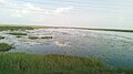
 A Swamp at Lake Bisinia.jpg 1,280 × 720; 531 KB
-
 A Swamp in Masaka District along Kampala-Masaka Highway.jpg 2,845 × 2,254; 1.12 MB
-
 A Swamp overlooking a hill along Kabale-Mbarara Highway.jpg 3,264 × 2,292; 1.96 MB
-
 A Thorn tree in a Swamp along Soroti Mbale Highway.jpg 3,264 × 2,448; 3.14 MB
-
 A tilled garden along Kabale-Mbarara Highway.jpg 3,264 × 2,448; 3.36 MB
-
 A Tree in a Swamp Along Kabale-Mbarara Highway.jpg 3,264 × 2,448; 3.41 MB
-
 Banana Plantation along Kabale-Mbarara Highway with green Vegetation.jpg 3,264 × 2,448; 3.22 MB
-
 Banana Plantation along Kabale-Mbarara Highway with Hills in the background.jpg 3,264 × 2,448; 2.95 MB
-
 Cattle Grazing Along Kabale-Mbarara Highway with a gentle Slope.jpg 3,264 × 2,175; 1.42 MB
-
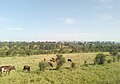 Cattle Grazing Along Kabale-Mbarara Highway.jpg 3,264 × 2,276; 1.74 MB
-
 Eucalyptus trees Plantation on a Hill Along Kabale-Mbarara Highway.jpg 3,264 × 2,286; 1.62 MB
-
 Fenced Ranch in Lyantonde District.jpg 2,907 × 2,244; 1.38 MB
-
 Fenced Ranch with gentle grasslands in Lyantonde District.jpg 3,264 × 2,154; 1.66 MB
-
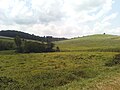
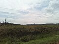
 Gentle slopes of Hills along Kabale-Mbarara Highway.jpg 3,264 × 2,448; 3.08 MB
-
 Gentle Slopes with Green Vegetation Along Kampala Jinja Highway.jpg 3,264 × 2,448; 3.21 MB
-
 Grazing Land at a Ranch in Lyantonde District.jpg 3,264 × 2,156; 1.52 MB
-
 Green Vegetation Along Kabale-Mbarara Highway.jpg 3,264 × 2,448; 3.48 MB
-
 Green Vegetation at a swamp in Kumi District.jpg 3,264 × 2,448; 3.1 MB
-
 Green Vegetation with a House in the Background Along Kabale-Mbarara Highway.jpg 3,264 × 2,448; 3.03 MB
-
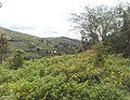 Hill View with Yellow flowers and Trees in Masaka District.jpg 2,837 × 2,209; 1.3 MB
-
 Images Flat green Vegetation with a tall tree.jpg 3,264 × 2,448; 2.63 MB
-
 Katonga River Bridge in Mpigi District along Kampala-Masaka Highway.jpg 3,264 × 2,293; 1.31 MB
-
 Katonga River Swamp in Mpigi District along Kampala-Masaka Highway.jpg 2,994 × 2,222; 1.1 MB
-
 Katonga River View along Kampala-Masaka Highway.jpg 3,264 × 2,279; 1.54 MB
-
 Lake Bisinia along Soroti Mbale Highway.jpg 1,280 × 720; 630 KB
-
 Lake Bisinia Swamp with Papyrus along Soroti Mbale Highway.jpg 3,264 × 2,448; 2.71 MB
-
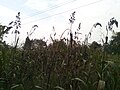 Lango Traditional Food Crop (Sorghum) in Lira City.jpg 3,264 × 2,448; 2.88 MB
-
 Lango Traditional Food Crop (Sorghum).jpg 2,448 × 3,264; 2.52 MB
-
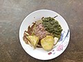
 Lango Traditional Meal 01.jpg 3,264 × 2,448; 2.99 MB
-
 Lango Traditional Meal 03.jpg 3,264 × 2,448; 2.89 MB
-
 Maize Garden along Soroti Lira Highway.jpg 3,264 × 2,448; 3.16 MB
-
 Maize Garden along Soroti Mbale Highway with Trees at the Background.jpg 3,264 × 2,448; 3.95 MB
-
 Maize Garden with Cloudy Skies in Masaka.jpg 3,264 × 1,886; 1.35 MB
-
 Papyrus Swamp with Hill View along Kabale-Mbarara Highway.jpg 3,264 × 2,232; 1.72 MB
-
 Roadside Fruit Vending In Mpigi District along Kampala-Mpigi Highway.jpg 2,172 × 2,271; 1.17 MB
-
 Savanna trees at a Ranch in Lyantonde District.jpg 3,264 × 2,257; 1.81 MB
-
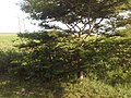
 Scattered trees at a Ranch in Lyantonde District.jpg 3,264 × 2,289; 1.48 MB
-
 Soil Erosion in Lyantonde District Along Mbarara-Masaka Highway.jpg 2,919 × 2,213; 2.13 MB
-
 Swamp along Kumi Soroti Highway.jpg 3,264 × 2,448; 2.64 MB
-
 Swamp along Soroti Mbale Highway with shrub Trees.jpg 3,264 × 2,448; 2.88 MB
-
 Tea Plantation at Lugazi along Kampala Jinja.jpg 3,264 × 2,448; 2.34 MB
-
 Tea Plantation with hills in the background in Lugazi.jpg 3,264 × 2,448; 3.13 MB
-
 Tree plantation with soil Erosion along Kabale-Mbarara Highway.jpg 3,264 × 2,448; 4.11 MB
-
 Trees at a Ranch in Lyantonde District Along Mbarara-Masaka Highway.jpg 3,264 × 2,216; 1.87 MB
-
 Trees in a Fenced Ranch with Cloudy Skies in Lyantonde District.jpg 3,264 × 2,099; 1.63 MB


_in_Lira_City.jpg)
.jpg)


