Category:Tadworth
Jump to navigation
Jump to search
English: Tadworth is a village in Surrey, on the south-east slope of Epsom Downs. It forms part of the Borough of Reigate and Banstead. The census area Tadworth and Walton has a population of 7,016. Neighbouring settlements include Walton-on-the-Hill, Kingswood, Epsom, Burgh Heath, Banstead, Reigate and Sutton. Tadworth lay within the Copthorne hundred, an administrative division devised by the Saxons, and later formed part of the former Banstead Urban District.
village in Reigate and Banstead, Surrey, United Kingdom  | |||||
| Upload media | |||||
| Instance of | |||||
|---|---|---|---|---|---|
| Location | Reigate and Banstead, Surrey, South East England, England | ||||
 | |||||
Subcategories
This category has the following 10 subcategories, out of 10 total.
- Houses in Tadworth (13 F)
- Streets in Tadworth (23 F)
J
- Jubilee Woodland, Tadworth (4 F)
T
- New Mill, Tadworth (3 F)
- Tadworth Court (5 F)
- Tadworth Green Hall (8 F)
- Tadworth Village Hall (2 F)
Media in category "Tadworth"
The following 31 files are in this category, out of 31 total.
-
 Banstead Heath at Hogden Bottom - geograph.org.uk - 370330.jpg 640 × 481; 94 KB
-
 Bridge over a public footpath - geograph.org.uk - 613901.jpg 640 × 427; 113 KB
-
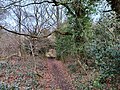
 Bridleway to Tadworth - geograph.org.uk - 370332.jpg 640 × 481; 112 KB
-
 Chinthurst school crest on brick wall N01273.jpg 1,268 × 1,268; 887 KB
-
 Chinthurst School pupils push commemorative crosses into lawn.jpg 1,362 × 1,649; 2.56 MB
-
 Footpath east of Tadworth Roundabout.jpg 4,000 × 3,000; 6.56 MB
-
 Footpath from Walton-on-the-Hill to Tadworth (August 2013).JPG 2,400 × 1,800; 1.26 MB
-
 North Downs - panoramio - franek2.jpg 2,816 × 2,120; 1.53 MB
-
 Public footpath sign on Banstead Heath.jpg 4,000 × 3,000; 4.34 MB
-
 Railway bridge over the B290 - geograph.org.uk - 613930.jpg 640 × 427; 94 KB
-
 Red Lodge Entrance - geograph.org.uk - 362384.jpg 640 × 481; 92 KB
-
 Tadworth 01.jpg 4,000 × 3,000; 2.74 MB
-
 Tadworth 02.jpg 4,000 × 3,000; 2.73 MB
-
 Tadworth Cricket Club pavilion - geograph.org.uk - 2170632.jpg 640 × 428; 121 KB
-
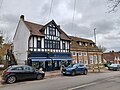
 Tadworth Post Office - geograph.org.uk - 1887311.jpg 2,048 × 1,536; 965 KB
-
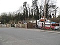
 Tadworth Roundabout on Brighton Road - geograph.org.uk - 3122455.jpg 2,048 × 1,536; 1.43 MB
-
 Tadworth Tyres on Shelvers Hill - geograph.org.uk - 3908034.jpg 2,560 × 1,920; 2.03 MB
-
 Tadworth Water Tower - geograph.org.uk - 1838682.jpg 432 × 640; 85 KB
-
 Tadworth Windmill - geograph.org.uk - 1152737.jpg 426 × 640; 71 KB
-
 Tadworth Windmill - geograph.org.uk - 1838930.jpg 437 × 640; 110 KB
-
 Tadworth Windmill - geograph.org.uk - 1838955.jpg 640 × 426; 88 KB
-
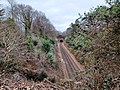
 Tattenham Corner line at Tadworth 01.jpg 4,000 × 3,000; 5.65 MB
-
 Tattenham Corner line at Tadworth 02.jpg 4,000 × 3,000; 6.14 MB
-
 View across Dorking Road, Tadworth.jpg 4,000 × 3,000; 4.26 MB
-
 Bridleway near Red Lodge - geograph.org.uk - 370270.jpg 450 × 600; 122 KB
-
 Bridleway to Mogador - geograph.org.uk - 370331.jpg 640 × 481; 133 KB
-

-
 Footpath, looking north - geograph.org.uk - 613914.jpg 640 × 427; 131 KB
-
 Railway Bridge near Tadworth - geograph.org.uk - 24905.jpg 640 × 480; 135 KB
-
 Reflections on a crane - geograph.org.uk - 185989.jpg 640 × 480; 109 KB
-
 The Clock Tower Riding Centre - geograph.org.uk - 361756.jpg 640 × 481; 76 KB


.JPG)


