Category:Tabernakelpfeiler Weißenalbern
Jump to navigation
Jump to search
| Object location | | View all coordinates using: OpenStreetMap |
|---|
 | |||||
| Upload media | |||||
| Instance of | |||||
|---|---|---|---|---|---|
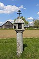
| Location | Kirchberg am Walde, Gmünd District, Lower Austria, Austria | ||||
| Heritage designation | |||||
 | |||||
Media in category "Tabernakelpfeiler Weißenalbern"
The following 3 files are in this category, out of 3 total.
-
 Bildstock bei Weißenalbern.jpg 2,308 × 3,648; 1.11 MB
-
 Tabernakelpfeiler Weißenalbern 01 2016-05.jpg 3,000 × 4,500; 6.93 MB
-
 Tabernakelpfeiler Weißenalbern 02 2016-05.jpg 3,000 × 4,500; 7.75 MB

