Category:Synagoge (Gleusdorf)
Jump to navigation
Jump to search
| Object location | | View all coordinates using: OpenStreetMap |
|---|
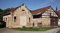
cultural heritage monument D-6-74-210-27 (0) in Untermerzbach, Bavaria | |||||
| Upload media | |||||
| Instance of | |||||
|---|---|---|---|---|---|
| Location | Untermerzbach, Haßberge, Lower Franconia, Bavaria, Germany | ||||
| Street address |
| ||||
| Heritage designation | |||||
 | |||||
This is the category of the Bavarian Baudenkmal (cultural heritage monument) with the ID D-6-74-210-27 (Wikidata)
|
Media in category "Synagoge (Gleusdorf)"
The following 3 files are in this category, out of 3 total.
-
 Gleusdorf Synagoge 5311387.jpg 3,888 × 5,184; 10.54 MB
-
 Gleusdorf-Synagoge1.jpg 5,616 × 3,159; 3.17 MB
-
 Gleusdorf-Synagoge2.jpg 4,822 × 3,616; 3.51 MB


