Category:Symondsbury
Jump to navigation
Jump to search

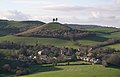
English: Symondsbury is a village in south west Dorset, England, west of Dorchester. It is located just off the A35 road. The village has a pub (the Ilchester Arms), a pottery and a primary school. It is the head of Symondsbury Parish which extends from Eype and West Cliff (West Bay) in the south, to the Marshwood Vale in the north.
village and civil parish in Dorset, United Kingdom  | |||||
| Upload media | |||||
| Instance of | |||||
|---|---|---|---|---|---|
| Location | Dorset, South West England, England | ||||
| Population |
| ||||
 | |||||
Subcategories
This category has the following 6 subcategories, out of 6 total.
C
- Colmer's Hill (38 F)
E
- Eype Mouth (73 F)
I
- Ilchester Arms, Symondsbury (4 F)
S
T
- Thorncombe Beacon (32 F)
Media in category "Symondsbury"
The following 200 files are in this category, out of 781 total.
(previous page) (next page)-
 'Portmead' - geograph.org.uk - 3159646.jpg 1,024 × 683; 185 KB
-
 A converted railway carriage - geograph.org.uk - 4577295.jpg 1,600 × 1,199; 476 KB
-

-
 A35 at Miles Cross - geograph.org.uk - 4730087.jpg 1,920 × 1,000; 361 KB
-
 A35 Eype turn - geograph.org.uk - 2958448.jpg 3,780 × 2,520; 1.64 MB
-
 A35 heading west - geograph.org.uk - 6218981.jpg 1,024 × 684; 227 KB
-
 A35 west of Bridport at Watton - geograph.org.uk - 3419643.jpg 640 × 465; 83 KB
-
 A35, end of the Bridport bypass - geograph.org.uk - 3035476.jpg 640 × 430; 48 KB
-
 Along the South West Coast Path - geograph.org.uk - 2832688.jpg 640 × 430; 52 KB
-
 Animal Pellet - geograph.org.uk - 4506777.jpg 640 × 480; 139 KB
-
 Approaching West Bay - geograph.org.uk - 3161087.jpg 640 × 394; 73 KB
-
 Area closed - risk of cliff fall - geograph.org.uk - 3087050.jpg 1,280 × 856; 115 KB
-

-
 Ascending Coppet Hill - geograph.org.uk - 5479074.jpg 640 × 427; 52 KB
-
 Ascending out of West Bay - geograph.org.uk - 2825286.jpg 640 × 430; 53 KB
-
 Attractive entrance to Broadoak - geograph.org.uk - 5862455.jpg 640 × 427; 89 KB
-
 Axen Farm - geograph.org.uk - 4728464.jpg 1,920 × 1,116; 403 KB
-
 Axen Farm - geograph.org.uk - 4728613.jpg 1,920 × 1,181; 626 KB
-
 Axen Farm - geograph.org.uk - 5859098.jpg 1,024 × 768; 136 KB
-
 Balancing on the edge^ - geograph.org.uk - 2835275.jpg 640 × 430; 46 KB
-
 Bar, Restaurant and Leisure centre at Highlands End - geograph.org.uk - 4448829.jpg 3,888 × 2,592; 3.48 MB
-
 Barn and Trees, Moorbath - geograph.org.uk - 2676301.jpg 640 × 480; 104 KB
-
 Barton Cottages, Symondsbury - geograph.org.uk - 5703769.jpg 3,648 × 2,736; 3.18 MB
-

-
 Beach at Eype Mouth - geograph.org.uk - 6176801.jpg 4,000 × 3,000; 4.82 MB
-
 Beach, east of Eype Mouth - geograph.org.uk - 2832797.jpg 640 × 430; 58 KB
-
 Below West Cliff, West Bay, Dorset - geograph.org.uk - 5392228.jpg 1,279 × 1,600; 1.3 MB
-
 Below West Cliff, West Bay, Dorset - geograph.org.uk - 5392274.jpg 1,600 × 1,281; 832 KB
-
 Below West Cliff, West Bay, Dorset - geograph.org.uk - 5392280.jpg 1,600 × 1,200; 674 KB
-

-
 Benchmark at entrance to 'Seabreeze', Mount Lane - geograph.org.uk - 5185239.jpg 683 × 1,024; 356 KB
-

-
 Benchmark on ^3 Duck Street - geograph.org.uk - 4411907.jpg 683 × 1,024; 286 KB
-
 Bidlake Farm - geograph.org.uk - 5018192.jpg 3,048 × 1,676; 1.2 MB
-
 Black sheep, Cowleaze Farm - geograph.org.uk - 2822560.jpg 640 × 430; 79 KB
-
 Blocked bridleway on the Monarch's Way - geograph.org.uk - 4726067.jpg 1,920 × 1,280; 1.05 MB
-
 Blocked bridleway on the Monarch's Way - geograph.org.uk - 4726643.jpg 1,920 × 1,280; 854 KB
-
 Boats at Eype - geograph.org.uk - 4577280.jpg 1,600 × 1,200; 489 KB
-
 Breakwater - West Bay - geograph.org.uk - 3085344.jpg 1,280 × 856; 228 KB
-
 Bridge over the River Brit - geograph.org.uk - 2817285.jpg 640 × 430; 96 KB
-
 Bridleway below Jan's Hill - geograph.org.uk - 4727677.jpg 1,920 × 2,612; 1.66 MB
-
 Bridleway near Down House Farm - geograph.org.uk - 6176915.jpg 4,000 × 3,000; 4.89 MB
-
 Bridleway on Coppet Hill - geograph.org.uk - 4727237.jpg 1,920 × 1,280; 929 KB
-
 Bridleway on Coppet Hill - geograph.org.uk - 4727294.jpg 1,920 × 1,179; 806 KB
-
 Bridleway on Coppet Hill - geograph.org.uk - 4727415.jpg 1,920 × 1,280; 800 KB
-
 Bridport , A35 Bridge - geograph.org.uk - 6489429.jpg 6,000 × 4,000; 5.96 MB
-
 Bridport , Brewery Cottage - geograph.org.uk - 6489404.jpg 6,000 × 4,000; 7.52 MB
-
 Bridport , Bridport Scenery - geograph.org.uk - 6489355.jpg 6,000 × 4,000; 7.1 MB
-
 Bridport , Bridport Scenery - geograph.org.uk - 6489358.jpg 6,000 × 4,000; 5.71 MB
-
 Bridport , Bridport Scenery - geograph.org.uk - 6489364.jpg 6,000 × 4,000; 6.47 MB
-
 Bridport , Bridport Scenery - geograph.org.uk - 6489446.jpg 6,000 × 4,000; 7.78 MB
-
 Bridport , Bridport Suburbs - geograph.org.uk - 6489457.jpg 6,000 × 4,000; 7.84 MB
-
 Bridport , Bridport Suburbs - geograph.org.uk - 6489460.jpg 6,000 × 4,000; 6.49 MB
-
 Bridport , Broad Lane - geograph.org.uk - 6489350.jpg 6,000 × 4,000; 7.03 MB
-
 Bridport , Broad Lane - geograph.org.uk - 6489353.jpg 6,000 × 4,000; 6.12 MB
-
 Bridport , Broad Lane - geograph.org.uk - 6489360.jpg 6,000 × 4,000; 6.04 MB
-
 Bridport , Dark Lane - geograph.org.uk - 6489367.jpg 6,000 × 4,000; 7.23 MB
-
 Bridport , Dunnock - geograph.org.uk - 6489381.jpg 3,272 × 2,181; 2.06 MB
-
 Bridport , Footpath - geograph.org.uk - 6489427.jpg 6,000 × 4,000; 6.61 MB
-
 Bridport , Footpath - geograph.org.uk - 6489432.jpg 6,000 × 4,000; 7.91 MB
-
 Bridport , Footpath - geograph.org.uk - 6489435.jpg 6,000 × 4,000; 7.75 MB
-
 Bridport , Grassy Field - geograph.org.uk - 6489422.jpg 6,000 × 4,000; 7 MB
-
 Bridport , Grassy Field - geograph.org.uk - 6489438.jpg 6,000 × 4,000; 6.83 MB
-
 Bridport , Grassy Field - geograph.org.uk - 6489441.jpg 6,000 × 4,000; 7.79 MB
-
 Bridport , Grassy Field - geograph.org.uk - 6489450.jpg 6,000 × 4,000; 7.63 MB
-
 Bridport , Grassy Field - geograph.org.uk - 6489451.jpg 6,000 × 4,000; 6.59 MB
-
 Bridport , Leisure Centre - geograph.org.uk - 6489417.jpg 6,000 × 4,000; 6.24 MB
-
 Bridport , Playing Field - geograph.org.uk - 6489396.jpg 5,437 × 3,624; 5.79 MB
-
 Bridport , Playing Field - geograph.org.uk - 6489401.jpg 6,000 × 4,000; 6.3 MB
-
 Bridport , Port Mead - geograph.org.uk - 6489418.jpg 6,000 × 4,000; 7.12 MB
-
 Bridport , Port Mead - geograph.org.uk - 6489421.jpg 6,000 × 4,000; 5.99 MB
-
 Bridport , Skilling Hill Road - geograph.org.uk - 6489365.jpg 6,000 × 4,000; 5.79 MB
-
 Bridport , Skilling Hill Road - geograph.org.uk - 6489368.jpg 6,000 × 4,000; 7.84 MB
-
 Bridport , Skilling Hill Road - geograph.org.uk - 6489385.jpg 6,000 × 4,000; 7.38 MB
-
 Bridport , Watton Lane - geograph.org.uk - 6489362.jpg 6,000 × 4,000; 5.91 MB
-
 Bridport brewery weir with fish pass - geograph.org.uk - 2669536.jpg 3,888 × 2,592; 3.1 MB
-
 Bridport Leisure Centre - geograph.org.uk - 2955832.jpg 1,600 × 1,067; 328 KB
-
 Bridport Rest Area - geograph.org.uk - 5438640.jpg 4,000 × 3,000; 3.21 MB
-
 Bridport Waste Management-Recycling Centre - geograph.org.uk - 5464459.jpg 3,648 × 2,736; 2.24 MB
-
 Bridport Waste Management-Recycling Centre - geograph.org.uk - 5464471.jpg 3,648 × 2,736; 1.96 MB
-
 Bridport Waste Management-Recycling Centre - geograph.org.uk - 5464478.jpg 3,648 × 2,736; 2.1 MB
-
 Bridport Waste Management-Recycling Centre - geograph.org.uk - 5464482.jpg 3,648 × 2,736; 1.75 MB
-
 Bridport Waste Management-Recycling Centre - geograph.org.uk - 5464490.jpg 3,648 × 2,736; 3.02 MB
-
 Bridport Waste Management-Recycling Centre - geograph.org.uk - 5464494.jpg 3,648 × 2,736; 2.1 MB
-
 Bridport Waste Management-Recycling Centre - geograph.org.uk - 5464512.jpg 3,648 × 2,736; 3.09 MB
-
 Bridport Waste Management-Recycling Centre - geograph.org.uk - 5464523.jpg 3,648 × 2,736; 2.29 MB
-
 Bridport, River Brit - geograph.org.uk - 3666064.jpg 1,024 × 768; 199 KB
-
 Broad Lane A35 overbridge - geograph.org.uk - 2958469.jpg 3,888 × 2,592; 4.96 MB
-
 Broad Lane bridge across the A35 - geograph.org.uk - 3132451.jpg 1,024 × 683; 167 KB
-
 Broad Lane bridge over A35 at Eype - geograph.org.uk - 3803995.jpg 1,536 × 1,151; 979 KB
-
 Broad Lane Bridge, A35 - geograph.org.uk - 3035468.jpg 640 × 430; 52 KB
-
 Broad Lane looking east - geograph.org.uk - 2958472.jpg 3,888 × 2,592; 5.38 MB
-
 Broadoak - geograph.org.uk - 4478439.jpg 800 × 533; 202 KB
-
 Broadoak - geograph.org.uk - 4479655.jpg 800 × 533; 221 KB
-
 Broadoak Farm - geograph.org.uk - 4913273.jpg 1,920 × 1,280; 835 KB
-
 Broadoak Road - geograph.org.uk - 4913313.jpg 2,782 × 1,500; 1.1 MB
-
 Broadoak Road - geograph.org.uk - 4913445.jpg 1,920 × 1,280; 1.16 MB
-
 Broadoak Road - geograph.org.uk - 4913469.jpg 1,920 × 1,280; 1.1 MB
-
 Broadoak Road - geograph.org.uk - 5614734.jpg 427 × 640; 98 KB
-
 Broadoak Road at Old Warren Hill - geograph.org.uk - 4258673.jpg 640 × 480; 145 KB
-
 Broadoak to Dottery road - geograph.org.uk - 4478414.jpg 800 × 533; 253 KB
-
 Broomhill Farm - geograph.org.uk - 2822527.jpg 640 × 430; 57 KB
-
 Broomhill Farmhouse - geograph.org.uk - 2822530.jpg 640 × 430; 53 KB
-
 Broomhills Farm recycling facility construction - geograph.org.uk - 4449183.jpg 3,888 × 2,592; 3.91 MB
-
 Buildings at Symondsbury - geograph.org.uk - 4728998.jpg 1,920 × 2,290; 726 KB
-
 But is it Art^ - geograph.org.uk - 675424.jpg 640 × 480; 99 KB
-
 Byway junction, Quarry Cross - geograph.org.uk - 2867608.jpg 640 × 430; 93 KB
-
 Church and school, Symondsbury - geograph.org.uk - 4729013.jpg 2,466 × 1,331; 723 KB
-
 Churchyard and school, Symondsbury - geograph.org.uk - 5703755.jpg 3,648 × 2,736; 2.5 MB
-
 Cliff above Eype's Mouth - geograph.org.uk - 2908128.jpg 1,024 × 768; 166 KB
-
 Cliff by Mill Lane - geograph.org.uk - 2873837.jpg 640 × 430; 69 KB
-
 Cliff erosion - geograph.org.uk - 2835278.jpg 640 × 430; 67 KB
-
 Cliff erosion - geograph.org.uk - 2835315.jpg 640 × 430; 53 KB
-
 Cliff top path - geograph.org.uk - 2832775.jpg 640 × 430; 56 KB
-
 Cliffs and blocked beach - geograph.org.uk - 3035933.jpg 3,888 × 2,592; 3.62 MB
-
 Cliffs east of Eype - geograph.org.uk - 3161401.jpg 504 × 640; 99 KB
-
 Cliffs East of Eype Mouth - geograph.org.uk - 5392107.jpg 1,600 × 1,200; 646 KB
-
 Cliffs East of Eype Mouth - geograph.org.uk - 5392208.jpg 1,282 × 1,600; 1.04 MB
-
 Clifftop above Eype Mouth - geograph.org.uk - 3161462.jpg 640 × 478; 75 KB
-
 Coast east of Thorncombe Beacon - geograph.org.uk - 2839036.jpg 640 × 430; 47 KB
-
 Coast path above Hope Corner - geograph.org.uk - 3162144.jpg 483 × 640; 105 KB
-
 Coast path above Hope Corner - geograph.org.uk - 3162182.jpg 640 × 476; 113 KB
-
 Coast path approaching West Bay - geograph.org.uk - 3160853.jpg 640 × 423; 77 KB
-
 Coast path at Doghouse Hill - geograph.org.uk - 2908022.jpg 1,024 × 768; 176 KB
-
 Coast path below Thorncombe Beacon - geograph.org.uk - 3162232.jpg 640 × 480; 79 KB
-
 Coast path below Thorncombe Beacon - geograph.org.uk - 3162765.jpg 480 × 640; 69 KB
-
 Coast path on West Cliff - geograph.org.uk - 3161203.jpg 640 × 462; 101 KB
-
 Coast path on West Cliff - geograph.org.uk - 3161261.jpg 640 × 449; 94 KB
-
 Coast path to Eype Mouth - geograph.org.uk - 3161527.jpg 640 × 475; 87 KB
-
 Coast path to Eype Mouth - geograph.org.uk - 3161541.jpg 640 × 487; 94 KB
-
 Coast path to Eype Mouth - geograph.org.uk - 3161602.jpg 518 × 640; 105 KB
-
 Coast path to Thorncombe Beacon - geograph.org.uk - 3162119.jpg 640 × 428; 71 KB
-
 Coast path, West Cliff - geograph.org.uk - 3160771.jpg 640 × 380; 61 KB
-
 Coast path, West Cliff, West Bay - geograph.org.uk - 6176364.jpg 4,000 × 3,000; 4.81 MB
-
 Coastal erosion East of Eype Mouth - geograph.org.uk - 5392149.jpg 1,600 × 1,200; 755 KB
-

-
 Cockcrowing, Eype - geograph.org.uk - 5912137.jpg 427 × 640; 110 KB
-
 Colmer Hill - geograph.org.uk - 4012410.jpg 480 × 640; 108 KB
-
 Colmer's Hill above Symondsbury - geograph.org.uk - 409188.jpg 640 × 411; 97 KB
-
 Combe, Hope Corner - geograph.org.uk - 3162207.jpg 640 × 457; 71 KB
-
 Combe, Hope Corner - geograph.org.uk - 3162211.jpg 640 × 447; 61 KB
-
 Cool Surfing - geograph.org.uk - 5332213.jpg 5,152 × 3,864; 6.66 MB
-
 Coppet Hill - geograph.org.uk - 4727454.jpg 1,920 × 1,047; 805 KB
-
 Coppet Hill Trig column - geograph.org.uk - 4520209.jpg 1,280 × 1,280; 406 KB
-
 Coppet Hill trig point - geograph.org.uk - 2091688.jpg 800 × 600; 114 KB
-
 Cottages near Symondsbury - geograph.org.uk - 4729150.jpg 1,920 × 1,217; 582 KB
-
 Countryside at Moorbath - geograph.org.uk - 4913304.jpg 1,920 × 1,189; 877 KB
-
 Countryside near Broadoak - geograph.org.uk - 1560725.jpg 640 × 429; 89 KB
-
 Countryside south of Bridport - geograph.org.uk - 5588532.jpg 2,069 × 767; 168 KB
-
 Countryside, Broadoak - geograph.org.uk - 5018331.jpg 2,990 × 1,620; 1.26 MB
-
 Cowleaze Farm - geograph.org.uk - 2822558.jpg 640 × 430; 46 KB
-
 Cows in field by Higher Eype Road - geograph.org.uk - 3132401.jpg 1,024 × 683; 197 KB
-
 Cows under the A35 - geograph.org.uk - 5842899.jpg 1,024 × 768; 204 KB
-
 Crepe Farm - geograph.org.uk - 2873855.jpg 640 × 430; 38 KB
-
 De facto bridleway near Doctor's Copse - geograph.org.uk - 4728192.jpg 1,920 × 1,234; 842 KB
-
 Denhay Cross - geograph.org.uk - 4727648.jpg 1,920 × 1,280; 879 KB
-
 Denhay Cross - geograph.org.uk - 4727654.jpg 1,920 × 1,280; 1.09 MB
-
 Denhay Hill - geograph.org.uk - 4264672.jpg 640 × 459; 87 KB
-
 Denhay Rookery - geograph.org.uk - 4264652.jpg 640 × 428; 51 KB
-
 Detail of West Cliff, West Bay, Dorset - geograph.org.uk - 5392288.jpg 1,600 × 1,200; 476 KB
-
 Development land, Vearse Farm - geograph.org.uk - 5709620.jpg 3,648 × 2,736; 2.62 MB
-
 Development land, Vearse Farm - geograph.org.uk - 5709656.jpg 3,648 × 2,736; 2.64 MB
-
 Direction Sign – Signpost - geograph.org.uk - 6513828.jpg 584 × 779; 163 KB
-
 Direction Sign – Signpost - geograph.org.uk - 6513830.jpg 831 × 960; 325 KB
-

-
 Door with a wreath (8271308906).jpg 1,912 × 2,550; 4.73 MB
-
 Dorset Hills - geograph.org.uk - 4520227.jpg 1,280 × 1,280; 455 KB
-
 Drinking trough with a view, Coppet Hill - geograph.org.uk - 4727451.jpg 1,920 × 955; 615 KB
-
 Dry Stone Wall, West Bay - geograph.org.uk - 3161690.jpg 4,272 × 2,848; 4.93 MB
-
 Duck Street, Symondsbury - geograph.org.uk - 5703715.jpg 3,648 × 2,736; 3.66 MB
-
 Duck Street, Symondsbury - geograph.org.uk - 5843682.jpg 1,024 × 768; 333 KB
-
 Dunster Farm - geograph.org.uk - 4479659.jpg 800 × 533; 224 KB
-
 Dunster Farm - geograph.org.uk - 4479660.jpg 800 × 533; 234 KB
-
 Eagles Nest - geograph.org.uk - 2672014.jpg 640 × 480; 73 KB
-
 Ebb Plantation - geograph.org.uk - 892104.jpg 640 × 480; 99 KB
-
 Elevated A35 - geograph.org.uk - 2817317.jpg 640 × 430; 66 KB
-
 Enjoying the River Brit - geograph.org.uk - 5842924.jpg 1,024 × 770; 402 KB
-
 Entering Down House Farm estate - geograph.org.uk - 2835297.jpg 640 × 430; 39 KB
-
 Entrance drive to 'Seabreeze' and 'Bonville' - geograph.org.uk - 5185264.jpg 1,024 × 683; 292 KB
-
 Epiphone Mandolin, Clearleft Hack Farm 2012.jpg 1,920 × 2,560; 3.78 MB
-
 Erosion marker, West Cliff, West Bay, Dorset - geograph.org.uk - 5392302.jpg 1,600 × 1,200; 768 KB
-
 Esplanade and West Cliff - geograph.org.uk - 5437680.jpg 640 × 481; 430 KB
-
 Eype , Coastal Scenery - geograph.org.uk - 6491593.jpg 6,000 × 4,000; 7.67 MB
-
 Eype , Coastal Scenery - geograph.org.uk - 6491595.jpg 6,000 × 4,000; 5.47 MB
-
 Eype , Coastal Scenery - geograph.org.uk - 6491597.jpg 6,000 × 4,000; 6.14 MB
-
 Eype , Eype Beach - geograph.org.uk - 6491564.jpg 6,000 × 4,000; 7.04 MB
-
 Eype , Eype Beach - geograph.org.uk - 6491567.jpg 6,000 × 4,000; 6.3 MB
-
 Eype , Eype Beach - geograph.org.uk - 6491568.jpg 6,000 × 4,000; 6.65 MB
-
 Eype , Eype Beach - geograph.org.uk - 6491571.jpg 6,000 × 4,000; 7.33 MB
-
 Eype , Eype Beach - geograph.org.uk - 6491577.jpg 6,000 × 4,000; 6.88 MB
-
 Eype , Eype Beach - geograph.org.uk - 6491583.jpg 6,000 × 4,000; 6.51 MB
-
 Eype , Eype Beach - geograph.org.uk - 6491598.jpg 6,000 × 4,000; 7.11 MB
-
 Eype , Eype Car Park - geograph.org.uk - 6491585.jpg 6,000 × 4,000; 7.34 MB
-
 Eype , Eype Car Park - geograph.org.uk - 6491589.jpg 6,000 × 4,000; 7.61 MB
-
 Eype , Eype House Caravan and Camping Site - geograph.org.uk - 6491561.jpg 6,000 × 4,000; 7.75 MB
-
 Eype , Eype House Caravan and Camping Site - geograph.org.uk - 6491572.jpg 6,000 × 4,000; 6.67 MB
-
 Eype , Eype Mouth - geograph.org.uk - 6491580.jpg 6,000 × 4,000; 6.86 MB
-
 Eype , South West Coast Path - geograph.org.uk - 6491563.jpg 6,000 × 4,000; 7.51 MB
-
 Eype , South West Coast Path - geograph.org.uk - 6491574.jpg 5,625 × 3,751; 5.55 MB
-
 Eype , South West Coast Path - geograph.org.uk - 6491579.jpg 6,000 × 4,000; 5.38 MB


_on_trig_pillar_on_Coppet_Hill_-_geograph.org.uk_-_2091949.jpg)


.jpg)


