Category:Sydling St Nicholas
Jump to navigation
Jump to search
English: Sydling St Nicholas is a village in west Dorset, England, situated on Sydling Water, a tributary of the River Frome, about nine miles north of Dorchester. The village has a population of 401 .
village and civil parish in Dorset, UK  | |||||
| Upload media | |||||
| Instance of | |||||
|---|---|---|---|---|---|
| Location | Dorset, South West England, England | ||||
| official website | |||||
 | |||||
Subcategories
This category has the following 4 subcategories, out of 4 total.
Media in category "Sydling St Nicholas"
The following 196 files are in this category, out of 196 total.
-
 A View Westwards from the Flanks of Cowdown Hill - geograph.org.uk - 6055157.jpg 5,184 × 3,456; 6.35 MB
-
 Animal tracks - geograph.org.uk - 730578.jpg 640 × 480; 109 KB
-
 Approaching Sydling St Nicholas from the east - geograph.org.uk - 6057009.jpg 3,776 × 2,520; 3.32 MB
-
 Ayles's Hill - geograph.org.uk - 4466243.jpg 800 × 533; 204 KB
-
 Barn in Pond Bottom - geograph.org.uk - 5865556.jpg 640 × 427; 45 KB
-
 Batcombe, a colourful field edge - geograph.org.uk - 1876095.jpg 640 × 480; 100 KB
-
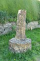
 Batcombe, the Cross-in-Hand - geograph.org.uk - 1876101.jpg 480 × 640; 125 KB
-

-
 Benchmark, Huish Farm - geograph.org.uk - 4331553.jpg 640 × 427; 80 KB
-
 Break Heart Hill from Sidling St Nicholas - geograph.org.uk - 3587374.jpg 1,024 × 678; 172 KB
-
 Bridle Path at City Farm - geograph.org.uk - 975600.jpg 640 × 360; 39 KB
-
 Bridle Path at Sydling St Nicholas - geograph.org.uk - 1308286.jpg 640 × 487; 176 KB
-
 Bridle path on Ridge Hill - geograph.org.uk - 975188.jpg 640 × 360; 52 KB
-
 Bridle Track on Combe Hill - geograph.org.uk - 1308530.jpg 640 × 480; 105 KB
-
 Bridleway on East Hill - geograph.org.uk - 5091286.jpg 640 × 480; 112 KB
-

-

-

-

-
 Church Bottom from Sherrins Hill - geograph.org.uk - 1308287.jpg 640 × 480; 65 KB
-
 Church Bottom, Sydling St Nicholas - geograph.org.uk - 908366.jpg 640 × 480; 145 KB
-
 Clay Pigeon Launcher - geograph.org.uk - 1034724.jpg 640 × 445; 111 KB
-

-
 Combe Hill - geograph.org.uk - 551735.jpg 640 × 480; 136 KB
-
 Comical sign at Huish Farm - geograph.org.uk - 4331610.jpg 427 × 640; 82 KB
-
 Construction of new Radar Dome - geograph.org.uk - 2921688.jpg 640 × 480; 82 KB
-
 Cottages in Sydling St Nicholas - geograph.org.uk - 1869124.jpg 640 × 480; 69 KB
-
 Countryside near Dickley Down Farm - geograph.org.uk - 975602.jpg 640 × 360; 60 KB
-
 Countryside near Up Sydling - geograph.org.uk - 1769337.jpg 640 × 480; 58 KB
-
 Cowdown Hill - geograph.org.uk - 5419760.jpg 640 × 480; 102 KB
-
 Cowdown Hill - Sydling St Nicholas - geograph.org.uk - 2789387.jpg 640 × 480; 94 KB
-
 Descending off Break Heart Hill - geograph.org.uk - 6054285.jpg 5,184 × 3,456; 6.57 MB
-
 Downland, Sydling St Nicholas - geograph.org.uk - 540140.jpg 640 × 480; 133 KB
-
 Downland, Sydling St Nicholas - geograph.org.uk - 545252.jpg 640 × 480; 115 KB
-
 Downland, Sydling St Nicholas - geograph.org.uk - 552980.jpg 640 × 480; 112 KB
-
 Downland, Sydling St Nicholas - geograph.org.uk - 908338.jpg 640 × 480; 151 KB
-
 Downland, Sydling St Nicholas - geograph.org.uk - 908343.jpg 640 × 480; 121 KB
-
 Downland, Sydling St Nicholas - geograph.org.uk - 908351.jpg 640 × 480; 176 KB
-
 Downland, Sydling St Nicholas - geograph.org.uk - 908354.jpg 640 × 480; 173 KB
-
 Downland, Sydling St Nicholas - geograph.org.uk - 908358.jpg 640 × 480; 142 KB
-
 Downland, Sydling St Nicholas - geograph.org.uk - 908360.jpg 640 × 480; 178 KB
-
 Downland, Sydling St Nicholas - geograph.org.uk - 908463.jpg 640 × 427; 140 KB
-
 Downland, Sydling St Nicholas - geograph.org.uk - 910753.jpg 640 × 480; 147 KB
-

-
 East Hill - geograph.org.uk - 5038067.jpg 640 × 480; 79 KB
-
 East Hill, barley field - geograph.org.uk - 4723213.jpg 1,024 × 768; 208 KB
-
 East Hill, bridleway - geograph.org.uk - 4723204.jpg 1,024 × 769; 234 KB
-
 East Hill, footpath - geograph.org.uk - 4722718.jpg 1,024 × 768; 333 KB
-
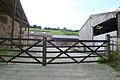
 East Hill, gates - geograph.org.uk - 4723208.jpg 1,024 × 768; 248 KB
-
 East Street - Sydling St Nicholas - geograph.org.uk - 1046161.jpg 640 × 445; 81 KB
-
 East Street, Sydling St Nicholas - geograph.org.uk - 907818.jpg 640 × 480; 211 KB
-
 East Street, Sydling St Nicholas - geograph.org.uk - 907830.jpg 640 × 480; 131 KB
-

-
 Evening - Sydling St Nicholas - geograph.org.uk - 4062488.jpg 800 × 600; 90 KB
-
 Evening Stripes - geograph.org.uk - 998071.jpg 640 × 421; 99 KB
-
 Farm Field Bottom - geograph.org.uk - 545198.jpg 640 × 480; 165 KB
-
 Farm Machinery on Cowdown Hill - geograph.org.uk - 6055143.jpg 5,184 × 3,456; 7.73 MB
-
-

-
 Farmland in the Sydling Valley - geograph.org.uk - 4892347.jpg 640 × 480; 59 KB
-
 Farmland in the Sydling Valley - geograph.org.uk - 979974.jpg 640 × 399; 69 KB
-
 Field Farm Bottom - geograph.org.uk - 539971.jpg 640 × 480; 162 KB
-

-

-
 Fields on Hog Hill - geograph.org.uk - 1869117.jpg 640 × 480; 65 KB
-
 Fields on Peak End Hill - geograph.org.uk - 1869126.jpg 640 × 480; 66 KB
-
 Folly Hill - geograph.org.uk - 898128.jpg 640 × 426; 57 KB
-
 Folly Hill - geograph.org.uk - 998070.jpg 640 × 408; 89 KB
-

-
 Footpath on Gore Hill - geograph.org.uk - 2432254.jpg 640 × 480; 101 KB
-
 Footpath to Up Sydling - geograph.org.uk - 5038068.jpg 480 × 640; 62 KB
-
 Footpath up Magiston Hill - geograph.org.uk - 4898757.jpg 480 × 640; 145 KB
-
 Ford at Up Sydling - geograph.org.uk - 1769451.jpg 640 × 443; 86 KB
-
 Ford at Up Sydling - geograph.org.uk - 4839105.jpg 640 × 427; 74 KB
-
 Ford Mondeo in Ford (7858062700).jpg 2,592 × 1,944; 1.64 MB
-
 Ford near Sydling St Nicholas - geograph.org.uk - 1869122.jpg 640 × 480; 99 KB
-
 Ford north of Sydling St. Nicholas - geograph.org.uk - 5416703.jpg 640 × 480; 142 KB
-
 Ford over Sydling Water - geograph.org.uk - 3391298.jpg 4,320 × 3,240; 5.41 MB
-
 Ford, Up Sydling - geograph.org.uk - 3602359.jpg 4,608 × 3,456; 6.24 MB
-
 Former chapel, Sydling St Nicholas - geograph.org.uk - 907771.jpg 640 × 480; 166 KB
-
 Gore Hill, bridleway junction - geograph.org.uk - 4723866.jpg 1,024 × 769; 202 KB
-
 Hay bales, Sydling St Nicholas - geograph.org.uk - 908345.jpg 640 × 480; 132 KB
-
 High Street, Sydling St Nicholas - geograph.org.uk - 907577.jpg 640 × 480; 124 KB
-
 High Street, Sydling St Nicholas - geograph.org.uk - 907612.jpg 640 × 480; 158 KB
-
 High Street, Sydling St Nicholas - geograph.org.uk - 907668.jpg 640 × 480; 131 KB
-
 High Street, Sydling St Nicholas - geograph.org.uk - 907741.jpg 640 × 480; 160 KB
-
 High Street, Sydling St. Nicholas - geograph.org.uk - 5416699.jpg 640 × 428; 110 KB
-
 Higher City Farm - geograph.org.uk - 5865576.jpg 640 × 427; 67 KB
-
 Hillside cattle - geograph.org.uk - 5416708.jpg 640 × 428; 91 KB
-

-

-

-
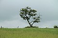 Isolated tree - geograph.org.uk - 2990894.jpg 1,024 × 683; 124 KB
-
 Karting circuit, Warden Hill - geograph.org.uk - 4465548.jpg 800 × 533; 144 KB
-
 Lamperts Farm Dairy - geograph.org.uk - 979972.jpg 640 × 426; 69 KB
-
 Large Bar Hill - geograph.org.uk - 975189.jpg 640 × 360; 64 KB
-
 Large Bar Hill - geograph.org.uk - 975190.jpg 640 × 431; 61 KB
-
 Large Bar Hill - geograph.org.uk - 975255.jpg 640 × 360; 49 KB
-
 Long Ash Lane - geograph.org.uk - 2414869.jpg 640 × 480; 74 KB
-

-
 Loscombe Hill - geograph.org.uk - 979971.jpg 640 × 396; 53 KB
-
 MG TF 135 (7858078044).jpg 2,592 × 1,944; 1.57 MB
-
-
 Minor road joins the A37 - geograph.org.uk - 1869131.jpg 640 × 416; 39 KB
-
 Mists on Folly Hill - geograph.org.uk - 5264381.jpg 640 × 480; 40 KB
-
-

-
 Old fuel pump, Sydling St Nicholas - geograph.org.uk - 907720.jpg 480 × 640; 224 KB
-
 Old minor road to Cerne Abbas - geograph.org.uk - 4465501.jpg 640 × 480; 73 KB
-
 Old petrol pump at Magiston Farm - geograph.org.uk - 4331596.jpg 427 × 640; 79 KB
-
 On the Southern Flanks of Cowdown Hill - geograph.org.uk - 6055151.jpg 5,184 × 3,456; 5.6 MB
-
 Outdoor ring south of Sydling - geograph.org.uk - 2344319.jpg 1,280 × 839; 337 KB
-

-
 Pond Bottom - geograph.org.uk - 545275.jpg 640 × 480; 153 KB
-
 Pond Bottom and Shearplace Hill - geograph.org.uk - 975257.jpg 640 × 381; 50 KB
-
 Post box, Up Sydling - geograph.org.uk - 3602367.jpg 3,456 × 4,608; 2.95 MB
-
 Quagmire on the Wessex Ridgeway path, Break Heart Hill - geograph.org.uk - 6056960.jpg 3,776 × 2,520; 3.03 MB
-
 Radar, Warden Hill - geograph.org.uk - 4465550.jpg 800 × 533; 123 KB
-

-
 Road entering Sydling St. Nicholas - geograph.org.uk - 5416691.jpg 640 × 480; 119 KB
-
 Road passing Cross and Hand - geograph.org.uk - 4465517.jpg 800 × 533; 179 KB
-
 Row Hill Coppice - geograph.org.uk - 4465526.jpg 800 × 533; 282 KB
-

-
 Scarecrow on large Bar Hill - geograph.org.uk - 975259.jpg 640 × 410; 92 KB
-
 Sheep and lambs - geograph.org.uk - 5416681.jpg 640 × 480; 103 KB
-
 Sheep grazing on turnips, Higher City Farm - geograph.org.uk - 6057081.jpg 3,514 × 2,291; 2.48 MB
-

-

-
 Signpost at Sydling St Nicholas - geograph.org.uk - 4465511.jpg 480 × 640; 83 KB
-
 Silage bales, Sydling St Nicholas - geograph.org.uk - 908004.jpg 640 × 480; 140 KB
-
 Silage bales, Sydling St Nicholas - geograph.org.uk - 909718.jpg 640 × 480; 144 KB
-
 Skoda 1000MB (7858069548).jpg 2,592 × 1,944; 1.53 MB
-
 South Field Down - geograph.org.uk - 2990875.jpg 1,024 × 683; 125 KB
-
 South Field Down - geograph.org.uk - 2990886.jpg 1,024 × 683; 145 KB
-
 South Field Down - geograph.org.uk - 5416677.jpg 640 × 480; 109 KB
-
 Stubble field at Ridge Hill - geograph.org.uk - 975258.jpg 640 × 389; 86 KB
-
 Studebaker Hawk GT (7858034834).jpg 2,592 × 1,944; 2.08 MB
-
 Sun and Mist on Folly Hill - geograph.org.uk - 5264387.jpg 640 × 427; 32 KB
-
 Sunset, Warden Hill - geograph.org.uk - 4465555.jpg 800 × 533; 98 KB
-
 Sydling Ford before Tatra assault (7858010690).jpg 2,592 × 1,944; 1.76 MB
-
 Sydling Ford before Tatra assault (7858019442).jpg 2,592 × 1,944; 2.55 MB
-
 Sydling St Nicholas - geograph.org.uk - 1418457.jpg 640 × 480; 94 KB
-
 Sydling St Nicholas - geograph.org.uk - 2791947.jpg 640 × 480; 107 KB
-
 Sydling St Nicholas - geograph.org.uk - 545206.jpg 640 × 480; 159 KB
-
 Sydling St Nicholas Ford - geograph.org.uk - 4550033.jpg 1,084 × 725; 333 KB
-
 Sydling St Nicholas ford - geograph.org.uk - 724362.jpg 640 × 480; 109 KB
-
 Sydling St Nicholas ford - geograph.org.uk - 724363.jpg 640 × 480; 124 KB
-

-
 Sydling St Nicholas-sign - geograph.org.uk - 3160391.jpg 640 × 480; 123 KB
-

-
 Sydling St. Nicholas, junction - geograph.org.uk - 4722709.jpg 1,024 × 768; 181 KB
-

-

-
-
 Sydling St. Nicholas, village centre - geograph.org.uk - 2242575.jpg 640 × 480; 84 KB
-
 Sydling Valley - geograph.org.uk - 1308532.jpg 640 × 480; 88 KB
-
 Sydling Valley - geograph.org.uk - 4331600.jpg 640 × 427; 38 KB
-
 Sydling Valley, farmland in spring - geograph.org.uk - 2344292.jpg 1,280 × 960; 504 KB
-
 Sydling Water - geograph.org.uk - 724365.jpg 640 × 480; 145 KB
-
 Sydling Water - geograph.org.uk - 724644.jpg 640 × 480; 134 KB
-
 Sydling Woods, Wardon Hill - geograph.org.uk - 1034726.jpg 640 × 428; 65 KB
-
 Tatra T2 603 (7858089992).jpg 2,592 × 1,944; 1.56 MB
-
 Tatra T2 603 (7858382290).jpg 2,592 × 1,944; 1.46 MB
-
 Tatra T2 603 nose (7858028230).jpg 2,592 × 1,944; 2.36 MB
-
 The ford at Sydling St Nicholas - geograph.org.uk - 311260.jpg 640 × 416; 61 KB
-
 The Wessex Ridgeway bridleway north from Higher City Farm - geograph.org.uk - 6057570.jpg 3,776 × 2,520; 3.42 MB
-
 Thistle and Wheat on Wardon Hill - geograph.org.uk - 913169.jpg 640 × 428; 178 KB
-
 Thistle Wheat and clouds - geograph.org.uk - 913167.jpg 640 × 426; 73 KB
-
 Track descending into Pond Bottom - geograph.org.uk - 539989.jpg 640 × 480; 178 KB
-
 Track heading towards The Combe - geograph.org.uk - 6054939.jpg 5,184 × 3,456; 7.69 MB
-

-
 Track towards Higher City Farm - geograph.org.uk - 6057066.jpg 3,776 × 2,520; 3.31 MB
-
 Track towards Sydling St Nicholas - geograph.org.uk - 6056964.jpg 3,776 × 2,520; 3.33 MB
-
 View East from Folly Hill - geograph.org.uk - 898120.jpg 640 × 426; 51 KB
-
 View from Folly Hill - geograph.org.uk - 898133.jpg 640 × 426; 65 KB
-
 View from Sherrins Hill - geograph.org.uk - 1308529.jpg 640 × 480; 53 KB
-
 View south from Folly Hill - geograph.org.uk - 5416717.jpg 640 × 480; 92 KB
-
 View towards Sydling St. Nicholas - geograph.org.uk - 4587089.jpg 1,024 × 768; 161 KB
-
 Volvo C303 4x4 (7858083974).jpg 2,592 × 1,944; 1.5 MB
-
 Wardon Hill - geograph.org.uk - 4465546.jpg 800 × 533; 146 KB
-
 Wardon Hill - geograph.org.uk - 913171.jpg 640 × 429; 48 KB
-
 Wardon Hill Radar Dome - geograph.org.uk - 2921812.jpg 640 × 480; 71 KB
-
 Wardon Hill Weather Radar - geograph.org.uk - 315756.jpg 480 × 640; 62 KB
-
 Wessex Ridgeway climbing Eastwards from Sydling St. Nicholas - geograph.org.uk - 6055133.jpg 5,184 × 3,456; 7.05 MB
-
 Wessex Ridgeway descending towards Sydling St. Nicholas - geograph.org.uk - 6055129.jpg 5,184 × 3,456; 7.23 MB
-
 Wessex Ridgeway heading towards Break Heart Hill - geograph.org.uk - 6054933.jpg 5,184 × 3,456; 6.22 MB
-
 Wessex Ridgeway in Sydling St.Nicholas - geograph.org.uk - 6055126.jpg 5,184 × 3,456; 7.37 MB
-
 Wessex Ridgeway near Sydling St. Nicholas - geograph.org.uk - 6054946.jpg 5,184 × 3,456; 5.97 MB
-
 Wessex Ridgeway on Cowdown Hill - geograph.org.uk - 6055137.jpg 5,184 × 3,456; 7.37 MB
-
 Wessex Ridgeway to Sydling St Nicholas - geograph.org.uk - 5699180.jpg 427 × 640; 113 KB
-

-
 Where's the Path^ on Balls Hill - geograph.org.uk - 1492701.jpg 640 × 446; 110 KB
-
 Wind Powered Farmyard - geograph.org.uk - 979973.jpg 640 × 426; 70 KB
-
 Wool in a hawthorn hedge - geograph.org.uk - 730597.jpg 640 × 480; 106 KB
-
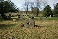
 Cerne Park Pale - geograph.org.uk - 1492386.jpg 640 × 480; 153 KB
-
 Road across the top of Folly Hill - geograph.org.uk - 311317.jpg 640 × 480; 61 KB


.jpg)


.jpg)


.jpg)


_-_geograph.org.uk_-_2432250.jpg)


.jpg)


.jpg)


.jpg)
.jpg)


.jpg)
.jpg)
.jpg)


.jpg)


