Category:Swyncombe
Jump to navigation
Jump to search
village and civil parish in South Oxfordshire district, Oxfordshire, England  | |||||
| Upload media | |||||
| Instance of | |||||
|---|---|---|---|---|---|
| Location | South Oxfordshire, Oxfordshire, South East England, England | ||||
| Population |
| ||||
| Area |
| ||||
| official website | |||||
 | |||||
English: Swyncombe is a hamlet and civil parish about east of Wallingford, England. Swyncombe's toponym derives from the Old English words Swin for wild boar and combe for valley or hollow.
Subcategories
This category has the following 3 subcategories, out of 3 total.
P
- Park Corner (2 F)
S
- Swyncombe House (5 F)
Media in category "Swyncombe"
The following 200 files are in this category, out of 243 total.
(previous page) (next page)-
 29 Maidensgrove - geograph.org.uk - 2180330.jpg 640 × 480; 100 KB
-
 A bit of snow in the garden - geograph.org.uk - 6052683.jpg 4,744 × 3,642; 3.26 MB
-
 A Burrow in Winter - geograph.org.uk - 2053875.jpg 1,536 × 2,048; 1.44 MB
-
 A Jetpatcher - geograph.org.uk - 3452567.jpg 3,648 × 2,736; 2.78 MB
-

-
 Access downland on Swyncombe Downs - geograph.org.uk - 3834196.jpg 640 × 480; 85 KB
-
 Across the green - geograph.org.uk - 3447386.jpg 640 × 427; 177 KB
-
 Across the green - geograph.org.uk - 3447394.jpg 640 × 427; 187 KB
-
 Approaching Magpies - geograph.org.uk - 2133472.jpg 640 × 426; 212 KB
-
 Arable land between Lower Warren and Sliding Hill - geograph.org.uk - 3439611.jpg 3,648 × 2,736; 3.64 MB
-
 B451 passes across Cookley Green - geograph.org.uk - 2891336.jpg 3,648 × 2,736; 2.42 MB
-
 B481 into Cookley Green - geograph.org.uk - 3009444.jpg 2,560 × 1,920; 1.08 MB
-
 B481 junction at Park Corner - geograph.org.uk - 2890912.jpg 3,218 × 2,420; 1.52 MB
-
 B481 south of Cookley Green - geograph.org.uk - 2891322.jpg 3,411 × 2,437; 1.21 MB
-
 Barn at Coates Farm - geograph.org.uk - 3447264.jpg 640 × 427; 221 KB
-
 Beechwoods near Cookley Green - geograph.org.uk - 2241707.jpg 3,312 × 2,616; 2.19 MB
-
 Bequest in the porch - geograph.org.uk - 3637186.jpg 400 × 600; 47 KB
-
 Bridleway and drive heading to Ewelme Park - geograph.org.uk - 6671288.jpg 1,024 × 576; 263 KB
-
 Bridleway by Thick Wood - geograph.org.uk - 6125221.jpg 768 × 1,024; 337 KB
-
 Bridleway from Cookley Green - geograph.org.uk - 3447418.jpg 640 × 427; 221 KB
-
 Bridleway from Cookley Green - geograph.org.uk - 3447423.jpg 640 × 427; 210 KB
-
 Britwell Salome House from Swyncombe Downs - geograph.org.uk - 2907635.jpg 1,024 × 683; 133 KB
-
 Brown Field Site - geograph.org.uk - 2241805.jpg 3,888 × 2,592; 1.3 MB
-
 Building work taking place at Magpies - geograph.org.uk - 2181325.jpg 640 × 480; 112 KB
-
 Buildings at Ewelme Park - geograph.org.uk - 2131923.jpg 640 × 427; 200 KB
-
 Bus shelter at Park Corner - geograph.org.uk - 2131992.jpg 640 × 426; 187 KB
-
 Candles in the window - geograph.org.uk - 3634183.jpg 400 × 600; 27 KB
-
 Cattle at Park Corner - geograph.org.uk - 2132030.jpg 640 × 427; 252 KB
-
 Chancel windows - geograph.org.uk - 3627245.jpg 900 × 600; 75 KB
-
 Chiltern Way - geograph.org.uk - 1270006.jpg 640 × 480; 113 KB
-
 Chiltern Way - geograph.org.uk - 1270029.jpg 640 × 480; 116 KB
-
 Chiltern Way - geograph.org.uk - 1270044.jpg 640 × 480; 85 KB
-
 Chiltern Way - geograph.org.uk - 1270198.jpg 640 × 480; 134 KB
-
 Chiltern Way - geograph.org.uk - 1271055.jpg 640 × 480; 101 KB
-
 Chiltern Way - geograph.org.uk - 1271127.jpg 640 × 480; 152 KB
-
 Chiltern Way, Swyncombe Downs - geograph.org.uk - 5697782.jpg 4,592 × 3,056; 3.7 MB
-
 Church Lane - geograph.org.uk - 3623565.jpg 900 × 600; 121 KB
-
 Clearing at Warburg Nature Reserve - geograph.org.uk - 6181926.jpg 2,592 × 1,944; 1.27 MB
-
 Coates Farm - geograph.org.uk - 2240550.jpg 3,648 × 2,736; 1.81 MB
-
 Coates Farm - geograph.org.uk - 3445449.jpg 3,648 × 2,736; 2.68 MB
-
 Coates Farm - geograph.org.uk - 3447269.jpg 640 × 427; 200 KB
-
 Coates Farm 2 - geograph.org.uk - 2240557.jpg 3,888 × 2,592; 822 KB
-
 Coates Lane - geograph.org.uk - 3447321.jpg 640 × 427; 216 KB
-
 Cookley Green - geograph.org.uk - 2191680.jpg 3,648 × 2,736; 2.43 MB
-
 Covered in Ivy - geograph.org.uk - 3637532.jpg 900 × 600; 163 KB
-
 Cowslips on Great Cookley Hill - geograph.org.uk - 3447453.jpg 638 × 640; 416 KB
-
 Darkwood Farm - geograph.org.uk - 2132035.jpg 640 × 427; 237 KB
-
 Darkwood Farm - geograph.org.uk - 2132041.jpg 640 × 428; 255 KB
-
 Detail on the Taylor window - geograph.org.uk - 3632630.jpg 942 × 600; 74 KB
-
 Didcot in the distance - geograph.org.uk - 3623557.jpg 900 × 600; 108 KB
-
 Didcot through the trees - geograph.org.uk - 3621699.jpg 900 × 600; 96 KB
-
 Earthwork, Park Corner - geograph.org.uk - 3597443.jpg 1,024 × 768; 310 KB
-
 Ellen Lloyd - geograph.org.uk - 3637252.jpg 900 × 600; 124 KB
-
 Eroded away - geograph.org.uk - 3637478.jpg 900 × 600; 134 KB
-
 Ewelme Down - geograph.org.uk - 3403710.jpg 1,600 × 1,047; 339 KB
-
 Ewelme Park - geograph.org.uk - 2131917.jpg 640 × 427; 273 KB
-
 Ewelme Park - geograph.org.uk - 2131963.jpg 640 × 426; 233 KB
-
 Ewelme Park estate houses - geograph.org.uk - 2131946.jpg 640 × 426; 200 KB
-
 Ewelme Park estate road - geograph.org.uk - 2131954.jpg 640 × 427; 206 KB
-
 Ewelme Park estate road - geograph.org.uk - 2131959.jpg 640 × 428; 235 KB
-
 Ewelme Park estate road - geograph.org.uk - 2131960.jpg 640 × 427; 207 KB
-
 Ewelme Park estate road - geograph.org.uk - 2131969.jpg 640 × 426; 235 KB
-
 Ewelme Park Farm Buildings - geograph.org.uk - 4516177.jpg 1,280 × 720; 458 KB
-
 Ewelme Park from the Ridgeway - geograph.org.uk - 2131928.jpg 640 × 427; 244 KB
-
 Ewelme Park Gate House - geograph.org.uk - 4515442.jpg 1,280 × 720; 620 KB
-
 Ewelme Park Gatehouse - geograph.org.uk - 2409687.jpg 3,276 × 2,232; 1.66 MB
-
 Farm Buildings at Lower Farm, Swyncombe - geograph.org.uk - 2735392.jpg 1,600 × 1,293; 504 KB
-
 Farmland near Ewelme Park - geograph.org.uk - 2131908.jpg 640 × 426; 230 KB
-
 Farmland north of Swyncombe House - geograph.org.uk - 6444625.jpg 1,802 × 1,201; 385 KB
-
 Farmland, Britwell Salome - geograph.org.uk - 6080464.jpg 1,024 × 768; 238 KB
-
 Farmland, Swyncombe - geograph.org.uk - 1270464.jpg 640 × 427; 94 KB
-
 Farmland, Swyncombe - geograph.org.uk - 6081520.jpg 1,024 × 768; 210 KB
-
 Farmland, Swyncombe - geograph.org.uk - 6081521.jpg 1,024 × 768; 265 KB
-
 Farmland, Swyncombe - geograph.org.uk - 6673594.jpg 1,024 × 683; 246 KB
-
 Farmland, Swyncombe - geograph.org.uk - 6673600.jpg 1,024 × 683; 257 KB
-
 Farmland, Swyncombe - geograph.org.uk - 932692.jpg 640 × 480; 135 KB
-
 Farmland, Swyncombe - geograph.org.uk - 932713.jpg 640 × 480; 102 KB
-
 Feeder at Westwood Manor Farm - geograph.org.uk - 2133469.jpg 640 × 427; 232 KB
-
 Field boundary near Shepherds Barn - geograph.org.uk - 2133458.jpg 640 × 427; 210 KB
-
 Fields near Cookley Green - geograph.org.uk - 3896765.jpg 4,320 × 3,240; 5.17 MB
-
 Fields West of Cookley Farm - geograph.org.uk - 2191690.jpg 3,648 × 2,736; 2.79 MB
-
 The Five Horseshoes Public House - geograph.org.uk - 88657.jpg 640 × 481; 37 KB
-
 Five Horseshoes - geograph.org.uk - 3448857.jpg 640 × 427; 240 KB
-
 Flowers by the rood screen - geograph.org.uk - 3634354.jpg 400 × 600; 65 KB
-
 Footpath across the field - geograph.org.uk - 1271103.jpg 640 × 480; 79 KB
-
 Footpath approaching Magpies Cottage - geograph.org.uk - 2181295.jpg 640 × 480; 97 KB
-
 Footpath by Church Wood - geograph.org.uk - 2191702.jpg 3,120 × 2,220; 2.4 MB
-

-
 Footpath past the house - geograph.org.uk - 3637247.jpg 900 × 600; 126 KB
-
 Footstone and headstone - geograph.org.uk - 3637785.jpg 900 × 600; 141 KB
-
 Former Park Corner Methodist Chapel - geograph.org.uk - 3662786.jpg 3,359 × 2,631; 2.27 MB
-
 From under a Yew Tree - geograph.org.uk - 3637784.jpg 900 × 600; 140 KB
-
 Frozen Cricket Pitch - geograph.org.uk - 2191675.jpg 3,648 × 2,736; 1.42 MB
-
 Frozen Holly in Church Wood - geograph.org.uk - 2191742.jpg 3,308 × 2,308; 3.15 MB
-
 Frozen Oak Tree in Church Wood - geograph.org.uk - 2191752.jpg 3,328 × 2,472; 2.22 MB
-
 Fungus off Coates Lane - geograph.org.uk - 3447286.jpg 640 × 427; 223 KB
-
 Gateway to nowhere - geograph.org.uk - 6163351.jpg 3,840 × 2,160; 4.05 MB
-
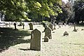
 Gravestones in St Botolph churchyard - geograph.org.uk - 2297118.jpg 1,500 × 1,000; 340 KB
-
 Great Cookley Hill - geograph.org.uk - 3447446.jpg 640 × 427; 208 KB
-
 Great Cookley Hill - geograph.org.uk - 3447450.jpg 640 × 427; 188 KB
-
 Hidden Barn - geograph.org.uk - 3375088.jpg 2,560 × 1,920; 1.52 MB
-
 Horses near Cookley Green - geograph.org.uk - 3447405.jpg 640 × 438; 258 KB
-
 House at Park Corner - geograph.org.uk - 2131982.jpg 640 × 426; 239 KB
-
 House at Park Corner - geograph.org.uk - 2131987.jpg 640 × 427; 226 KB
-
 Houses at Cookley Green - geograph.org.uk - 3447390.jpg 640 × 427; 167 KB
-
 Houses at Park Corner - geograph.org.uk - 3896779.jpg 4,320 × 3,240; 4.06 MB
-
 Houses, Cookley Green - geograph.org.uk - 3834292.jpg 640 × 428; 104 KB
-
 Hut in the Woods - geograph.org.uk - 2907609.jpg 1,600 × 1,017; 868 KB
-
 Information Board at Warburg Nature Reserve (2) - geograph.org.uk - 6182211.jpg 2,592 × 1,944; 1.42 MB
-
 Information on the window - geograph.org.uk - 3634193.jpg 400 × 600; 38 KB
-
 Inscription on the window - geograph.org.uk - 3632471.jpg 900 × 600; 84 KB
-
 J H Barnett - geograph.org.uk - 3637491.jpg 900 × 600; 118 KB
-
 Jet patching - geograph.org.uk - 3452555.jpg 3,648 × 2,736; 2.94 MB
-
 Junction at Great Cookley Hill - geograph.org.uk - 3447427.jpg 640 × 427; 211 KB
-
 Junction within the park - geograph.org.uk - 2131941.jpg 640 × 426; 198 KB
-
 Kissing gate by the sign - geograph.org.uk - 3623566.jpg 900 × 600; 186 KB
-
 Kneeling Angel - geograph.org.uk - 3632464.jpg 902 × 600; 56 KB
-
 Ladies Walk bridlepath and Colliersbottom Shaw - geograph.org.uk - 5703952.jpg 4,592 × 3,056; 5.43 MB
-
 Ladies Walk bridlepath on the Swyncombe Estate - geograph.org.uk - 5703929.jpg 4,592 × 3,056; 4.56 MB
-
 Lane at Upper Maidensgrove - geograph.org.uk - 3448838.jpg 640 × 427; 211 KB
-
 Lane below Sliding Hill - geograph.org.uk - 3834218.jpg 640 × 480; 174 KB
-
 Light on the pews - geograph.org.uk - 3637183.jpg 400 × 600; 36 KB
-
 Little Hatch, Park Corner - geograph.org.uk - 1439449.jpg 640 × 480; 101 KB
-
 Lodge Farm Cottage, Maidensgrove - geograph.org.uk - 2180318.jpg 640 × 480; 101 KB
-
 Lower Farm - geograph.org.uk - 1308466.jpg 640 × 480; 105 KB
-
 Lower Farm - geograph.org.uk - 3834252.jpg 640 × 480; 107 KB
-
 Lower Farm and Swyncombe Downs - geograph.org.uk - 5703959.jpg 4,592 × 3,056; 3.3 MB
-
 Lower Farm from Swyncombe Downs - geograph.org.uk - 2813770.jpg 3,379 × 2,253; 2.54 MB
-
 Lower Farm, Swyncombe Downs - geograph.org.uk - 1439444.jpg 640 × 480; 78 KB
-
 Lower Farm, Swyncombe, from Ladies Walk - geograph.org.uk - 5703943.jpg 4,592 × 3,056; 4.63 MB
-
 Maidensgrove Common - geograph.org.uk - 3448899.jpg 640 × 427; 201 KB
-

-

-
 New Cemetery - geograph.org.uk - 3638828.jpg 1,024 × 450; 179 KB
-
 New Year's Day in the Woods - geograph.org.uk - 2053842.jpg 2,048 × 1,536; 1.28 MB
-
 North Farm - geograph.org.uk - 2546997.jpg 3,648 × 2,736; 2.89 MB
-
 North Farm viewed from Swyncombe Downs - geograph.org.uk - 5697770.jpg 4,592 × 3,056; 3.34 MB
-
 Northern Churchyard - geograph.org.uk - 3623800.jpg 900 × 600; 157 KB
-
 Old Stained Glass - geograph.org.uk - 3634173.jpg 400 × 600; 33 KB
-
 Parish Church of St Botolph - Swyncombe - geograph.org.uk - 4515267.jpg 1,280 × 720; 589 KB
-
 Park Corner - geograph.org.uk - 2132025.jpg 640 × 426; 237 KB
-
 Park Corner - geograph.org.uk - 6125163.jpg 1,024 × 779; 272 KB
-

-
 Parkcorner Farm - geograph.org.uk - 2131975.jpg 640 × 427; 242 KB
-
 Parkland at Swyncombe - geograph.org.uk - 5703975.jpg 4,592 × 3,056; 5.04 MB
-
 Parkland, Swyncombe - geograph.org.uk - 677165.jpg 640 × 480; 154 KB
-
 Past Rector - geograph.org.uk - 3637499.jpg 400 × 600; 84 KB
-
 Past Rectors - geograph.org.uk - 3627239.jpg 400 × 600; 33 KB
-
 Pasture, Russell's Water, Swyncombe - geograph.org.uk - 6020125.jpg 1,024 × 768; 213 KB
-
 Pasture, Swyncombe - geograph.org.uk - 6020124.jpg 1,024 × 768; 256 KB
-
 Path heading to the B481 - geograph.org.uk - 6671278.jpg 1,024 × 544; 127 KB
-
 Path, the Warburg nature reserve - geograph.org.uk - 3834431.jpg 640 × 480; 122 KB
-
 Path, the Warburg nature reserve - geograph.org.uk - 3834437.jpg 640 × 480; 147 KB
-
 Path, the Warburg nature reserve - geograph.org.uk - 3834444.jpg 640 × 480; 161 KB
-
 Periwinkle at Upper Maidensgrove - geograph.org.uk - 3448853.jpg 640 × 427; 188 KB
-
 Photo of the Chancel Arch - geograph.org.uk - 3634350.jpg 900 × 600; 60 KB
-
 Pillar in the Chancel - geograph.org.uk - 3634358.jpg 900 × 600; 83 KB
-
 Pishill Bottom and Greenfield Wood - geograph.org.uk - 2698212.jpg 1,600 × 1,123; 635 KB
-
 Pistol Plantation, Swyncombe Estate - geograph.org.uk - 5703997.jpg 4,592 × 3,056; 5.35 MB
-
 Plaque by the lamp - geograph.org.uk - 3637182.jpg 900 × 600; 84 KB
-
 Restricted byway near Westwood Manor Farm - geograph.org.uk - 641124.jpg 640 × 480; 156 KB
-
 Ridgeway north of Swyncombe House - geograph.org.uk - 586572.jpg 640 × 480; 89 KB
-
 Ridgeway Signpost - geograph.org.uk - 3621692.jpg 900 × 600; 126 KB
-

-
 Road junction and grass island - geograph.org.uk - 5472821.jpg 3,648 × 2,736; 2.77 MB
-
 Road junction and grass triangle - geograph.org.uk - 5472830.jpg 3,648 × 2,736; 2.52 MB
-
 Road to Coates Farm - geograph.org.uk - 641161.jpg 640 × 480; 92 KB
-
 Road verge with rosebay willowherb - geograph.org.uk - 5700679.jpg 4,592 × 3,056; 4.33 MB
-
 Roll out the feeders - geograph.org.uk - 2132057.jpg 427 × 640; 244 KB
-

-
 Roof on the window - geograph.org.uk - 3638820.jpg 600 × 900; 171 KB
-
 Sandwich inspector - geograph.org.uk - 3452524.jpg 3,648 × 2,736; 2.78 MB
-
 Seats in the screen - geograph.org.uk - 3626821.jpg 900 × 600; 76 KB
-
 Sheds in Church Wood - geograph.org.uk - 2191773.jpg 3,176 × 2,412; 1.6 MB
-
 Sheep at Warburg nature reserve - geograph.org.uk - 2180307.jpg 640 × 480; 97 KB
-
 Sheep on a Hillside - geograph.org.uk - 3597534.jpg 1,600 × 1,166; 353 KB
-
 Showground within the park - geograph.org.uk - 2131935.jpg 640 × 427; 214 KB
-
 Side of B481 Red Lane and field beyond - geograph.org.uk - 6502704.jpg 3,648 × 2,736; 3.41 MB
-

-
-
 Sinking in the ground - geograph.org.uk - 3637246.jpg 900 × 600; 176 KB
-
 Sliding Hill, Swyncombe Downs - geograph.org.uk - 5700695.jpg 4,592 × 3,056; 4.37 MB
-
 Snowdrop Teas - geograph.org.uk - 3375209.jpg 1,600 × 1,096; 234 KB
-
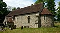
 St Botolph Church in Swyncombe - geograph.org.uk - 2297124.jpg 1,500 × 1,000; 226 KB
-
 St Botolph churchyard - geograph.org.uk - 2297112.jpg 1,500 × 1,000; 370 KB
-
 St Botolph churchyard - geograph.org.uk - 2297115.jpg 1,500 × 1,000; 378 KB
-
 St Botolph's church and graveyard, Swyncombe - geograph.org.uk - 5704019.jpg 4,592 × 3,056; 5.76 MB
-
 St Botolph, Swyncombe - geograph.org.uk - 3233231.jpg 3,008 × 2,000; 716 KB
-
 Sudden Cold Field - geograph.org.uk - 2191667.jpg 3,648 × 2,736; 1.22 MB
-
 Sunlit window - geograph.org.uk - 3632459.jpg 400 × 600; 51 KB
-
 Farm buildings, Ewelme Park - geograph.org.uk - 677140.jpg 640 × 480; 148 KB
-
 Icknieldbank Plantation, Swyncombe - geograph.org.uk - 1058696.jpg 640 × 480; 246 KB
-
 Swyncombe church - geograph.org.uk - 6125680.jpg 1,024 × 816; 302 KB
-
 Swyncombe Cricket Club pavilion - geograph.org.uk - 2891326.jpg 3,608 × 2,645; 1.91 MB
-
 Swyncombe Downs - geograph.org.uk - 2924820.jpg 1,600 × 1,188; 526 KB
-
 Swyncombe House - geograph.org.uk - 5283487.jpg 1,600 × 1,200; 589 KB
-
 The Chancel Window - geograph.org.uk - 3634353.jpg 900 × 600; 76 KB
-
 The Chiltern Way near Maidensgrove - geograph.org.uk - 3597550.jpg 800 × 605; 121 KB
-
 The common, Maidensgrove - geograph.org.uk - 641132.jpg 640 × 480; 114 KB
-
 The entrance to Cookley Farm - geograph.org.uk - 6125640.jpg 1,024 × 769; 153 KB


_-_geograph.org.uk_-_6182211.jpg)


