Category:Swisstopo maps, cropped
Jump to navigation
Jump to search
Subcategories
This category has the following 3 subcategories, out of 3 total.
0
- Swisstopo 1:25'000 maps cropped (27 F)
- Swisstopo 1:100'000 maps cropped (16 F)
Media in category "Swisstopo maps, cropped"
The following 39 files are in this category, out of 39 total.
-
 Bahnhof Arth-Goldau Karte.png 3,604 × 2,108; 12.57 MB
-
 Bahnhof Buchs SG Karte.png 2,799 × 4,046; 15.56 MB
-
 Bahnhof Chur Karte.png 3,400 × 2,467; 12.49 MB
-
 Bahnhof Gossau SG Karte.png 2,189 × 1,200; 3.96 MB
-
 Bahnhof Herisau Karte 2019.png 2,189 × 1,358; 4.24 MB
-
 Bahnhof Landquart Karte.png 2,986 × 4,801; 18.22 MB
-
 Bahnhof Nesslau Neu St. Johann Karte.png 1,527 × 1,902; 2.77 MB
-
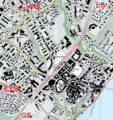
 Bahnhof Rapperswil Karte.png 3,930 × 1,800; 8.97 MB
-
 Bahnhof Romanshorn Karte.png 2,632 × 3,768; 10.21 MB
-
 Bahnhof Rorschach Karte.png 6,000 × 1,800; 12.68 MB
-
 Bahnhof Sargans Karte.png 3,892 × 2,621; 10.73 MB
-
 Bahnhof St. Gallen Karte.png 4,871 × 3,600; 29.13 MB
-
 Bahnhof Wattwil Karte 1908.png 1,397 × 2,022; 4.79 MB
-
 Bahnhof Wattwil Karte 1911.png 1,397 × 2,022; 4.98 MB
-
 Bahnhof Ziegelbrücke Karte.png 3,742 × 2,670; 15.53 MB
-
 Einzugsgebiet-gigler.jpg 807 × 686; 620 KB
-
 FW Wil - Schweizerhof 1959.png 1,400 × 820; 2.75 MB
-
 FW Wil - Schweizerhof 1965.png 1,400 × 820; 2.87 MB
-
 Gare d'Aigle.png 2,184 × 1,357; 5.88 MB
-
 Gare de Bex.png 1,525 × 1,988; 3.51 MB
-
 Gare de Morges.png 2,187 × 1,356; 4.8 MB
-
 Gare de Nyon.png 1,526 × 1,625; 4.47 MB
-
 Gemeinde Kallnach - Gewässer.jpg 1,705 × 602; 789 KB
-
 Güterbahnhof Wolfurt.png 1,013 × 662; 1.08 MB
-
 Hausen AG LK 1955.jpg 1,414 × 731; 284 KB
-
 Karte der Brücken im Hundwilertobel.png 1,852 × 1,012; 3.38 MB
-
 Kartenausschnitt Ulisbach.png 1,212 × 673; 2.06 MB
-
 Luckepass, map by Swisstopo 2018.PNG 1,404 × 808; 2.6 MB
-
 Ruckhaldekurve Karte.png 792 × 535; 980 KB
-
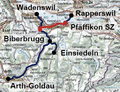
 Streckennetz Biberbrugg–Arth-Goldau (SOB Südnetz).png 370 × 285; 268 KB
-
 Streckennetz Pfäffikon SZ–Samstagern (SOB Südnetz).png 370 × 285; 269 KB
-
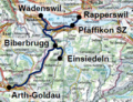 Streckennetz Südostbahn (Südnetz).png 370 × 285; 291 KB
-
 Streckennetz Südostbahn.png 704 × 704; 1.4 MB
-
 Swisstopo 1.jpg 800 × 800; 500 KB
-
 Swisstopo 2.jpg 800 × 800; 623 KB
-
 Swisstopo 3.jpg 800 × 800; 701 KB
-
 Swisstopo 7.jpg 800 × 800; 467 KB
-
 Vens (Sembrancher) - Map.png 1,071 × 1,071; 2.86 MB
-
 Versegères - Map.png 1,130 × 1,079; 3.4 MB


.png)
.png)
.png)


_-_Map.png)
