Category:Swindon, Staffordshire
Jump to navigation
Jump to search
English: Swindon is a village located in Staffordshire, just outside the West Midlands conurbation. The nearest major town is Dudley, approximately five miles eastwards. It stands halfway between the small town of Kingswinford and village of Wombourne.
village and civil parish in Staffordshire, United Kingdom  | |||||
| Upload media | |||||
| Instance of | |||||
|---|---|---|---|---|---|
| Location | South Staffordshire, Staffordshire, West Midlands, England | ||||
| Population |
| ||||
 | |||||
Subcategories
This category has the following 2 subcategories, out of 2 total.
S
- Smestow Brook, Swindon (18 F)
Media in category "Swindon, Staffordshire"
The following 200 files are in this category, out of 439 total.
(previous page) (next page)-
 A brown field - geograph.org.uk - 2218577.jpg 1,024 × 668; 159 KB
-
-
 Access road to Hinksford Park in Staffordshire - geograph.org.uk - 5536500.jpg 1,280 × 960; 1.21 MB
-
 Albert Drive View - geograph.org.uk - 6781762.jpg 800 × 600; 73 KB
-
 Ashwood Lower Lane at Greensforge, Staffordshire - geograph.org.uk - 2398674.jpg 1,024 × 657; 330 KB
-
 Autumn Boats - geograph.org.uk - 5182584.jpg 800 × 600; 165 KB
-
 Bank Farm - geograph.org.uk - 368785.jpg 640 × 417; 125 KB
-
 Barn on the Wombourne Road - geograph.org.uk - 293537.jpg 600 × 450; 200 KB
-
 Barns by Greensforge Farm, Staffordshire - geograph.org.uk - 5383078.jpg 1,280 × 769; 800 KB
-
 Blaze Park bus turning circle, Wall Heath - geograph.org.uk - 3510092.jpg 1,024 × 768; 138 KB
-
 Blue View - geograph.org.uk - 5757925.jpg 800 × 600; 209 KB
-

-

-

-

-
 Boggy field - geograph.org.uk - 783499.jpg 640 × 480; 86 KB
-
 Botterham Lane, Swindon, Staffordshire - geograph.org.uk - 641681.jpg 640 × 480; 146 KB
-
 Brickwork on old barn in Swindon, Staffordshire - geograph.org.uk - 6840045.jpg 1,440 × 1,080; 2.17 MB
-
 Bridgnorth Road - geograph.org.uk - 6177761.jpg 640 × 480; 61 KB
-

-

-

-
 Camp Hill Road south of Swindon, Staffordshire - geograph.org.uk - 3223628.jpg 1,024 × 745; 648 KB
-
 Canal and Staffordshire farmland near Swindon - geograph.org.uk - 6839435.jpg 1,440 × 960; 1.26 MB
-
 Canal approaching Hinksford Lock in Staffordshire - geograph.org.uk - 6834853.jpg 1,440 × 960; 1.66 MB
-
 Canal at Hinksford Bridge in Staffordshire - geograph.org.uk - 6834658.jpg 1,280 × 960; 1.73 MB
-

-

-
 Canal at Marsh Lock near Swindon, Staffordshire - geograph.org.uk - 6835830.jpg 1,080 × 1,440; 1.74 MB
-
 Canal Cottage at Hinksford - geograph.org.uk - 5206630.jpg 800 × 601; 133 KB
-
 Canal in Swindon, Staffordshire - geograph.org.uk - 6840068.jpg 960 × 1,280; 1.48 MB
-
 Canal in Swindon, Staffordshire - geograph.org.uk - 6840099.jpg 1,440 × 1,080; 1.69 MB
-
 Canal Lambs - geograph.org.uk - 6079724.jpg 800 × 600; 217 KB
-
 Canal moorings north of Greensforge Bridge in Staffordshire - geograph.org.uk - 6844419.jpg 1,280 × 1,280; 2.19 MB
-
 Canal near Hinksford in Staffordshire - geograph.org.uk - 6834640.jpg 1,440 × 960; 1.79 MB
-
 Canal near Hinksford in Staffordshire - geograph.org.uk - 6834662.jpg 1,440 × 1,080; 1.86 MB
-
 Canal near Swindon in Staffordshire - geograph.org.uk - 6835746.jpg 1,440 × 960; 1.53 MB
-
 Canal near Swindon in Staffordshire - geograph.org.uk - 6835800.jpg 1,280 × 960; 1.66 MB
-
 Canal north of Swindon in Staffordshire - geograph.org.uk - 6836728.jpg 1,080 × 1,440; 1.91 MB
-
 Canal north of Swindon in Staffordshire - geograph.org.uk - 6837287.jpg 1,440 × 1,080; 1.92 MB
-
 Canal south of Swindon in Staffordshire - geograph.org.uk - 6835735.jpg 1,600 × 900; 1.64 MB
-
 Canal south-east of Swindon in Staffordshire - geograph.org.uk - 6806001.jpg 1,440 × 960; 2.11 MB
-
 Canal, woodland and pasture near Swindon, Staffordshire - geograph.org.uk - 5541713.jpg 1,440 × 1,032; 1.86 MB
-
 Canalside house, Botterham - geograph.org.uk - 5794520.jpg 1,024 × 768; 292 KB
-
 Cereal crop south west of Swindon - geograph.org.uk - 6177724.jpg 800 × 600; 102 KB
-
 Cereal crop Swindon, Staffordshire - geograph.org.uk - 6177754.jpg 800 × 600; 80 KB
-
 Cereal crop, Greensforge - geograph.org.uk - 6177720.jpg 800 × 600; 98 KB
-
 Chapel Lane - geograph.org.uk - 997191.jpg 480 × 640; 75 KB
-
 Chapel Lane Scene - geograph.org.uk - 6511136.jpg 800 × 600; 142 KB
-
 Chase Pool Lodge trig point, SW of Swindon, Staffs - geograph.org.uk - 5219862.jpg 5,184 × 2,920; 4.8 MB
-
 Chasepool Farm Track - geograph.org.uk - 6757005.jpg 800 × 600; 86 KB
-
 Chasepool Farm Track - geograph.org.uk - 882419.jpg 640 × 480; 49 KB
-
 Chasepool Lodge trig in evening sunshine - geograph.org.uk - 2635861.jpg 1,142 × 857; 383 KB
-
 Chasepool Road - geograph.org.uk - 6678277.jpg 800 × 600; 96 KB
-
 Chasepool Road - geograph.org.uk - 882433.jpg 640 × 480; 49 KB
-
 Chasepool Road Scene - geograph.org.uk - 6788315.jpg 800 × 600; 112 KB
-

-
 Chasepool Road towards Swindon - geograph.org.uk - 6177726.jpg 800 × 600; 91 KB
-
 Chasepool Road View - geograph.org.uk - 6678283.jpg 800 × 600; 89 KB
-
 Church Road, Swindon, Staffordshire - geograph.org.uk - 6177752.jpg 800 × 600; 100 KB
-
 Church Road, Swindon, Staffordshire - geograph.org.uk - 6177759.jpg 800 × 600; 85 KB
-
 Club House View - geograph.org.uk - 4461824.jpg 800 × 600; 74 KB
-

-
 Converted school at Swindon, Staffordshire - geograph.org.uk - 2466952.jpg 1,024 × 604; 363 KB
-

-

-

-
 Development land near Hinksford in Staffordshire - geograph.org.uk - 5396791.jpg 1,280 × 896; 820 KB
-
 Dog Walker - geograph.org.uk - 3205351.jpg 800 × 600; 223 KB
-
 Donkey Scene - geograph.org.uk - 5182462.jpg 800 × 600; 107 KB
-
 Driveway near Greensforge in Staffordshire - geograph.org.uk - 5382930.jpg 1,280 × 960; 1.38 MB
-
 Driveway near Greensforge in Staffordshire - geograph.org.uk - 5382935.jpg 1,280 × 894; 1.17 MB
-
 Empty Barn next to The Greyhound Inn - geograph.org.uk - 4090758.jpg 3,648 × 2,736; 2.97 MB
-
 Entering Smestow - geograph.org.uk - 783201.jpg 640 × 480; 96 KB
-
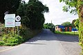
 Entering Swindon - geograph.org.uk - 5424082.jpg 800 × 600; 156 KB
-
 Entrance to the car park - geograph.org.uk - 1223420.jpg 600 × 450; 328 KB
-
 Entrance to the Swindon Golf Club - geograph.org.uk - 3186716.jpg 1,044 × 783; 273 KB
-
 Enville Road Field - geograph.org.uk - 6496127.jpg 800 × 600; 95 KB
-
 Evening light on the Lych Gates - geograph.org.uk - 3187218.jpg 857 × 1,142; 332 KB
-
 Farm land near Greensforge in Staffordshire - geograph.org.uk - 5384207.jpg 1,280 × 874; 990 KB
-
 Farm land near Greensforge in Staffordshire - geograph.org.uk - 5388388.jpg 1,280 × 855; 826 KB
-
 Farm land north of Greensforge in Staffordshire - geograph.org.uk - 5389810.jpg 1,280 × 960; 1.09 MB
-
 Farm land north of Greensforge in Staffordshire - geograph.org.uk - 5389817.jpg 1,280 × 811; 1.01 MB
-
 Farm land north of Greensforge in Staffordshire - geograph.org.uk - 5389829.jpg 1,280 × 896; 1.21 MB
-
 Farm land north of Greensforge in Staffordshire - geograph.org.uk - 5394929.jpg 1,280 × 845; 1.06 MB
-
 Farm Machine - geograph.org.uk - 5435580.jpg 800 × 600; 218 KB
-
 Farm Track - geograph.org.uk - 6867827.jpg 800 × 600; 101 KB
-

-
 Farm track near Greensforge in Staffordshire - geograph.org.uk - 5383438.jpg 768 × 1,024; 780 KB
-
 Farm track near Greensforge in Staffordshire - geograph.org.uk - 5384204.jpg 1,280 × 886; 858 KB
-
 Farm track near Greensforge in Staffordshire - geograph.org.uk - 5384205.jpg 1,024 × 1,024; 902 KB
-
 Farm track near Greensforge in Staffordshire - geograph.org.uk - 5384206.jpg 960 × 1,280; 1.2 MB
-
 Farm track near Greensforge in Staffordshire - geograph.org.uk - 5388408.jpg 960 × 1,280; 1.39 MB
-
 Farm yard and track near Greensforge in Staffordshire - geograph.org.uk - 5383405.jpg 1,280 × 861; 1,013 KB
-

-

-

-

-
 Farmland near Swindon, Staffordshire - geograph.org.uk - 3223567.jpg 1,024 × 663; 376 KB
-
 Farmland near Swindon, Staffordshire - geograph.org.uk - 641680.jpg 640 × 447; 122 KB
-
 Farmland north of Swindon, Staffordshire - geograph.org.uk - 4406161.jpg 1,024 × 768; 522 KB
-
 Farmland south of Swindon in Staffordshire - geograph.org.uk - 5517096.jpg 1,280 × 858; 1.17 MB
-
 Farmland south of Swindon in Staffordshire - geograph.org.uk - 5517105.jpg 1,280 × 960; 1.27 MB
-
 Farmland south-east of Swindon, Staffordshire - geograph.org.uk - 4081137.jpg 1,024 × 676; 390 KB
-
 Farmland south-east of Swindon, Staffordshire - geograph.org.uk - 4081145.jpg 1,024 × 709; 357 KB
-
 Farmland south-west of Swindon, Staffordshire - geograph.org.uk - 2467030.jpg 1,024 × 668; 384 KB
-
 Farmland south-west of Swindon, Staffordshire - geograph.org.uk - 3223526.jpg 1,280 × 630; 357 KB
-
 Farmland south-west of Swindon, Staffordshire - geograph.org.uk - 3223544.jpg 1,280 × 629; 375 KB
-
 Farmland south-west of Swindon, Staffordshire - geograph.org.uk - 3223576.jpg 1,024 × 694; 429 KB
-
 Farmland west of Smestow, Staffordshire - geograph.org.uk - 2115673.jpg 640 × 480; 102 KB
-
 Feiashill Road - geograph.org.uk - 6511139.jpg 800 × 600; 101 KB
-
 Feiashill Road Scene - geograph.org.uk - 6798763.jpg 800 × 553; 61 KB
-
 Feiashill Road View - geograph.org.uk - 6511150.jpg 800 × 600; 185 KB
-

-

-
 Field edge north of Greensforge in Staffordshire - geograph.org.uk - 5394899.jpg 1,280 × 902; 1.27 MB
-

-
 Field Path - geograph.org.uk - 6262077.jpg 800 × 600; 201 KB
-
 Field Scene - geograph.org.uk - 4674842.jpg 800 × 600; 128 KB
-
 Field Scene - geograph.org.uk - 5183378.jpg 800 × 600; 89 KB
-
 Field View - geograph.org.uk - 3205335.jpg 800 × 600; 185 KB
-
 Filling Marsh Lock near Swindon, Staffordshire - geograph.org.uk - 6835868.jpg 1,440 × 1,080; 1.88 MB
-
 Footbridge View - geograph.org.uk - 6511129.jpg 800 × 600; 219 KB
-
 Footpath in a Heat wave - geograph.org.uk - 5434947.jpg 800 × 600; 135 KB
-
 Footpath to Swindon, Staffordshire - geograph.org.uk - 642444.jpg 501 × 640; 138 KB
-
 Gas Works - geograph.org.uk - 5424070.jpg 800 × 600; 143 KB
-

-
 Golf Course View - geograph.org.uk - 4461816.jpg 800 × 600; 86 KB
-
 Grazing Fields - geograph.org.uk - 5424044.jpg 800 × 600; 87 KB
-
 Grazing Land with Oak Tree, Staffordshire - geograph.org.uk - 368118.jpg 640 × 640; 174 KB
-
 Grazing View - geograph.org.uk - 4674867.jpg 800 × 600; 81 KB
-
 Green Man Pub - geograph.org.uk - 6019858.jpg 800 × 600; 95 KB
-
 Green Man Pub Sign - geograph.org.uk - 6019866.jpg 800 × 600; 84 KB
-
 Green Man View - geograph.org.uk - 6678297.jpg 800 × 600; 136 KB
-
 Greenforge Farm - geograph.org.uk - 6868736.jpg 800 × 600; 165 KB
-
 Greenforge Junction - geograph.org.uk - 1038145.jpg 640 × 480; 61 KB
-
 Greensforge Mill in Staffordshire - geograph.org.uk - 5381755.jpg 1,280 × 960; 1.14 MB
-
 Greensforge Mill in Staffordshire - geograph.org.uk - 5382940.jpg 1,280 × 960; 962 KB
-
 Greensforge Mill in Staffordshire - geograph.org.uk - 5382970.jpg 1,280 × 832; 983 KB
-
 Hedge Row View - geograph.org.uk - 3223531.jpg 800 × 600; 162 KB
-
 Heron by the Staffordshire ^ Worcestershire Canal - geograph.org.uk - 5825119.jpg 5,451 × 3,634; 6.9 MB
-

-
 Hicksford Sub Station - geograph.org.uk - 3179476.jpg 800 × 600; 129 KB
-
 Hidden Heron - geograph.org.uk - 6771492.jpg 1,024 × 768; 354 KB
-
 High Street - geograph.org.uk - 524601.jpg 640 × 480; 156 KB
-
 High Street in Swindon, Staffordshire - geograph.org.uk - 6805887.jpg 1,440 × 1,080; 1.61 MB
-
 High Street looking southwest, Swindon, Staffs - geograph.org.uk - 2838219.jpg 1,024 × 670; 153 KB
-

-
 High Street View - geograph.org.uk - 3179604.jpg 800 × 600; 132 KB
-
 High Street, Swindon, Staffordshire - geograph.org.uk - 6177745.jpg 800 × 600; 106 KB
-
 Hillside View - geograph.org.uk - 5434958.jpg 800 × 600; 129 KB
-
 Himley Frog - geograph.org.uk - 6069213.jpg 800 × 600; 193 KB
-
 Himley Lane - geograph.org.uk - 6678291.jpg 800 × 600; 73 KB
-
 Himley Lane - geograph.org.uk - 6781773.jpg 800 × 600; 73 KB
-
 Himley Lane Bend - geograph.org.uk - 2802331.jpg 800 × 600; 183 KB
-
 Himley Lane View - geograph.org.uk - 6756956.jpg 800 × 600; 103 KB
-
 Himley Lane View - geograph.org.uk - 6781783.jpg 800 × 600; 97 KB
-
 Himley Lane Wall - geograph.org.uk - 2802330.jpg 800 × 600; 167 KB
-
 Himley Mushroom - geograph.org.uk - 6259219.jpg 800 × 600; 203 KB
-
 Himley Nest Box - geograph.org.uk - 5797350.jpg 800 × 600; 138 KB
-
 Himley Path - geograph.org.uk - 2802321.jpg 800 × 600; 237 KB
-
 Himley Plantation - geograph.org.uk - 6657474.jpg 800 × 600; 213 KB
-
 Himley Plantation Path - geograph.org.uk - 2801180.jpg 800 × 600; 224 KB
-
 Himley Wood View - geograph.org.uk - 5929875.jpg 800 × 600; 71 KB
-
 Hinksford Bridge south of Swindon in Staffordshire - geograph.org.uk - 6665234.jpg 1,280 × 960; 1.56 MB
-
 Hinksford Bridge south of Swindon in Staffordshire - geograph.org.uk - 6834642.jpg 1,440 × 1,080; 1.74 MB
-
 Hinksford Bridge south of Swindon in Staffordshire - geograph.org.uk - 6834646.jpg 1,440 × 960; 1.94 MB
-
 Hinksford Bridge View - geograph.org.uk - 3179546.jpg 800 × 600; 146 KB
-
 Hinksford Farm Pool - geograph.org.uk - 1303850.jpg 640 × 480; 137 KB
-
 Hinksford Lane south-east of Swindon, Staffordshire - geograph.org.uk - 5534917.jpg 1,280 × 841; 1,021 KB
-
 Hinksford Lane south-east of Swindon, Staffordshire - geograph.org.uk - 5534945.jpg 960 × 1,280; 1.14 MB
-
 Hinksford Lane, near Swindon, Staffs - geograph.org.uk - 6065691.jpg 1,024 × 681; 217 KB
-
 Hinksford Lock Bridge and Lock in Staffordshire - geograph.org.uk - 6835503.jpg 1,280 × 960; 1.76 MB
-
 Hinksford Lock Bridge and Lock in Staffordshire - geograph.org.uk - 6835507.jpg 1,280 × 960; 1.8 MB
-
 Hinksford Lock Bridge near Swindon in Staffordshire - geograph.org.uk - 6665269.jpg 1,440 × 960; 1.73 MB
-
 Hinksford Lock south of Swindon in Staffordshire - geograph.org.uk - 6805979.jpg 1,280 × 960; 1.53 MB
-
 Hinksford Park View - geograph.org.uk - 6734517.jpg 800 × 600; 126 KB
-
 Hinksford Path - geograph.org.uk - 6081094.jpg 800 × 600; 162 KB
-
 Hinksford Path View - geograph.org.uk - 6678315.jpg 800 × 600; 149 KB
-
 Hinksford Pumping Station - geograph.org.uk - 1078813.jpg 640 × 480; 119 KB
-
 Hinksford pumping station - geograph.org.uk - 5794559.jpg 1,024 × 768; 239 KB
-
 Hinksford Pumping Station - geograph.org.uk - 6745667.jpg 640 × 418; 84 KB
-
 Hinksford Pumping Station - geograph.org.uk - 6746346.jpg 640 × 427; 69 KB
-
 Hinksford Scene - geograph.org.uk - 5424037.jpg 800 × 600; 112 KB
-
 Hinksford Stile - geograph.org.uk - 3223528.jpg 800 × 600; 199 KB
-
 Hinksford View - geograph.org.uk - 1038134.jpg 640 × 480; 93 KB
-
 Hinksford View - geograph.org.uk - 5424028.jpg 800 × 600; 112 KB
-
 Hinksford View - geograph.org.uk - 6734489.jpg 800 × 600; 146 KB
-
 Hinksford View - geograph.org.uk - 6868805.jpg 800 × 600; 97 KB
-
 Hinksford Water Works - geograph.org.uk - 3179506.jpg 589 × 800; 161 KB
-
 Holloway Path - geograph.org.uk - 4674817.jpg 800 × 600; 74 KB
-
 House, Greensforge - geograph.org.uk - 6177718.jpg 800 × 600; 98 KB
-
 Houses near Church Farm, Swindon - geograph.org.uk - 3187200.jpg 1,142 × 857; 291 KB
-

-

-
 Housing near Swindon in Staffordshire - geograph.org.uk - 5396472.jpg 1,028 × 710; 1 MB
-
 In Greensforge Lock near Ashwood, Staffordshire - geograph.org.uk - 6638248.jpg 960 × 1,280; 1.48 MB
-
 Kingfisher Flowers - geograph.org.uk - 4674797.jpg 800 × 600; 204 KB
-
 Kingfisher Mooring - geograph.org.uk - 5929694.jpg 800 × 600; 160 KB
-
 Knowurrys Mooring - geograph.org.uk - 6737659.jpg 800 × 600; 136 KB


