Category:Swinderby
Jump to navigation
Jump to search
English: Swinderby is a settlement and civil parish in Lincolnshire, England, on the outskirts of Lincoln, close to Newark. The village is well known for its old RAF base which has now closed, RAF Swinderby. At the heart of the village are various organisations that hold the village together like a family, for example the Good Companions. There is also a village magazine called the Swinderby Link-up which provides useful information on things happening within the village and brings the village together turning it into a pleasant community. Swinderby is a hot spot for pensioners due to its quite and scenic nature.
village and civil parish in Lincolnshire, United Kingdom  | |||||
| Upload media | |||||
| Instance of | |||||
|---|---|---|---|---|---|
| Location | North Kesteven, Lincolnshire, East Midlands, England | ||||
| Population |
| ||||
 | |||||
Subcategories
This category has the following 4 subcategories, out of 4 total.
Media in category "Swinderby"
The following 141 files are in this category, out of 141 total.
-
 25 High Street, Swinderby - geograph.org.uk - 2668682.jpg 1,024 × 768; 178 KB
-
 A46 Fosseway - geograph.org.uk - 2811225.jpg 1,280 × 853; 302 KB
-
 A46 northbound - geograph.org.uk - 3657811.jpg 640 × 444; 51 KB
-
 A46 towards Lincoln - geograph.org.uk - 2945869.jpg 640 × 480; 51 KB
-
 A46 towards Lincoln - geograph.org.uk - 2945879.jpg 640 × 480; 53 KB
-
 A46 towards Lincoln - geograph.org.uk - 2945884.jpg 640 × 480; 58 KB
-
 All Saints' Church of England Primary School - geograph.org.uk - 2669507.jpg 1,024 × 768; 135 KB
-
 All Saints' Schoolroom - geograph.org.uk - 3484250.jpg 640 × 427; 76 KB
-
 Approaching Morton Manor - geograph.org.uk - 3725272.jpg 1,024 × 768; 184 KB
-
 Bridleway to Eagle Barnsdale - geograph.org.uk - 3725284.jpg 1,024 × 768; 103 KB
-
 Bridleway to Tunman Wood - geograph.org.uk - 2489282.jpg 640 × 480; 108 KB
-
 Bridleway to Tunman Wood - geograph.org.uk - 3809101.jpg 640 × 427; 69 KB
-
 Bulpit Lane towards South Scarle - geograph.org.uk - 2945607.jpg 640 × 480; 94 KB
-
 Bungalows on the A46 - geograph.org.uk - 2945882.jpg 640 × 480; 56 KB
-
 Chicken Farm off the A46 - geograph.org.uk - 2583977.jpg 1,280 × 960; 319 KB
-
 Collingham Road towards Swinderby - geograph.org.uk - 2945594.jpg 640 × 480; 85 KB
-
 Corn field by Swinderby station - geograph.org.uk - 1560486.jpg 640 × 427; 56 KB
-
 Coronation Cottages, Swinderby - geograph.org.uk - 2668694.jpg 1,024 × 768; 245 KB
-
 Cottage in Swinderby - geograph.org.uk - 2367586.jpg 640 × 480; 256 KB
-

-
 County Boundary - geograph.org.uk - 2367746.jpg 640 × 480; 275 KB
-
 Cow Lane entering Swinderby - geograph.org.uk - 2811228.jpg 682 × 1,024; 308 KB
-
 Cross Roads Cottage - geograph.org.uk - 2669093.jpg 1,024 × 768; 299 KB
-
 Dale Farm - geograph.org.uk - 2367741.jpg 640 × 480; 244 KB
-
 Dale Farm - geograph.org.uk - 4261212.jpg 1,024 × 768; 189 KB
-
 Derelict staff house at Morton Hall - geograph.org.uk - 3809075.jpg 640 × 427; 116 KB
-
 Disused pit - geograph.org.uk - 3357219.jpg 640 × 427; 68 KB
-
 Ditch by Green Lane - geograph.org.uk - 2334626.jpg 800 × 600; 416 KB
-
 Doves and a Waggon, detail - geograph.org.uk - 3355394.jpg 640 × 427; 110 KB
-
 Drain in need of clearing - geograph.org.uk - 5094475.jpg 1,024 × 768; 252 KB
-
 Drain near Swinderby - geograph.org.uk - 2811237.jpg 682 × 1,024; 348 KB
-
 Drain near Swinderby House - geograph.org.uk - 5094482.jpg 1,024 × 768; 243 KB
-

-

-
 Entrance to a farm - geograph.org.uk - 5205359.jpg 1,024 × 768; 174 KB
-
 Escorted off the premises - geograph.org.uk - 3809080.jpg 640 × 427; 85 KB
-
 Farm building off the A46 - geograph.org.uk - 2945875.jpg 640 × 480; 62 KB
-
 Farm track - geograph.org.uk - 3026360.jpg 640 × 427; 104 KB
-
 Farmland off Collingham Road - geograph.org.uk - 2945592.jpg 640 × 480; 79 KB
-
 Farmland off Halfway House Lane - geograph.org.uk - 2945891.jpg 640 × 480; 67 KB
-
 Farmland off Moor Lane - geograph.org.uk - 2945627.jpg 640 × 480; 60 KB
-
 Farmland, Newton's Farm - geograph.org.uk - 2945645.jpg 640 × 480; 53 KB
-
 Farmland, Swinderby - geograph.org.uk - 2945602.jpg 640 × 480; 90 KB
-
 Fenmarc Produce Ltd entrance - geograph.org.uk - 2367576.jpg 640 × 427; 237 KB
-
 Field by Southern Lane - geograph.org.uk - 1363129.jpg 640 × 394; 111 KB
-
 Field of barley - geograph.org.uk - 3026366.jpg 640 × 427; 146 KB
-
 Field of barley - geograph.org.uk - 3026369.jpg 640 × 427; 101 KB
-
 Follow the yellow grass road - geograph.org.uk - 2669106.jpg 1,024 × 768; 274 KB
-
 Footpath from Ling Moor to Morton Manor - geograph.org.uk - 3357198.jpg 640 × 427; 125 KB
-
 Footpath to Halfway Houses - geograph.org.uk - 2669098.jpg 1,024 × 768; 225 KB
-
 Footpath to Swinderby - geograph.org.uk - 1589646.jpg 640 × 426; 99 KB
-
 Footpath towards Swinderby - geograph.org.uk - 2945868.jpg 640 × 480; 83 KB
-
 Footpath, A46 near Swinderby - geograph.org.uk - 2170124.jpg 2,736 × 3,648; 3.77 MB
-
 Free range chicken farming - geograph.org.uk - 2945649.jpg 640 × 480; 73 KB
-
 Grazing, Merdsall Crossing - geograph.org.uk - 2946236.jpg 640 × 492; 50 KB
-
 Halfway Farm Motel - geograph.org.uk - 2945900.jpg 640 × 480; 56 KB
-
 Halfway House Lane towards Swinderby - geograph.org.uk - 2945896.jpg 640 × 480; 56 KB
-
 Hedgerow off Green Lane - geograph.org.uk - 3383723.jpg 1,024 × 768; 194 KB
-
 Holly House - geograph.org.uk - 3026372.jpg 640 × 427; 104 KB
-
 Holt Farm, Swinderby - geograph.org.uk - 2668693.jpg 1,024 × 768; 275 KB
-
 Hurst Farm House, Swinderby - geograph.org.uk - 2668689.jpg 1,024 × 768; 166 KB
-

-
 Inter-City - geograph.org.uk - 2708289.jpg 640 × 427; 92 KB
-
 Junction of Moor Lane ^ Green Lane - geograph.org.uk - 2813327.jpg 1,280 × 853; 511 KB
-
 Lay-by with Emergency telephone on the A46 - geograph.org.uk - 5298999.jpg 1,280 × 853; 328 KB
-
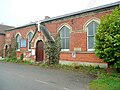 Light and Life Mission Hall, Swinderby.jpg 640 × 480; 271 KB
-
 Ling Moor footpath - geograph.org.uk - 3357191.jpg 640 × 427; 94 KB
-

-
 Looking towards Swinderby - geograph.org.uk - 2730171.jpg 640 × 443; 142 KB
-
 Meardsall Crossing - geograph.org.uk - 503232.jpg 640 × 427; 93 KB
-
 Meardsall view - geograph.org.uk - 1589647.jpg 640 × 426; 79 KB
-
 Moor Lane heading east - geograph.org.uk - 2945633.jpg 640 × 480; 87 KB
-

-
 Moor Lane, Swinderby - geograph.org.uk - 2367582.jpg 640 × 480; 238 KB
-

-
 Morton Lane - geograph.org.uk - 6485927.jpg 1,024 × 683; 208 KB
-
 New homes - geograph.org.uk - 174704.jpg 640 × 427; 73 KB
-
 New Houses - geograph.org.uk - 174688.jpg 640 × 427; 74 KB
-

-
 Newton's Farm - geograph.org.uk - 2626277.jpg 640 × 480; 88 KB
-
 Newton's Farm - geograph.org.uk - 2945636.jpg 640 × 480; 78 KB
-
 Newton's Farm - geograph.org.uk - 4411121.jpg 1,024 × 683; 213 KB
-
 Norton Disney quarries - geograph.org.uk - 3930190.jpg 427 × 640; 48 KB
-
 Old hangar - geograph.org.uk - 174699.jpg 640 × 427; 53 KB
-
 Old shed - geograph.org.uk - 3356242.jpg 640 × 427; 59 KB
-
 Ordnance Survey Cut Mark - geograph.org.uk - 4982672.jpg 640 × 611; 173 KB
-
 Please feed me - geograph.org.uk - 2669090.jpg 1,024 × 768; 212 KB
-
 Ponies in front of Anson's Farm - geograph.org.uk - 3357212.jpg 640 × 427; 41 KB
-
 Potter Hill Farm, near Swinderby - geograph.org.uk - 2583981.jpg 640 × 429; 65 KB
-

-

-
 RAF Swinderby - geograph.org.uk - 122791.jpg 640 × 427; 75 KB
-
 RAF Swinderby - geograph.org.uk - 183619.jpg 640 × 427; 32 KB
-
 Rural road mind the puddles but - geograph.org.uk - 1712203.jpg 640 × 427; 100 KB
-

-
 Seed drills - geograph.org.uk - 2626181.jpg 640 × 480; 114 KB
-
 Signs on the A46 - geograph.org.uk - 5299276.jpg 1,280 × 853; 260 KB
-
 So near and yet so far - geograph.org.uk - 5222523.jpg 1,024 × 768; 123 KB
-
 South end of Swinderby village - geograph.org.uk - 2367735.jpg 640 × 480; 224 KB
-
 South Scarle Crossing - geograph.org.uk - 167984.jpg 640 × 427; 83 KB
-
 South Scarle Crossing - geograph.org.uk - 2668680.jpg 1,024 × 768; 192 KB
-
 South Scarle Crossing - geograph.org.uk - 3026318.jpg 640 × 427; 140 KB
-
 South Scarle Crossing House - geograph.org.uk - 1589649.jpg 640 × 426; 94 KB
-
 Spray gear near Green Lane Farm - geograph.org.uk - 3357214.jpg 640 × 427; 101 KB
-
 Stack of new straw - geograph.org.uk - 5094469.jpg 1,024 × 768; 213 KB
-
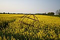 Steel frame sphere - geograph.org.uk - 167997.jpg 640 × 427; 128 KB
-
 Stile and fields towards Swinderby - geograph.org.uk - 2170129.jpg 2,736 × 3,648; 3.66 MB
-
 Swinderby - geograph.org.uk - 2232917.jpg 640 × 439; 100 KB
-
 Swinderby village hall - geograph.org.uk - 2367723.jpg 640 × 480; 210 KB
-
 The Dovecot - geograph.org.uk - 5350302.jpg 640 × 426; 89 KB
-
 The Grange, Swinderby - geograph.org.uk - 2945616.jpg 640 × 480; 70 KB
-
 The Plough Inn, High street, Swinderby - geograph.org.uk - 2811216.jpg 1,280 × 853; 272 KB
-
 The Plough, Swinderby - geograph.org.uk - 2945635.jpg 640 × 480; 61 KB
-
 Track to an isolated house - geograph.org.uk - 2668672.jpg 1,024 × 768; 185 KB
-
 Track to Anson's Farm - geograph.org.uk - 2498869.jpg 1,280 × 960; 590 KB
-
 Two footpath bridges - geograph.org.uk - 2334611.jpg 800 × 600; 412 KB
-
 Valley farm - geograph.org.uk - 2730174.jpg 640 × 424; 93 KB
-
 Victorian postbox - geograph.org.uk - 6485913.jpg 683 × 1,024; 319 KB
-

-
 Village houses - geograph.org.uk - 2367731.jpg 640 × 480; 229 KB
-
 Wellbeck Farm, Collingham Road - geograph.org.uk - 2367739.jpg 640 × 480; 247 KB
-
 Wet ditch and flooded fields - geograph.org.uk - 3357208.jpg 640 × 427; 97 KB
-

-
 A46 near Swinderby - geograph.org.uk - 361352.jpg 640 × 427; 37 KB
-
 Autumn on Southern Lane - geograph.org.uk - 280793.jpg 640 × 427; 116 KB
-
 Autumnal scene on Southern Lane - geograph.org.uk - 280796.jpg 640 × 427; 115 KB
-
 Birch Lea Diner - geograph.org.uk - 319551.jpg 640 × 427; 56 KB
-
 Cattle Shed - geograph.org.uk - 361348.jpg 640 × 427; 108 KB
-
 County boundary - geograph.org.uk - 173967.jpg 640 × 427; 61 KB
-
 Gilbert's Wood - geograph.org.uk - 174713.jpg 640 × 427; 125 KB
-
 Ling Moor - geograph.org.uk - 183613.jpg 640 × 427; 120 KB
-
 Old gate - geograph.org.uk - 183631.jpg 640 × 427; 79 KB
-
 Radio Mast - geograph.org.uk - 167970.jpg 427 × 640; 62 KB
-
 Romanstone Plantation - geograph.org.uk - 168489.jpg 640 × 427; 170 KB
-
 The Plough - geograph.org.uk - 174675.jpg 640 × 427; 62 KB
-
 Thurlby Lake - geograph.org.uk - 183616.jpg 640 × 427; 41 KB
-
 Thurlby Lakes - geograph.org.uk - 57293.jpg 640 × 427; 56 KB
-
 Thurlby Top Wood - geograph.org.uk - 174716.jpg 640 × 427; 136 KB
-
 View from Romanstone Plantation - geograph.org.uk - 168490.jpg 640 × 427; 46 KB
-
 Wood Lane - geograph.org.uk - 174717.jpg 640 × 427; 102 KB
-
 Wood Lane - geograph.org.uk - 183625.jpg 640 × 427; 90 KB


