Category:Swarte Peert
Jump to navigation
Jump to search
| Object location | | View all coordinates using: OpenStreetMap |
|---|
 | |||||
| Upload media | |||||
| Instance of | |||||
|---|---|---|---|---|---|
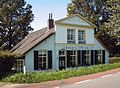
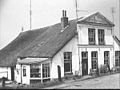
| Location | Terwolde, Voorst, Gelderland, Netherlands | ||||
| Street address |
| ||||
| Located on street |
| ||||
| Heritage designation |
| ||||
 | |||||
|
This is a category about rijksmonument number 523344
|
| Address |
|
Media in category "Swarte Peert"
The following 5 files are in this category, out of 5 total.
-
 Lovely traditional houses along the IJsselriver near Deventer - panoramio.jpg 4,288 × 2,848; 3.46 MB
-
 Swarte Peert Bandijk 17 Terwolde.jpg 1,575 × 1,160; 682 KB
-
 Voor- en zijgevel - Terwolde - 20468670 - RCE.jpg 1,200 × 900; 136 KB
-
 Voorgevel - Terwolde - 20468671 - RCE.jpg 1,200 × 900; 190 KB
-
 Zij- en voorgevel - Terwolde - 20468672 - RCE.jpg 1,200 × 900; 163 KB


