Category:Swarland
Jump to navigation
Jump to search
village in United Kingdom  | |||||
| Upload media | |||||
| Instance of | |||||
|---|---|---|---|---|---|
| Location | Newton-on-the-Moor and Swarland, Northumberland, North East England, England | ||||
 | |||||
English: Category:Villages in Northumberland
Media in category "Swarland"
The following 43 files are in this category, out of 43 total.
-

-
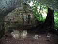
 A covered spring-head north of Glantlees - geograph.org.uk - 1380714.jpg 640 × 426; 121 KB
-
 A Swarland Settlement bungalow - geograph.org.uk - 5954634.jpg 3,447 × 2,456; 1.35 MB
-
 A Swarland Settlement house - geograph.org.uk - 5954644.jpg 3,058 × 1,773; 831 KB
-

-
 Chicken run at Shield Dykes - geograph.org.uk - 616430.jpg 640 × 480; 86 KB
-
 Footbridge over the Fence Burn - geograph.org.uk - 1802041.jpg 640 × 480; 98 KB
-
 Footpath near Midge Park - geograph.org.uk - 334290.jpg 640 × 480; 156 KB
-
 Iced over Puddle - geograph.org.uk - 1724926.jpg 4,000 × 3,000; 5.63 MB
-
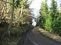
 Leamington Lane, Swarland - geograph.org.uk - 4459123.jpg 640 × 480; 94 KB
-
 Overgrass Tower - geograph.org.uk - 1421243.jpg 640 × 480; 86 KB
-
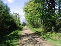
 Park Road, Swarland - geograph.org.uk - 3635292.jpg 1,600 × 1,080; 186 KB
-

-
 Picea sitchensis - geograph.org.uk - 688649.jpg 640 × 480; 127 KB
-
 Secluded houses in Swarland - geograph.org.uk - 3427864.jpg 1,600 × 1,095; 574 KB
-
 Smalldene - geograph.org.uk - 688599.jpg 640 × 331; 65 KB
-
 Sports Pavilion at Swarland - geograph.org.uk - 1445284.jpg 640 × 480; 113 KB
-
 Stables near Glantlees Farm - geograph.org.uk - 613850.jpg 640 × 480; 85 KB
-
 Swarland Burn - geograph.org.uk - 693784.jpg 640 × 480; 146 KB
-
 Swarland Village shop and Post Office - geograph.org.uk - 438499.jpg 640 × 480; 109 KB
-
 Swarland Village Square - geograph.org.uk - 1445273.jpg 640 × 480; 73 KB
-
 The Fence Burn - geograph.org.uk - 1802066.jpg 640 × 480; 121 KB
-
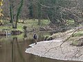 Angler anticipating a bite^ - geograph.org.uk - 1802372.jpg 640 × 480; 98 KB
-
 Barn - geograph.org.uk - 693775.jpg 640 × 588; 128 KB
-
 Below Snook Bank - geograph.org.uk - 616253.jpg 640 × 480; 82 KB
-
 Cottages at Shiel Dykes - geograph.org.uk - 613877.jpg 640 × 480; 79 KB
-
 Farmland at Swarland Fence - geograph.org.uk - 451257.jpg 640 × 480; 103 KB
-
 Farmland near Snook Bank - geograph.org.uk - 616256.jpg 640 × 480; 69 KB
-
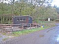 Fishing hut at Shiel Dykes Farm - geograph.org.uk - 613890.jpg 640 × 480; 83 KB
-
 Fishing lake near Shiel Dykes - geograph.org.uk - 616438.jpg 640 × 480; 73 KB
-

-
 Glantlees Farm - geograph.org.uk - 616429.jpg 640 × 480; 55 KB
-

-
 Park Road, Swarland - geograph.org.uk - 438497.jpg 637 × 462; 100 KB
-
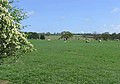 Pasture at Swarlanddean - geograph.org.uk - 438505.jpg 634 × 445; 104 KB
-
 Public footpath sign - geograph.org.uk - 438483.jpg 640 × 480; 133 KB
-
 Road - geograph.org.uk - 693796.jpg 640 × 480; 134 KB
-
 Rolling Fields - geograph.org.uk - 688631.jpg 640 × 480; 95 KB
-
 Shelter belt below Snook Bank. - geograph.org.uk - 613844.jpg 640 × 450; 66 KB
-
 Small valley above Glantlees Farm - geograph.org.uk - 616257.jpg 640 × 480; 85 KB
-
 Swarland County First School - geograph.org.uk - 451248.jpg 640 × 480; 97 KB
-
 Swarland Wood - geograph.org.uk - 438503.jpg 640 × 480; 177 KB
-
 Walking the dog in Swarland Wood - geograph.org.uk - 451260.jpg 640 × 480; 142 KB
_-_geograph.org.uk_-_1380720.jpg)


