Category:Swardeston
Jump to navigation
Jump to search
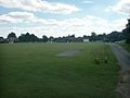
English: Swardeston is a village four miles (6 km) south of Norwich in Norfolk, on high ground above the Tas valley. It covers an area of and had a population of 540 in 246 households as of the 2001 census.
village and civil parish in Norfolk, UK  | |||||
| Upload media | |||||
| Instance of | |||||
|---|---|---|---|---|---|
| Location | South Norfolk, Norfolk, East of England, England | ||||
| Area |
| ||||
 | |||||
Subcategories
This category has the following 4 subcategories, out of 4 total.
M
S
- Swardeston Village Sign (5 F)
- Swardeston War Memorial (4 F)
Media in category "Swardeston"
The following 200 files are in this category, out of 327 total.
(previous page) (next page)-
 1920s cottages on Swardeston Lane - geograph.org.uk - 1602907.jpg 640 × 480; 126 KB
-
 A field of Barley - geograph.org.uk - 2686123.jpg 640 × 430; 61 KB
-
 A field of poppies under a thundery sky - geograph.org.uk - 1350067.jpg 640 × 480; 112 KB
-
 A field of Wheat - geograph.org.uk - 2686124.jpg 640 × 430; 62 KB
-

-

-
 A row of cottages at High Common - geograph.org.uk - 5558119.jpg 640 × 477; 270 KB
-
 An almost dry pond, Swardeston Common - geograph.org.uk - 2481174.jpg 640 × 480; 240 KB
-
 Apple orchard by Dairy Farm - geograph.org.uk - 5204880.jpg 640 × 586; 504 KB
-
 Apple orchard in late November - geograph.org.uk - 5204882.jpg 640 × 605; 595 KB
-
 B1113 Main Road ^ Swardeston Post Office George VI Postbox - geograph.org.uk - 4416117.jpg 3,072 × 2,304; 1.84 MB
-
 B1113 Main Road, Mangreen - geograph.org.uk - 4414677.jpg 3,072 × 2,304; 1.79 MB
-
 B1113 Main Road, Swardeston - geograph.org.uk - 4414695.jpg 3,072 × 2,217; 1.89 MB
-
 B1113 Main Road, Swardeston - geograph.org.uk - 4415826.jpg 3,072 × 2,304; 1.71 MB
-
 B1113 Main Road, Swardeston - geograph.org.uk - 4415832.jpg 3,072 × 2,304; 1.83 MB
-
 B1113 Main Road, Swardeston - geograph.org.uk - 4415966.jpg 3,072 × 2,304; 1.85 MB
-
 B1113 Main Road, Swardeston - geograph.org.uk - 4415968.jpg 3,072 × 2,304; 1.69 MB
-
 B1113 Main Road, Swardeston - geograph.org.uk - 4416147.jpg 3,072 × 2,304; 1.88 MB
-
 B1113 Main Road, Swardeston - geograph.org.uk - 4416154.jpg 3,072 × 2,304; 1.83 MB
-
 Bare trees in The Grove - geograph.org.uk - 1602965.jpg 640 × 480; 192 KB
-
 Barley ripening in the sun - geograph.org.uk - 2683119.jpg 640 × 430; 59 KB
-
 Barn, Cavell House - geograph.org.uk - 2683068.jpg 640 × 430; 73 KB
-
 Barns at Gowthorpe Manor - geograph.org.uk - 1585344.jpg 640 × 451; 123 KB
-
 Barns, Mulbarton - geograph.org.uk - 114149.jpg 640 × 480; 199 KB
-
 Beech (Fagus sylvatica) - fruit - geograph.org.uk - 5558152.jpg 635 × 640; 376 KB
-
 Bend, The Common - geograph.org.uk - 2683071.jpg 640 × 430; 105 KB
-
 Bowling green and clubhouse - geograph.org.uk - 5558131.jpg 640 × 480; 305 KB
-
 Bridleway North East of Mulbarton - geograph.org.uk - 995049.jpg 640 × 480; 79 KB
-
 Bridleway, Swardeston - geograph.org.uk - 114111.jpg 640 × 480; 198 KB
-
 Browne's Lane ^ Swardeston Village Hall - geograph.org.uk - 4416359.jpg 3,072 × 2,304; 1.88 MB
-
 Browne's Lane, Swardeston - geograph.org.uk - 4416288.jpg 2,304 × 3,072; 2.13 MB
-
 Browne's Lane, Swardeston - geograph.org.uk - 4416306.jpg 2,304 × 3,072; 1.62 MB
-
 Browne's Lane, Swardeston - geograph.org.uk - 4416540.jpg 3,072 × 2,304; 1.72 MB
-
 Bungalow at High Common - geograph.org.uk - 5558140.jpg 640 × 480; 384 KB
-
 Bungalow in Swardeston Lane - geograph.org.uk - 5204862.jpg 640 × 480; 417 KB
-
 Bungalows at High Common - geograph.org.uk - 5558107.jpg 640 × 480; 304 KB
-
 Car park on Swardeston Common - geograph.org.uk - 5558127.jpg 640 × 475; 265 KB
-
 Cherry Tree Cottage - geograph.org.uk - 5558109.jpg 471 × 640; 331 KB
-
 Church Path ^ Lych Gate of St Mary's Church - geograph.org.uk - 4415940.jpg 3,072 × 2,304; 1.77 MB
-

-

-

-

-
 Cottage beside path to Intwood Lane - geograph.org.uk - 1602908.jpg 640 × 473; 129 KB
-
 Cottage by Swardeston Common - geograph.org.uk - 2481140.jpg 640 × 480; 150 KB
-
 Cottage on the corner of Mangreen Lane - geograph.org.uk - 1584318.jpg 640 × 454; 140 KB
-
 Cottages at High Common - geograph.org.uk - 5558112.jpg 640 × 477; 361 KB
-
 Cottages at High Common - geograph.org.uk - 5558118.jpg 640 × 570; 427 KB
-
 Creeping cinquefoil (Potentilla reptans) - geograph.org.uk - 5438437.jpg 640 × 544; 463 KB
-
 Cricket match, Swardeston - geograph.org.uk - 44807.jpg 640 × 480; 43 KB
-
 Crop field north of Mangreen Hall - geograph.org.uk - 4416484.jpg 640 × 480; 322 KB
-
 Crop field south of the A47 road - geograph.org.uk - 4416519.jpg 640 × 480; 435 KB
-
 Crop fields by Swardeston - geograph.org.uk - 4860761.jpg 640 × 480; 449 KB
-

-

-

-
 Cut hedgerows beside Mangreen - geograph.org.uk - 4416490.jpg 640 × 480; 468 KB
-
 Dairy Farmhouse - geograph.org.uk - 5204875.jpg 640 × 521; 404 KB
-
 Dairy Farmhouse - geograph.org.uk - 5204878.jpg 640 × 576; 594 KB
-
 Dead tree at High Common - geograph.org.uk - 5558137.jpg 640 × 480; 413 KB
-
 Disused old gate onto Swardeston Common - geograph.org.uk - 2481158.jpg 640 × 480; 292 KB
-
 Disused shed in Sonney Loke - geograph.org.uk - 4860790.jpg 640 × 480; 455 KB
-
 Ditch beside bridleway to Mangreen - geograph.org.uk - 1602951.jpg 640 × 460; 199 KB
-
 Dog Inn Public House, Swardeston - geograph.org.uk - 4416141.jpg 3,072 × 2,304; 1.94 MB
-
 Driveway to Swardeston House - geograph.org.uk - 4860704.jpg 640 × 440; 340 KB
-
 Dwellings at High Common - geograph.org.uk - 5558121.jpg 640 × 546; 319 KB
-
 Early 19th century gravestone - geograph.org.uk - 5791645.jpg 640 × 637; 159 KB
-
 Early 19th century gravestone - geograph.org.uk - 5791647.jpg 618 × 640; 155 KB
-
 Early 19th century gravestone - geograph.org.uk - 5791648.jpg 634 × 640; 166 KB
-
 Enter at own risk - geograph.org.uk - 4860804.jpg 640 × 480; 400 KB
-
 Entering Swardeston on the B1113 Main Road - geograph.org.uk - 4414687.jpg 3,072 × 2,304; 1.87 MB
-
 Entrance to The Old Rectory - geograph.org.uk - 4415932.jpg 2,304 × 3,072; 3.66 MB
-
 Field bindweed (Convolvulus arvensis) - geograph.org.uk - 5438434.jpg 640 × 628; 424 KB
-

-
 Field boundary west of Mangreen - geograph.org.uk - 1584312.jpg 640 × 447; 155 KB
-

-

-
 Footpath east of Mulbarton - geograph.org.uk - 4750408.jpg 640 × 360; 321 KB
-
 Footpath in Swardeston - geograph.org.uk - 4860726.jpg 640 × 480; 407 KB
-
 Footpath marker at path junction - geograph.org.uk - 1602969.jpg 640 × 454; 129 KB
-

-
 Footpath markers at junction - geograph.org.uk - 4860738.jpg 640 × 480; 421 KB
-

-
 Footpath through the Old Rectory grounds - geograph.org.uk - 4860708.jpg 640 × 430; 380 KB
-
 Footpath to Catbridge Lane - geograph.org.uk - 4860727.jpg 640 × 480; 345 KB
-
 Footpath to Inwood Lane over Swardeston Common - geograph.org.uk - 4416402.jpg 3,072 × 2,304; 1.77 MB
-
 Footpath to Inwood Lane over Swardeston Common - geograph.org.uk - 4416468.jpg 3,072 × 2,304; 1.95 MB
-
 Footpath to Swardeston - geograph.org.uk - 4860742.jpg 640 × 480; 411 KB
-
 Footpath to Swardeston Common - geograph.org.uk - 4359064.jpg 640 × 480; 350 KB
-
 Footpath to Swardeston Common - geograph.org.uk - 4860748.jpg 640 × 480; 432 KB
-
 Footpath to The Carrs - geograph.org.uk - 4860743.jpg 640 × 480; 383 KB
-
 Footpath to the Old Rectory - geograph.org.uk - 4860814.jpg 640 × 480; 494 KB
-
 Footpath to Wood Lane, Swardeston - geograph.org.uk - 4750416.jpg 640 × 360; 325 KB
-

-
 Frozen field pond, Swardeston - geograph.org.uk - 114118.jpg 640 × 480; 209 KB
-
 Gate on the driveway to the Old Rectory - geograph.org.uk - 4860706.jpg 640 × 440; 395 KB
-
 Gated track off Sonney Loke - geograph.org.uk - 4860800.jpg 640 × 477; 365 KB
-
 Gated yard in Sonney Loke - geograph.org.uk - 4860793.jpg 640 × 480; 369 KB
-
 Gated yard in Sonney Loke - geograph.org.uk - 4860796.jpg 640 × 480; 412 KB
-
 Gowthorpe Lane sign - geograph.org.uk - 4415261.jpg 3,072 × 2,304; 1.97 MB
-
 Gowthorpe Lane, Swardeston - geograph.org.uk - 4415799.jpg 3,072 × 2,197; 2.47 MB
-
 Gowthorpe Lane, Swardeston - geograph.org.uk - 4415829.jpg 3,072 × 2,304; 1.93 MB
-
 Gowthorpe Manor - geograph.org.uk - 2683108.jpg 640 × 430; 70 KB
-
 Grass encroaching on disused road - geograph.org.uk - 4416480.jpg 640 × 480; 446 KB
-
 Heading south, Intwood Lane - geograph.org.uk - 2683044.jpg 640 × 430; 82 KB
-
 Hedgerows beside Mangreen - geograph.org.uk - 4416471.jpg 640 × 480; 466 KB
-
 Here comes the rain - geograph.org.uk - 1350112.jpg 640 × 480; 107 KB
-
 Here Mangreen ends - geograph.org.uk - 4416515.jpg 640 × 480; 397 KB
-

-
 High Common in autumn - geograph.org.uk - 5558142.jpg 640 × 480; 445 KB
-
 Hillside Close - geograph.org.uk - 2683083.jpg 640 × 430; 60 KB
-
 Hillside, Swardeston - geograph.org.uk - 2683074.jpg 640 × 430; 122 KB
-
 House at High Common - geograph.org.uk - 5558110.jpg 640 × 562; 419 KB
-
 House at The Common - geograph.org.uk - 1350083.jpg 640 × 491; 116 KB
-
 House on Low Common - geograph.org.uk - 5204863.jpg 640 × 486; 403 KB
-
 Houses at High Common - geograph.org.uk - 5558115.jpg 640 × 477; 329 KB
-
 Houses at Low Common - geograph.org.uk - 5204810.jpg 640 × 480; 339 KB
-
 Houses by Swardeston Common - geograph.org.uk - 2481137.jpg 640 × 480; 199 KB
-
 Houses by Swardeston Common - geograph.org.uk - 4860802.jpg 640 × 544; 496 KB
-
 Houses in Lower East Carleton - geograph.org.uk - 2481180.jpg 640 × 480; 213 KB
-
 Houses in Swardeston - geograph.org.uk - 4860768.jpg 640 × 480; 349 KB
-
 Houses on Swardeston Common - geograph.org.uk - 5558113.jpg 640 × 480; 303 KB
-
 Houses on the edge of Swardeston Common - geograph.org.uk - 5204804.jpg 640 × 480; 363 KB
-
 Information Board on Swardeston Common - geograph.org.uk - 4416455.jpg 2,304 × 3,072; 3.07 MB
-
 Information Board on Swardeston Common - geograph.org.uk - 4416458.jpg 3,072 × 2,304; 1.89 MB
-
 Intwood Lane - geograph.org.uk - 2683042.jpg 640 × 430; 104 KB
-
 Intwood Lane - geograph.org.uk - 2683047.jpg 640 × 430; 99 KB
-
 Intwood Lane looking south - geograph.org.uk - 2683067.jpg 640 × 430; 77 KB
-
 Ivy-clad trees beside Sonney Loke - geograph.org.uk - 4860766.jpg 640 × 480; 519 KB
-

-
 Kett's Country footpath - geograph.org.uk - 4416342.jpg 3,072 × 2,304; 1.78 MB
-
 Kett's Country Walk to St Mary's Church - geograph.org.uk - 4415836.jpg 3,072 × 2,304; 1.95 MB
-
 Kett's Country Walk to St Mary's Church - geograph.org.uk - 4415958.jpg 2,304 × 3,072; 3.28 MB
-
 Kett's Country Walk to the B1113 Main Road - geograph.org.uk - 4415935.jpg 2,304 × 3,072; 2.87 MB
-
 Lane and tree, near Swainsthorpe - geograph.org.uk - 114089.jpg 640 × 480; 193 KB
-
 Lane Block on Mangreen - geograph.org.uk - 4414610.jpg 3,072 × 2,162; 2.4 MB
-
 Large shed in Sonney Loke - geograph.org.uk - 4860799.jpg 640 × 480; 380 KB
-
 Lichens on an old gravestone - geograph.org.uk - 5791662.jpg 631 × 640; 153 KB
-
 Locked gate on Mangreen - geograph.org.uk - 4416452.jpg 640 × 480; 469 KB
-
 Low Common - geograph.org.uk - 5204808.jpg 640 × 480; 417 KB
-
 Main Rd - geograph.org.uk - 2683105.jpg 640 × 430; 66 KB
-
 Main Rd, Swardeston - geograph.org.uk - 2683104.jpg 640 × 430; 51 KB
-
 Mangreen - geograph.org.uk - 2686132.jpg 640 × 430; 74 KB
-
 Mangreen - geograph.org.uk - 2686137.jpg 640 × 430; 127 KB
-
 Mangreen Hall - geograph.org.uk - 5812134.jpg 3,456 × 2,592; 3.93 MB
-
 Mangreen Hall Farmhouse - geograph.org.uk - 5812133.jpg 3,456 × 2,592; 3.87 MB
-
 Mangreen heading north - geograph.org.uk - 2683133.jpg 640 × 430; 104 KB
-
 Mangreen Lane - geograph.org.uk - 2683107.jpg 640 × 430; 75 KB
-
 Mangreen Lane - geograph.org.uk - 2683112.jpg 640 × 430; 75 KB
-
 Mangreen Lane - geograph.org.uk - 2683114.jpg 640 × 430; 77 KB
-
 Mangreen Lane - geograph.org.uk - 2683118.jpg 640 × 430; 87 KB
-
 Mangreen Lane - geograph.org.uk - 2683126.jpg 640 × 430; 131 KB
-
 Mangreen Lane - geograph.org.uk - 994864.jpg 640 × 480; 83 KB
-
 Mangreen Lane sign - geograph.org.uk - 4414635.jpg 3,072 × 2,304; 4.33 MB
-
 Mangreen Lane, Mangreen - geograph.org.uk - 4414599.jpg 3,072 × 2,304; 1.78 MB
-
 Mangreen Lane, Mangreen - geograph.org.uk - 4414624.jpg 3,072 × 2,304; 1.83 MB
-
 Mangreen Lane, Mangreen - geograph.org.uk - 4414638.jpg 3,072 × 2,031; 1.85 MB
-
 Mangreen Lane, near Swardeston - geograph.org.uk - 5812062.jpg 3,456 × 2,592; 3.93 MB
-
 Mangreen off Mangreen Lane - geograph.org.uk - 2683128.jpg 640 × 430; 82 KB
-
 Mangreen, Mangreen - geograph.org.uk - 4414530.jpg 3,072 × 2,304; 1.99 MB
-
 Mangreen, Mangreen - geograph.org.uk - 4414547.jpg 3,072 × 2,172; 2.4 MB
-
 Mangreen, Mangreen - geograph.org.uk - 4414591.jpg 3,072 × 2,222; 2.59 MB
-
 Mangreen, Mangreen - geograph.org.uk - 4414653.jpg 3,072 × 2,304; 1.82 MB
-
 Manor Cottages, at Swardeston - geograph.org.uk - 5812019.jpg 3,456 × 2,592; 3.86 MB
-
 Marsh Stitchwort (Stellaria palustris) - geograph.org.uk - 5438415.jpg 640 × 635; 600 KB
-
 Marsh Stitchwort (Stellaria palustris) - geograph.org.uk - 5438416.jpg 640 × 555; 312 KB
-

-
 Mossy road surface - geograph.org.uk - 4416508.jpg 640 × 560; 578 KB
-
 Newly renovated cottage at Mangreen, Swardeston - geograph.org.uk - 5812065.jpg 3,456 × 2,592; 3.85 MB
-

-
 Old gravestone in St Mary's churchyard - geograph.org.uk - 5791656.jpg 617 × 640; 158 KB
-
 Old gravestones in St Mary's churchyard - geograph.org.uk - 5791650.jpg 640 × 614; 152 KB
-
 Old gravestones in St Mary's churchyard - geograph.org.uk - 5791653.jpg 640 × 605; 145 KB
-
 Old Milestone - geograph.org.uk - 1254739.jpg 480 × 640; 112 KB
-
 Old oak trees growing beside Mangreen - geograph.org.uk - 4416496.jpg 640 × 480; 391 KB
-

-
 Old Rectory in Swardeston - geograph.org.uk - 4860723.jpg 640 × 555; 365 KB
-
 On the edge of Swardeston Common - geograph.org.uk - 5558141.jpg 640 × 480; 450 KB
-
 One of the ponds on Swardeston Common - geograph.org.uk - 5558133.jpg 640 × 476; 375 KB
-
 Ordnance Survey Cut Mark - geograph.org.uk - 4218601.jpg 640 × 480; 123 KB
-
 Overgrown and un-passable footpath - geograph.org.uk - 5812060.jpg 3,456 × 2,592; 4.1 MB
-
 P ^ V Quality Cars ^ B1113 Main Road - geograph.org.uk - 4416184.jpg 3,072 × 2,304; 2.04 MB
-
 Paddocks by Swardeston House - geograph.org.uk - 4860705.jpg 640 × 480; 354 KB
-
 Pasture by Swardeston House - geograph.org.uk - 4860730.jpg 640 × 480; 443 KB
-
 Pasture by Swardeston House - geograph.org.uk - 4860732.jpg 640 × 600; 478 KB
-
 Pasture by Swardeston House - geograph.org.uk - 4860736.jpg 640 × 618; 509 KB
-
 Pasture gate by Swardeston House - geograph.org.uk - 4860728.jpg 640 × 480; 427 KB
-
 Path across Swardeston Common - geograph.org.uk - 1350031.jpg 640 × 480; 134 KB
-
 Path along a field boundary hedge - geograph.org.uk - 4860746.jpg 640 × 480; 411 KB
-
 Path on Swardeston Common - geograph.org.uk - 2481153.jpg 640 × 480; 194 KB
-
 Path on Swardeston Common - geograph.org.uk - 2481160.jpg 640 × 480; 217 KB
-
 Path past "The Wood" - geograph.org.uk - 4750407.jpg 640 × 360; 327 KB
-
 Path through the Common - geograph.org.uk - 1350102.jpg 640 × 480; 125 KB
-

-
 Permanent closure, except for permit holders - geograph.org.uk - 5812068.jpg 3,456 × 2,592; 3.93 MB
-
 Plantation beside the Tas Valley Way - geograph.org.uk - 4359061.jpg 640 × 480; 559 KB
-
 Pond at Swardeston - geograph.org.uk - 5812012.jpg 3,456 × 2,592; 4.02 MB
-
 Pond beside Mangreen - geograph.org.uk - 4416460.jpg 640 × 480; 522 KB
-
 Pond by The Common in Swardeston - geograph.org.uk - 1350021.jpg 640 × 480; 139 KB
-
 Pond off Browne's Lane - geograph.org.uk - 4416212.jpg 3,072 × 2,304; 1.81 MB


_-_fruit_-_geograph.org.uk_-_5558152.jpg)


_-_geograph.org.uk_-_5438437.jpg)


_on_a_limestone_gravestone_-_geograph.org.uk_-_5791669.jpg)


_-_geograph.org.uk_-_5438434.jpg)
_and_hoverfly_-_geograph.org.uk_-_5438436.jpg)


_-_geograph.org.uk_-_5438415.jpg)
_-_geograph.org.uk_-_5438416.jpg)


