Category:Svetlenkoye Lake (Krasnoyarsk Krai)
Jump to navigation
Jump to search
| Object location | | View all coordinates using: OpenStreetMap |
|---|
| This is the category of the protected area of Russia number 2410066 | |
| This template and pages using it are maintained by the Russian WLE team. Please read the guidelines before making any changes that can affect the database! |
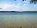
Озеро Светленькое, Светлое в Енисейском районе Красноярского края
Media in category "Svetlenkoye Lake (Krasnoyarsk Krai)"
The following 5 files are in this category, out of 5 total.
-
 The Road to lake. Дорога к -Светленькому - panoramio.jpg 1,427 × 1,070; 332 KB
-
 На берегу-Светленького - panoramio.jpg 1,427 × 1,070; 372 KB
-
 Озеро -Светленькое - panoramio.jpg 1,427 × 1,070; 252 KB
-
 Озеро Светленькое.JPG 2,048 × 1,536; 573 KB
-
 Светленькое - panoramio.jpg 1,427 × 1,070; 332 KB


