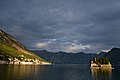
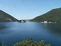
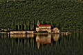
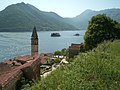
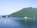
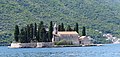
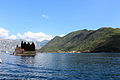
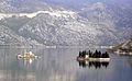
Category:Sveti Đorđe Island
Jump to navigation
Jump to search
| Object location | | View all coordinates using: OpenStreetMap |
|---|
islet off the coast of Perast in Bay of Kotor, Montenegro  | |||||
| Upload media | |||||
| Instance of | |||||
|---|---|---|---|---|---|
| Part of | |||||
| Location | Kotor Municipality, Montenegro | ||||
| Located in or next to body of water | |||||
| Width |
| ||||
| Length |
| ||||
| Area |
| ||||
| Elevation above sea level |
| ||||
 | |||||
Media in category "Sveti Đorđe Island"
The following 101 files are in this category, out of 101 total.
-
 35 - Sveti Đorđe (1932).jpg 2,743 × 1,742; 2.55 MB
-
 38 - Faltboot vor Sveti Đorđe (1932).jpg 2,713 × 3,954; 5.43 MB
-
 Bay of Kotor with Sveti Đorđe and Our Lady of the Rocks.jpg 2,592 × 1,944; 907 KB
-
 Bay of Kotor with Sveti Đorđe.jpg 2,592 × 1,944; 952 KB
-
 Bay of Kotor, Sveti Đorđe, Credit to Pavle Cikovac.jpg 4,032 × 3,024; 5.92 MB
-
 Bocca di Cattaro acquaforte.jpg 3,791 × 2,373; 3.05 MB
-
 Boka Kotorska, Montenegro.jpg 1,286 × 586; 225 KB
-
 Bucht-von-kotor.jpg 1,727 × 896; 208 KB
-
 E80, Perast, Montenegro - panoramio - ines lukic (3).jpg 1,280 × 960; 561 KB
-
 Gospa od Skrpjela otocic sveti Dorde Perast Kotor.jpg 721 × 400; 66 KB
-
 I negde ispred nas... - panoramio.jpg 1,280 × 960; 540 KB
-
 Island of Saint George - panoramio.jpg 4,176 × 2,784; 3.28 MB
-
 Islands Perast.JPG 1,280 × 960; 559 KB
-
 Islet of St. George in the Bay of Kotor (1) (29870773535).jpg 6,000 × 4,000; 12.52 MB
-
 Islet of St. George in the Bay of Kotor (10) (29756592702).jpg 6,000 × 4,000; 12.13 MB
-
 Islet of St. George in the Bay of Kotor (11) (29756530692).jpg 6,000 × 4,000; 12.99 MB
-
 Islet of St. George in the Bay of Kotor (12) (29576546210).jpg 5,992 × 3,988; 10.58 MB
-
 Islet of St. George in the Bay of Kotor (14) (29835111366).jpg 5,878 × 3,808; 11.92 MB
-
 Islet of St. George in the Bay of Kotor (2) (29577189770).jpg 6,000 × 4,000; 11.95 MB
-
 Islet of St. George in the Bay of Kotor (3) (29577115740).jpg 5,994 × 3,992; 11.7 MB
-
 Islet of St. George in the Bay of Kotor (4) (29835568256).jpg 5,856 × 3,770; 9.95 MB
-
 Islet of St. George in the Bay of Kotor (5) (29243182504).jpg 6,000 × 4,000; 7.7 MB
-
 Islet of St. George in the Bay of Kotor (6) (29787565021).jpg 5,996 × 3,994; 7.01 MB
-
 Islet of St. George in the Bay of Kotor (7) (29870377155).jpg 5,984 × 3,976; 8.72 MB
-
 Islet of St. George in the Bay of Kotor (8) (29835350716).jpg 5,986 × 3,980; 11.02 MB
-
 Islet of St. George in the Bay of Kotor (9) (29243017394).jpg 5,984 × 3,976; 9.71 MB
-
 Kotor Bay - St George Island.JPG 1,296 × 972; 155 KB
-
 Kotorbay3.jpg 480 × 360; 33 KB
-
 Kruzer pored ostrva Sveti Djordje 1.jpg 5,152 × 3,864; 9.34 MB
-
 Kruzer pored ostrva Sveti Djordje 2.jpg 5,152 × 3,864; 8.9 MB
-
 Monasterio de San Jorge, Perast, Bahía de Kotor, Montenegro, 2014-04-19, DD 07.JPG 5,587 × 3,518; 8.4 MB
-
 Monasterio de San Jorge, Perast, Bahía de Kotor, Montenegro, 2014-04-19, DD 08.JPG 5,616 × 3,744; 5.48 MB
-
 Monasterio de San Jorge, Perast, Bahía de Kotor, Montenegro, 2014-04-19, DD 10.JPG 5,616 × 3,744; 5.93 MB
-
 Monasterio de San Jorge, Perast, Bahía de Kotor, Montenegro, 2014-04-19, DD 13.JPG 5,479 × 3,653; 7.95 MB
-
 Monasterio de San Jorge, Perast, Bahía de Kotor, Montenegro, 2014-04-19, DD 18.JPG 5,221 × 3,594; 7.35 MB
-
 Monasterio de San Jorge, Perast, Bahía de Kotor, Montenegro, 2014-04-19, DD 21.JPG 4,675 × 3,254; 7.68 MB
-
 Monasterio de San Jorge, Perast, Bahía de Kotor, Montenegro, 2014-04-19, DD 26.JPG 5,518 × 3,679; 6.79 MB
-
 Monasterio de San Jorge, Perast, Bahía de Kotor, Montenegro, 2014-04-19, DD 29.JPG 5,616 × 3,744; 7.48 MB
-
 Monasterio de San Jorge, Perast, Bahía de Kotor, Montenegro, 2014-04-19, DD 41.JPG 5,615 × 2,897; 8.65 MB
-
 Monastyr sw. Jerzego.jpg 800 × 536; 142 KB
-
 Montenegro zátoka.jpg 2,560 × 1,920; 997 KB
-

-

-

-

-
-

-

-
-
 OSTRVA - panoramio.jpg 2,048 × 1,536; 465 KB
-
-

-
 Ostrvo Sveti Đorđe (Island of Saint George) - Bay of Kotor, Montenegro - 28 July 2010.jpg 4,221 × 2,803; 4.08 MB
-

-

-

-
 Peaceful island on a lake (Unsplash).jpg 4,272 × 2,848; 4.22 MB
-
 Perast - ostrovy P. Marie (umely) a sv. Jiri, kostely na nic.jpg 640 × 480; 52 KB
-
 Perast - Sveti Đorđe Insel 1.jpg 3,920 × 1,928; 5.89 MB
-
 Perast - Sveti Đorđe Insel 2.jpg 3,864 × 1,900; 4.52 MB
-
 Perast - Sveti Đorđe Insel 3.jpg 4,000 × 3,000; 6.95 MB
-
 Perast - Sveti Đorđe Insel 4.jpg 3,808 × 1,804; 6.09 MB
-
 Perast - Sveti Đorđe Insel 5.jpg 3,796 × 1,932; 3.79 MB
-
 Perast, isola di san giorgio 00,1.JPG 3,456 × 2,304; 4.68 MB
-
 Perast, isola di san giorgio 00,2.JPG 3,456 × 2,304; 4.69 MB
-
 Perast, isola di san giorgio 01.JPG 3,456 × 2,304; 4.65 MB
-
 Perast, isola di san giorgio 02.JPG 3,456 × 2,304; 5.55 MB
-
 Perast, isola di san giorgio 03.JPG 3,411 × 1,581; 3.69 MB
-
 Perast, isola di san giorgio 04.JPG 3,456 × 2,304; 4.76 MB
-
 Perast, isola di san giorgio 05.JPG 3,456 × 2,304; 4.73 MB
-
 Perast, isola di san giorgio 06.JPG 3,456 × 2,304; 4.66 MB
-
 Perast0560.JPG 2,592 × 1,944; 820 KB
-
 Saint George Monastery, Sveti Đorđe.jpg 2,592 × 1,944; 1.03 MB
-
 St George Monastry - panoramio.jpg 5,152 × 3,408; 2.64 MB
-
 St-Georges ND-du-Récif.JPG 1,722 × 1,069; 297 KB
-
 Sv.Djordje.JPG 1,280 × 960; 614 KB
-
 Sveti Dorde and Gospa od Skrpjela Island.jpg 6,016 × 4,000; 13.8 MB
-
 Sveti Dorde Island Kotor.jpg 6,016 × 4,000; 10.44 MB
-
 Sveti Dorde Island.jpg 3,888 × 2,592; 4.3 MB
-
 Sveti Đorđe and boat from Our Lady of the Rocks.jpg 1,944 × 2,592; 1.13 MB
-
 Sveti Đorđe and Gospa od Škrpjela.jpg 2,592 × 1,944; 967 KB
-
 Sveti Đorđe and Perast from boat.jpg 2,592 × 1,944; 1.03 MB
-
 Sveti Đorđe and Perast.jpg 2,592 × 1,944; 1.18 MB
-
 Sveti Đorđe Island - 2021.jpg 3,216 × 2,136; 1.7 MB
-
 Sveti Đorđe, Perast.jpg 3,264 × 2,448; 839 KB
-
 Sveti Đorđe. - panoramio (1).jpg 1,600 × 1,067; 1.37 MB
-
 Sveti Đorđe. - panoramio.jpg 1,600 × 1,067; 1.18 MB
-
 Sveti Đorđe.jpg 2,592 × 1,944; 1.06 MB
-
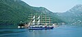 The "Royal Clipper" at the Montenegrin coast.jpg 3,960 × 1,780; 3.63 MB
-
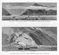 The Crisis in the East, Bay of Cattaro - The Graphic - 1880.jpg 1,024 × 968; 462 KB
-

-

-
 Two.islands.inKotorGulf.jpg 2,023 × 1,036; 488 KB
-
 Word-image-29.jpg 1,024 × 683; 478 KB
-
 Wysepki w Peraście św Jerzego i Matki Boskiej na Skale.jpg 2,670 × 1,780; 5.06 MB
-
 Wyspa św. Jerzego w Peraście 01.jpg 3,356 × 2,236; 6.51 MB
-
 Wyspa św. Jerzego w Peraście 02.jpg 2,862 × 1,612; 5.93 MB
-
 X03.31 Sveti Ðorđe.jpg 5,584 × 3,745; 8.86 MB
-
 X03.32 Risanski Zaliv, Gospa od Škrpjela, Sveti Ðorđe.jpg 5,585 × 3,733; 5.74 MB
-
 X04.31 Risanski zaliv, SS Royal Clipper.jpg 5,602 × 3,724; 5.99 MB
-
 Остров Святого Георгия .jpg 2,288 × 1,830; 1.61 MB
.jpg)
.jpg)


.jpg)


_(29870773535).jpg)
_(29756592702).jpg)
_(29756530692).jpg)
_(29576546210).jpg)
_(29835111366).jpg)
_(29577189770).jpg)
_(29577115740).jpg)
_(29835568256).jpg)
_(29243182504).jpg)
_(29787565021).jpg)
_(29870377155).jpg)
_(29835350716).jpg)
_(29243017394).jpg)


_-_Bay_of_Kotor,_Montenegro_-_28_July_2010_-_(1).jpg)
_-_Bay_of_Kotor,_Montenegro_-_28_July_2010_-_(2).jpg)
_-_Bay_of_Kotor,_Montenegro_-_28_July_2010.jpg)
.jpg)


.jpg)
_a_sv._Jiri,_kostely_na_nic.jpg)


.jpg)


