Category:Sutton, Bedfordshire
Jump to navigation
Jump to search
village and civil parish in Bedfordshire, UK  | |||||
| Upload media | |||||
| Instance of | |||||
|---|---|---|---|---|---|
| Location | Central Bedfordshire, Bedfordshire, East of England, England | ||||
| Population |
| ||||
 | |||||
English: Sutton, Bedfordshire, is a small village to the south of Potton, England. Sutton falls under the postal town of Sandy and is also near the market town of Biggleswade.
Subcategories
This category has the following 3 subcategories, out of 3 total.
S
- Sutton Ford (8 F)
- Sutton packhorse bridge (11 F)
Media in category "Sutton, Bedfordshire"
The following 114 files are in this category, out of 114 total.
-
 A bend in the road - geograph.org.uk - 5728685.jpg 1,024 × 768; 898 KB
-
 All Saints' Church, Sutton - geograph.org.uk - 3097632.jpg 640 × 480; 79 KB
-
 All Saints' Church, Sutton - geograph.org.uk - 3804370.jpg 4,320 × 3,240; 4.76 MB
-
 Approaching Sutton in spring - geograph.org.uk - 5728680.jpg 1,024 × 768; 1 MB
-
 B1040 towards Potton - geograph.org.uk - 3097625.jpg 640 × 480; 96 KB
-
 Bedfordshire Growers, Biggleswade - geograph.org.uk - 5793214.jpg 1,954 × 1,402; 1.21 MB
-
 Bedfordshire Growers, Biggleswade Road - geograph.org.uk - 2971393.jpg 1,594 × 1,152; 578 KB
-
 Bend on Biggleswade Road, Sutton - geograph.org.uk - 5793212.jpg 1,916 × 1,338; 1.37 MB
-
 Big foot - geograph.org.uk - 390250.jpg 640 × 481; 72 KB
-

-
 Biggleswade Road (B1040) towards Potton - geograph.org.uk - 3097620.jpg 640 × 480; 108 KB
-
 Biggleswade Road overlooking Bedfordshire Growers - geograph.org.uk - 2971392.jpg 1,600 × 1,200; 582 KB
-
 Biggleswade Road, Sutton - geograph.org.uk - 2971356.jpg 1,600 × 1,200; 561 KB
-
 Biggleswade Road, Sutton - geograph.org.uk - 2971389.jpg 1,600 × 1,200; 676 KB
-
 Biggleswade Road, Sutton - geograph.org.uk - 5793213.jpg 2,048 × 1,536; 1.72 MB
-
 Bridleway heading east - geograph.org.uk - 3097660.jpg 640 × 480; 102 KB
-
 Bridleway towards Biggleswade - geograph.org.uk - 3097655.jpg 640 × 480; 102 KB
-
 Car crossing the ford of Potton Brook, Sutton - geograph.org.uk - 3804408.jpg 4,320 × 3,240; 6.28 MB
-

-
 Country Store Farm Shop - geograph.org.uk - 3097600.jpg 640 × 480; 71 KB
-
 Depth Gauge, Sutton Ford - geograph.org.uk - 1495186.jpg 640 × 495; 186 KB
-
 Dunton bridleway - geograph.org.uk - 6566830.jpg 768 × 1,024; 163 KB
-
 Dunton bridleway - geograph.org.uk - 6566831.jpg 768 × 1,024; 201 KB
-

-
 Eyeworth to Sutton in April - geograph.org.uk - 5728697.jpg 1,024 × 1,024; 1.37 MB
-
 Farm building off Biggleswade Road - geograph.org.uk - 3097617.jpg 640 × 480; 72 KB
-
 Farmland and pylons near Biggleswade - geograph.org.uk - 3097597.jpg 640 × 435; 43 KB
-
 Farmland and woodland - geograph.org.uk - 3097663.jpg 640 × 480; 92 KB
-
 Farmland near Sutton - geograph.org.uk - 3097621.jpg 640 × 480; 82 KB
-
 Farmland near Sutton - geograph.org.uk - 3097650.jpg 640 × 480; 90 KB
-
 Farmland near Sutton - geograph.org.uk - 3097667.jpg 640 × 480; 85 KB
-
 Farmland, Havannah Farm - geograph.org.uk - 3097677.jpg 640 × 480; 90 KB
-
 Farmland, Portobello Farm - geograph.org.uk - 3097613.jpg 640 × 480; 81 KB
-
 Field by Biggleswade Road, Sutton - geograph.org.uk - 6249243.jpg 1,892 × 1,236; 1.48 MB
-

-
 Footpath off High Street, Sutton - geograph.org.uk - 3097648.jpg 480 × 640; 143 KB
-
 Footpath view - geograph.org.uk - 4911003.jpg 480 × 640; 59 KB
-
 Ford and bridge, Sutton - geograph.org.uk - 5392802.jpg 640 × 480; 162 KB
-
 Ford and Packhorse Bridge at Sutton - geograph.org.uk - 3069286.jpg 3,872 × 2,592; 2.36 MB
-
 Ford and uneven road warning sign in Sutton.JPG 2,604 × 3,472; 2.3 MB
-
 Ford, Sutton - geograph.org.uk - 3097639.jpg 640 × 480; 124 KB
-
 Havannah Farm - geograph.org.uk - 4911007.jpg 640 × 480; 81 KB
-
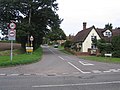
 High Street, Sutton - geograph.org.uk - 3097643.jpg 640 × 480; 97 KB
-
 High Street, Sutton, Beds - geograph.org.uk - 174995.jpg 640 × 489; 280 KB
-
 John O Gaunts Hill Sutton 2021-01.jpg 2,048 × 1,536; 1.52 MB
-
 John O'Gaunt Golf Club - geograph.org.uk - 2409135.jpg 640 × 480; 167 KB
-
 Nearing Potton on Sutton Road - geograph.org.uk - 5728647.jpg 1,024 × 732; 887 KB
-
 Not so lone dwelling near Eyeworth - geograph.org.uk - 3878052.jpg 640 × 427; 78 KB
-
 Old Milepost - geograph.org.uk - 5525410.jpg 1,024 × 683; 208 KB
-
 Old Milepost - geograph.org.uk - 5525422.jpg 1,024 × 683; 223 KB
-
 Old Milestone by the B1040, Biggleswade Road, Sutton (geograph 5614245).jpg 768 × 1,024; 192 KB
-
 On the way to Potton - geograph.org.uk - 5728673.jpg 1,024 × 768; 1.05 MB
-
 On the way to Sutton - geograph.org.uk - 5728691.jpg 1,024 × 768; 902 KB
-
 OS trig point, Sutton Hill - geograph.org.uk - 3097673.jpg 640 × 480; 105 KB
-
 Packhorse Bridge, Sutton - geograph.org.uk - 3097641.jpg 640 × 480; 105 KB
-
 Parking area on Biggleswade Road, Sutton - geograph.org.uk - 2971357.jpg 1,600 × 1,200; 546 KB
-
 Path towards Dunton - geograph.org.uk - 4911008.jpg 480 × 640; 105 KB
-
 Path towards Dunton - geograph.org.uk - 4911011.jpg 640 × 480; 52 KB
-
 Path towards Dunton - geograph.org.uk - 4911012.jpg 480 × 640; 53 KB
-
 Path towards Havannah Farm - geograph.org.uk - 4911006.jpg 480 × 640; 64 KB
-
 Path, John O'Gaunt Golf Club - geograph.org.uk - 3097628.jpg 640 × 480; 114 KB
-
 Players' entrance to John O'Gaunt golf club - geograph.org.uk - 2971388.jpg 1,600 × 1,200; 608 KB
-
 Pond on bridleway - geograph.org.uk - 4910999.jpg 480 × 640; 94 KB
-
 Potton Brook and ford from the medieval bridge - geograph.org.uk - 3804396.jpg 4,302 × 2,651; 4.33 MB
-
 Potton Brook seen from the medieval bridge, looking North - geograph.org.uk - 3804404.jpg 4,320 × 3,240; 4.73 MB
-
 Potton Road (B1040) - geograph.org.uk - 3097598.jpg 640 × 480; 83 KB
-
 Replica Milestone by the B1040, Biggleswade Road, Sutton (geograph 5614223).jpg 757 × 1,024; 233 KB
-
 Road to Eyeworth - geograph.org.uk - 4911005.jpg 480 × 640; 63 KB
-
 Road towards Eyeworth - geograph.org.uk - 3097670.jpg 640 × 480; 95 KB
-
 Road towards Eyeworth - geograph.org.uk - 3097679.jpg 640 × 480; 99 KB
-
 Road towards Sutton from Eyeworth - geograph.org.uk - 5392762.jpg 640 × 480; 162 KB
-
 Roadside rookery - geograph.org.uk - 3804473.jpg 4,320 × 3,240; 4.8 MB
-
 Sharp bend on Biggleswade Road, Sutton - geograph.org.uk - 2971390.jpg 1,590 × 1,042; 501 KB
-
 Stream, Watermill Bridge - geograph.org.uk - 3097603.jpg 480 × 640; 133 KB
-
 Sutton (Bedfordshire) ford in flood 2020-12-24.jpg 2,048 × 1,536; 1.19 MB
-
 Sutton - Old Rectory (geograph 7360570).jpg 1,600 × 1,200; 1,009 KB
-
 Sutton church - geograph.org.uk - 5392828.jpg 640 × 428; 120 KB
-
 Sutton Ford 2014-06.jpg 5,184 × 3,456; 12.19 MB
-
 Sutton High Street - geograph.org.uk - 5728679.jpg 1,024 × 731; 918 KB
-
 Sutton primary school.JPG 3,472 × 2,604; 2.66 MB
-
 Sutton Road - geograph.org.uk - 5592294.jpg 640 × 480; 129 KB
-
 Sutton Road heading south - geograph.org.uk - 3097652.jpg 640 × 480; 62 KB
-
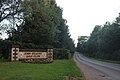
 Sutton village hall sign.JPG 3,472 × 2,604; 1.98 MB
-
 Sutton village hall.JPG 3,472 × 2,604; 2.68 MB
-
 Sutton village sign.JPG 3,472 × 2,604; 2.46 MB
-
 Sutton, a bend in the village street - geograph.org.uk - 5645956.jpg 1,024 × 1,024; 1.8 MB
-
 Sutton, All Saints - geograph.org.uk - 5645900.jpg 1,024 × 1,024; 1.21 MB
-
 Sutton, All Saints' Church from the south-east - geograph.org.uk - 5645904.jpg 1,024 × 819; 1.12 MB
-
 Sutton, church and old rectory - geograph.org.uk - 5645741.jpg 1,024 × 1,024; 1.21 MB
-
 Sutton, Church Road - geograph.org.uk - 5645731.jpg 1,024 × 768; 973 KB
-
 Sutton, down to the ford - geograph.org.uk - 5645963.jpg 1,024 × 768; 1.3 MB
-
 Sutton, ford and packhorse bridge - geograph.org.uk - 5645613.jpg 1,024 × 768; 1.1 MB
-
 Sutton, golf course - geograph.org.uk - 5614233.jpg 1,024 × 768; 170 KB
-
 Sutton, houses on High Street - geograph.org.uk - 5728677.jpg 1,024 × 732; 753 KB
-
 Sutton, Manor Farm - geograph.org.uk - 5657338.jpg 819 × 1,024; 1.34 MB
-
 Sutton, over the packhorse bridge - geograph.org.uk - 5645957.jpg 1,024 × 768; 1.14 MB
-
 Sutton, Potton Brook from the packhorse bridge - geograph.org.uk - 5645692.jpg 1,024 × 1,024; 1.5 MB
-
 Sutton, school - geograph.org.uk - 5614252.jpg 1,024 × 768; 161 KB
-
 Sutton, through the ford - geograph.org.uk - 5645609.jpg 819 × 1,024; 1.06 MB
-
 Sutton, towards All Saints' Church - geograph.org.uk - 5645954.jpg 819 × 1,024; 932 KB
-
 The entrance to John O'Gaunt golf club - geograph.org.uk - 5793210.jpg 2,048 × 1,536; 1.37 MB
-
 The entrance to John O'Gaunt Golf Club, Potton - geograph.org.uk - 6249242.jpg 1,920 × 1,280; 1.66 MB
-
 The entrance to John O'Gaunt golf club, Sutton - geograph.org.uk - 2971387.jpg 1,600 × 1,200; 635 KB
-
 Timber-framed building next door to All Saints', Sutton - geograph.org.uk - 3804378.jpg 4,320 × 3,240; 3.93 MB
-
 To St. Ives 17 - geograph.org.uk - 5525416.jpg 683 × 1,024; 194 KB
-
 To St. Ives 18 - geograph.org.uk - 5525425.jpg 683 × 1,024; 203 KB
-
 Towards Havannah Farm - geograph.org.uk - 5728695.jpg 1,024 × 768; 914 KB
-
 Track to Portobello Farm - geograph.org.uk - 3097610.jpg 640 × 480; 77 KB
-
 View from Biggleswade Road, Sutton - geograph.org.uk - 2971359.jpg 1,600 × 1,200; 480 KB
-
 View south from Sutton Hill trig point - geograph.org.uk - 5392744.jpg 640 × 480; 150 KB
-
 Woodland near Watermill Bridge - geograph.org.uk - 3097605.jpg 640 × 480; 132 KB
-
 High Street, Sutton, Beds - geograph.org.uk - 62356.jpg 600 × 450; 264 KB
-
 Lupin crop, Sutton, Beds - geograph.org.uk - 188135.jpg 640 × 480; 440 KB
-
 Winter wheat, Sutton, Beds - geograph.org.uk - 188123.jpg 640 × 480; 349 KB


_towards_Potton_-_geograph.org.uk_-_3097608.jpg)
_towards_Potton_-_geograph.org.uk_-_3097620.jpg)


.jpg)


_-_geograph.org.uk_-_3097598.jpg)
.jpg)


_ford_in_flood_2020-12-24.jpg)
.jpg)


