Category:Sutterton
Jump to navigation
Jump to search
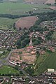
English: Sutterton is a village in Lincolnshire, England, around seven miles south-south-west of Boston, and near the junction of the A16 and A17 to the south.
village and rural parish in Lincolnshire, England  | |||||
| Upload media | |||||
| Instance of | |||||
|---|---|---|---|---|---|
| Location | Boston, Lincolnshire, East Midlands, England | ||||
| Population |
| ||||
 | |||||
Subcategories
This category has the following 5 subcategories, out of 5 total.
Media in category "Sutterton"
The following 102 files are in this category, out of 102 total.
-
 A17 approaching Sutterton Roundabout - geograph.org.uk - 3643896.jpg 640 × 481; 44 KB
-
 A17 junction with Waterbelly Lane - geograph.org.uk - 3547672.jpg 1,923 × 1,140; 1.42 MB
-
 A17 West of Sutterton Roundabout - geograph.org.uk - 4958568.jpg 640 × 427; 288 KB
-
 A17 westbound - geograph.org.uk - 3766637.jpg 640 × 411; 47 KB
-
 A17, Station Road - geograph.org.uk - 4958548.jpg 640 × 427; 307 KB
-

-
 A17-Broad Lane junction - geograph.org.uk - 3643898.jpg 640 × 481; 47 KB
-
 Agricultural dealers, Sutterton - geograph.org.uk - 3619957.jpg 640 × 480; 62 KB
-
 B1397 northbound - geograph.org.uk - 3766624.jpg 640 × 442; 41 KB
-
 Bell Mere Pool - geograph.org.uk - 1527575.jpg 640 × 426; 62 KB
-
 Blow's Lane - geograph.org.uk - 2288042.jpg 640 × 480; 111 KB
-
 Boston Road (B1397) heading north - geograph.org.uk - 3621489.jpg 640 × 480; 81 KB
-
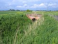
 Brick bridge over Three Towns Drain - geograph.org.uk - 4327974.jpg 4,320 × 3,240; 5.52 MB
-
 Brick bridge over Two Towns Drain - geograph.org.uk - 4325846.jpg 4,320 × 3,240; 5.82 MB
-
 Broad Lane - geograph.org.uk - 2155702.jpg 640 × 427; 96 KB
-
 Cabbage field on the edge of Sutterton - geograph.org.uk - 6257859.jpg 1,024 × 768; 194 KB
-
 Car park, Sutterton Services - geograph.org.uk - 6321555.jpg 2,000 × 1,277; 2.44 MB
-
 Cemetery pillbox - geograph.org.uk - 733242.jpg 640 × 427; 121 KB
-
 Cemetery pillbox - geograph.org.uk - 733244.jpg 640 × 427; 113 KB
-

-
-
 Crop field east of Boston Road - geograph.org.uk - 3621488.jpg 640 × 480; 56 KB
-
 Crop field south of Spalding Road - geograph.org.uk - 3619953.jpg 640 × 480; 78 KB
-
 Disused service station, Sutterton - geograph.org.uk - 3621469.jpg 640 × 480; 56 KB
-
 Dowdyke Road - geograph.org.uk - 2845152.jpg 682 × 1,024; 233 KB
-
 Drain near the Firs on Marsh Road - geograph.org.uk - 4325769.jpg 4,320 × 3,240; 5.42 MB
-
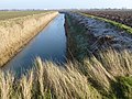
 East Drain - geograph.org.uk - 3619948.jpg 640 × 480; 85 KB
-
 Eastbound A17 - geograph.org.uk - 4958540.jpg 640 × 427; 278 KB
-

-
 Electricity Pole on Stone Lane - geograph.org.uk - 3230389.jpg 2,056 × 3,088; 1.49 MB
-
 Endeavour Way - geograph.org.uk - 5150691.jpg 640 × 480; 91 KB
-
 Farmland and dike off Waterbelly Lane - geograph.org.uk - 4325802.jpg 4,320 × 3,240; 5.73 MB
-
 Farmland east of Spalding Road - geograph.org.uk - 3619949.jpg 640 × 480; 72 KB
-
 Farmland near Sutterton Dowdyke - geograph.org.uk - 2094905.jpg 640 × 480; 146 KB
-
 Farmland track from the old sea bank - geograph.org.uk - 4325762.jpg 4,320 × 3,240; 5.81 MB
-
 Farmland track off Blow's Lane near Sutterton - geograph.org.uk - 4328219.jpg 4,320 × 3,240; 5.36 MB
-
 Field north of footpath - geograph.org.uk - 5150697.jpg 640 × 480; 79 KB
-
 Fishmere End Road - geograph.org.uk - 4414786.jpg 4,272 × 2,848; 5.87 MB
-
 Footbridge over Two Towns Drain - geograph.org.uk - 4325789.jpg 4,320 × 3,240; 5.61 MB
-
 Footpath to Algarkirk - geograph.org.uk - 6251967.jpg 1,024 × 768; 272 KB
-
 Footpath to Algarkirk - geograph.org.uk - 6251996.jpg 1,024 × 768; 236 KB
-
 Former station on the Lincolnshire Loop Line - geograph.org.uk - 2233102.jpg 1,024 × 683; 175 KB
-
 Fusion Home Improvements - geograph.org.uk - 5551575.jpg 1,600 × 1,065; 352 KB
-
 Goods yard - geograph.org.uk - 2155739.jpg 640 × 427; 72 KB
-
 Green Lane - geograph.org.uk - 5148147.jpg 640 × 480; 65 KB
-
 Grounded - geograph.org.uk - 2155686.jpg 640 × 427; 114 KB
-
 Houses on Boston Road, Sutterton - geograph.org.uk - 3621472.jpg 640 × 480; 52 KB
-
 Kit Cat Lane - geograph.org.uk - 2835971.jpg 1,280 × 853; 273 KB
-
 Large pipe crossing East Drain - geograph.org.uk - 4162704.jpg 4,320 × 3,240; 5.91 MB
-
 Lincolnshire cabbages - geograph.org.uk - 2155693.jpg 640 × 427; 144 KB
-

-
 Love Lane - geograph.org.uk - 4414767.jpg 4,290 × 2,856; 5.38 MB
-
 Marsh Lane near Fosdyke - geograph.org.uk - 6345451.jpg 1,024 × 728; 374 KB
-
 Old Ford motor car on the B1397 - geograph.org.uk - 3621487.jpg 1,167 × 677; 142 KB
-
 Old Milestone - geograph.org.uk - 1186362.jpg 480 × 640; 157 KB
-
 Old Milestone - geograph.org.uk - 1189242.jpg 480 × 640; 142 KB
-
 Old Milestone - geograph.org.uk - 2781826.jpg 1,024 × 768; 448 KB
-
 Park Avenue - geograph.org.uk - 5150686.jpg 640 × 480; 91 KB
-
 Post Office Lane - geograph.org.uk - 5148143.jpg 640 × 480; 121 KB
-
 Public footpath - geograph.org.uk - 5150695.jpg 640 × 480; 70 KB
-
 Public footpath and bridge - geograph.org.uk - 5150700.jpg 640 × 480; 77 KB
-
 Rainwall's Lane - geograph.org.uk - 4414781.jpg 4,272 × 2,848; 5.78 MB
-
 Rainwall's Lane - geograph.org.uk - 5148134.jpg 640 × 480; 92 KB
-
 Rainwall's Lane north of Sutterton, Lincolnshire - geograph.org.uk - 4327970.jpg 4,320 × 3,240; 5.71 MB
-
 Recreation ground in Sutterton, Lincolnshire - geograph.org.uk - 4325820.jpg 4,320 × 3,240; 5.25 MB
-
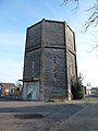
 Redundant water tower, Sutterton - geograph.org.uk - 3621466.jpg 640 × 480; 59 KB
-
 Remaining lodgehouse - geograph.org.uk - 5150684.jpg 640 × 480; 42 KB
-
 Road junction - geograph.org.uk - 5148162.jpg 640 × 480; 59 KB
-
 Road Traffic Accident on the A17 - geograph.org.uk - 4153637.jpg 640 × 426; 180 KB
-
 Roundabout - geograph.org.uk - 5148167.jpg 640 × 480; 62 KB
-
 Roundabout on Spalding Road (B1397) - geograph.org.uk - 3621470.jpg 640 × 480; 47 KB
-
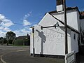 Soulby's Gold Medal Ales, ghost sign - geograph.org.uk - 5148156.jpg 640 × 480; 60 KB
-
 Spalding 9 - geograph.org.uk - 2781829.jpg 768 × 1,024; 383 KB
-
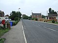
 Spalding Road (B1397) - geograph.org.uk - 3619950.jpg 640 × 480; 60 KB
-
 Spalding Road (B1397) - geograph.org.uk - 3619954.jpg 640 × 480; 75 KB
-
 Spalding Road (B1397), Sutterton - geograph.org.uk - 3621462.jpg 640 × 480; 66 KB
-
 Spalding Road - geograph.org.uk - 2155690.jpg 640 × 427; 76 KB
-
 Spalding Road Industrial Estate - geograph.org.uk - 3619952.jpg 640 × 480; 66 KB
-
 Stone Lane - geograph.org.uk - 2155708.jpg 640 × 427; 101 KB
-
 Sutterton Church, aerial 2016 - geograph.org.uk - 5012787.jpg 640 × 427; 82 KB
-
 Sutterton Methodist Church - geograph.org.uk - 5150677.jpg 640 × 480; 71 KB
-
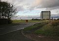
 Sutterton Roundabout A16, A17 - geograph.org.uk - 2392038.jpg 640 × 413; 52 KB
-
 Sutterton Services - geograph.org.uk - 6321556.jpg 2,000 × 1,334; 2.8 MB
-
 Sutterton Station - geograph.org.uk - 2537253.jpg 800 × 531; 70 KB
-

-
 Thatched Cottage Restaurant, Sutterton - geograph.org.uk - 4414777.jpg 4,187 × 2,791; 5.56 MB
-
 The old station at Sutterton - geograph.org.uk - 2074892.jpg 640 × 481; 87 KB
-
 The Thatched Cottage - geograph.org.uk - 2931676.jpg 640 × 427; 90 KB
-
 Three bends in Two Towns Drain - geograph.org.uk - 4325857.jpg 4,320 × 3,240; 5.35 MB
-
 Track off Fishmere End Road - geograph.org.uk - 4414794.jpg 4,215 × 2,806; 5.71 MB
-
 Track off Wash Road - geograph.org.uk - 2769697.jpg 1,280 × 853; 340 KB
-
 Two Towns Drain near Sutterton Dowdyke, Lincolnshire - geograph.org.uk - 4325775.jpg 4,320 × 3,240; 5.59 MB
-
 Two Towns Drain near Sutterton Dowdyke, Lincolnshire - geograph.org.uk - 4325852.jpg 4,320 × 3,240; 5.77 MB
-
 Water tower in Sutterton, Lincolnshire - geograph.org.uk - 4325811.jpg 3,240 × 4,320; 5.14 MB
-
 Waterbelly lane - geograph.org.uk - 1568235.jpg 640 × 441; 58 KB
-

-
 Westbound A17 near to Sutterton - geograph.org.uk - 4958576.jpg 640 × 427; 298 KB
-
 Young copse on Marsh Lane - geograph.org.uk - 4325757.jpg 4,320 × 3,240; 5.74 MB
-
-
 Choice of Route - geograph.org.uk - 416361.jpg 640 × 427; 76 KB
-

-
 Risegate Eau - geograph.org.uk - 423456.jpg 640 × 480; 91 KB


_heading_north_-_geograph.org.uk_-_3621489.jpg)


_-_geograph.org.uk_-_3621470.jpg)


_-_geograph.org.uk_-_3619950.jpg)
_-_geograph.org.uk_-_3619954.jpg)
,_Sutterton_-_geograph.org.uk_-_3621462.jpg)


