Category:Sustead
Jump to navigation
Jump to search
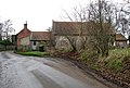
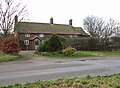
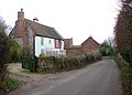
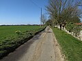
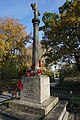
English: Sustead is a small village and parish in the county of Norfolk, England, about four miles south-west of Cromer.
village and civil parish in Norfolk, United Kingdom  | |||||
| Upload media | |||||
| Instance of | |||||
|---|---|---|---|---|---|
| Location | North Norfolk, Norfolk, East of England, England | ||||
| Population |
| ||||
| Area |
| ||||
 | |||||
Subcategories
This category has the following 8 subcategories, out of 8 total.
Media in category "Sustead"
The following 180 files are in this category, out of 180 total.
-
 19th century manor house, Bessingham - geograph.org.uk - 2287324.jpg 640 × 480; 158 KB
-
 19th century manor house, Bessingham - geograph.org.uk - 2287381.jpg 640 × 480; 142 KB
-
 A memorial to a WW1 veteran not on the War Memorial - geograph.org.uk - 4592910.jpg 3,456 × 2,592; 3.69 MB
-
 An empty grave - geograph.org.uk - 4514975.jpg 768 × 1,024; 545 KB
-
 Anglian Water site near Metton - geograph.org.uk - 5016862.jpg 1,600 × 1,200; 694 KB
-
 Attractive flint and brick cottages - geograph.org.uk - 1113206.jpg 640 × 434; 118 KB
-
 Bench mark at St Andrew's Church, Metton - geograph.org.uk - 5973217.jpg 1,600 × 1,064; 773 KB
-
 Benchmark on a church - geograph.org.uk - 6643660.jpg 1,600 × 1,200; 1.02 MB
-
 Bend in the road - geograph.org.uk - 1113201.jpg 640 × 444; 132 KB
-
 Bessingham Manor - collapsed floors - geograph.org.uk - 2287361.jpg 640 × 480; 109 KB
-
 Bessingham Manor - collapsed floors - geograph.org.uk - 2287415.jpg 640 × 480; 98 KB
-
 Bessingham Manor - collapsed staircase - geograph.org.uk - 2287420.jpg 640 × 480; 108 KB
-
 Bessingham Manor - creeping ivy - geograph.org.uk - 2287387.jpg 640 × 480; 141 KB
-
 Bessingham Manor - crystal chandelier - geograph.org.uk - 2329994.jpg 480 × 640; 105 KB
-
 Bessingham Manor - detail - geograph.org.uk - 2287390.jpg 480 × 640; 178 KB
-
 Bessingham Manor - geograph.org.uk - 2287385.jpg 640 × 480; 161 KB
-
 Bessingham Manor - geograph.org.uk - 2329352.jpg 760 × 570; 215 KB
-
 Bessingham Manor - interior - geograph.org.uk - 2287423.jpg 640 × 480; 105 KB
-
 Bessingham Manor - interior - geograph.org.uk - 2287426.jpg 640 × 480; 131 KB
-
 Bessingham Manor - interior - geograph.org.uk - 2287428.jpg 480 × 640; 139 KB
-
 Bessingham Manor - interior - geograph.org.uk - 2287429.jpg 491 × 640; 102 KB
-
 Bessingham Manor - interior - geograph.org.uk - 2287430.jpg 640 × 480; 140 KB
-
 Bessingham Manor - interior - geograph.org.uk - 2287434.jpg 480 × 640; 117 KB
-
 Bessingham Manor - interior - geograph.org.uk - 2287435.jpg 640 × 576; 150 KB
-
 Bessingham Manor - interior - geograph.org.uk - 2287442.jpg 640 × 480; 119 KB
-
 Bessingham Manor - leaded glass window - geograph.org.uk - 2287398.jpg 480 × 640; 197 KB
-
 Bessingham Manor - redundant doorknob - geograph.org.uk - 2329989.jpg 640 × 526; 134 KB
-
 Bessingham Manor - rotting timber - geograph.org.uk - 2287433.jpg 480 × 640; 127 KB
-
 Bessingham Manor - the bell - geograph.org.uk - 2329972.jpg 469 × 640; 134 KB
-
 Bessingham Manor - the chamber pot - geograph.org.uk - 2329986.jpg 640 × 617; 167 KB
-
 Bessingham Manor - the date stone - geograph.org.uk - 2287393.jpg 600 × 598; 148 KB
-
 Bessingham Manor - the wash-house - geograph.org.uk - 2329975.jpg 480 × 640; 150 KB
-
 Bessingham Manor - the wash-house - geograph.org.uk - 2329979.jpg 640 × 480; 154 KB
-
 Bessingham Manor - the wash-house - geograph.org.uk - 2329982.jpg 480 × 640; 153 KB
-
 Bessingham Manor and outbuildings - geograph.org.uk - 2330013.jpg 640 × 480; 138 KB
-
 Bessingham Road towards Bessingham - geograph.org.uk - 5974038.jpg 1,600 × 1,064; 944 KB
-
 Bessingham village sign - geograph.org.uk - 6707586.jpg 2,820 × 2,820; 1.97 MB
-
 Bessingham village sign - geograph.org.uk - 6707587.jpg 4,608 × 3,072; 3.41 MB
-
 Bessingham War Memorial - geograph.org.uk - 4592908.jpg 2,592 × 3,456; 3.07 MB
-
 Big Fen Plantation - geograph.org.uk - 4985340.jpg 1,600 × 1,200; 1.02 MB
-
 Bungalows in Bessingham - geograph.org.uk - 6568538.jpg 5,344 × 3,563; 4.72 MB
-
 Cemetery in Metton - geograph.org.uk - 5016880.jpg 1,600 × 1,200; 1.23 MB
-
 Cottages in Sustead - geograph.org.uk - 1113193.jpg 640 × 469; 119 KB
-
 Cottages in Sustead - geograph.org.uk - 1113204.jpg 640 × 457; 97 KB
-
 Cromer Road - geograph.org.uk - 5016884.jpg 1,600 × 1,200; 661 KB
-

-

-

-

-
 Entrance to Glen Farm, Sustead - geograph.org.uk - 5917857.jpg 3,456 × 2,592; 3.83 MB
-
 Field by Metton Road - geograph.org.uk - 5016796.jpg 1,600 × 1,200; 606 KB
-
 Field near Bessingham - geograph.org.uk - 5967255.jpg 1,600 × 1,200; 338 KB
-
 Field near Sustead - geograph.org.uk - 4990514.jpg 1,600 × 1,200; 1,014 KB
-
 Field of sugarbeet - geograph.org.uk - 5918093.jpg 3,456 × 2,592; 3.95 MB
-
 Fields near Bessingham - geograph.org.uk - 5967197.jpg 1,600 × 1,200; 484 KB
-
 Flint and brick barns - geograph.org.uk - 1113196.jpg 640 × 443; 110 KB
-
 Footpath from Bessingham - geograph.org.uk - 5967190.jpg 1,600 × 1,284; 517 KB
-
 Footpath from Bessingham - geograph.org.uk - 5967211.jpg 1,600 × 1,200; 640 KB
-
 Footpath from Bessingham - geograph.org.uk - 5967271.jpg 1,600 × 1,200; 784 KB
-
 Footpath from Metton Road - geograph.org.uk - 5016799.jpg 1,600 × 1,200; 791 KB
-
 Footpath leading towards Thurgarton Old Hall - geograph.org.uk - 5974030.jpg 1,600 × 1,064; 719 KB
-
 Footpath past Little Brigg Cottage - geograph.org.uk - 5967260.jpg 1,600 × 1,200; 693 KB
-
 Hall Farm, Metton - geograph.org.uk - 5016883.jpg 1,600 × 1,200; 815 KB
-
 Houses in Metton - geograph.org.uk - 5016863.jpg 1,600 × 1,200; 795 KB
-
 Main thoroughfare through Sustead - geograph.org.uk - 1113179.jpg 640 × 440; 107 KB
-
 Maize stubble - geograph.org.uk - 4985346.jpg 1,600 × 1,200; 978 KB
-
 Making hay while the sun shines - geograph.org.uk - 4514949.jpg 1,024 × 768; 437 KB
-
 Metton Road - geograph.org.uk - 5016798.jpg 1,600 × 1,200; 986 KB
-
 Metton Road - geograph.org.uk - 5016885.jpg 1,600 × 1,200; 627 KB
-
 Metton St. Andrew's church - geograph.org.uk - 5918083.jpg 3,072 × 2,304; 2.95 MB
-
 Metton War Memorial - geograph.org.uk - 6583282.jpg 3,456 × 2,592; 3.86 MB
-
 Metton, St. Andrews Church, Along the southern aspect - geograph.org.uk - 6316531.jpg 6,480 × 4,320; 7.67 MB
-

-

-

-

-

-

-
 Metton, St. Andrews Church, Eastern aspect from Church Lane - geograph.org.uk - 6316533.jpg 6,515 × 4,344; 7.59 MB
-
 Metton, St. Andrews Church, North eastern aspect - geograph.org.uk - 6316492.jpg 6,344 × 4,229; 7.18 MB
-

-

-
 Metton, St. Andrews Church, The nave - geograph.org.uk - 6316497.jpg 5,991 × 3,995; 3.94 MB
-
 Metton, St. Andrews Church, The nave - geograph.org.uk - 6316524.jpg 7,696 × 5,130; 7.72 MB
-
 Metton, St. Andrews Church, The Norman font - geograph.org.uk - 6316499.jpg 6,156 × 4,103; 6.13 MB
-
 Metton, St. Andrews Church, The pulpit - geograph.org.uk - 6316503.jpg 7,291 × 4,861; 6.64 MB
-
 Metton, St. Andrews Church, The pulpit - geograph.org.uk - 6316506.jpg 4,418 × 6,627; 5.55 MB
-
 Metton, St. Andrews Church, Tower and north porch - geograph.org.uk - 6316534.jpg 4,271 × 6,408; 6.6 MB
-
 Minor Junction on Bessingham Road - geograph.org.uk - 5974047.jpg 1,600 × 1,116; 927 KB
-
 Minor road leading towards Thurgarton - geograph.org.uk - 5973964.jpg 1,600 × 1,064; 698 KB
-

-
 Pit in the trees off Sustead Lane - geograph.org.uk - 5917695.jpg 3,456 × 2,592; 3.9 MB
-
 Private road, Bessingham - geograph.org.uk - 5967231.jpg 1,600 × 1,200; 346 KB
-
 Quiet water near Sustead - geograph.org.uk - 1223913.jpg 640 × 480; 103 KB
-
 Restricted byway - geograph.org.uk - 4985395.jpg 1,600 × 1,200; 901 KB
-
 Restricted byway - geograph.org.uk - 4990524.jpg 1,600 × 1,200; 839 KB
-
 Restricted byway sign and hawthorn berries - geograph.org.uk - 5918095.jpg 3,456 × 2,592; 3.93 MB
-
 Road junction at Bessingham - geograph.org.uk - 5974060.jpg 1,600 × 1,064; 1.15 MB
-
 Road junction at Metton - geograph.org.uk - 5918041.jpg 3,456 × 2,592; 3.82 MB
-
 Road junction at Sustead - geograph.org.uk - 5973225.jpg 1,600 × 1,064; 705 KB
-
 Road junction near Metton - geograph.org.uk - 5016889.jpg 1,600 × 1,200; 843 KB
-
 Road junction on Cromer Road - geograph.org.uk - 5973158.jpg 1,600 × 1,103; 1.44 MB
-
 Road leading to Sustead - geograph.org.uk - 5973220.jpg 1,600 × 1,085; 1 MB
-
 Road to Sustead - geograph.org.uk - 4985344.jpg 1,600 × 1,200; 902 KB
-
 Road to Sustead - geograph.org.uk - 4985350.jpg 1,600 × 1,200; 798 KB
-
 Road to Sustead - geograph.org.uk - 4990511.jpg 1,600 × 1,200; 966 KB
-
 Ruins near Bessingham - geograph.org.uk - 5967269.jpg 1,600 × 1,470; 290 KB
-
 Serendipty, Metton - geograph.org.uk - 5973169.jpg 1,600 × 1,064; 1.11 MB
-
 Small conifer plantation - geograph.org.uk - 5967212.jpg 1,200 × 1,600; 647 KB
-
 St Andrew's Church, Metton - geograph.org.uk - 5973172.jpg 1,600 × 1,064; 907 KB
-
 St Andrew's Church, Metton - geograph.org.uk - 5973174.jpg 1,064 × 1,600; 368 KB
-
 St Andrew's Church, Metton - geograph.org.uk - 5973178.jpg 1,600 × 1,064; 419 KB
-
 St Andrew's Church, Metton - geograph.org.uk - 5973180.jpg 1,064 × 1,600; 342 KB
-
 St Andrew's Church, Metton - geograph.org.uk - 5973182.jpg 1,064 × 1,600; 456 KB
-
 St Andrew's Church, Metton - geograph.org.uk - 5973186.jpg 1,064 × 1,600; 412 KB
-
 St Andrew's Church, Metton - geograph.org.uk - 5973188.jpg 1,600 × 1,064; 910 KB
-
 St Andrew's Church, Metton - geograph.org.uk - 5973214.jpg 1,600 × 1,064; 1.07 MB
-
 St Andrew, Metton - East end - geograph.org.uk - 3802626.jpg 1,000 × 667; 129 KB
-
 St Andrew, Metton - Font - geograph.org.uk - 3802638.jpg 579 × 1,000; 103 KB
-
 St Andrew, Metton - Memorial - geograph.org.uk - 3802625.jpg 1,000 × 856; 152 KB
-
 St Andrew, Metton - PIscina - geograph.org.uk - 3802630.jpg 651 × 1,000; 113 KB
-
 St Andrew, Metton - Roundel - geograph.org.uk - 3802632.jpg 1,000 × 891; 253 KB
-
 St Andrew, Metton - Roundel - geograph.org.uk - 3802634.jpg 1,000 × 949; 243 KB
-
 St Andrew, Metton - Roundel - geograph.org.uk - 3802635.jpg 1,000 × 979; 261 KB
-
 St Andrew, Metton - Roundel - geograph.org.uk - 3802636.jpg 1,000 × 841; 240 KB
-
 St Andrew, Metton - Wall monument - geograph.org.uk - 3802628.jpg 1,000 × 911; 131 KB
-

-
 St Mary's, Bessingham - geograph.org.uk - 5974067.jpg 1,600 × 1,064; 713 KB
-
 St Mary's, Bessingham - geograph.org.uk - 5974072.jpg 1,064 × 1,600; 365 KB
-
 St Mary's, Bessingham - geograph.org.uk - 5974091.jpg 1,064 × 1,600; 485 KB
-
 St Mary's, Bessingham - geograph.org.uk - 5974099.jpg 1,064 × 1,600; 426 KB
-
 St Mary's, Bessingham - geograph.org.uk - 5974103.jpg 1,064 × 1,600; 622 KB
-
 St Mary's, Bessingham - geograph.org.uk - 5974106.jpg 1,064 × 1,600; 589 KB
-
 St Mary's, Bessingham - geograph.org.uk - 5974110.jpg 1,163 × 1,600; 1.08 MB
-
 St Mary's, Bessingham - geograph.org.uk - 5974115.jpg 792 × 1,600; 730 KB
-
 St Mary's, Bessingham - geograph.org.uk - 5974117.jpg 783 × 1,600; 750 KB
-
 St Mary's, Bessingham - geograph.org.uk - 5974121.jpg 1,064 × 1,600; 426 KB
-
 St Mary's, Bessingham - geograph.org.uk - 5974124.jpg 1,064 × 1,600; 417 KB
-
 St Peter ^ St Paul's Church, Sustead - geograph.org.uk - 5973925.jpg 1,600 × 1,064; 1,004 KB
-
 St Peter ^ St Paul's Church, Sustead - geograph.org.uk - 5973929.jpg 1,600 × 1,064; 893 KB
-
 St Peter ^ St Paul's Church, Sustead - geograph.org.uk - 5973932.jpg 1,064 × 1,600; 450 KB
-
 St Peter ^ St Paul's Church, Sustead - geograph.org.uk - 5973936.jpg 1,600 × 1,064; 496 KB
-
 St Peter ^ St Paul's Church, Sustead - geograph.org.uk - 5973943.jpg 1,064 × 1,600; 588 KB
-
 St Peter ^ St Paul's Church, Sustead - geograph.org.uk - 5973945.jpg 1,064 × 1,600; 411 KB
-
 St Peter ^ St Paul's Church, Sustead - geograph.org.uk - 5973948.jpg 859 × 1,600; 607 KB
-
 St Peter ^ St Paul's Church, Sustead - geograph.org.uk - 5973953.jpg 843 × 1,600; 599 KB
-
 St Peter ^ St Paul's Church, Sustead - geograph.org.uk - 5973957.jpg 1,064 × 1,600; 599 KB
-
 St.Andrew, Metton - geograph.org.uk - 4616228.jpg 1,600 × 1,067; 545 KB
-
 Stream meandering through pasture - geograph.org.uk - 1113406.jpg 640 × 480; 160 KB
-
 Stream traversing pasture - geograph.org.uk - 1113395.jpg 640 × 480; 135 KB
-
 Sustead Lane - geograph.org.uk - 4990495.jpg 1,600 × 1,200; 896 KB
-
 Sustead Lane Cottages - geograph.org.uk - 1113296.jpg 640 × 614; 99 KB
-
 Sustead Lane, Sustead - geograph.org.uk - 5973922.jpg 1,600 × 1,064; 1.02 MB
-
 Sustead Roll of Honour - geograph.org.uk - 5801043.jpg 2,592 × 3,456; 3.04 MB
-
 Sustead village sign - geograph.org.uk - 5973224.jpg 1,064 × 1,600; 1.33 MB
-
 Sustead village sign in The Street - geograph.org.uk - 4514941.jpg 1,024 × 768; 448 KB
-
 The ambulatory beneath Metton church tower - geograph.org.uk - 5918090.jpg 3,072 × 2,304; 3.02 MB
-
 The Street, Bessingham - geograph.org.uk - 5967226.jpg 1,600 × 1,230; 282 KB
-
 This way to Thurgarton - geograph.org.uk - 1113180.jpg 640 × 479; 95 KB
-
 Thurgarton Old Hall - geograph.org.uk - 505001.jpg 640 × 480; 140 KB
-
 Tree-lined route between Sustead and Gresham - geograph.org.uk - 4514946.jpg 1,024 × 768; 557 KB
-
 Trees growing on field boundary - geograph.org.uk - 1113284.jpg 640 × 480; 132 KB
-
 Victoria postbox on Cromer Road, Metton - geograph.org.uk - 5973165.jpg 1,600 × 1,064; 922 KB
-
 Victoria postbox on Cromer Road, Metton - geograph.org.uk - 5973167.jpg 814 × 1,600; 619 KB
-
 Victoria postbox on Sustead Lane, Sustead - geograph.org.uk - 5973252.jpg 1,079 × 1,600; 788 KB
-

-
 Village Green, Sustead - geograph.org.uk - 714998.jpg 640 × 480; 123 KB
-
 War memorial names, Metton - geograph.org.uk - 5016873.jpg 1,600 × 1,200; 870 KB
-
 War memorial names, Metton - geograph.org.uk - 5016875.jpg 1,600 × 1,200; 729 KB
-
 War memorial names, Metton - geograph.org.uk - 5016876.jpg 1,600 × 1,200; 969 KB
-
 War memorial, Metton - geograph.org.uk - 5016869.jpg 1,279 × 1,600; 1.11 MB
-
 Weavers' Way - geograph.org.uk - 4985400.jpg 1,600 × 1,200; 762 KB
-
 Weavers' Way by Sustead Church - geograph.org.uk - 4990501.jpg 1,600 × 1,200; 1.17 MB
-
 WW1 memorial plaque - geograph.org.uk - 5971267.jpg 1,140 × 1,600; 462 KB
-
 WW1 memorial plaque - geograph.org.uk - 5971269.jpg 1,296 × 1,251; 391 KB
-
 WW1 War Memorial and Roll of Honour, Metton - geograph.org.uk - 5971250.jpg 1,064 × 1,600; 990 KB
-
 WW1 War Memorial and Roll of Honour, Metton - geograph.org.uk - 5971251.jpg 1,536 × 1,600; 1.47 MB
-
 WW1 War Memorial and Roll of Honour, Metton - geograph.org.uk - 5971253.jpg 1,379 × 1,600; 1.11 MB
-
 WW1 War Memorial and Roll of Honour, Metton - geograph.org.uk - 5971254.jpg 1,464 × 1,600; 1.01 MB
-
 WW1 War Memorial and Roll of Honour, Metton - geograph.org.uk - 5971255.jpg 1,600 × 852; 944 KB


_-_geograph.org.uk_-_2334184.jpg)


_1_-_geograph.org.uk_-_6316515.jpg)
_2_-_geograph.org.uk_-_6316516.jpg)
_3_-_geograph.org.uk_-_6316517.jpg)


_-_geograph.org.uk_-_5416116.jpg)


