Category:Surveying in Liberia
Jump to navigation
Jump to search
Liberia | ||
|---|---|---|
|
Media in category "Surveying in Liberia"
The following 11 files are in this category, out of 11 total.
-
 (1952) Fig.173 American personell in Liberia.jpg 424 × 480; 60 KB
-
 (1952) Fig.174 Typical bush country of Liberia.jpg 425 × 477; 61 KB
-
 (1954) Fig.184 Liberian Cartographic Service - Cessna 170 aircraft.jpg 731 × 659; 126 KB
-
 (1954) Fig.185 Pilot Paul J. Bradley, Payne Field, Liberia.jpg 725 × 617; 127 KB
-
 (1954) Fig.186 Aerial view of downtown Monrovia.jpg 717 × 595; 345 KB
-
 (1955) Fig.189 Pilot Paul J. Bradley at Suakoko airfield.jpg 854 × 629; 132 KB
-
 (1955) Fig.190 John T. Smith Jr. at Harper, Liberia.jpg 575 × 599; 90 KB
-
-
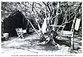 (1955) Fig.192 Camp used during surveys of the Lofa River.jpg 860 × 593; 191 KB
-
 (1955) Fig.192 The Liberian Cartographic Service.jpg 873 × 647; 196 KB
-
 (1956) Fig.200 Robert Perry, first liberian aerial photograph.jpg 429 × 621; 83 KB
_Fig.173_American_personell_in_Liberia.jpg)
_Fig.174_Typical_bush_country_of_Liberia.jpg)
_Fig.184_Liberian_Cartographic_Service_-_Cessna_170_aircraft.jpg)
_Fig.185_Pilot_Paul_J._Bradley,_Payne_Field,_Liberia.jpg)
_Fig.186_Aerial_view_of_downtown_Monrovia.jpg)
_Fig.189_Pilot_Paul_J._Bradley_at_Suakoko_airfield.jpg)
_Fig.190_John_T._Smith_Jr._at_Harper,_Liberia.jpg)
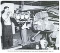
_Fig.191_Pilot_Paul_J._Bradley_changing_engine_on_Cessna_aircraft.jpg)
_Fig.192_Camp_used_during_surveys_of_the_Lofa_River.jpg)
_Fig.192_The_Liberian_Cartographic_Service.jpg)
_Fig.200_Robert_Perry,_first_liberian_aerial_photograph.jpg)