Category:Survey of Palestine maps of Tiberias
Jump to navigation
Jump to search
Media in category "Survey of Palestine maps of Tiberias"
The following 10 files are in this category, out of 10 total.
-
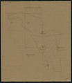
 Tiberias1 Survey of Palestine.jpg 9,533 × 6,477; 7.58 MB
-
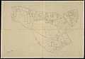
 Tiberias2 Survey of Palestine.jpg 10,092 × 9,593; 9.24 MB
-
 Tiberias3 Survey of Palestine.jpg 4,688 × 5,424; 2.53 MB
-
 Tiberias4 Survey of Palestine (cropped).jpg 5,522 × 7,840; 9.78 MB
-
 Tiberias4 Survey of Palestine.jpg 9,636 × 13,178; 22.42 MB
-
 Tiberias5.jpg 10,166 × 13,994; 12.85 MB
-
 Tiberias6.jpg 14,288 × 9,932; 14.71 MB
-
 Tiberias7.jpg 14,495 × 9,756; 14.92 MB
-
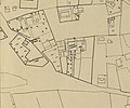 Tomb of Rambam, in a 1930s Survey of Palestine map of Tiberias.jpg 2,889 × 2,404; 1.4 MB
-
 Tomb of Sitt Sakina, at the southern edge of Tiberias, Survey of Palestine 1930s.jpg 4,119 × 2,781; 1.76 MB


.jpg)


