Category:Surroundings of the Christ the King church in Sanok
Jump to navigation
Jump to search
| Object location | | View all coordinates using: OpenStreetMap |
|---|
 | |||||
| Upload media | |||||
| Instance of | |||||
|---|---|---|---|---|---|
| Location | Sanok, Sanok County, Subcarpathian Voivodeship, Poland | ||||
| Inception |
| ||||
| Religion or worldview | |||||
| official website | |||||
 | |||||
English: Surroundings of the Christ the King Church in Sanok.
Subcategories
This category has the following 4 subcategories, out of 4 total.
E
G
Media in category "Surroundings of the Christ the King church in Sanok"
The following 8 files are in this category, out of 8 total.
-
 02315 Jana Pawła II Straße in Sanok (2012).JPG 640 × 480; 241 KB
-
 Christ the King Church in Sanok courtyard.jpg 3,872 × 2,592; 3.91 MB
-
 Christ the King Church in Sanok mission cross outside 1.jpg 2,592 × 3,872; 3.01 MB
-
 Christ the King Church in Sanok mission cross outside 2.jpg 3,872 × 2,592; 2.56 MB
-
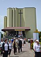 CSC 0498 corpus christi 2013 in sanok-059.JPG 3,254 × 4,568; 931 KB
-
 Interior of the Christ the King church in Sanok (2023) 46.jpg 6,000 × 4,000; 18.3 MB
-
 Interior of the Christ the King church in Sanok (2023) 47.jpg 4,000 × 6,000; 17.52 MB
-
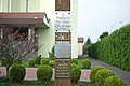
 Statue of Virgin Mary at the Christ the King church in Sanok (2022).jpg 4,128 × 3,096; 4.9 MB
.JPG)


_46.jpg)
_47.jpg)
.jpg)