Category:Surp Krikor Lousaworitch (Almelo)
Jump to navigation
Jump to search
| Object location | | View all coordinates using: OpenStreetMap |
|---|
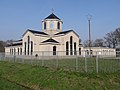
Nederlands: Almelo, Vriezenveenseweg 174 - Surp Krikor Lousaworitch - Armeense kerk
Media in category "Surp Krikor Lousaworitch (Almelo)"
The following 6 files are in this category, out of 6 total.
-
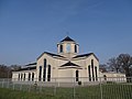 Armenische Kirche in Almelo 1.JPG 4,896 × 3,672; 5.06 MB
-
 Armenische Kirche in Almelo 2.JPG 4,896 × 3,672; 4.75 MB
-
 Armenische Kirche in Almelo 3.JPG 4,896 × 3,672; 6.43 MB
-
 Armenische Kirche in Almelo 4.JPG 4,896 × 3,672; 6.26 MB
-
 Eingangstor zur armenischen Kirche in Almelo.JPG 4,896 × 3,672; 7.52 MB
-
 Kreuz auf der armenischen Kirche in Almelo.JPG 3,672 × 4,896; 4.43 MB


