Category:Superstition Mountains
Jump to navigation
Jump to search
range of mountains east of Phoenix, Arizona | |||||
| Upload media | |||||
| Instance of | |||||
|---|---|---|---|---|---|
| Location | Arizona | ||||
| Mountain range | |||||
| Elevation above sea level |
| ||||
 | |||||
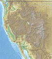
English: The Superstition Mountains — a mountain range located in Gila, Pinal, and eastern Maricopa Counties, in east−central Arizona.
Subcategories
This category has the following 15 subcategories, out of 15 total.
A
- Apache Gap (3 F)
C
F
- Fish Creek Hill (5 F)
H
L
- Lust for Gold (1 F)
Q
- Queen Creek Viaduct (4 F)
S
- Siphon Draw (12 F)
- Superstition Mountain (20 F)
T
W
- Weavers Needle (8 F)
Media in category "Superstition Mountains"
The following 54 files are in this category, out of 54 total.
-
2000-08-supersti-sunset.jpg 768 × 461; 23 KB
-
2013, Sonoran Desert Uplands, Supersition Mountains on the Horizon - panoramio.jpg 6,000 × 4,000; 6.09 MB
-
2016 Arizona Superstition Mountains 01.jpg 4,848 × 3,636; 14.1 MB
-
2016 Arizona Superstition Mountains Horse Mesa.jpg 5,472 × 3,648; 3.2 MB
-
2021 Superstition Mountains from Lost Dutchman State Park 1.jpg 4,031 × 2,386; 2.26 MB
-
2021 Superstition Mountains from Lost Dutchman State Park 2.jpg 4,032 × 3,024; 2.47 MB
-
2021 Superstition Mountains from U.S. Route 60 at Apache Junction, Arizona.jpg 3,570 × 2,215; 924 KB
-
2021 The Superstition Mountains from the Apache Trail at Pine, Arizona.jpg 4,031 × 2,423; 2.61 MB
-
2021 The Superstition Mountains from the Apache Trail near the Corral.jpg 3,764 × 2,305; 2.02 MB
-
2021 Tortilla Flat rock formation.jpg 5,136 × 3,746; 3.95 MB
-
2021 U.S. Route 60, Scenic Overlook, east of Queen Creek Tunnel, to southeast.jpg 3,878 × 2,663; 3.53 MB
-
2021 U.S. Route 60, scenic view west of Queen Creek Tunnel, to the southeast.jpg 3,573 × 2,051; 2.71 MB
-
4 Peaks & Superstition Stitched Pano - panoramio.jpg 7,778 × 2,593; 3.52 MB
-
A View of The Mountains Northeast of Superior, AZ - panoramio.jpg 1,600 × 1,200; 940 KB
-
A View of the West Side of the Superstition Mountains - panoramio.jpg 2,592 × 1,944; 2.41 MB
-
Apache Junction-Superstition Mountian.JPG 4,608 × 3,456; 3.66 MB
-
Celastrina echo-cinerea puddling.jpg 1,200 × 900; 239 KB
-
Celastrina echo-dorsal.jpg 1,200 × 900; 294 KB
-
Celastrina echo-ventral.jpg 1,200 × 900; 225 KB
-
Farm Fields North of Arizona Farms Road - panoramio.jpg 2,592 × 1,936; 2.09 MB
-
Gold Canyon, United States (Unsplash qR22avDPUr8).jpg 5,184 × 3,456; 5.57 MB
-
Goldfield Ghost Town (14540063576).jpg 2,048 × 1,536; 2.27 MB
-
Houses in the Superstition Foothills - panoramio.jpg 3,264 × 2,448; 3.39 MB
-
Las superticiosas, Arizona (1995), por Martha Joy Gottfried.jpg 351 × 166; 16 KB
-
Looking at the dead-end of Jeep trail - panoramio.jpg 4,000 × 3,000; 1.69 MB
-
Looking North Towards the Superstition Mountains From the Embankment - panoramio.jpg 1,600 × 1,200; 894 KB
-
PERALTA GOLD ORE.jpg 436 × 328; 231 KB
-
Peucetia eggs.jpg 661 × 497; 92 KB
-
Rock formations2.jpg 3,840 × 2,160; 1.82 MB
-
Rockformation.jpg 3,840 × 2,160; 1.58 MB
-
Saguaro Lake Superstition Mtns 1.jpg 4,864 × 3,243; 3.71 MB
-
Service road to Canyon Lake dam - panoramio.jpg 4,000 × 3,000; 1.91 MB
-
Snow Covered Superstition Mountains - panoramio.jpg 1,800 × 1,200; 2.02 MB
-
STONE CROSSES 1.jpg 484 × 595; 320 KB
-
SUNRISE OVER SUPERSTITION MOUNTAINS. URBAN SPRAWL IN FOREGROUNDS - NARA - 544047.jpg 3,000 × 2,026; 789 KB
-
Superstition Mountains From Route 60.jpg 3,228 × 1,520; 2.57 MB
-
Superstition Mountains in Apache Junction.jpg 4,031 × 2,281; 1.27 MB
-
Superstition Mountains.jpg 4,928 × 3,264; 13.19 MB
-
Superstition mountains.jpg 4,032 × 3,024; 2.21 MB
-
Superstition Mts SW01.jpg 4,685 × 2,858; 3.41 MB
-
Superstition Mts SW02.jpg 3,072 × 2,097; 1.67 MB
-
Superstition mts. One of Arizona's popular Landmarks.jpg 9,050 × 5,510; 7.19 MB
-
Superstition Range, March 2014 - panoramio.jpg 7,585 × 3,164; 13.95 MB
-
Superstition ridgeline.jpg 1,920 × 1,080; 597 KB
-
Superstition-Mts (16345132894).gif 792 × 594; 237 KB
-
Superstitions (39915445385).jpg 6,574 × 4,176; 16.53 MB
-
Superstitions from Gold Camp - panoramio.jpg 13,319 × 2,889; 7.11 MB
-
Superstitions-aj.jpg 799 × 361; 57 KB
-
Superstitions-north.jpg 799 × 328; 30 KB
-
The Superstion Mountain Cave Seen From the Trail - panoramio.jpg 2,592 × 1,944; 2.03 MB
-
USA Region West relief Superstition Mountains location map.jpg 1,867 × 2,091; 1.05 MB
-
View of the Mountains from Northern Pinal County - panoramio.jpg 1,504 × 1,098; 1.03 MB
-
Walkabout (145587395).jpeg 2,048 × 1,463; 868 KB
Categories:
- Mountain ranges of Maricopa County, Arizona
- Mountain ranges of Pinal County, Arizona
- Mountain ranges of Gila County, Arizona
- Arizona transition zone mountain ranges
- Mountain ranges of the Sonoran Desert
- Mountain ranges of Arizona by name
- Superstition Wilderness
- Superstitions in the United States
- Locations along Arizona State Route 88
- Arizona State Route 88


